Sponsored by Socorro County Historical Society
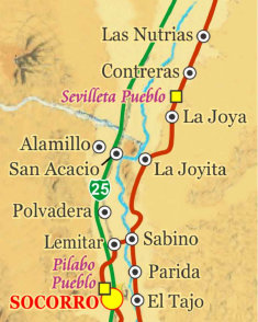
LAST MAP GOING NORTH

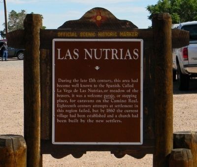
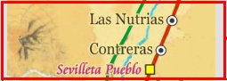
Las Nutrias
(La Vega de las Nutrias)

El Camino Real de Tierra Adentro
Maps, photos, and aerial photography of the trail
Primarily in Sierra & Socorro counties
TRAIL SEGMENT ON THIS PAGE:
Sevilleta (Tzelaqui pueblo)
to Las Nutrias
3
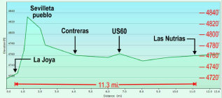
Elevation plot, La Joya to Las Nutrias
joya
The Sevilleta de La Joya land grant
The La Joya land grant is a long and convoluted story, cited here as concise as possible (and omitting
many details).
Sixty seven individuals of La Joya were awarded a "community" type
Spanish land grant in 1819, partially
for the defense given to travelers along El Camino Real. This was converted to a Mexican land grant in 1821. In 1848, the grant was
recognized by the U.S. government under the terms of the Treaty of Higaldo (which stated Mexican land grants must be respected). However,
when surveyed by the U.S., it was discovered the northern boundary of the La Joya land grant was also part of the Belen land grant,
triggering years of legal disputes. In 1891, the courts finally ruled the boundaries of the two land grants were in error and
11,000 acres were transferred from La Joya to the Belen land grant and the patents finally issued. This left the La Joya land grant
with about 216,000 acres.
Shortly thereafter, some of the original grant descendants, believing they had a private land grant,
began selling parcels of their land for farm and ranch land. This was determined to be in violation of the Treaty of Higaldo,
which states a community land grant can not be broken up or sold off without loosing the land grant status. At the time of 1912
statehood, and loosing their land grant status, residents were required to pay taxes on their large land holdings. Most were
unable to pay the taxes and the land reverted to ownership by the County of Socorro.
The courts ordered Socorro County to sell
the land for the back taxes owed, about $75,000. In 1936, Gen. Thomas Campbell purchased the land for $76,750 as the only bidder.
He ranched and farmed the land for the next 30 years. Before his death, he created a foundation to restore his ranch to the
natural environment and wildlife. The Foundation gave the land to the Nature Conservancy in 1973, who in turn donated it to
the U.S. Fish and Wildlife Service. Thus, much of the original La Joya land grant is now the Sevilleta National Wildlife Refuge
comprising 230,000 acres, some of which is through other land acquisitions.
Though no longer a land grant, La Joya remains a
viable community with many residents descendants of the original grant owners. In 1936, Socorro County allowed the square mile
of the town to remain as an unincorporated village.
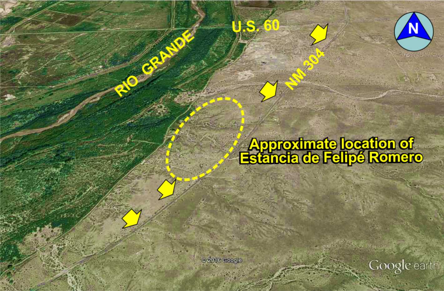
Contreras
Estancia de Felipé Romero is a well documented early 1600s
Colonial era homestead and ranch on the trail noted by many early travelers.
The estancia was destroyed during the 1680 Pueblo Revolt with only ruins noted after that. Today, the exact location is unknown.

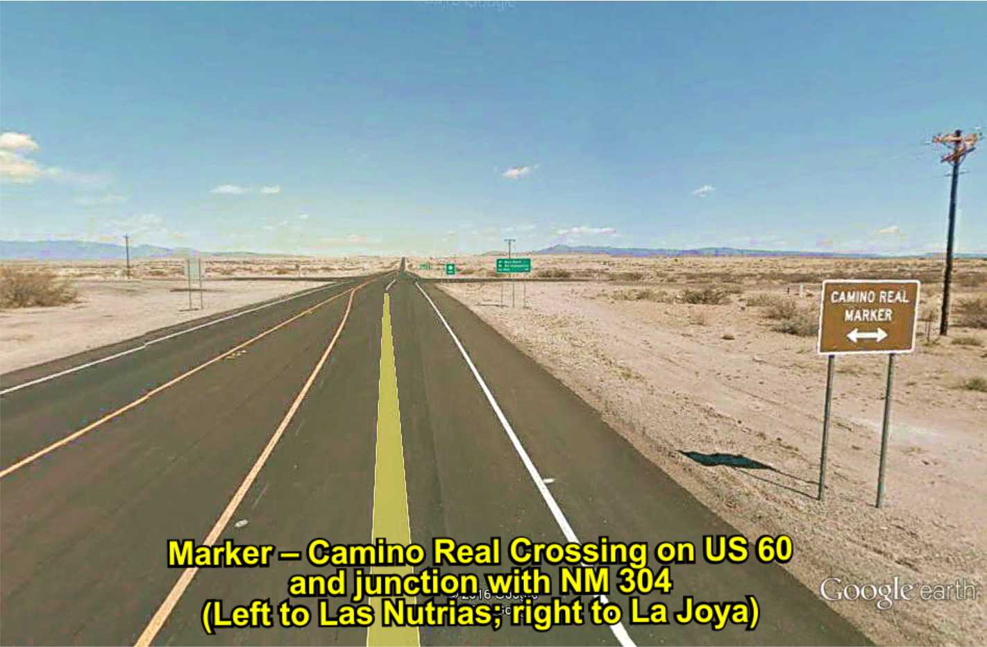
Camino Real
Marker
Estancia de Filipé Romero
First called La Vega de las Nutrias (Meadow of the Beavers) in the 1600s, it was a documented paraje a days journey
north of La Joya. It became a settlement around 1765, abandoned periodically due to Indian raids. By the mid-1800s, it
was a permanent settlement on the trail called Las Nutrias, and remains an active farming and ranching area today.
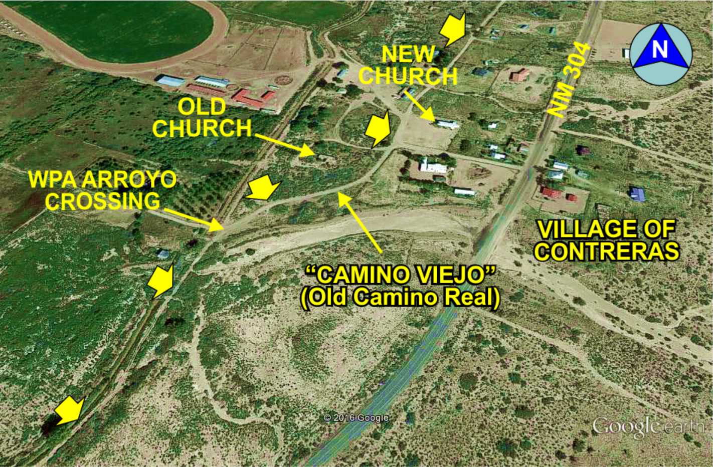
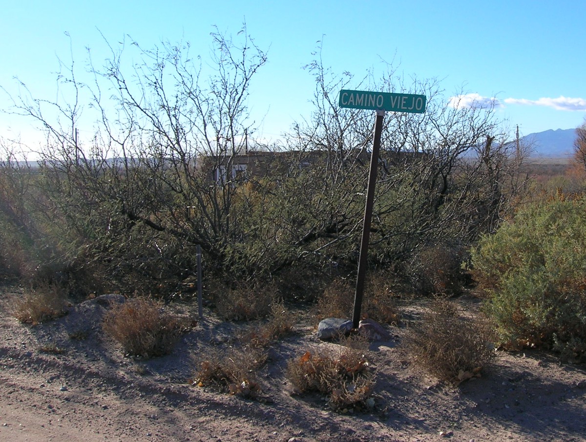
Contreras is a small village established at the very end of the trail era -- in the 1880s. The trail is a dirt road
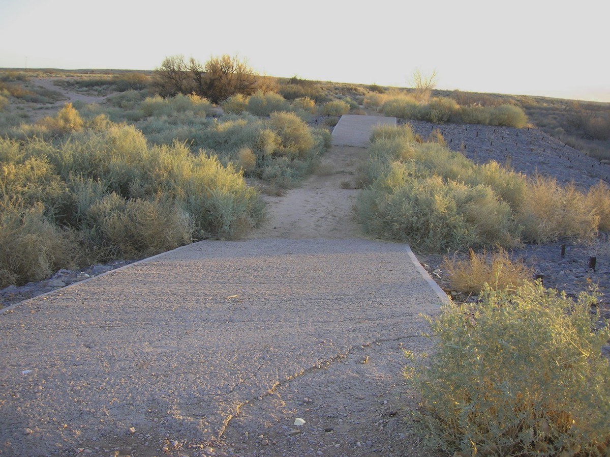
west of NM304 called 'Camino Viejo" and fortified in places with concrete by the WPA when El Camino Real was used for automobile traffic when
US85 was destroyed in the 1937 flood.
Camino
Viejo
Camino
church
WPA
trail
Historic
Marker
A few leagues north of La Joya, the trail becomes very straight and over relatively level ground with gentle hills (see elevation
plot). For northbound travelers, the rough parts of the trail were now behind them with a gentle trail to Santa Fe except the
climb up La Bajada.
Historic
Marker
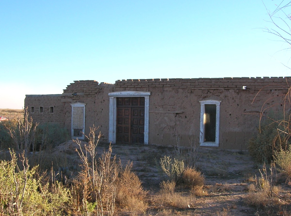
TZELAQUI/SEVILLETA PUEBLO
This large Piro pueblo was named Sevilleta (little Seville) by Juan de Oñate in 1598. It remained one
of the principal Piro pueblos in the region after Spanish contact with the San Juan Obispo de Sevilleta mission church and convento built
by the Franciscans in 1626. Sevilleta was abandoned during the 1680 Pueblo Revolt with caravans camping at the pueblo ruins
(1700s) or neaby La Joya (1800s) for the entire usage of the trail, and thus a well documented landmark on El Camino Real.
Click
here for more information on Tzelaqui/Sevilleta pueblo
Click here for photos of recent excavation work of the pueblo and mission
by archaeologist Dr. Michael Bletzer
There are very few visible remnants of the trail in this area due to extensive agriculture and human development.
Annotated
history
Website courtesy of the Socorro County Historical Society (SCHS), P.O. Box 921, Socorro, New Mexico 87801 [
SCHS home page]


GoogleEarth
image
Drone
aerial photo
Trail photo
Notes or
documentation
LEGEND
Aerial photos with DJI Phantom 3 quadcopter camera


The Camino Real Mapping Project
on these web pages
is the exclusive work of the
members of the Socorro County
Historical Society and other
volunteers dedicated to
documenting, mapping, presenting,
and preserving the historic trail.
34°22.84'N 106°48.89'W
Elev. 4750'
34°24.53'N 106°47.49'W
Elev. 4790'
34°20.97'N 106°50.32'W
Elev. 4850'