Sponsored by Socorro County Historical Society

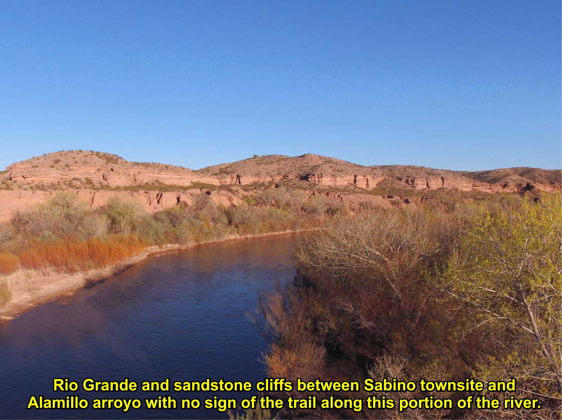
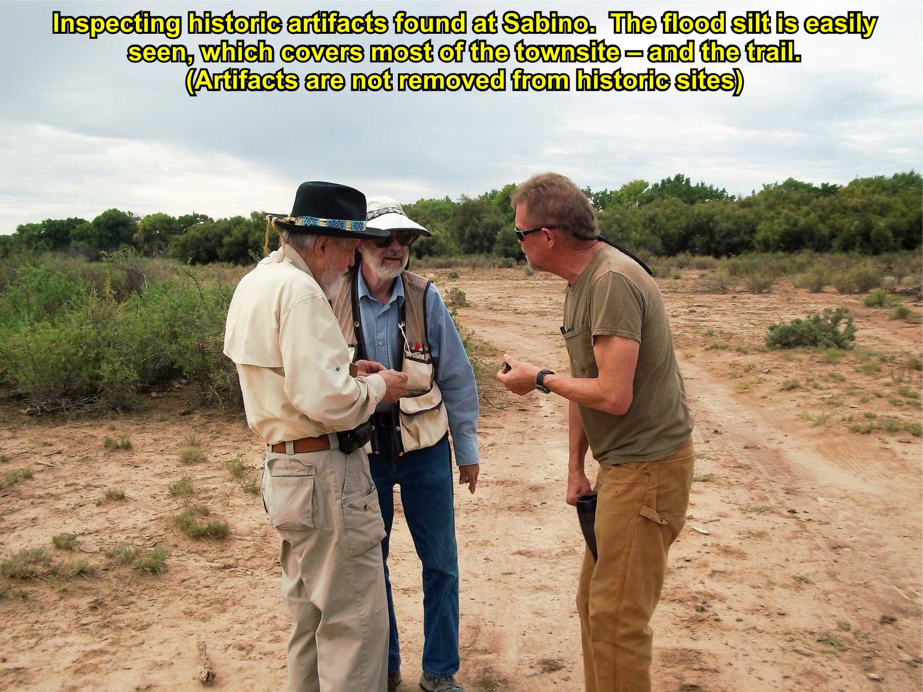
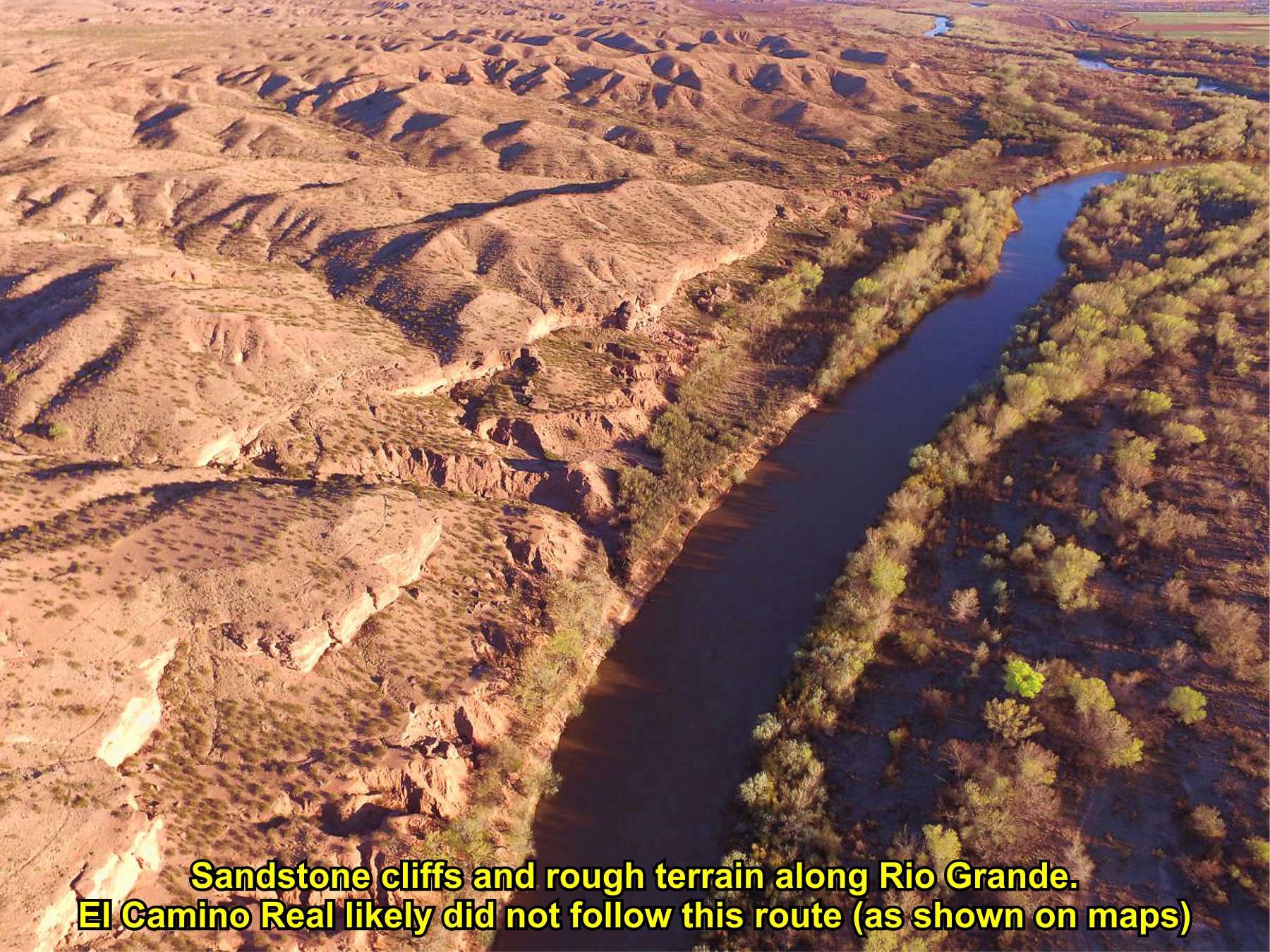
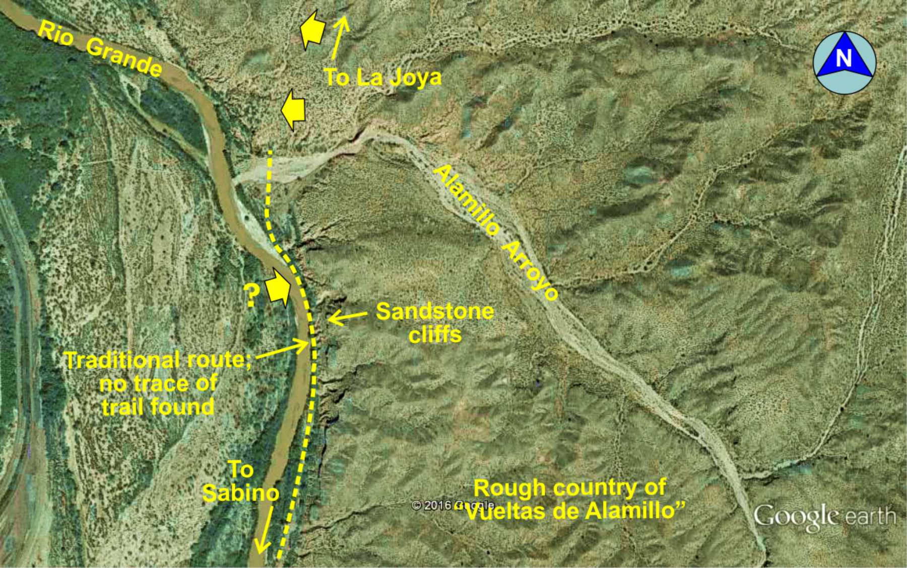
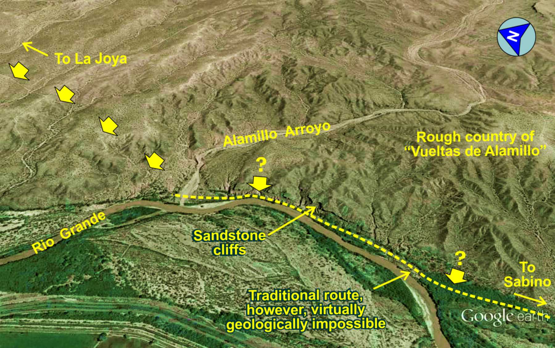
While this route may have been used in the early days of the trail, it was not used per documentation in the 1800s, likely due to a change in the river course forcing the Rio Grande up against the sandstone cliffs. El Camino Real is generally found on dry, solid ground above the river level to avoid the potentially muddy or sandy ground of the Rio Grande floodplain. This area was also inundated by floods in 1929 and 1937 (and earlier floods) that likely destroyed any traces of the trail in this area.

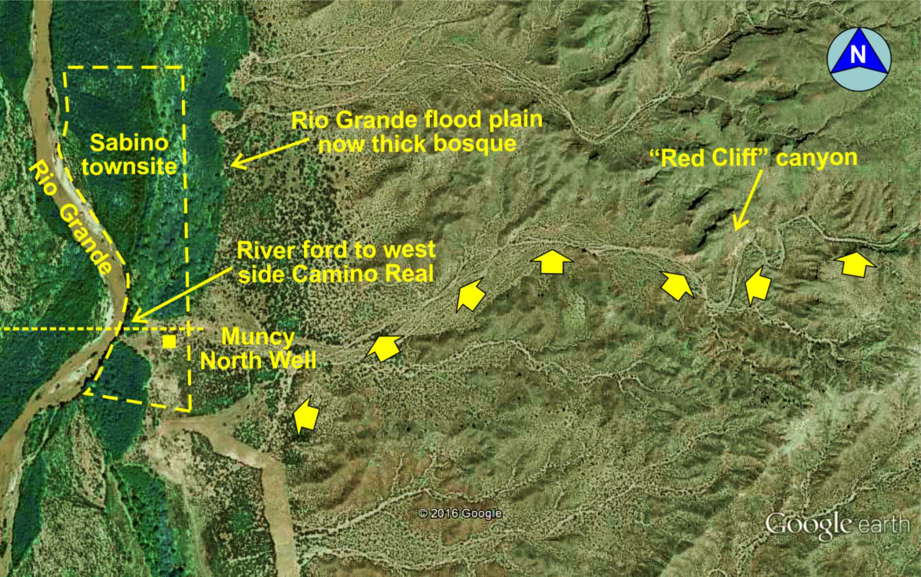
Sabino (historic trail village)
Sabino townsite
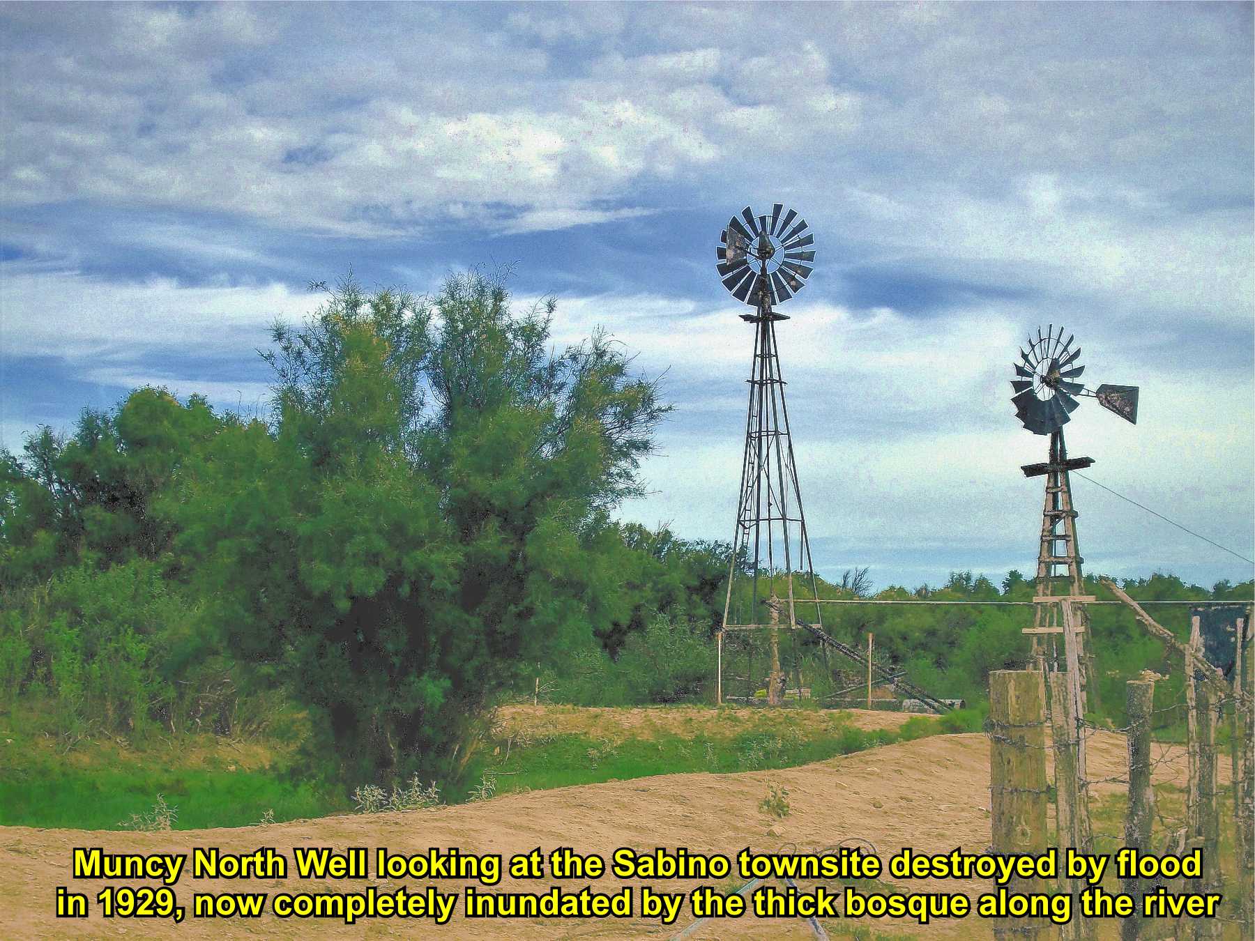
(Muncy North Well)
River route south of Alamillo arroyo
(Where trail likely is not)

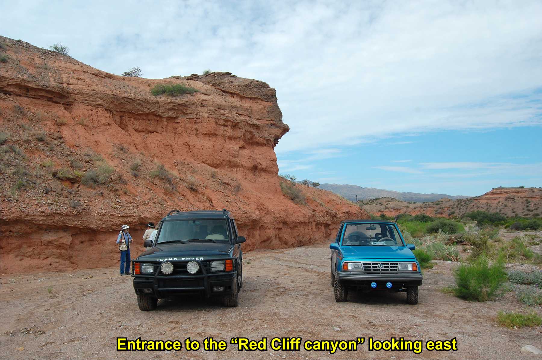
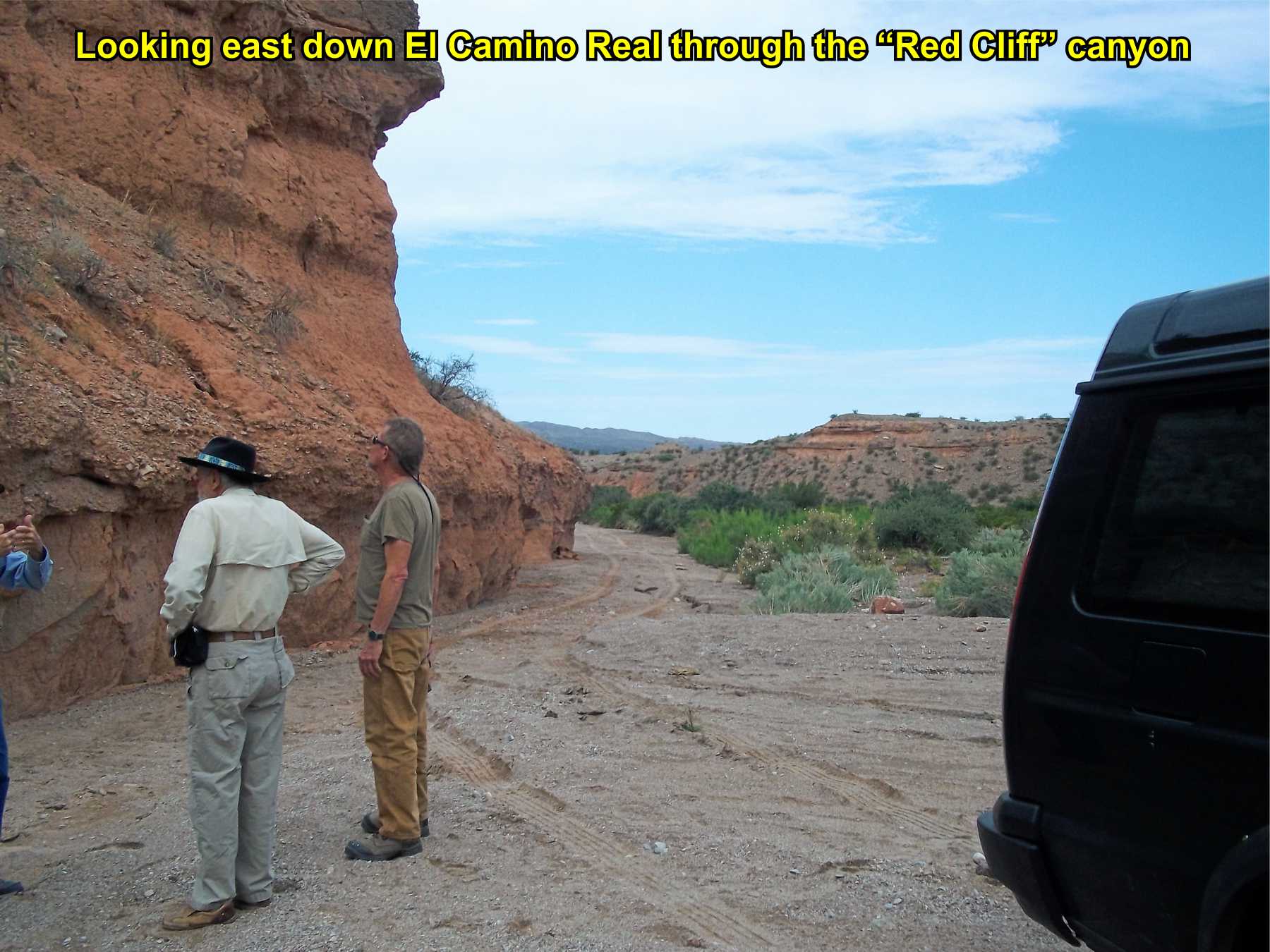
"Red Cliff"
canyon entrance
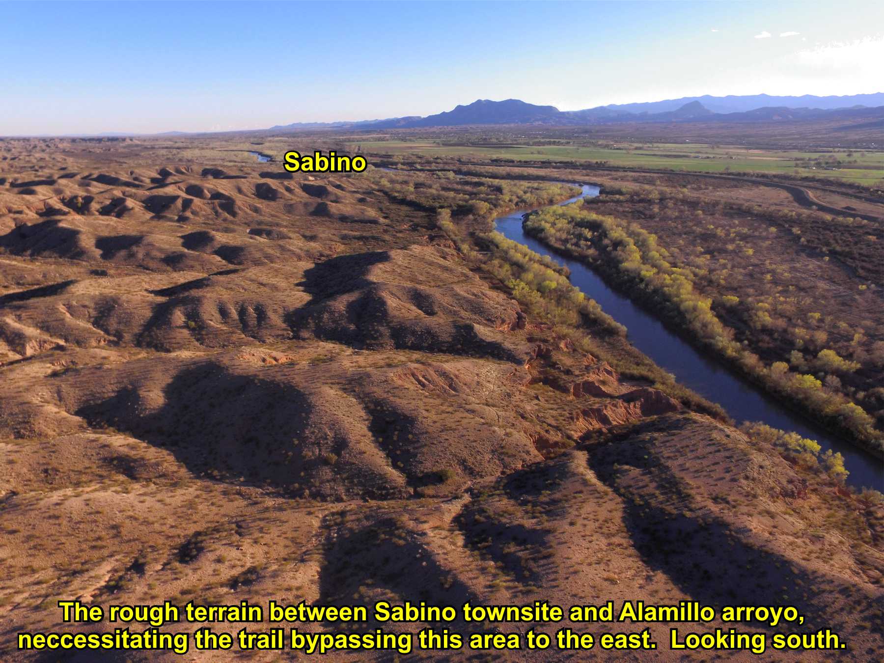
Ongoing research; About this page: Most official maps show the trail going north from Sabino to the Alamillo arroyo following the
river. Local geology does not support this nor has field work found any trace of the trail in this area. It has long been
a mystery how the trail went from Sabino north to Alamillo arroyo (and on to La Joya). The Falconer journal describes traveling
to Sabino around the mountain through red sandy country to Sabino and Wislizenus describes his trek along the trail as going
east along the Alamillo arroyo to Sabino, a distance of 10 miles (along the river would only be three miles). In 2013, while
mapping this area, Paul H. noticed red cliff walls northeast of Sabino. Driving to the red cliff walls, it was the entrance
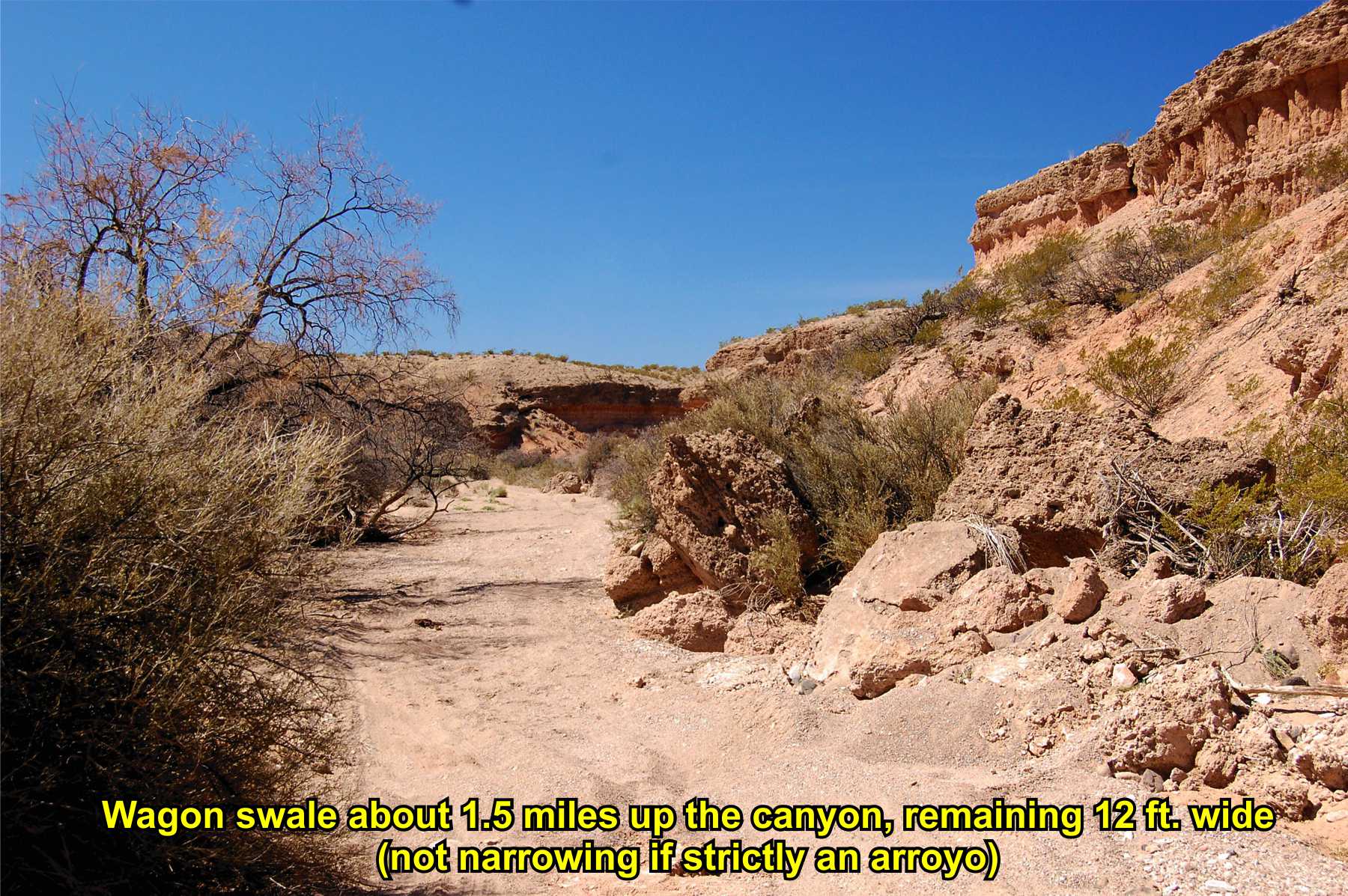
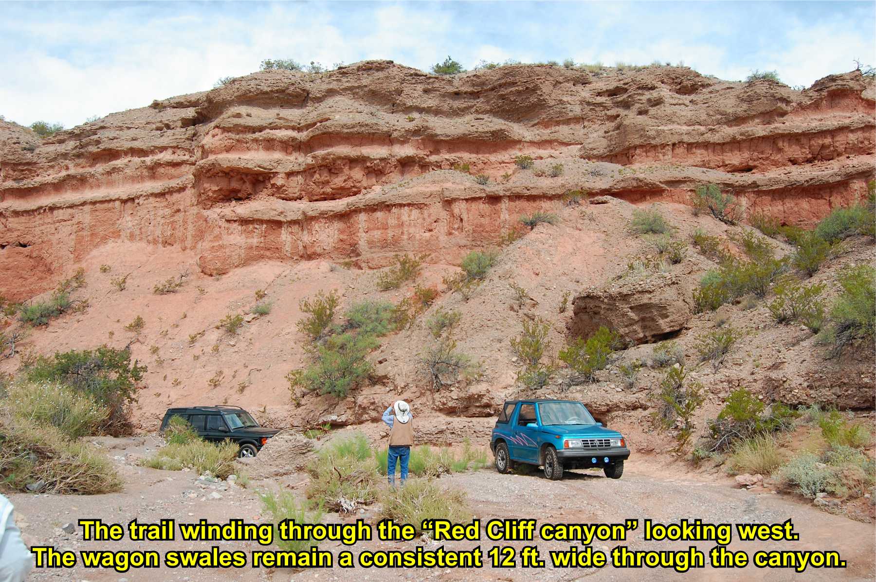
to a long canyon with unmistakable wagon swales about 12 feet wide. This wagon swale through the canyon continues to the top
of a ridge, where they disappear for about 1/4 mile, then down an arroyo saddle to the Alamillo arroyo (and back to the Rio Grande).
It appears the route from Sabino has been found, a 10-mile "detour" to loop around the rough sand hills between Sabino and Alamillo,
also called "Vueltas de Alamillo" in some accounts.
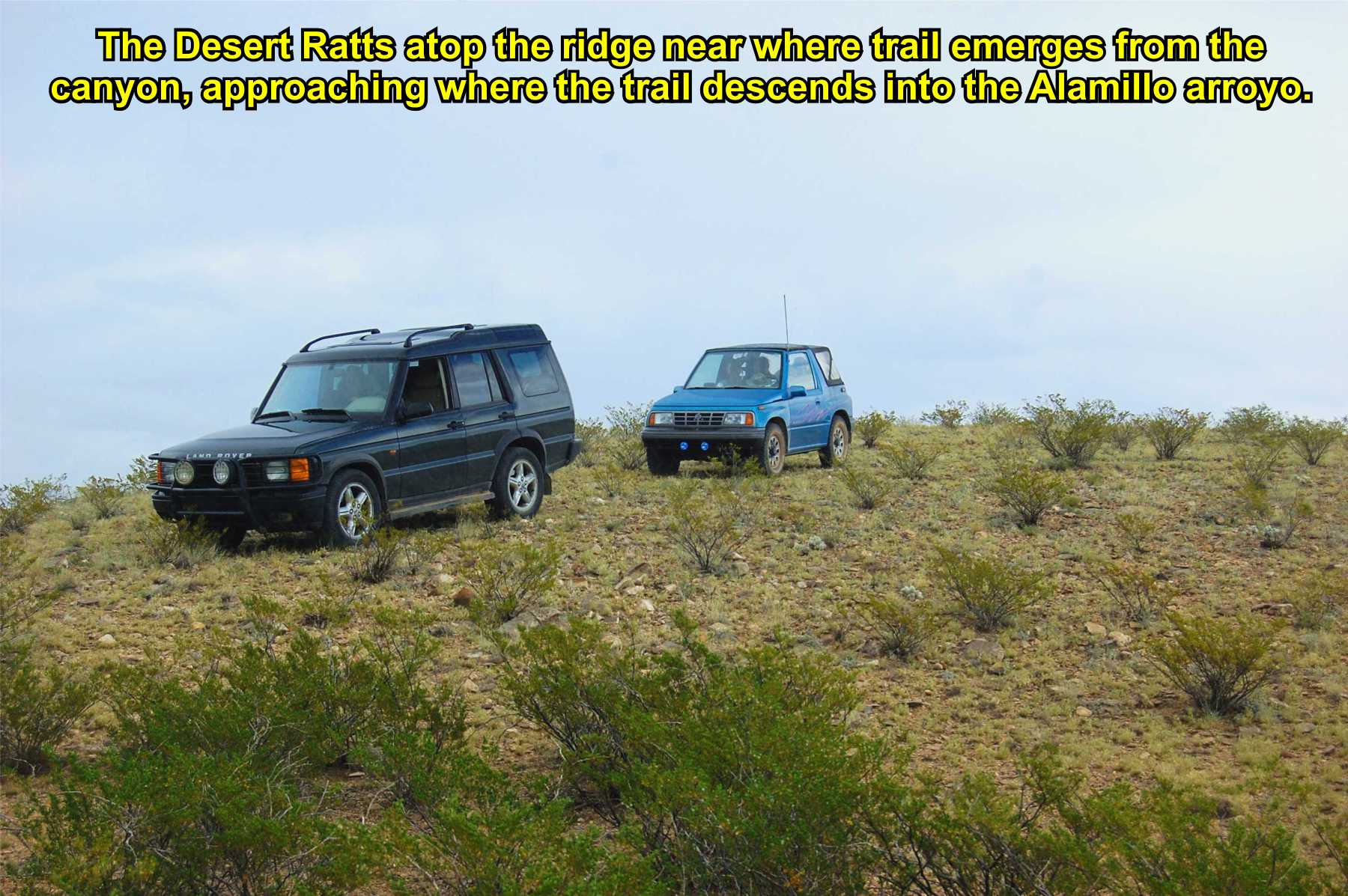
This is an area of ongoing research and mapping by the Socorro Desert Ratts
to document this "loop" from Sabino to Alamillo arroyo. An alternative path from the ridge to Alamillo arroyo has also possibly
been located that saves about a mile. Field trips require permission for the private ranch access and State Trust Land, which
has been granted on a limited basis.
1600s route is described by Otermin as traveling from Alamillo arroyo to Alamillo pueblo
and further south by following the river. (Location of Alamillo pueblo is unknown). This is the route shown on most trail
maps. However, today there is only a narrow gravel bench, in the flood plain, between the river and high sandstone cliffs
on the east side of the Rio Grande. It is possible this was El Camino Real in the 1600s, but perhaps due to river flooding and
the river course being altered, this route was no longer passable, for which an alternate route around the Alamillo hills, or Vueltas
de Alamillo, was developed. Study on this portion of the trail is ongoing.
GoogleEarth
image of this
overall area,
click here:
El Camino Real de Tierra Adentro
Maps, photos, and aerial photography of the trail
Primarily in Sierra & Socorro counties
TRAIL SEGMENT ON THIS PAGE:
Adjacent to Polvadera, NM;
Sabino townsite to Alamillo Arroyo

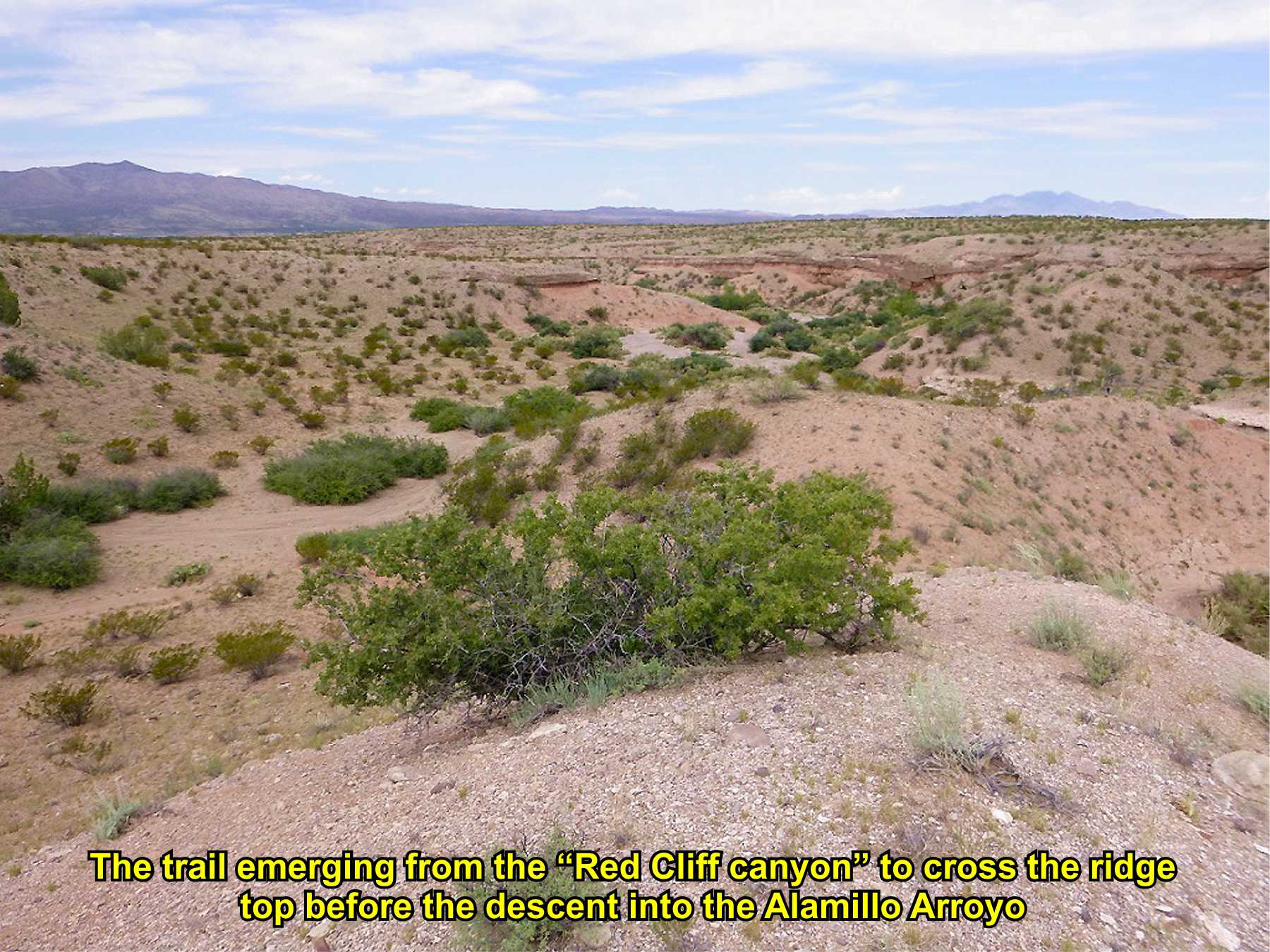
Trail emerging from canyon
Atop ridge
soc-N3
3

Trail inside
canyon
Sat
view
3D
view
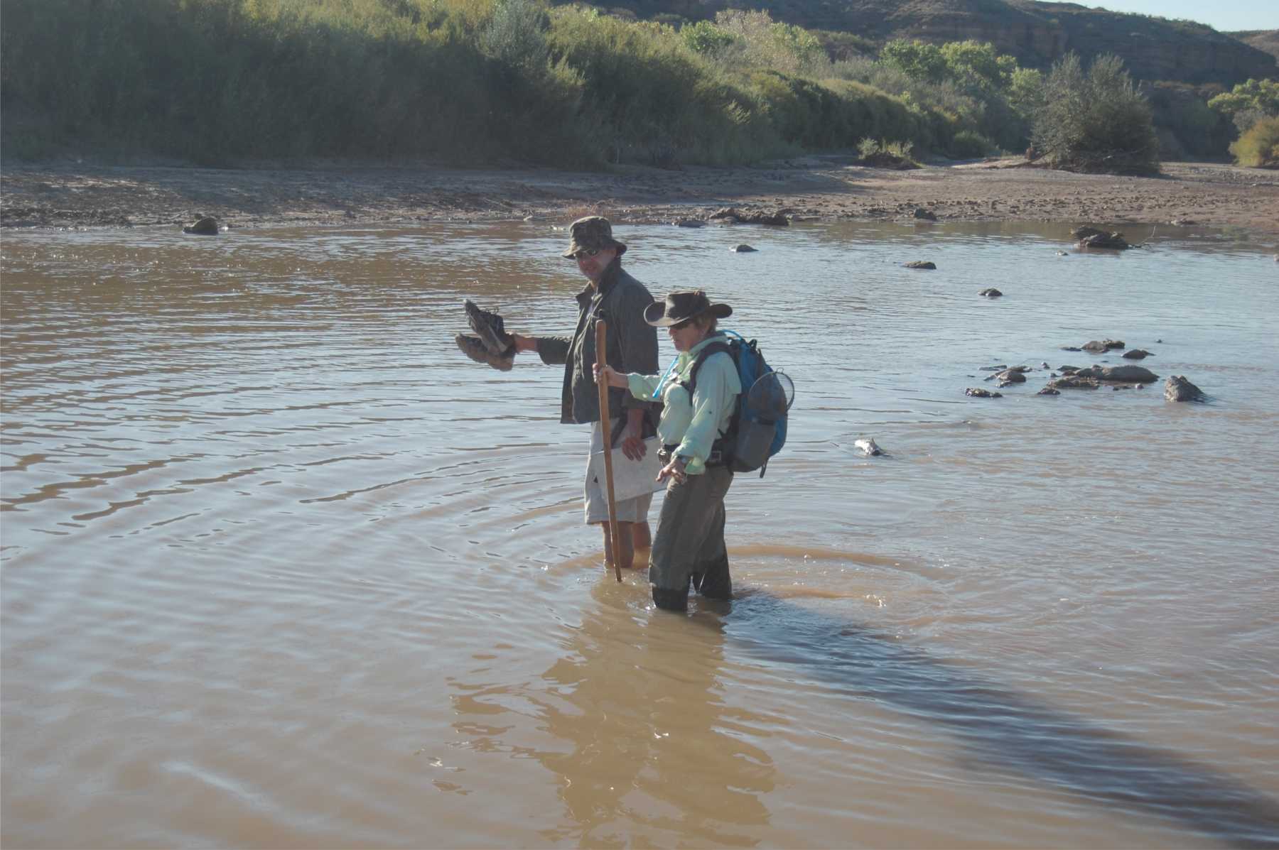
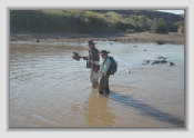
Sabino village first mentioned 1780; a popular stop on the trail and well documented river ford, including by U.S. Army supply wagons enroute to Ft. Craig. Abandoned around 1870-80; townsite destroyed by 1929 flood.
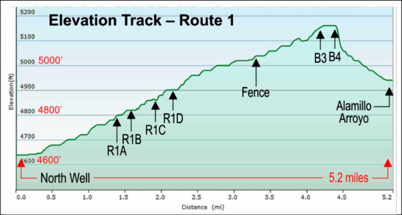
The trail from Sabino to Alamillo arroyo appears to follow a natural canyon and supported by documentation. Field work has identified wagon swales in several places. This "detour" route is to bypass the cliffs and the rough country north of Sabino along the river.
The ridge is the high point on the trail, descending north into the Alamillo arroyo.
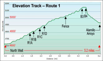
Elevation plot of the "Red Cliff" canyon route
A few more photos . . .
(click photos to enlarge)
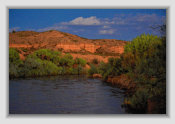

Alamillo cliffs under alpine light (just before sundown)
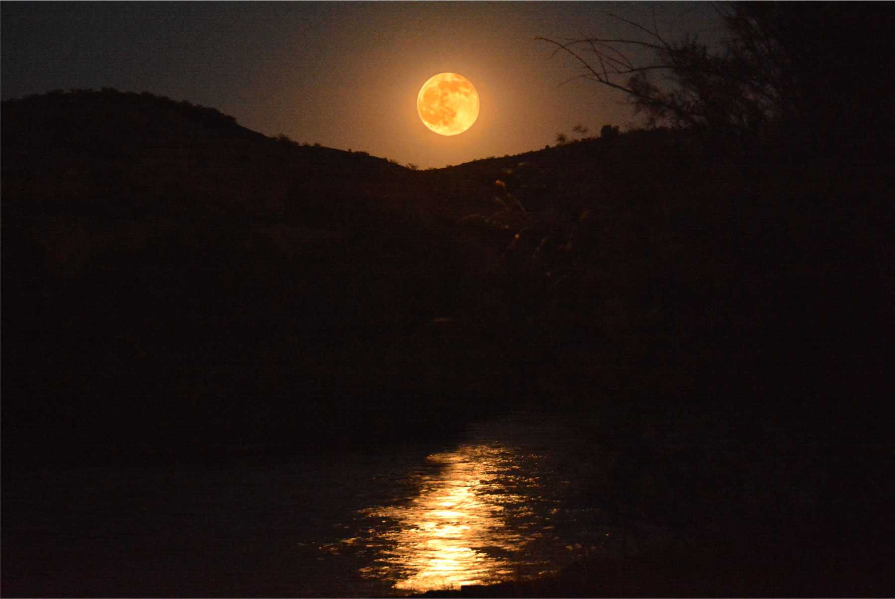
Full moon rising over
Alamillo arroyo
How to get to
Alamillo arroyo
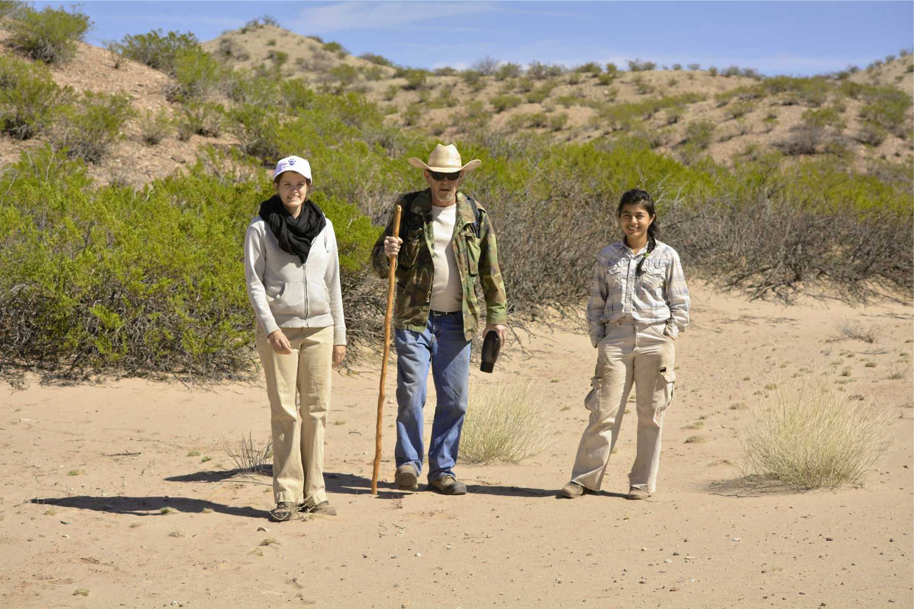
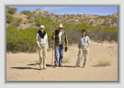
A visitor from Columbia
(far right) wanted to see "our" Camino Real
Alamillo Pueblo
is a well documented contact period Piro pueblo
located on the trail somewhere around the Alamillo arroyo. Trail distances were often measured (in leagues) to and from
Alamillo. A mission or visitas was built that served the pueblo until the 1680 Pueblo Revolt. It remained a favorite campsite
on the trail for decades after its 1680 abandonment.
In spite of several professional archaeological surveys in the area,
Alamillo pueblo has never been found. It is suspected the pueblo was destroyed by one of the many known floods down the Rio
Grande in this area.
In other words ... sorry, no photos!

From Thomas Falconer, Notes of a Journey through Texas and New Mexico, in the years 1841 and 1842:
Traveling south between La
Joyita and Sabino
"We did not continue long on the bank, our course being to the left of some mountain lying between the river
and the road, through a red sandy country abounding in dry waterholes in which were considerable quantities of crystalized salt."
This
appears to be describing the rough mountainous country and the cliffs against the river south of Alamillo arroyo and their detour
to the left (east) with the "red sandy country" likely describing the "Red Cliff canyon" area, which is indeed quite red. The
Desert Ratts are still looking for the "crystalized salt" in dry water holes for further confirmation of this route.
"We halted
in the evening (the 26th) at Pareida . . . On the opposite side was a wood of cotton-trees of large growth, and on the S.W. Of a level
plain, apparently of very good land, we came, at a distance of about 6 miles from the river, to the village of Socorro."
Falconer
is apparently describing the river village of Sabino, not Parida, and seems to have the two village names confused.
Furthermore, the documented river ford was between Sabino (east side of river) and Lemitar (west side), then 6 miles to Socorro (Parida
is about 2 mi. from Socorro, but no documented river ford near Parida-to-Socorro during this era).
From: The Frontiers of New Spain, Nicolas de Lafora,
Traveling Nueva España 1766-1768.
Traveling north opposite Socorro
to Alamillo Pueblo
"The first four leagues were over swampy ground with a great deal of course grass and reeds up to the
ruins of Luis Lopez' houses
"
Luis Lopez is about one league (3 miles) south of Socorro and on the east side Camino Real
in the 16001700s. The village is on the west side today due to a change in the river's course in the early 1800s.
"... then
over sand hills and cliffs which vehicles are very much in danger of going over the edge. These vueltas extend over a space
of three leagues. Before leaving this stretch one sees on the opposite side of the river the ruins of Socorro pueblo, at the
foot of the Socorro sierra, which runs at a high elevation in from of Los Ladrones sierra. The remaining three leagues are over
level road with an occasional ravine and finally terminate at the ruins of Alamillo pueblo, on the left bank of the river. We
camped there."
Socorro pueblo (Pilabo pueblo) was abandoned during the 1680 Pueblo Revolt. Socorro was not reoccupied until
1800. "Vueltas" refers a twisty, hilly bad road, in this case, opposite Socorro to Alamillo arroyo.
Annotated
history
Website courtesy of the Socorro County Historical Society (SCHS), P.O. Box 921, Socorro, New Mexico 87801 [
SCHS home page]
The Camino Real Mapping Project
on these web pages
is the exclusive work of the
members of the Socorro County
Historical Society and other
volunteers dedicated to
documenting, mapping, presenting,
and preserving the historic trail.
GoogleEarth
image
Drone
aerial photo
Trail photo
Notes or
documentation
LEGEND
Aerial photos with DJI Phantom 3 quadcopter camera


34°10.51'N 106°51.69'W
Elev. 4785'
34°11.29'N 106°49.97'W
Elev. 5070'
34°11.78'N 106°50.53'W
Elev. 5120'
34°12.98'N 106°53.10'W
Elev. 4700'
"Alamillo
cliffs"

.mp4
1:10min
21MB
Alamillo North
.mp4
1:23min
25 MB
1126/18 2.1