Website courtesy of the Socorro County Historical Society (SCHS), P.O. Box 921, Socorro, New Mexico 87801 [
SCHS home page]
El Camino Real de Tierra Adentro
Sponsored by Socorro County Historical Society
Maps, photos, and aerial photography of the trail
Primarily in Sierra & Socorro counties
GoogleEarth
image
Drone
aerial photo
Trail photo
Notes or
documentation
LEGEND
joya
Aerial photos with DJI Phantom 3 quadcopter camera
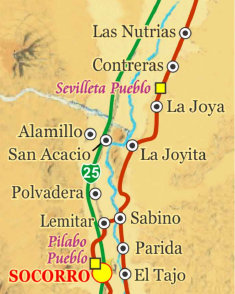
TRAIL SEGMENT ON THIS PAGE:
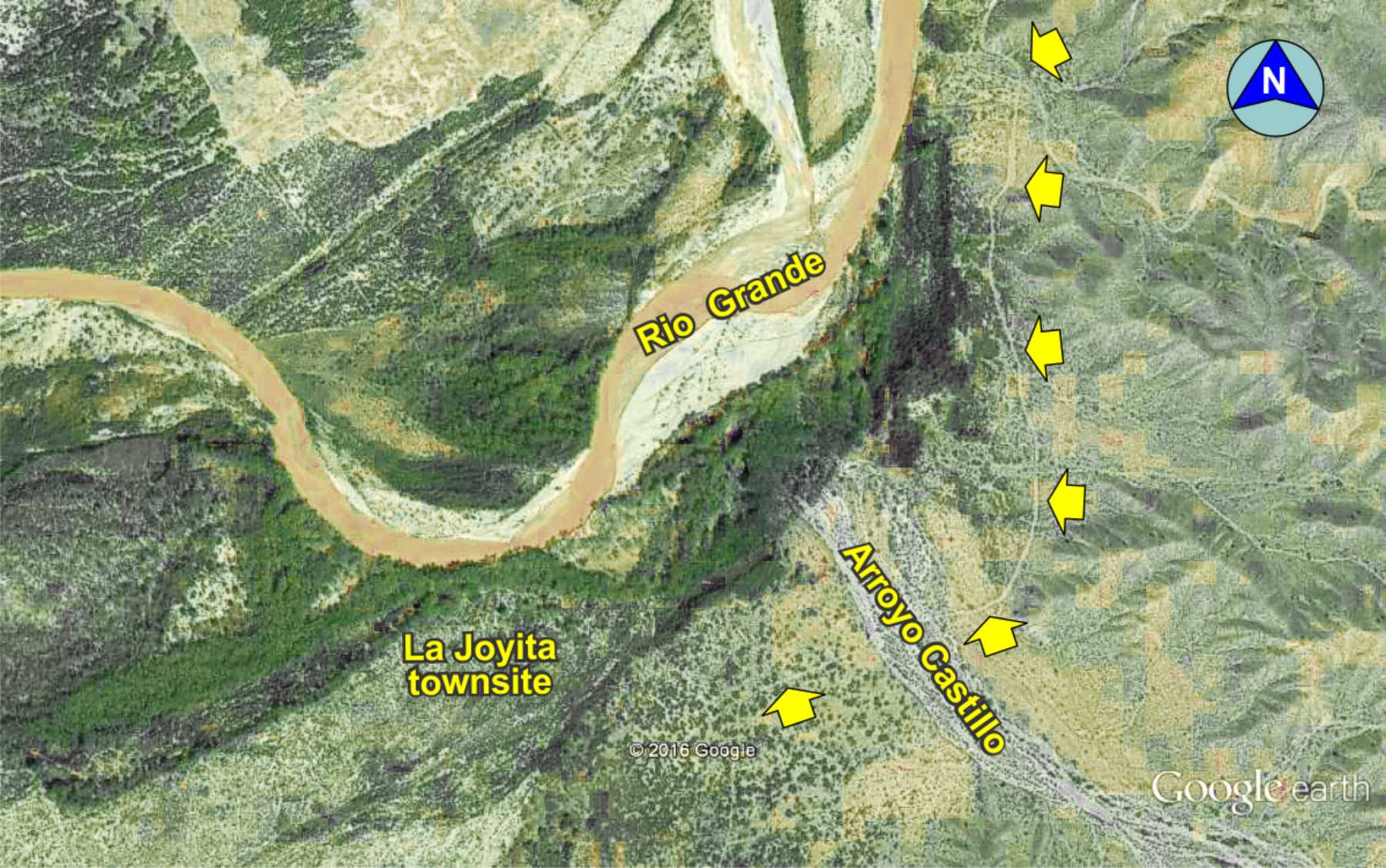
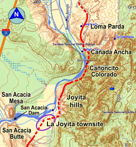
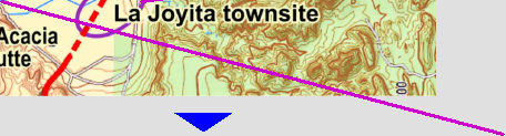
La Joyita townsite
north to Loma Parda

1


La Joyita townsite


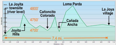
Elevation plot, La Joyita to La Joya
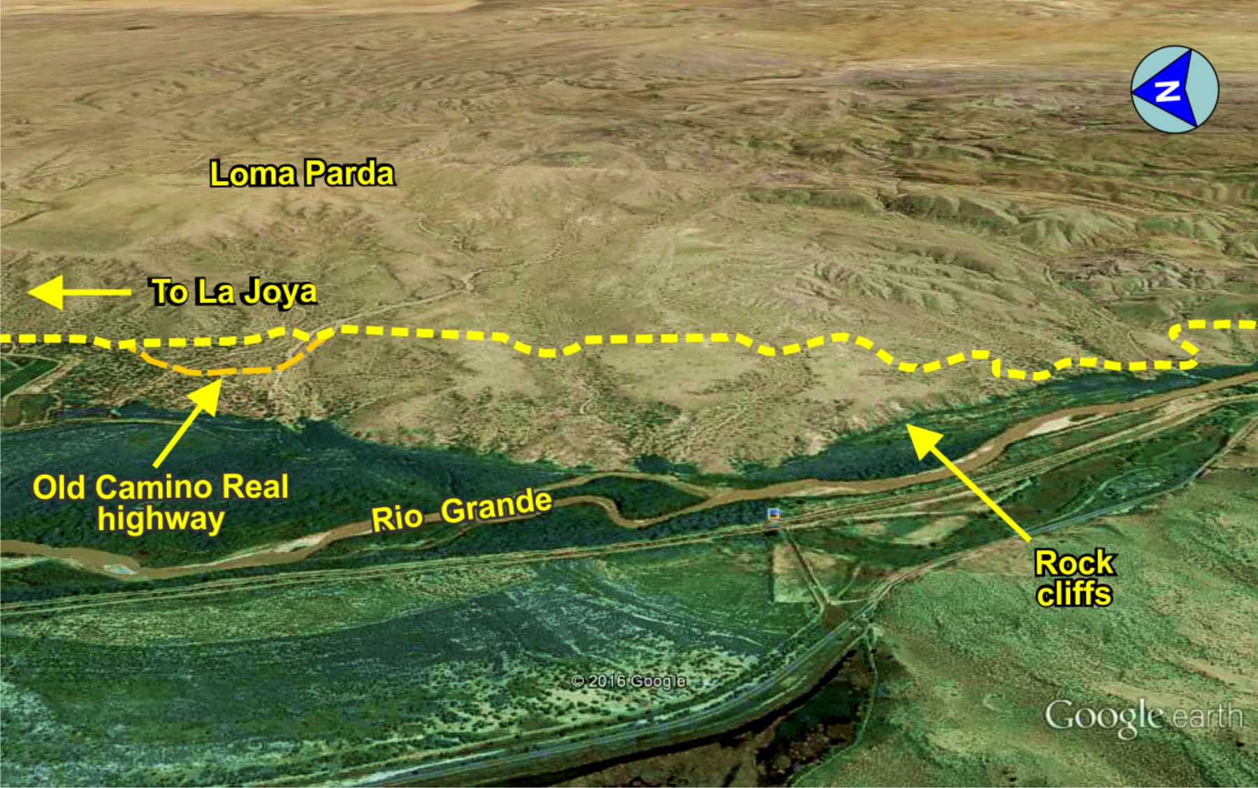
Trail over Loma Parda
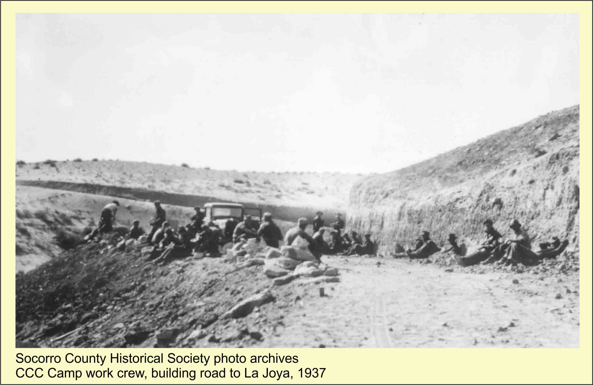
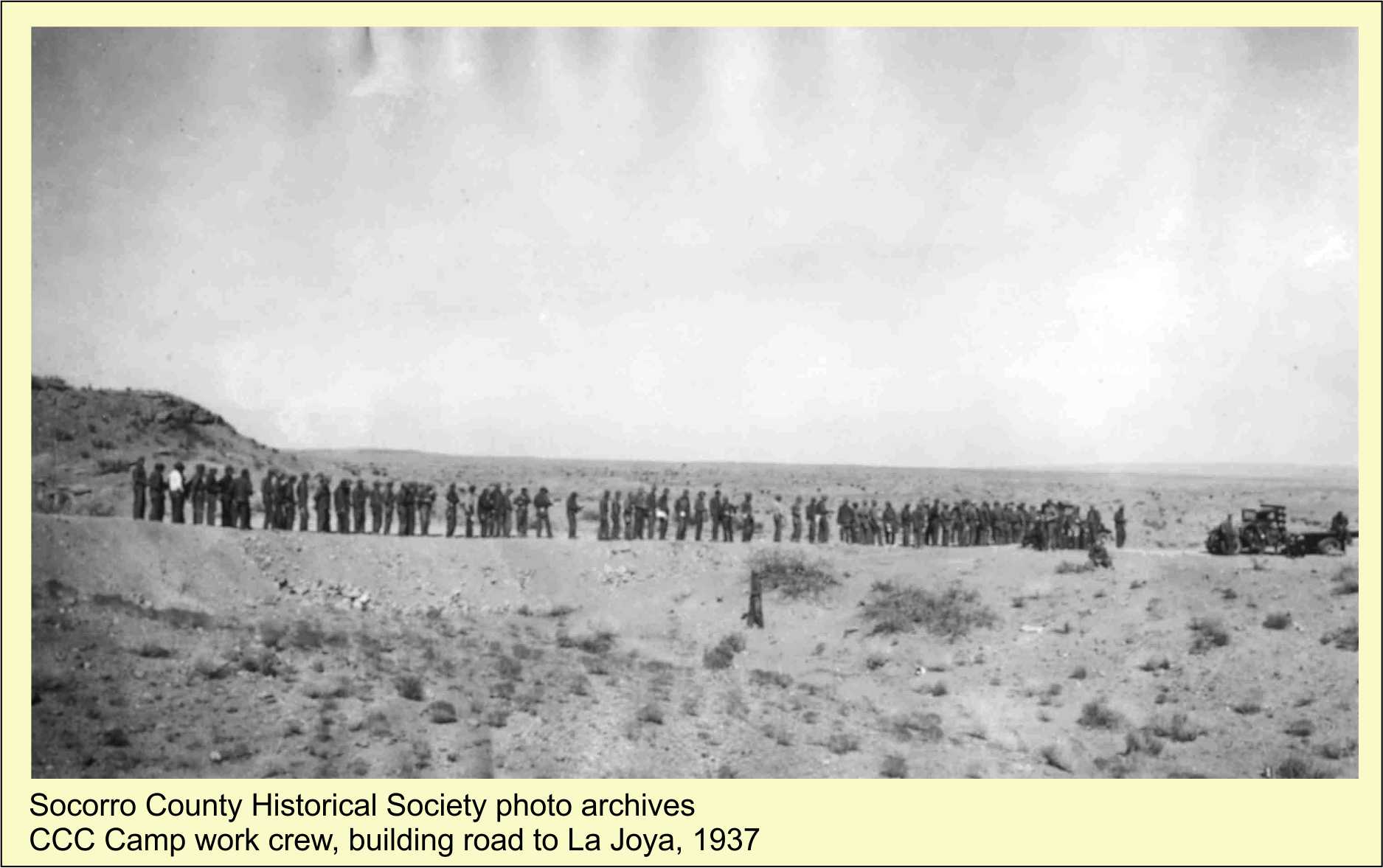
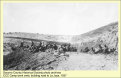
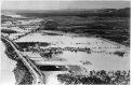
A devastating flood in May 1937 washed out US 85 and railroad tracks in the Socorro area, halting Albuquerque to El Paso traffic,
and leaving dozens of Socorro area towns isolated. The CCC and WPA were dispatched to the area to assist with
flood relief. The CCC was tasked with repairing river levies and building an emergency road to bypass destroyed US 85. The Rio
Grande bridges near Socorro and San Antonio were destroyed, leaving only the US60 bridge at Bernardo. The CCC chose theCamino Real trail from San Acacia to La Joya to reach the bridge at Bernardo. Traffic crossed to the east side of the river over
the newly built San Acacia Dam and a ferry. Thus, the CCC bladed and built up portions of the trail between San Acacia and La Joya
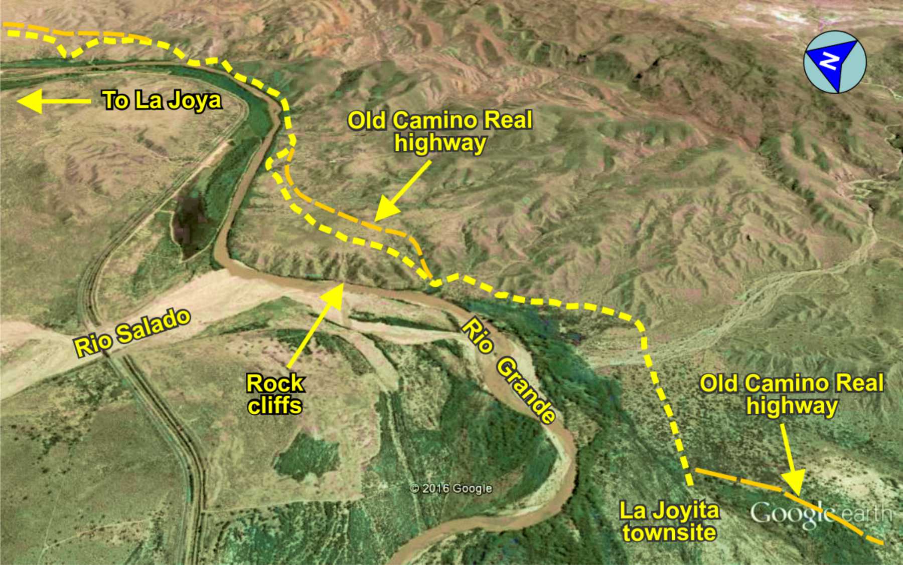
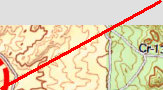
for this temporary "Camino Real Highway." Portions of the original trail can be seen where the bladed road deviated from the trail
- still visible today. This also dispells the myth El Camino Real was not used after about 1885. Portions, such as this stretch,
was used by early automobile traffic in Sierra and Socorro counties.
Photos (click to enlarge)
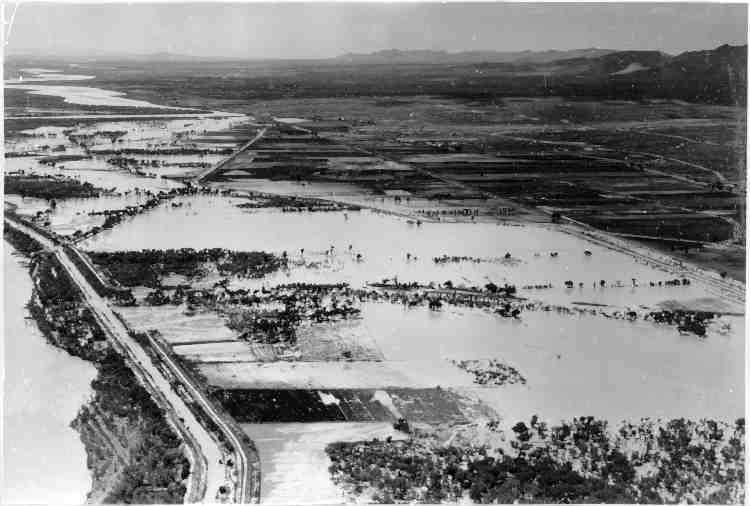
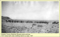
1937 flood waters at Polvadera;
US-85 submerged
Photos of the "CCC boys" building the Camino Real Highway near La Joya in 1937.

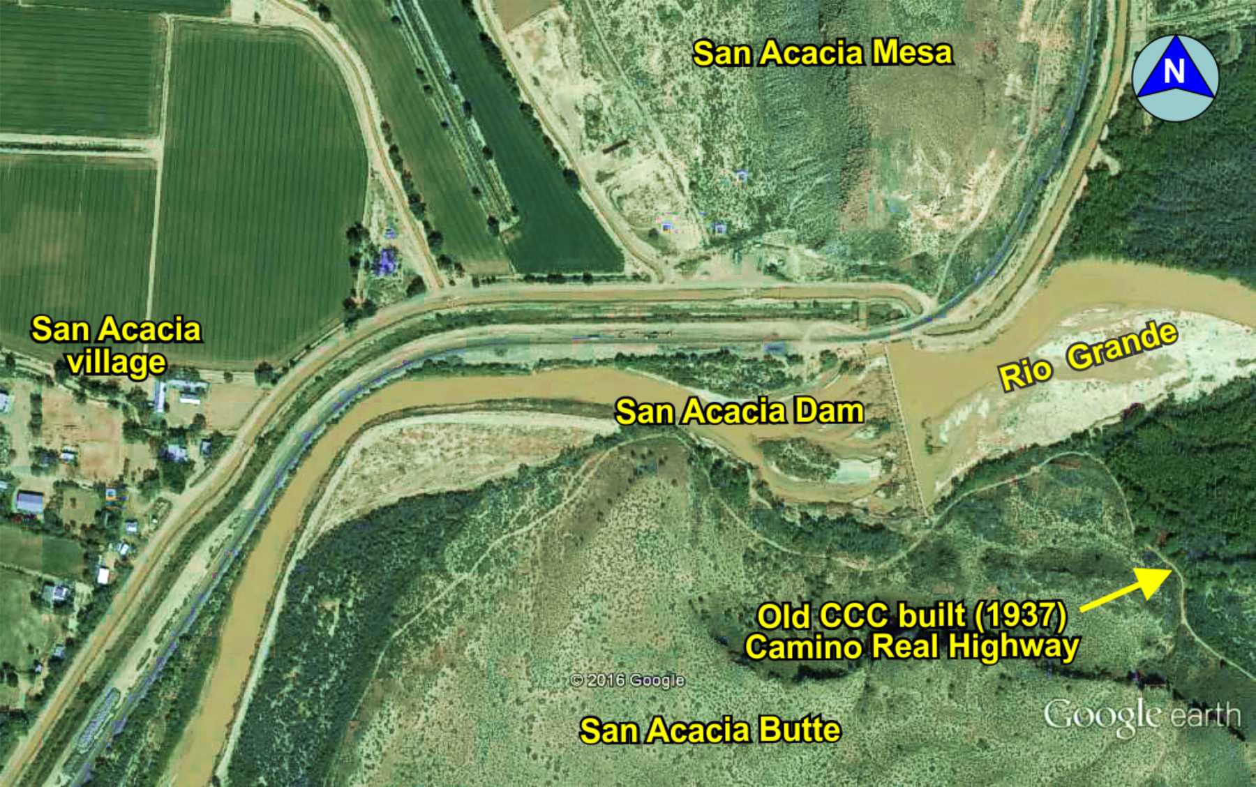
San Acacia Dam
El Camino Real trail
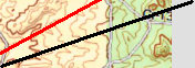
Trail vs. old highway
Meaning "Gray Hill" in Spanish, this was a 100+ foot climb on the trail, though smooth and flat along the top terrace for the wagons before the descent back into the Rio Grande valley.

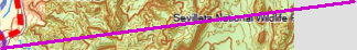
The GoogleEarth image shows an example of where the 1937 Camino Real Highway deviated from El Camino Real trail, where both can be easily seen.
La Joyita had a population of 186 in the 1850 census and grew to 460 by 1880 due to the rich farm land irrigated by the Rio Grande. The river location made for a nice stop on the trail, being about mid-way between La Joya and Sabino. The town was completely destroyed by a flood in 1886, the very end of El Camino Real usage.
Built in 1934, following the 1929 flood, to control flooding and irrigation water down stream. The dam was used 1937-1940, in addition to a ferry, to cross to the east side of the river for the Camino Real highway to La Joya. There was also a ferry at San Acacia for crossing the river used by autos and larger trucks.

NOTE: This segment of the trail has not been well explored or mapped due to inaccessibility. The San Acacia dam and roadway is
now locked by the Middle Rio Grande Conservancy District which prevents access to the east side of the river (Camino Real
side). The trail south of La Joya runs through locked private ranch land for which access is seldom granted.

I-25 Rest Area
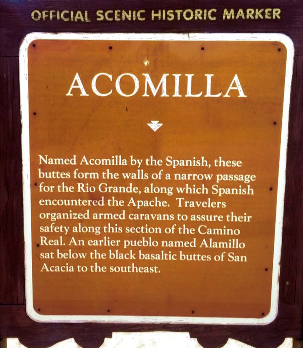
Historic Marker
Dam
Annotated
History
The Camino Real Mapping Project
on these web pages
is the exclusive work of the
members of the Socorro County
Historical Society and other
volunteers dedicated to
documenting, mapping, presenting,
and preserving the historic trail.


34°16.31'N 106°51.18'W
Elev. 4740'