El Camino Real de Tierra Adentro
Sponsored by Socorro County Historical Society
Maps, photos, and aerial photography of the trail
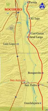
Primarily in Sierra & Socorro counties
Soc-S
Website courtesy of the Socorro County Historical Society (SCHS), P.O. Box 921, Socorro, New Mexico 87801 [
SCHS home page]
1


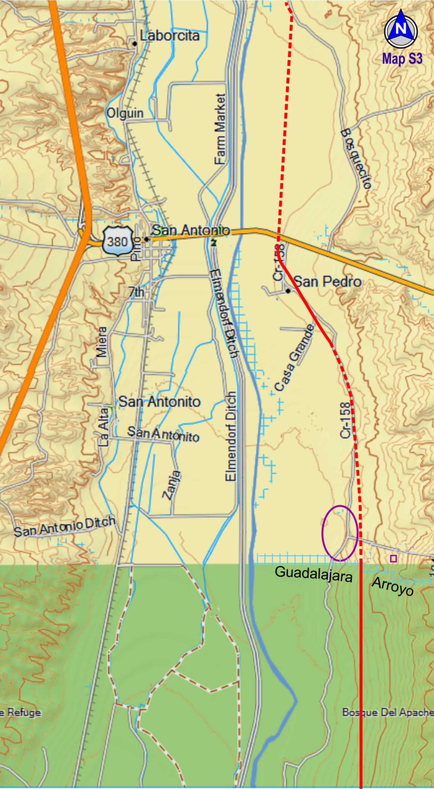
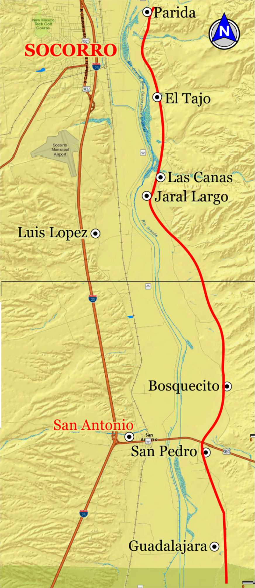
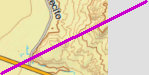
TRAIL SEGMENT ON THIS PAGE:
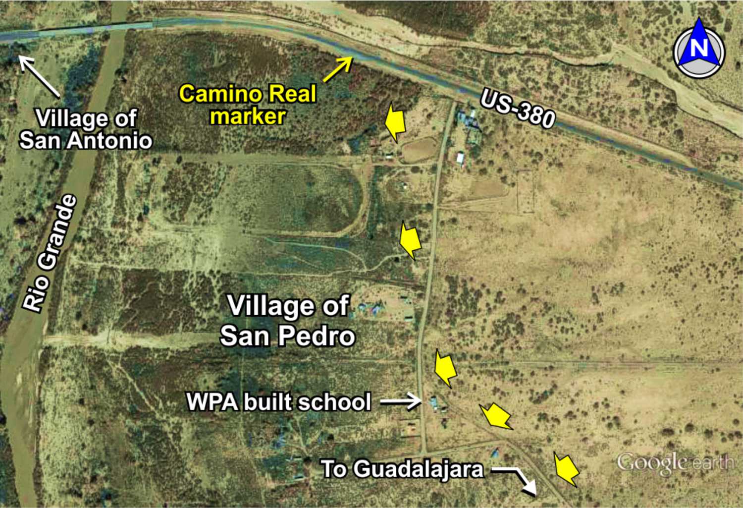
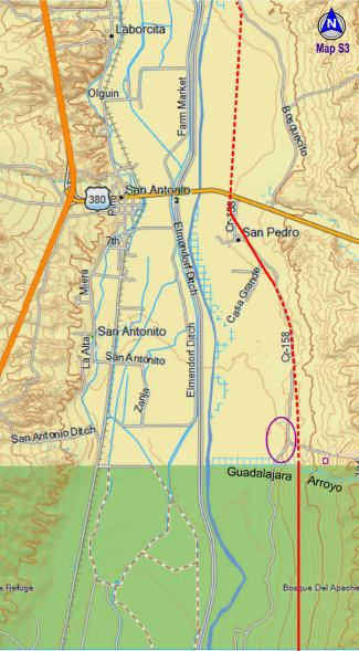
Guadalajara village
north to San Pedro

Roadside Camino Real Marker


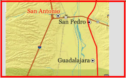
Guadalajara
townsite
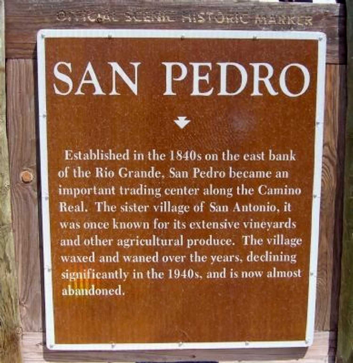
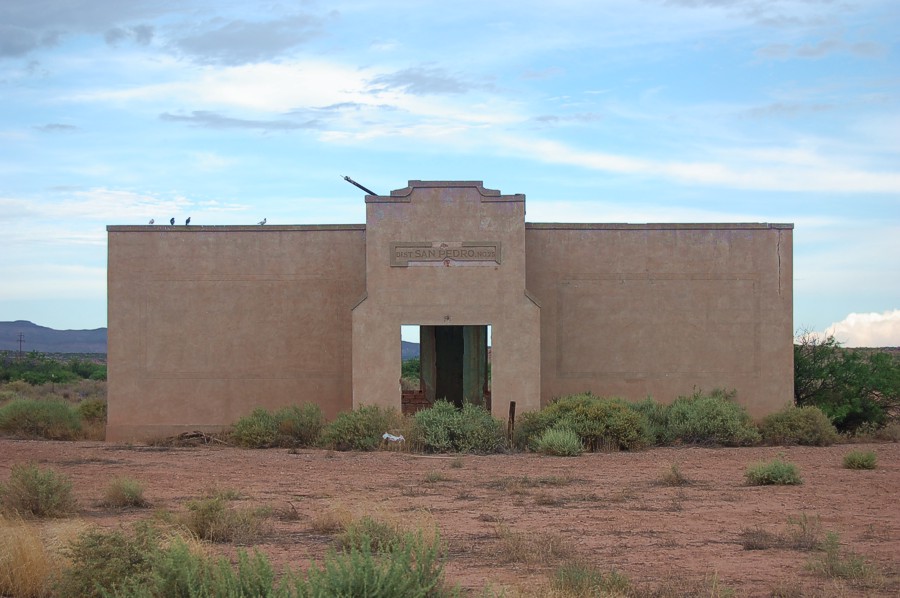
San Pedro
First called Don Pedro, the village was first recorded in 1846 by Lt. Aberts. It was a popular village stop on El Camino Real with
merchants and other services. It was a ranching and farming area, noted for its vineyards of Mission grapes producing wines and champaign.
With the arrival of the railroad, the population grew with miners working in the nearby Carthage coal fields. San Pedro declined in
the 1940s as demand for heating coal dropped and the Santa Fe RR converted to diesel locomotives. Today's population of this
historic town is less than 50.
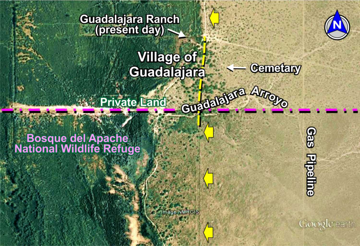
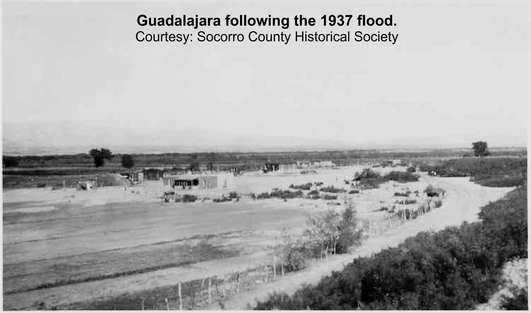
Guadalajara was a small village on El Camino Real, consisting of a handful of ranch and farming families. No exact population or founding
(probably mid-1800s) is known, as included with the San Pedro census. The town was heavily damaged in the 1929 flood, and inundated
in the 1937 flood, leaving only one ranch house remaining today - still occupied. The San Pedro acequia ran south to serve the
village. The school house was located just west of the surviving windmill.
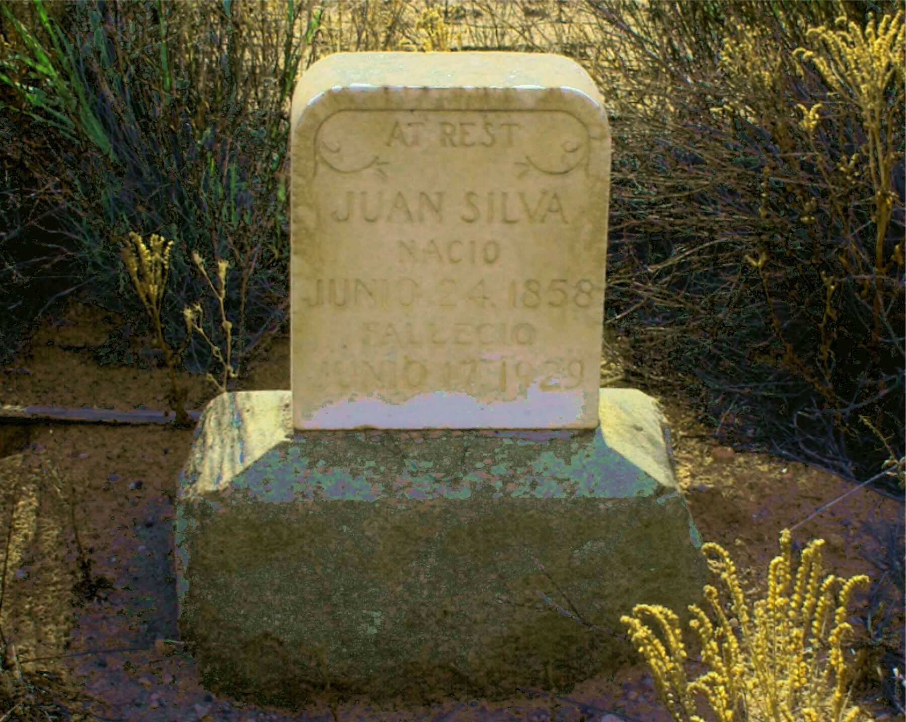
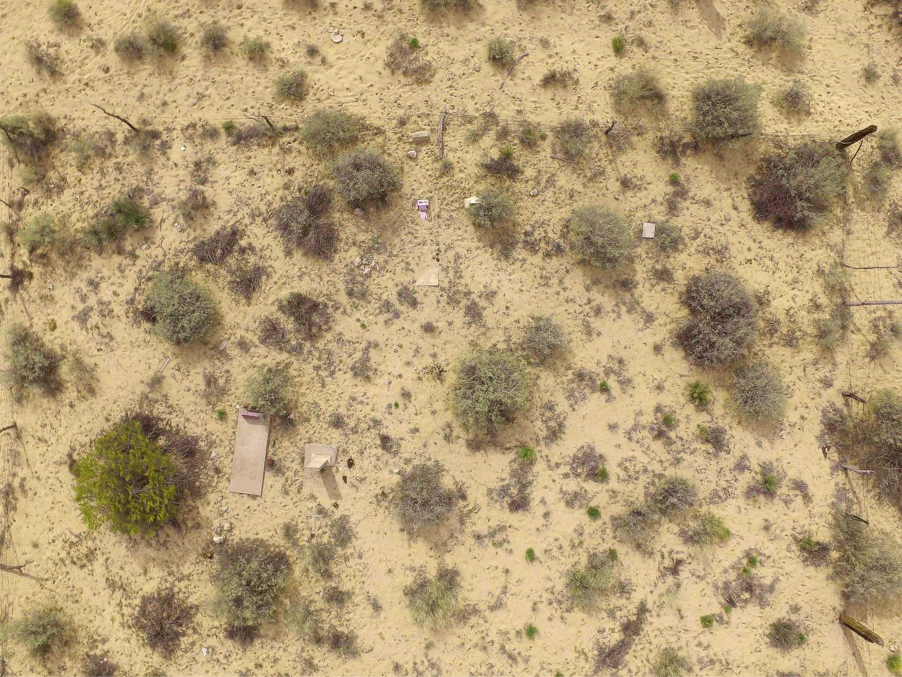
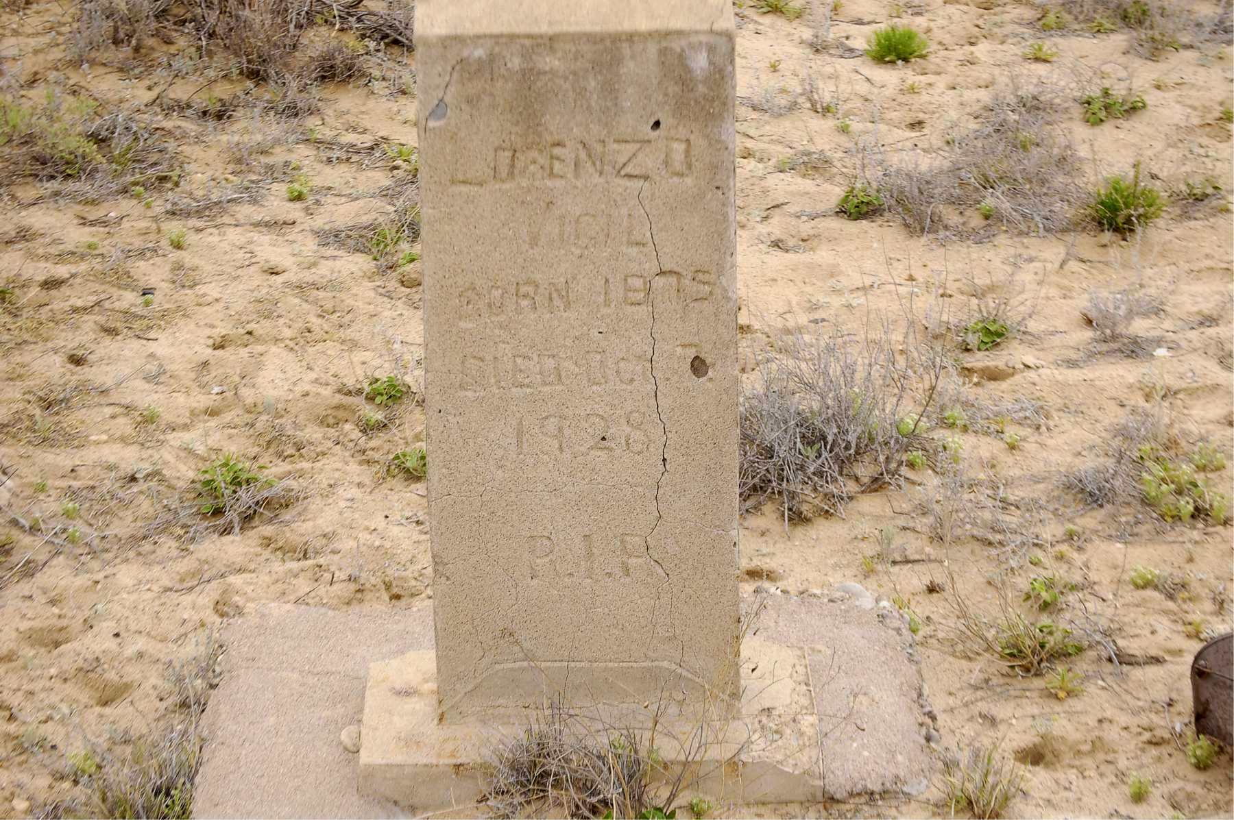
Cemetery
One of the saddest and loneliest cemeteries you will see. When in the area, we always stop to give them some company. Graves are pre-1937 when Guadalajara was destroyed by flood waters. Some graves unreadable or with no markers.

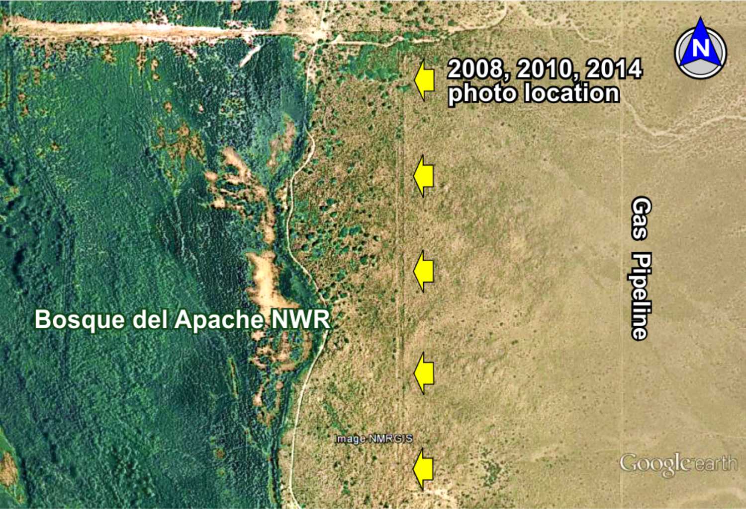
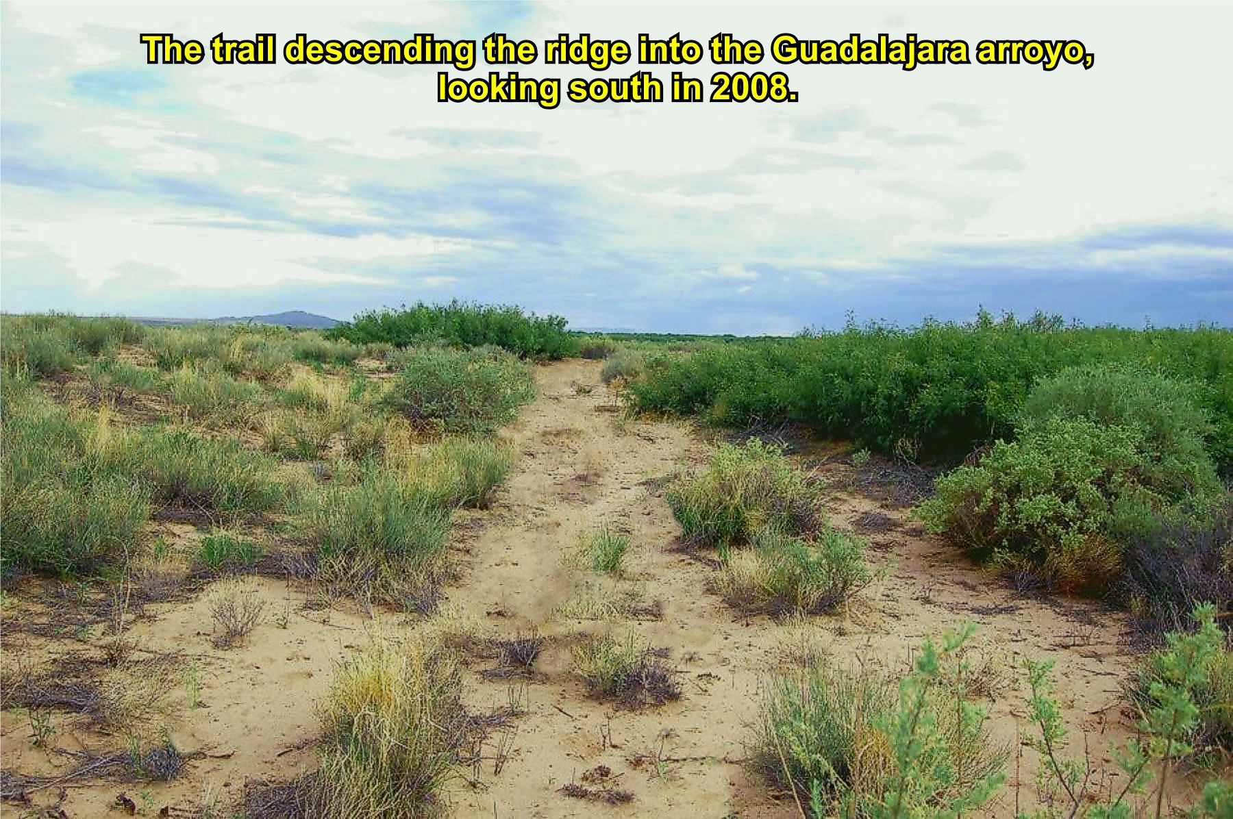
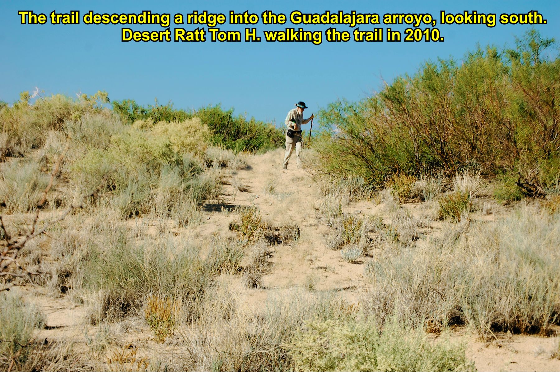
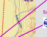
Bosque trail
Disappearing Trail. This once pristine section of the trail is now completely overgrown with wild flowers and vegetation due to heavy
spring rains in 2014. Compare the views of the trail in 2008, 2010, and 2014. Vegetation overtaking the trail is a common
problem causing large sections of El Camino Real to no longer be visible in some areas.


2008
2010
2014
1937
2014

Silva
Vigil
WPA
school
Website courtesy of the Socorro County Historical Society (SCHS), P.O. Box 921, Socorro, New Mexico 87801 [
SCHS home page]
The Camino Real Mapping Project
on these web pages
is the exclusive work of the
members of the Socorro County
Historical Society and other
volunteers dedicated to
documenting, mapping, presenting,
and preserving the historic trail.

GoogleEarth
image
Drone
aerial photo
Trail photo
Notes or
documentation
LEGEND
Aerial photos with DJI Phantom 3 quadcopter camera


33°52.17'N 106°49.93'W
Elev. 4550'

33°54.64'N 106°50.50'W
Elev. 4570'