El Camino Real de Tierra Adentro
Sponsored by Socorro County Historical Society
Maps, photos, and aerial photography of the trail
Primarily in Sierra & Socorro counties


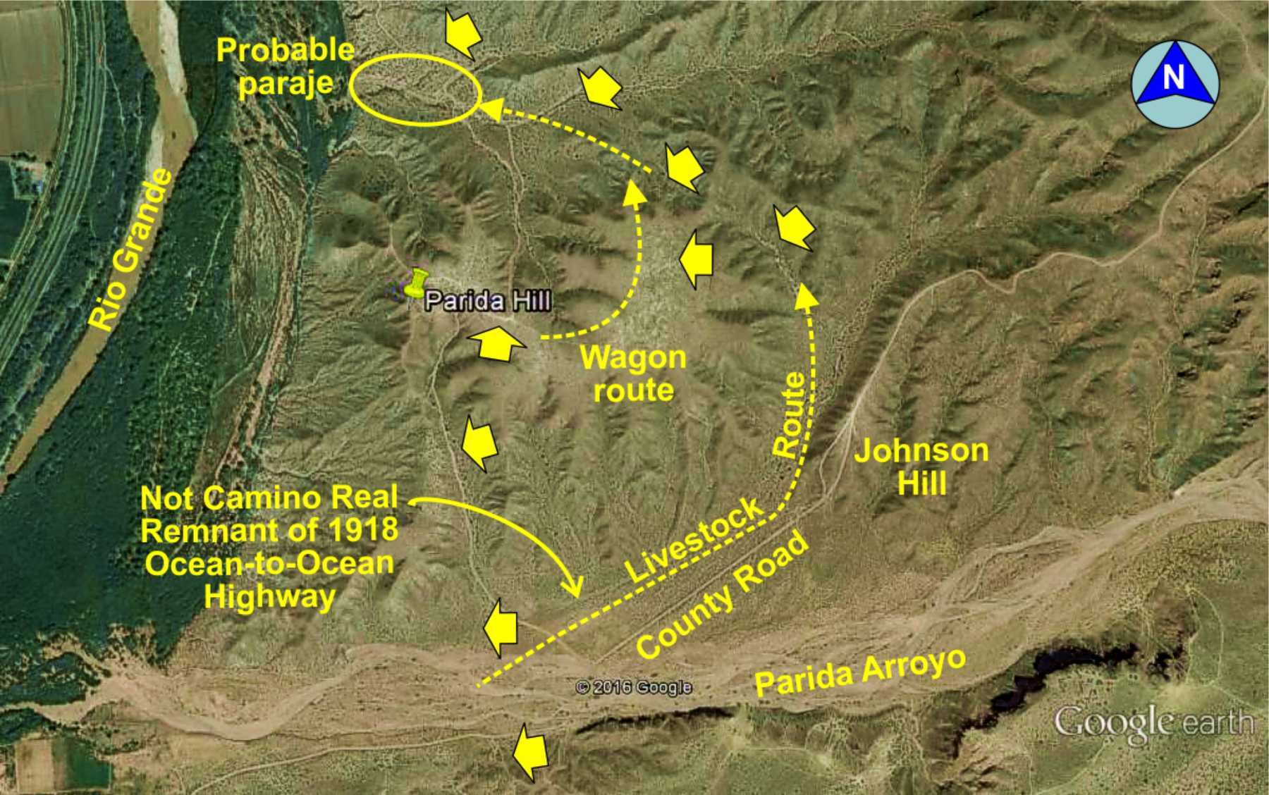
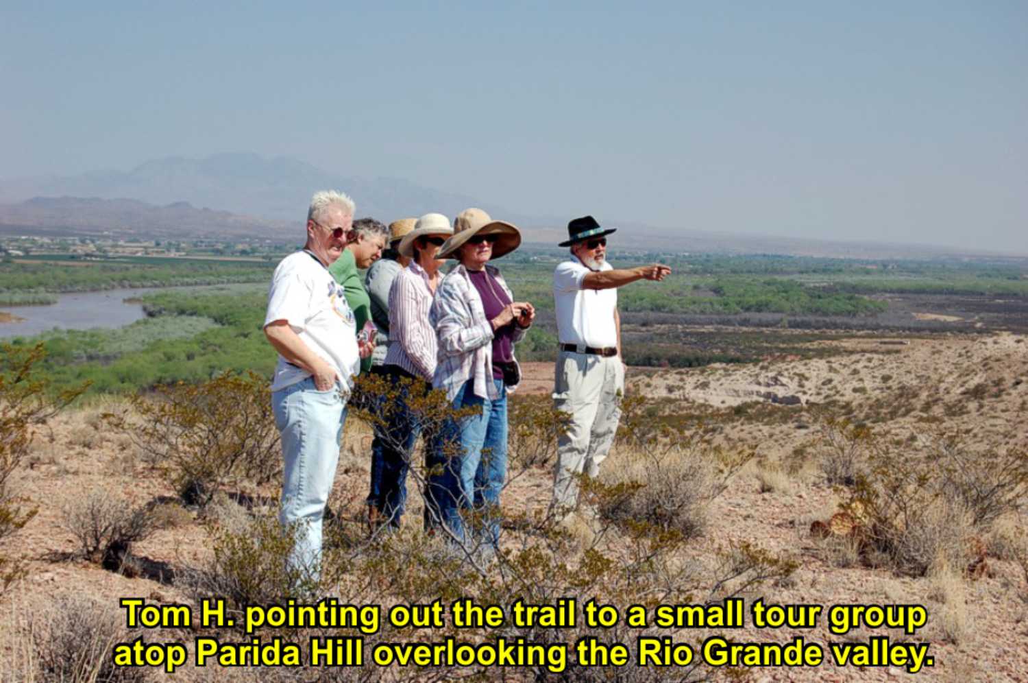
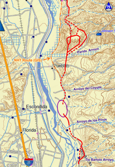
Parida Hill

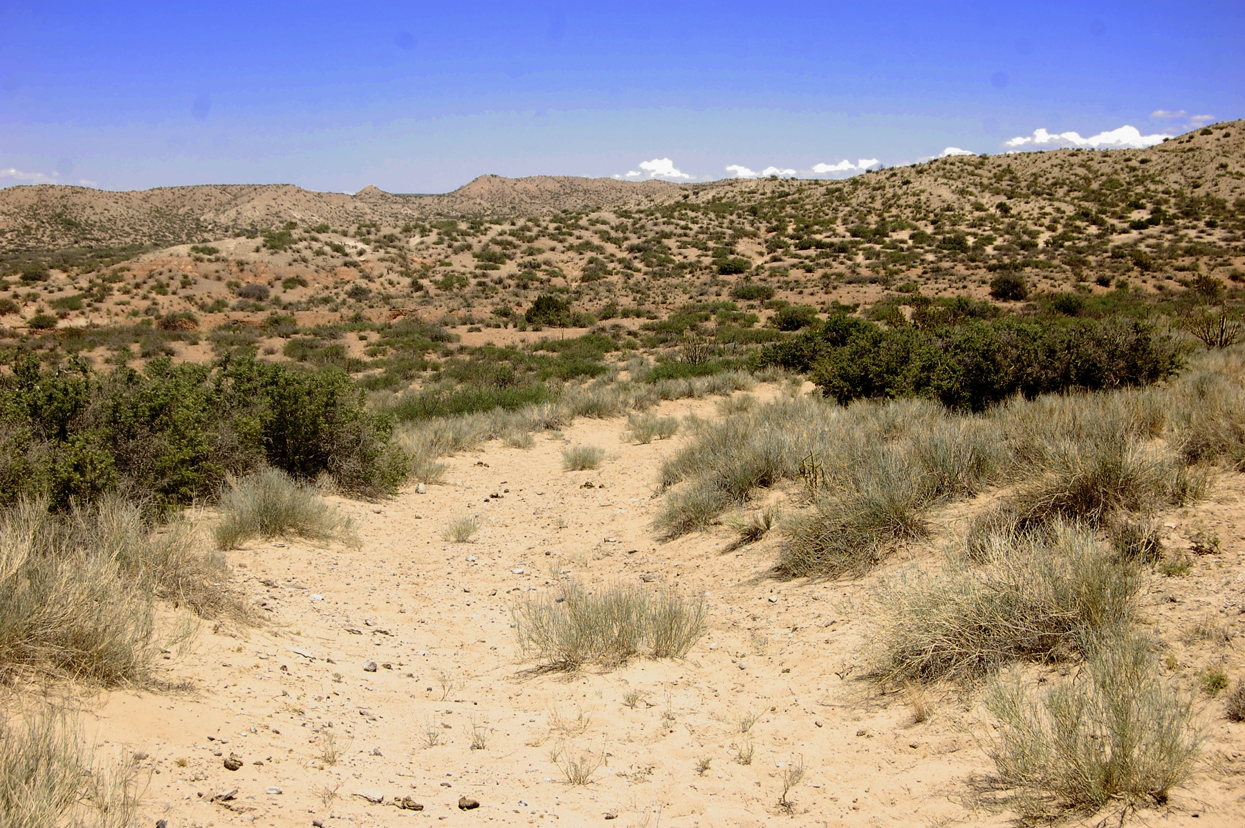
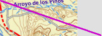
Arroyo de los Pinos
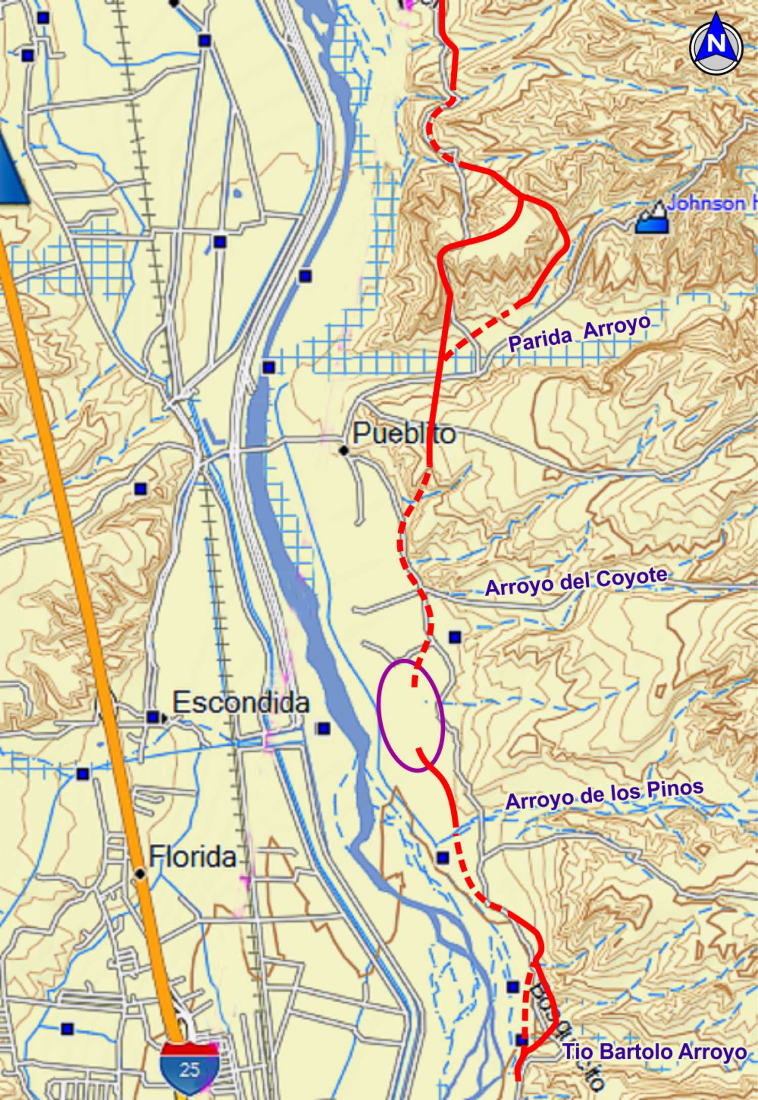
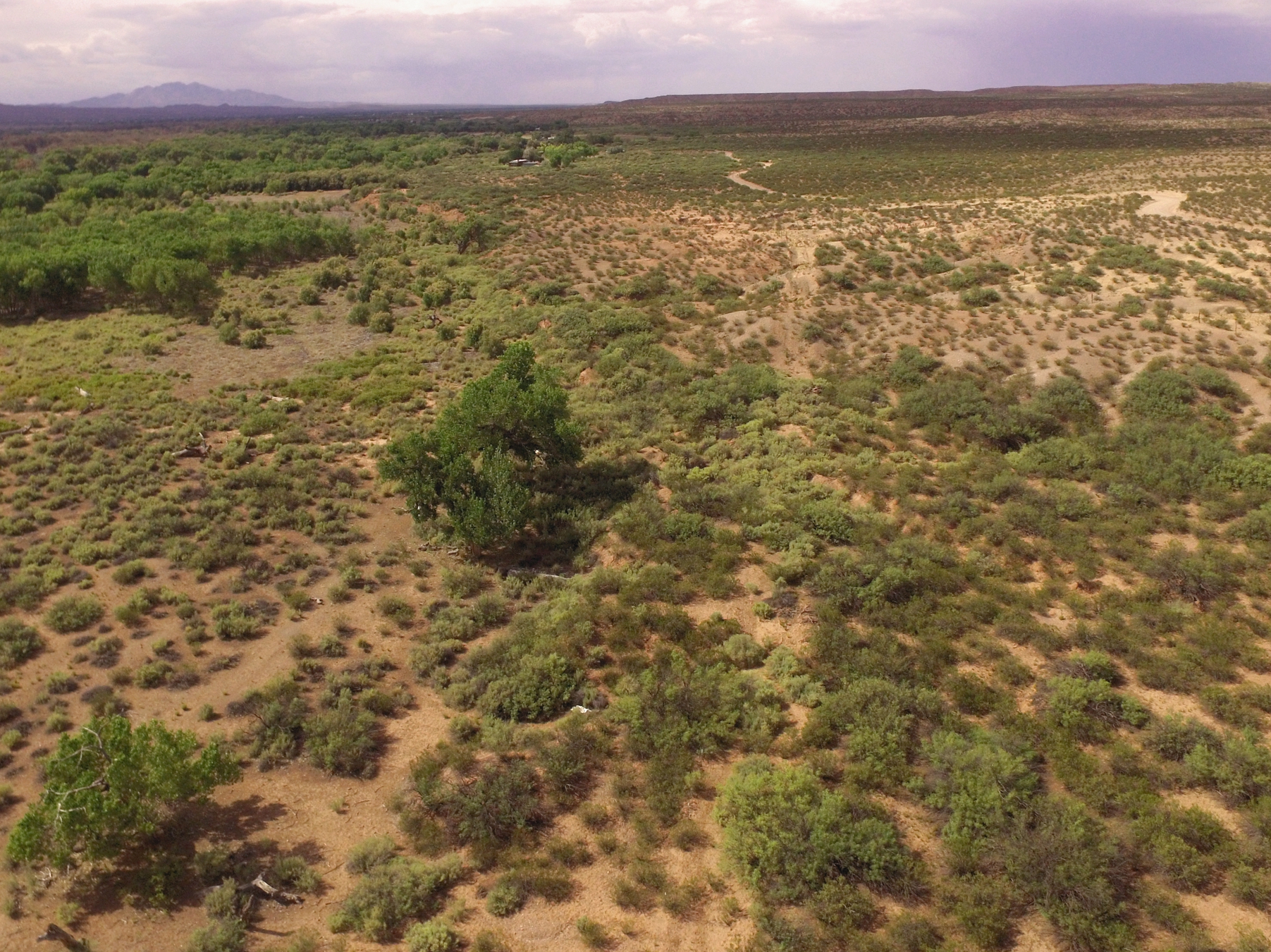
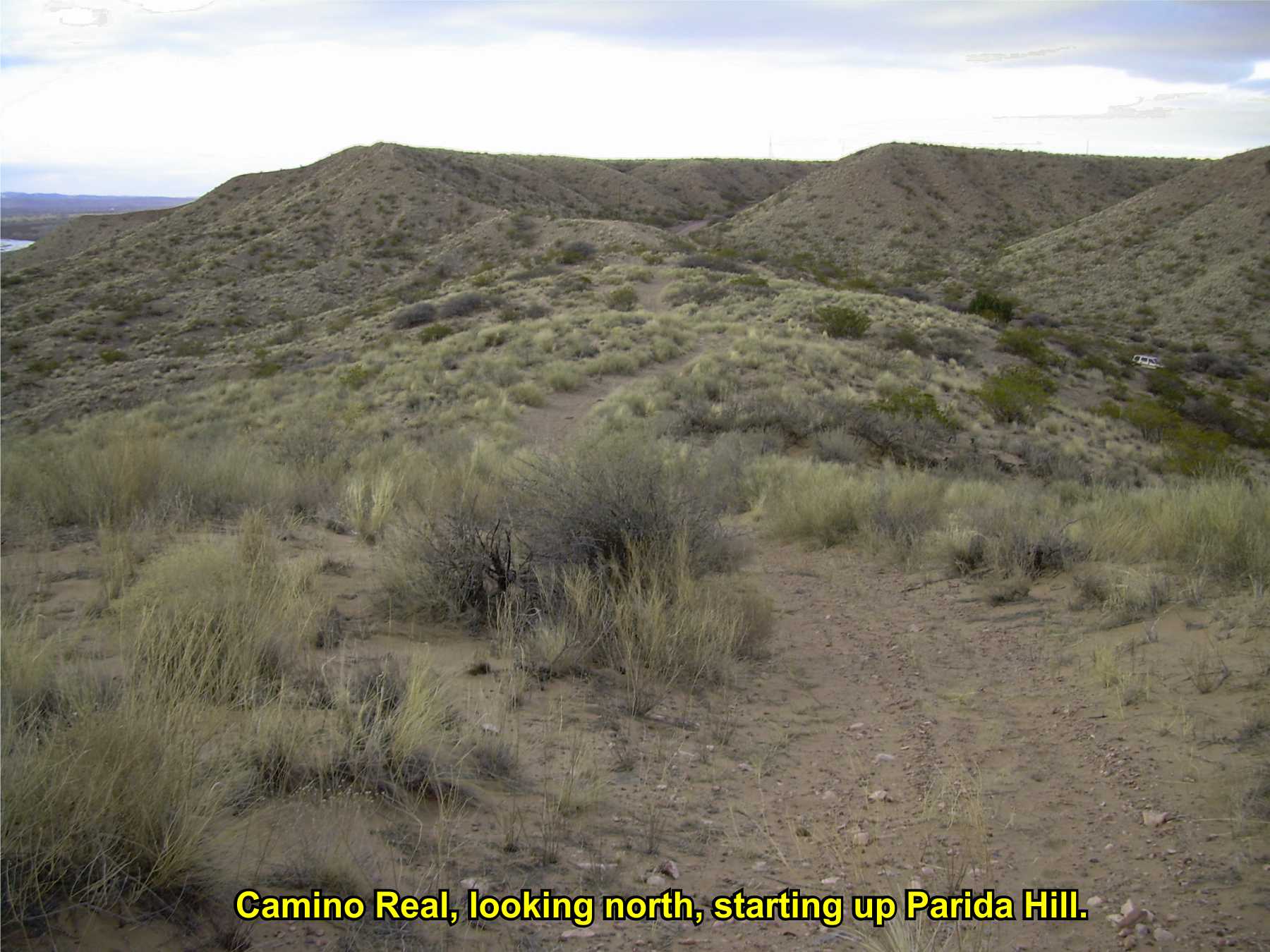
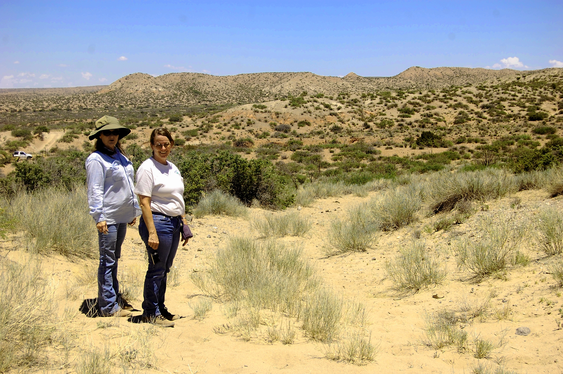
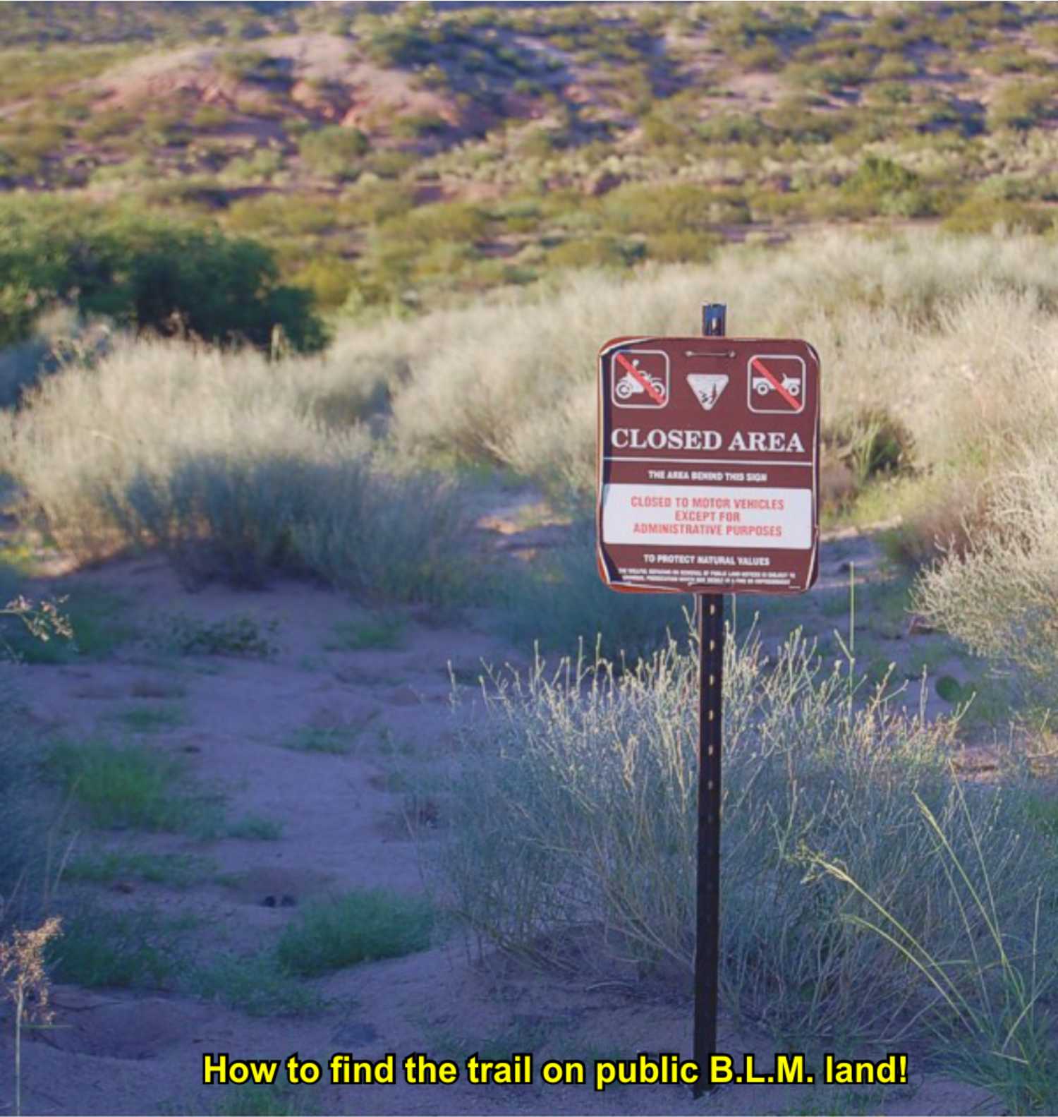
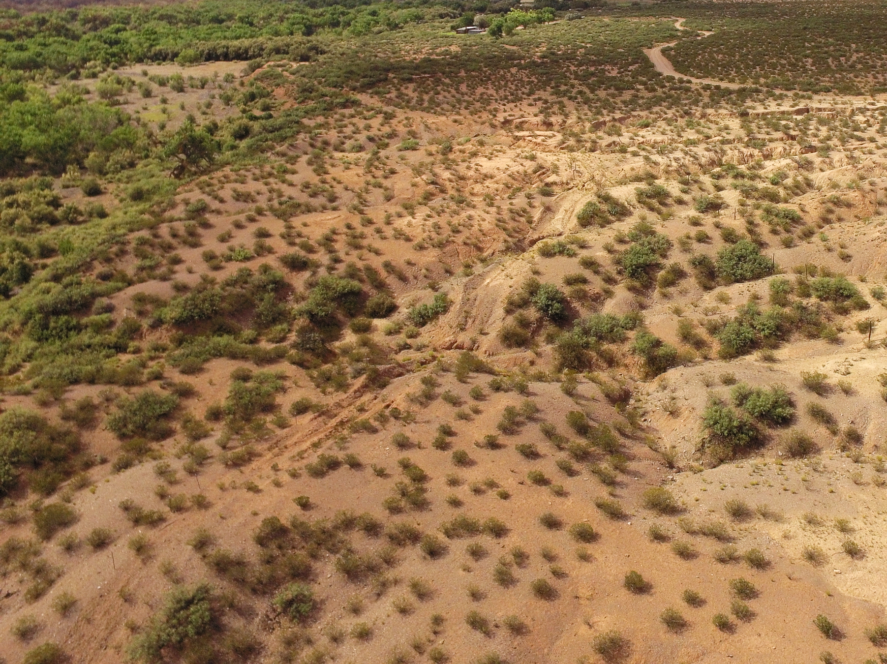
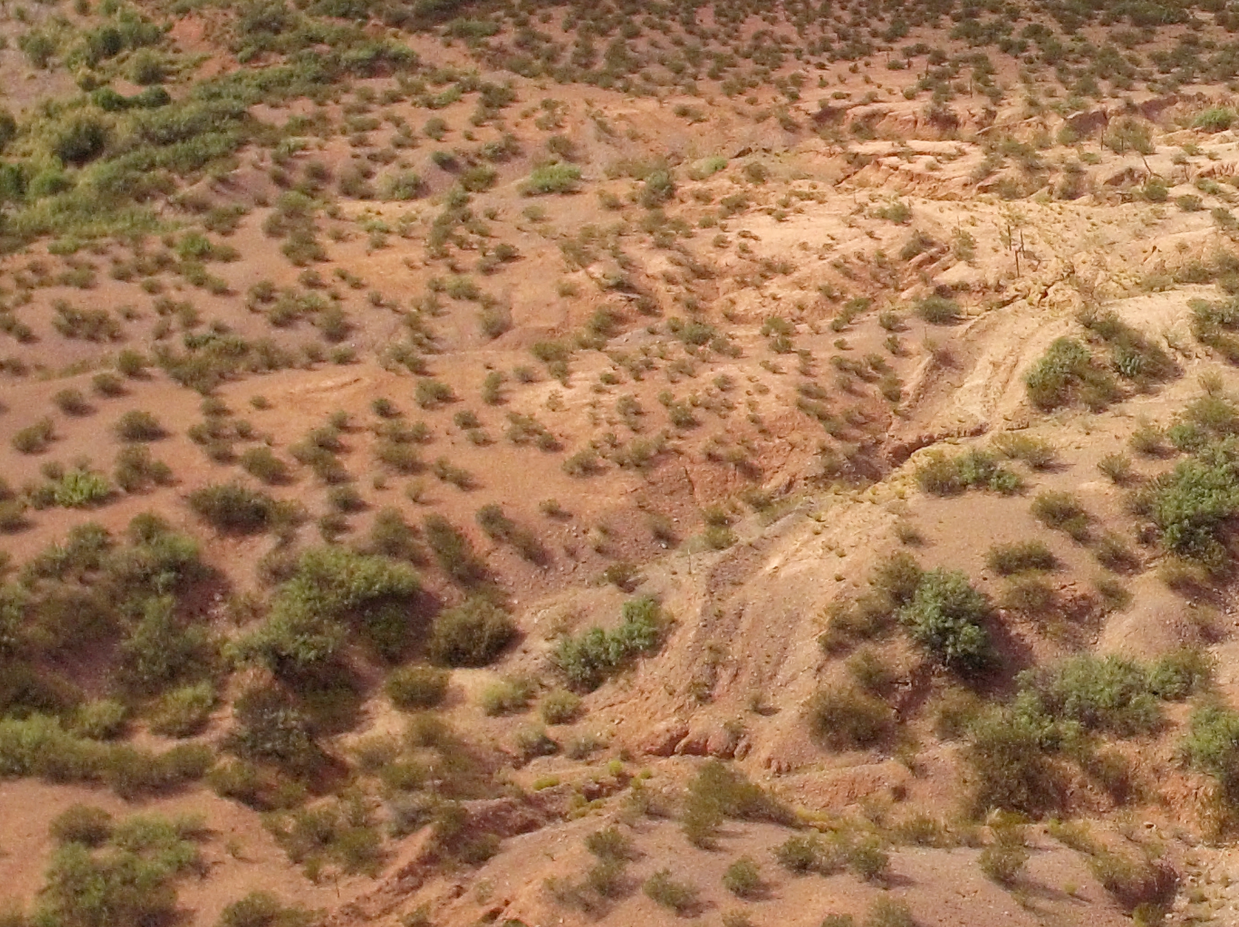
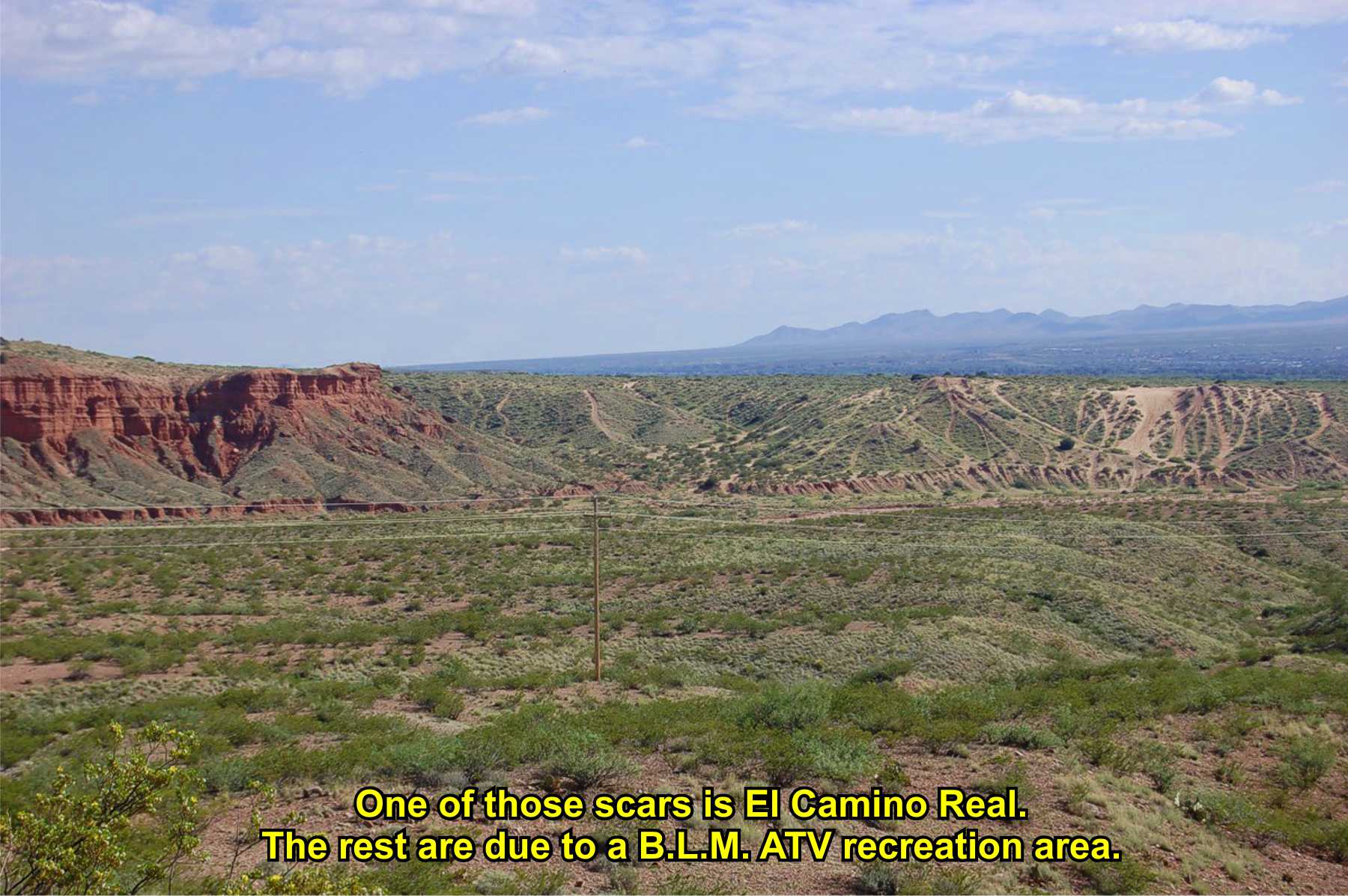
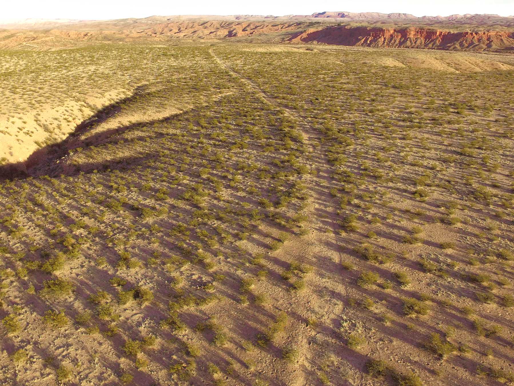
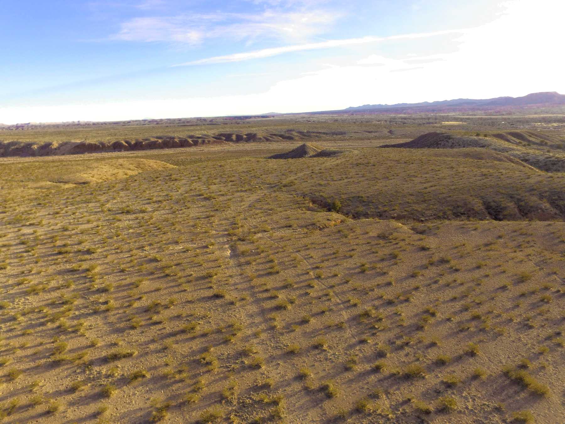
Wagons were double-teamed to ascend the hill. The livestock with the caravans were routed through a saddle a bit to the west.It was generally an all day job getting the livestock, wagons, and people over the hill. Many caravans made camp at the north foot of the hill, in an unnamed arroyo, and close to the river bed to rest before the next day's journey. There are several visible threads of the trail atop Parida Hill.
Good views where the trail crosses an arroyo and visible on both sides. On north side, view of a split in the trail, where it appears the earlier trail was damaged by a ravine, and the later trail was routed around the obstruction.

soc-N1

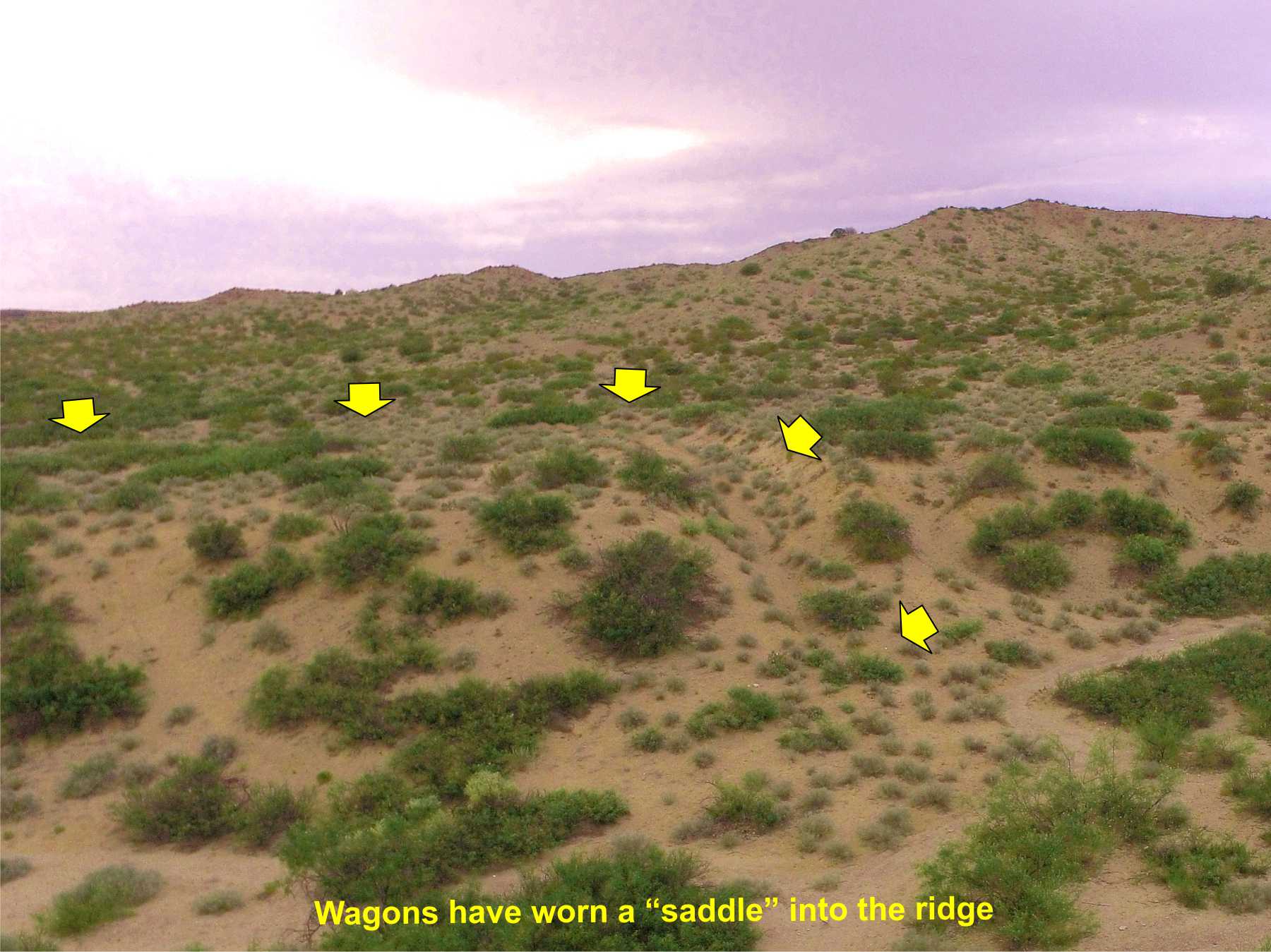
Parida Saddle

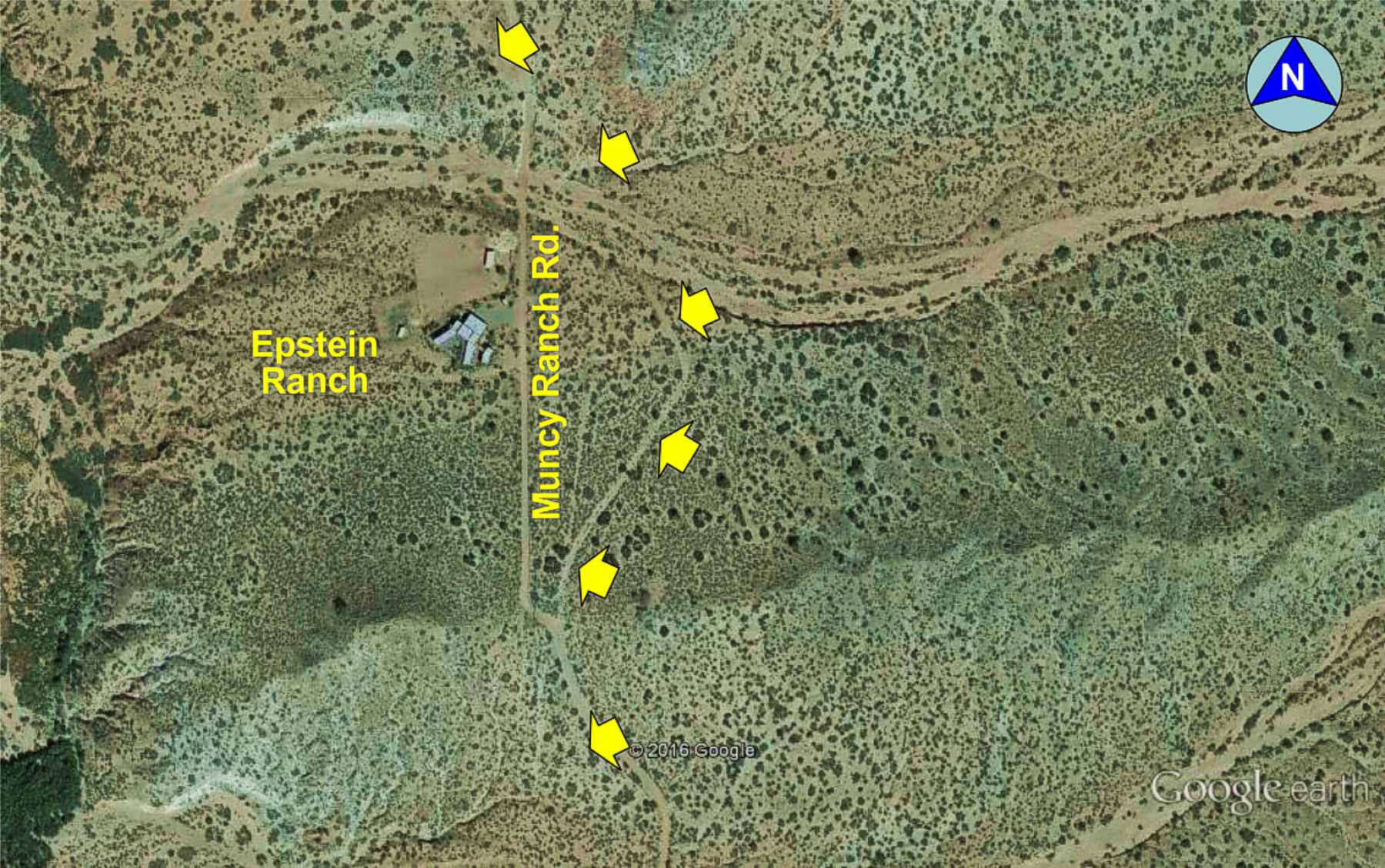
Parida village
Muncy Ranch route
(The road to Sabino)
A short, pristine section of the trail departing the Muncy Ranch road, leading into an unnamed arroyo northward towards Sabino village.
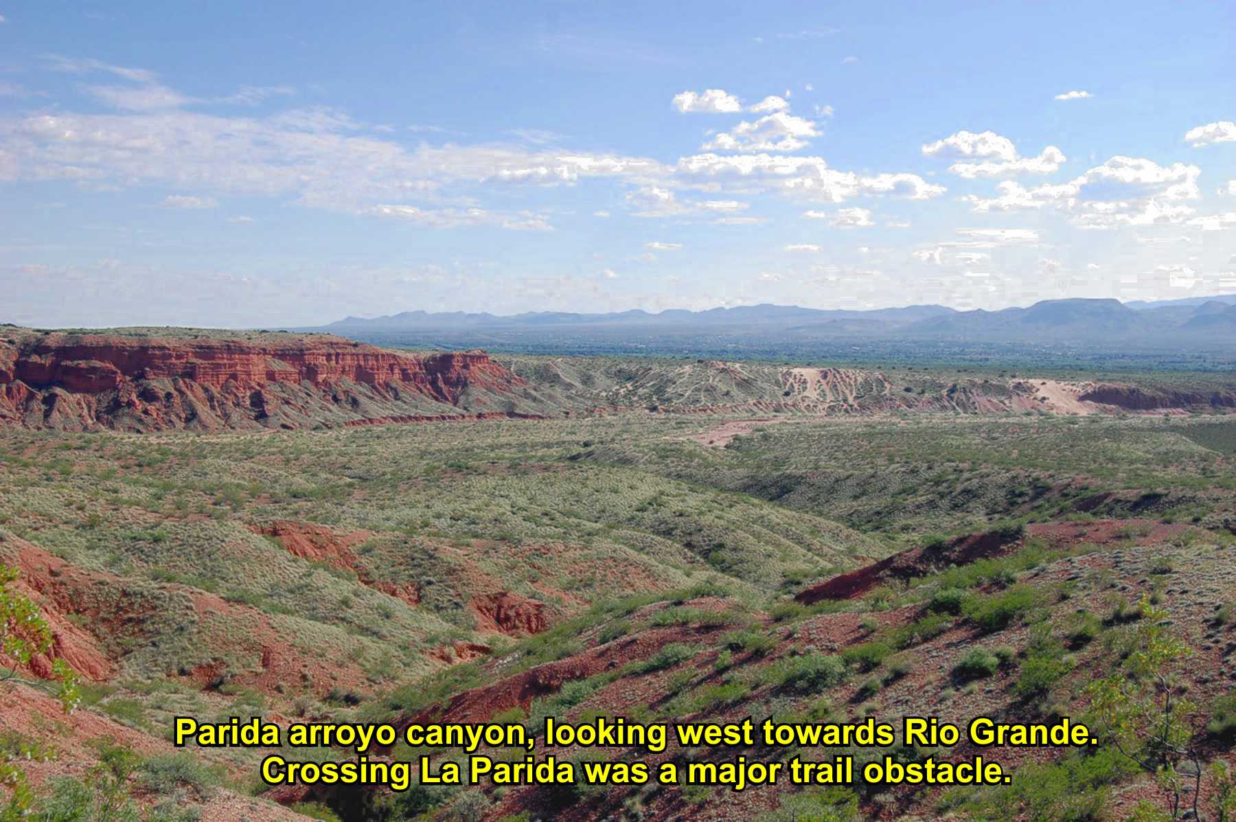
Parida Arroyo canyon
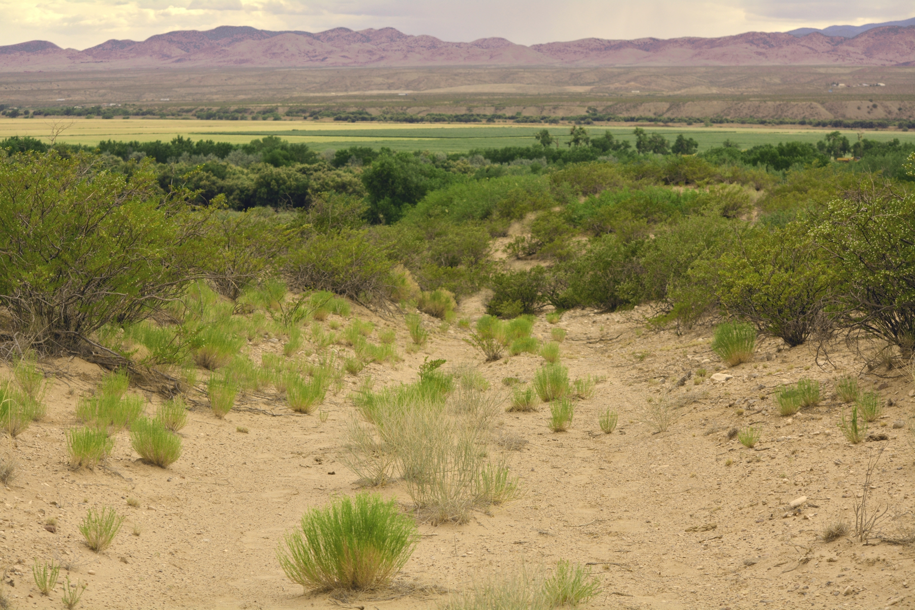
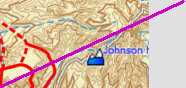
Parida was a village on the trail and the Rio Grande, destroyed by floods in 1929 and 1937. For southbound caravans, it was "the last village until Doña Ana."
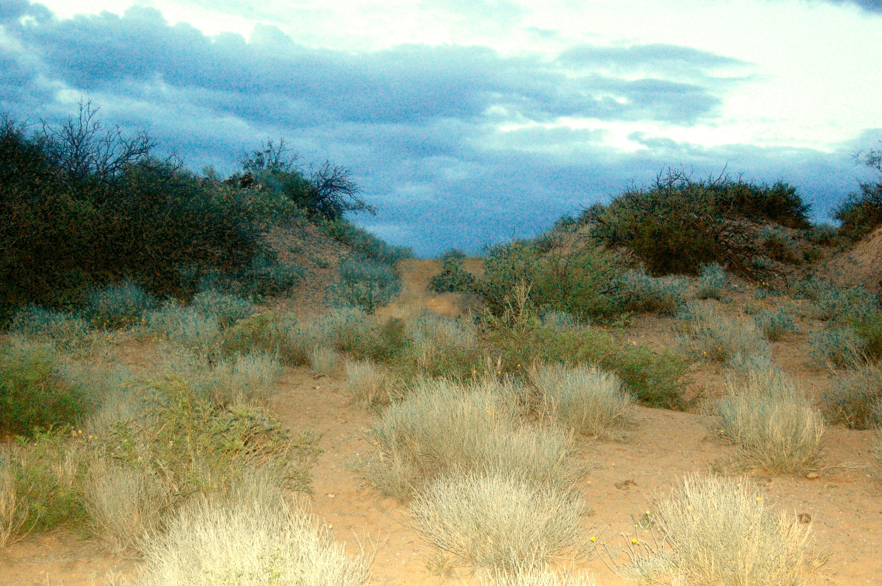
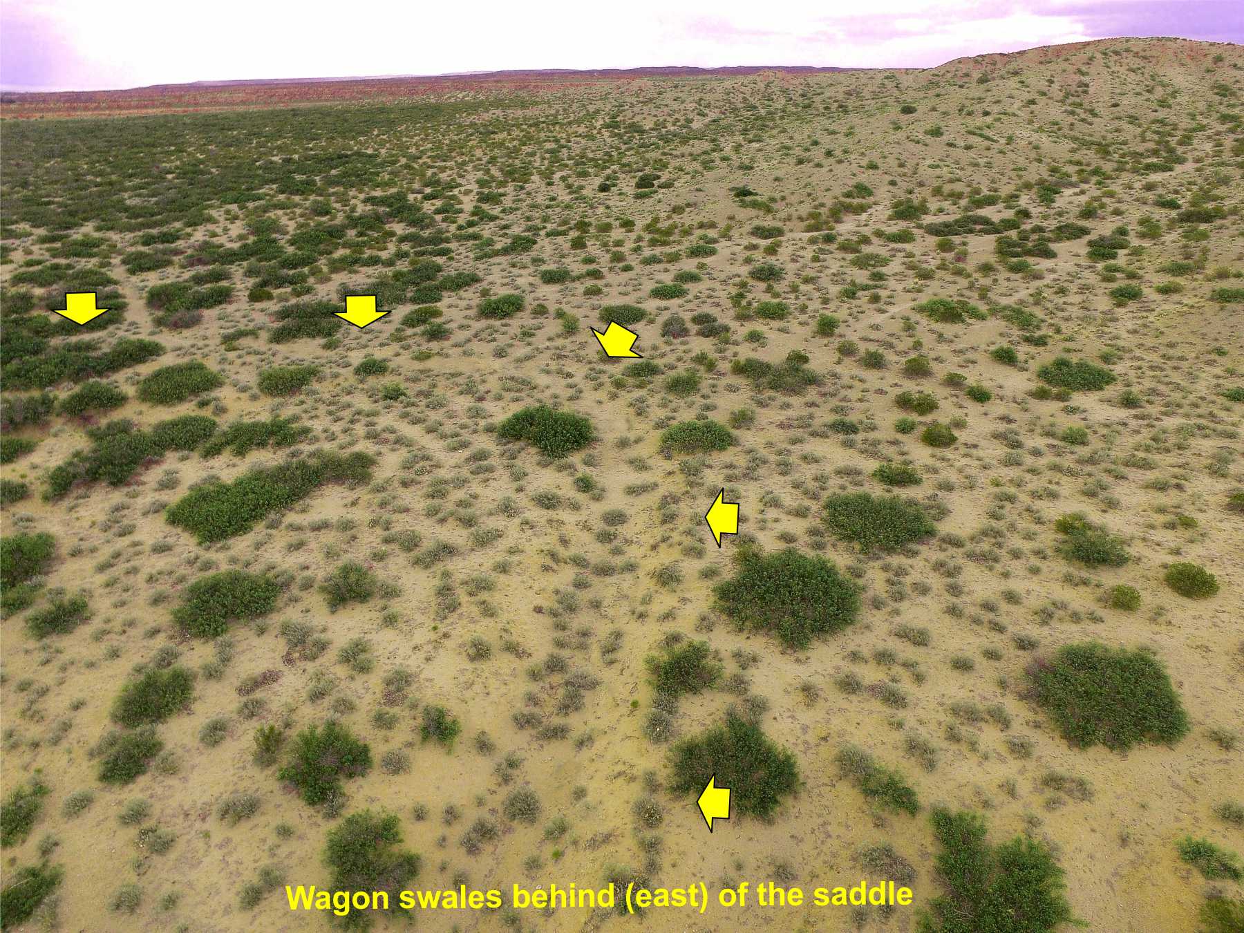
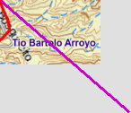
The trail crosses a ridge then turns north to Parida. Years of wagons wore a deep saddle over the sandstone ridge, still visible today.
Wagon
routes
Animal
route
Parida
townsite
GTX001751
TRAIL SEGMENT ON THIS PAGE:
Adjacent to Socorro, NM;
Tio Bartolo north to Parida Hill

1
From Thomas Falconer, Notes of a Journey through Texas and New Mexico, in the years 1841 and 1842:
Traveling south, La Joya
to El Paso
"We halted in the evening at Pareida, again striking the river. This is the last settlement on the left bank
between Santa Fe and Paso del Norte. At Pareida is the commencement of a great bend of the river to the E; and in order to shorten
our road we crossed the water, about 2 feet deep, the greater number of our party wading through it."

Website courtesy of the Socorro County Historical Society (SCHS), P.O. Box 921, Socorro, New Mexico 87801 [
SCHS home page]
The Camino Real Mapping Project
on these web pages
is the exclusive work of the
members of the Socorro County
Historical Society and other
volunteers dedicated to
documenting, mapping, presenting,
and preserving the historic trail.
GoogleEarth
image
Drone
aerial photo
Trail photo
Notes or
documentation
LEGEND
Aerial photos with DJI Phantom 3 quadcopter camera


West trail
East trail

34°08.89'N 106°52.20'W
Elev. 4730'


34°05.00'N 106°51.66'W
Elev. 4635'
34°05.73'N 106°52.11'W
Elev. 4640'
34°08.18'N 106°52.06'W
Elev. 4890'
Climb up
the hill
Parida Hill, (Pareida) was a trail landmark and major obstacle descending into the arroyo and canyon, and the ascent over the hill.

.mp4
2:25min
37MB

.mp4
1:58min
36MB
.mp4
0:42min
14MB
.mp4
1:09min
18MB
Parida to Sabino
Top of hill
.mp4
0:55min
14MB
1126/18 2.1