El Camino Real de Tierra Adentro
Sponsored by Socorro County Historical Society
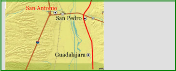
Maps, photos, and aerial photography of the trail
Primarily in Sierra & Socorro counties


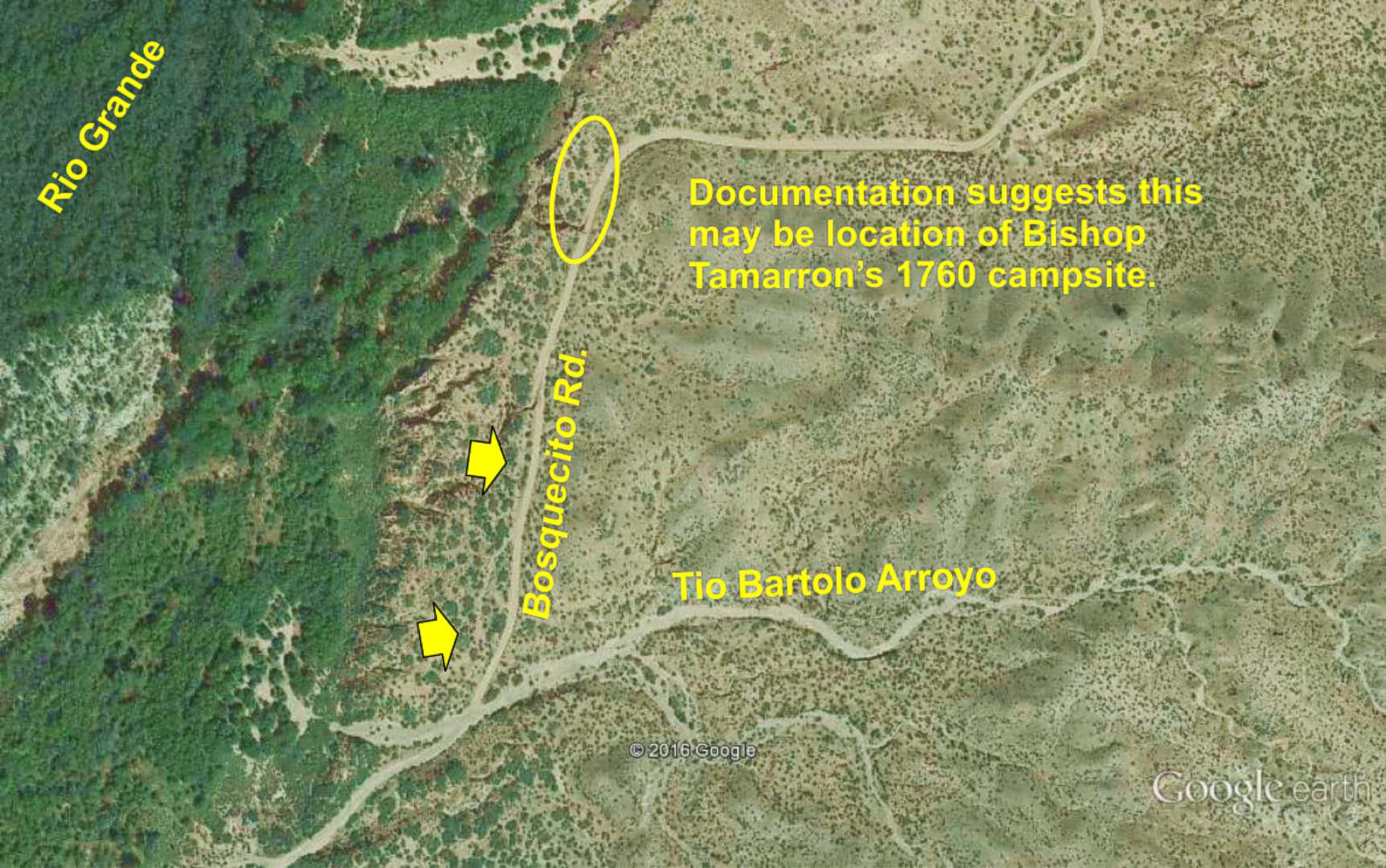
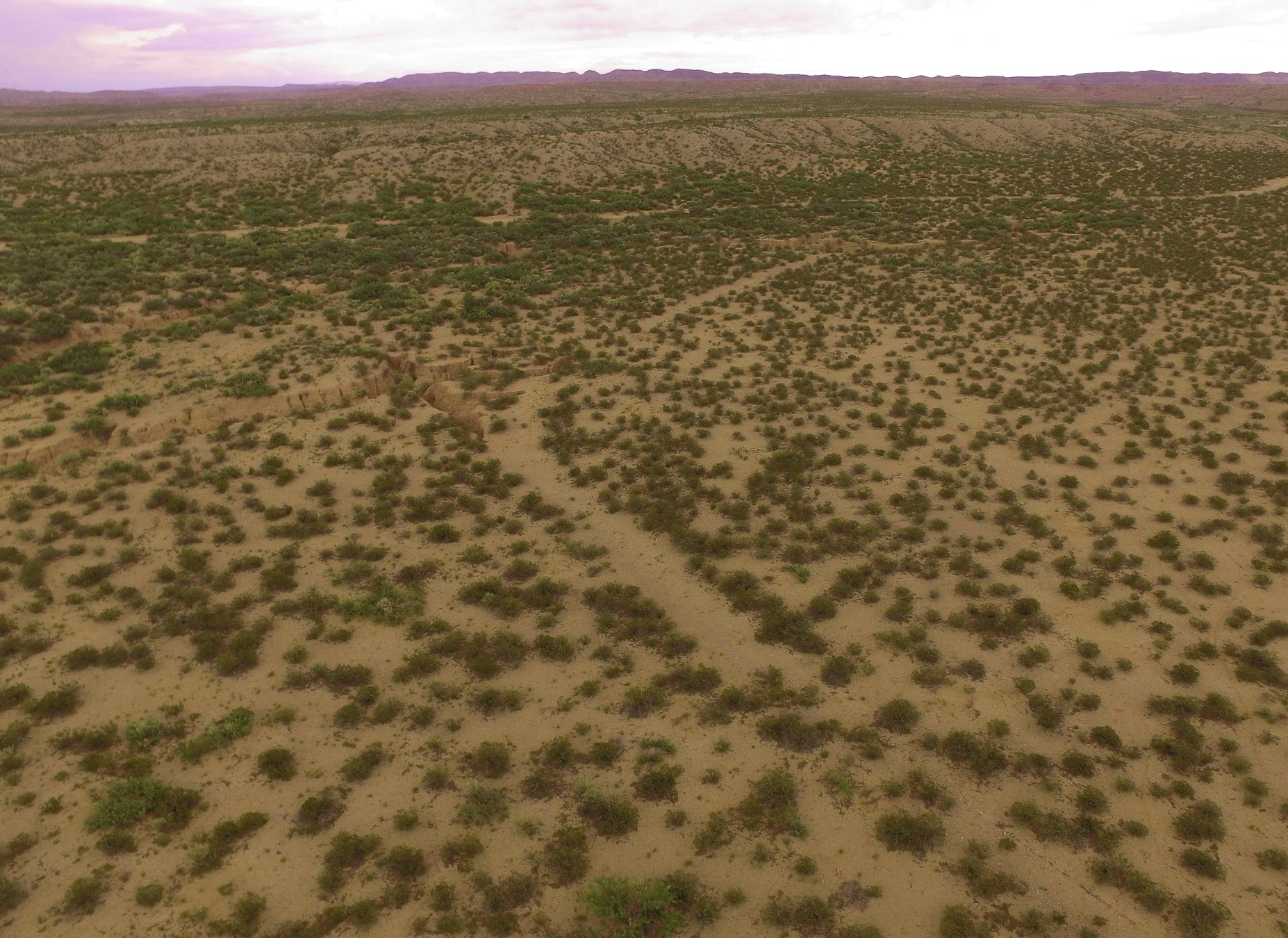
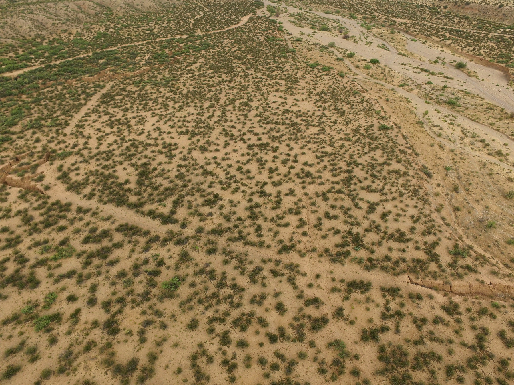
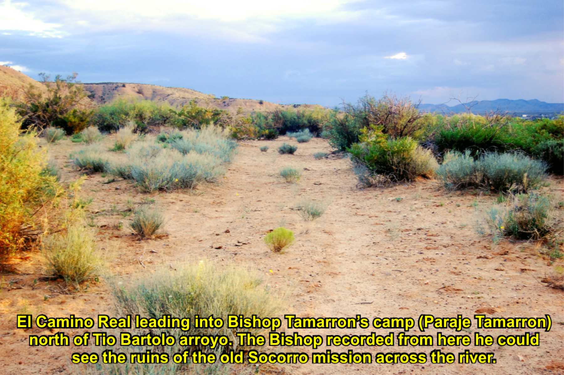
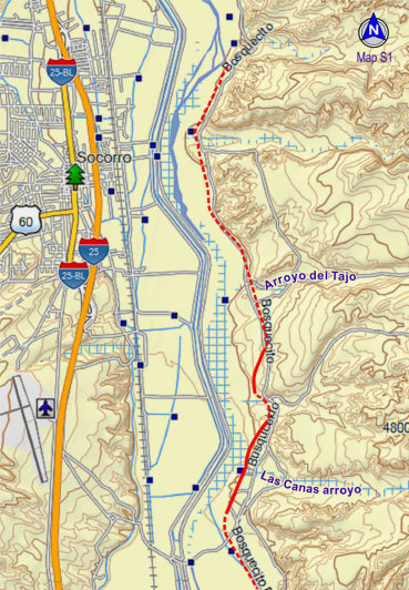
Tio Bartolo arroyo
Unnamed arroyo
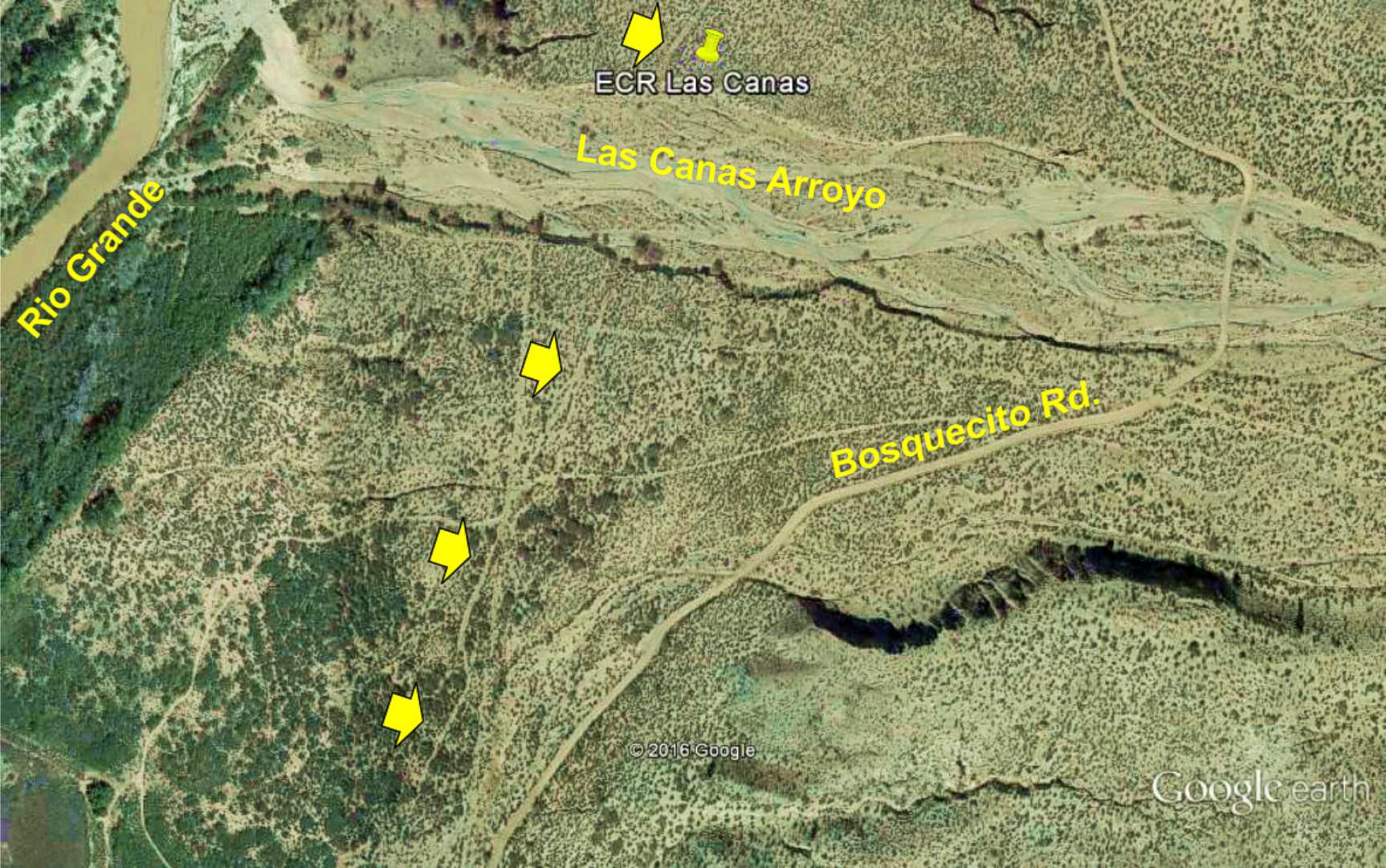
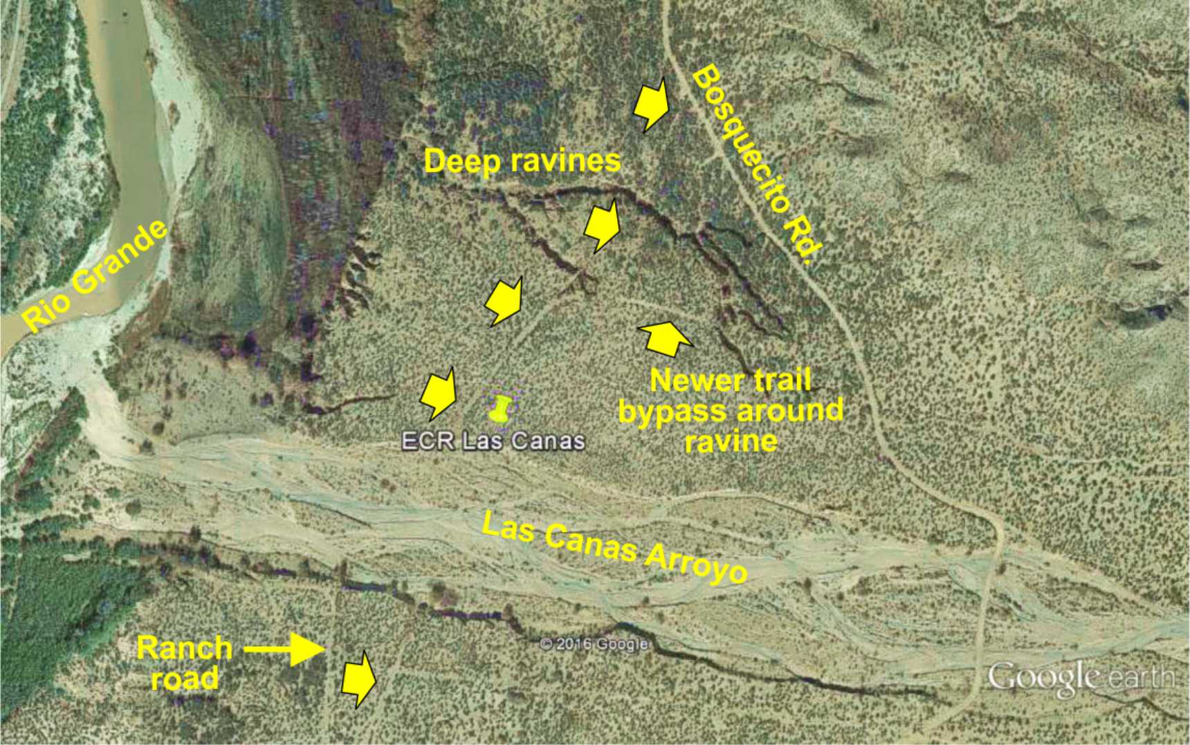
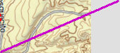
Las Cañas arroyo (south side)
Las Cañas arroyo (north side)
Likely site of Bishop Tamarron's 1760 campsite, and
noted hill to climb on the trail. Climbing the hill is also recorded by others, a trail obstacle.
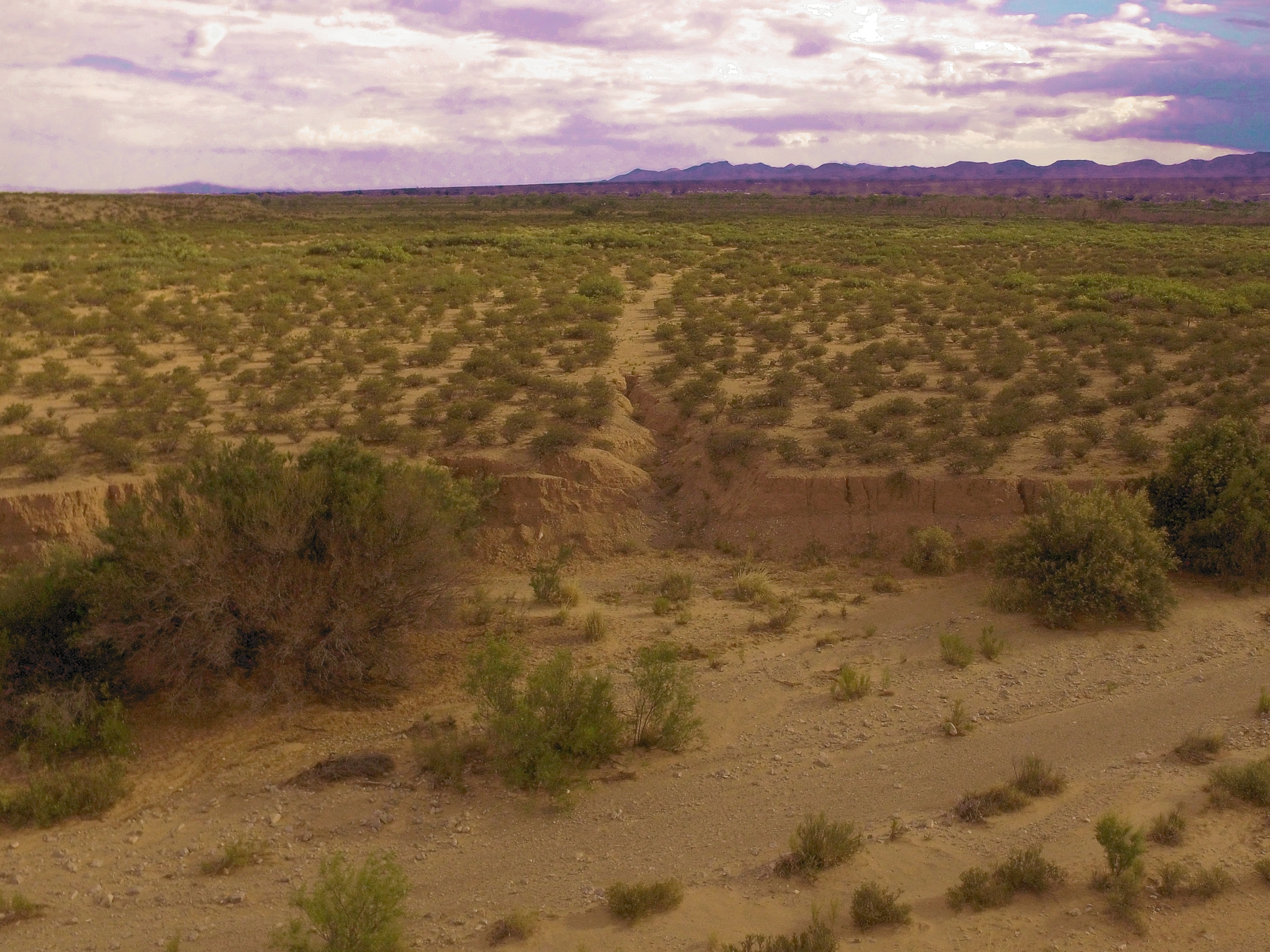
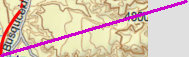
Good views where the trail crosses an arroyo and visible on both sides.
On north side, view of a split in the trail, where it appears the earlier trail was damaged by a ravine, and the later trail was routed around the obstruction.
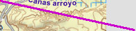
On south side, the trail comes north from through Las Cañas village.
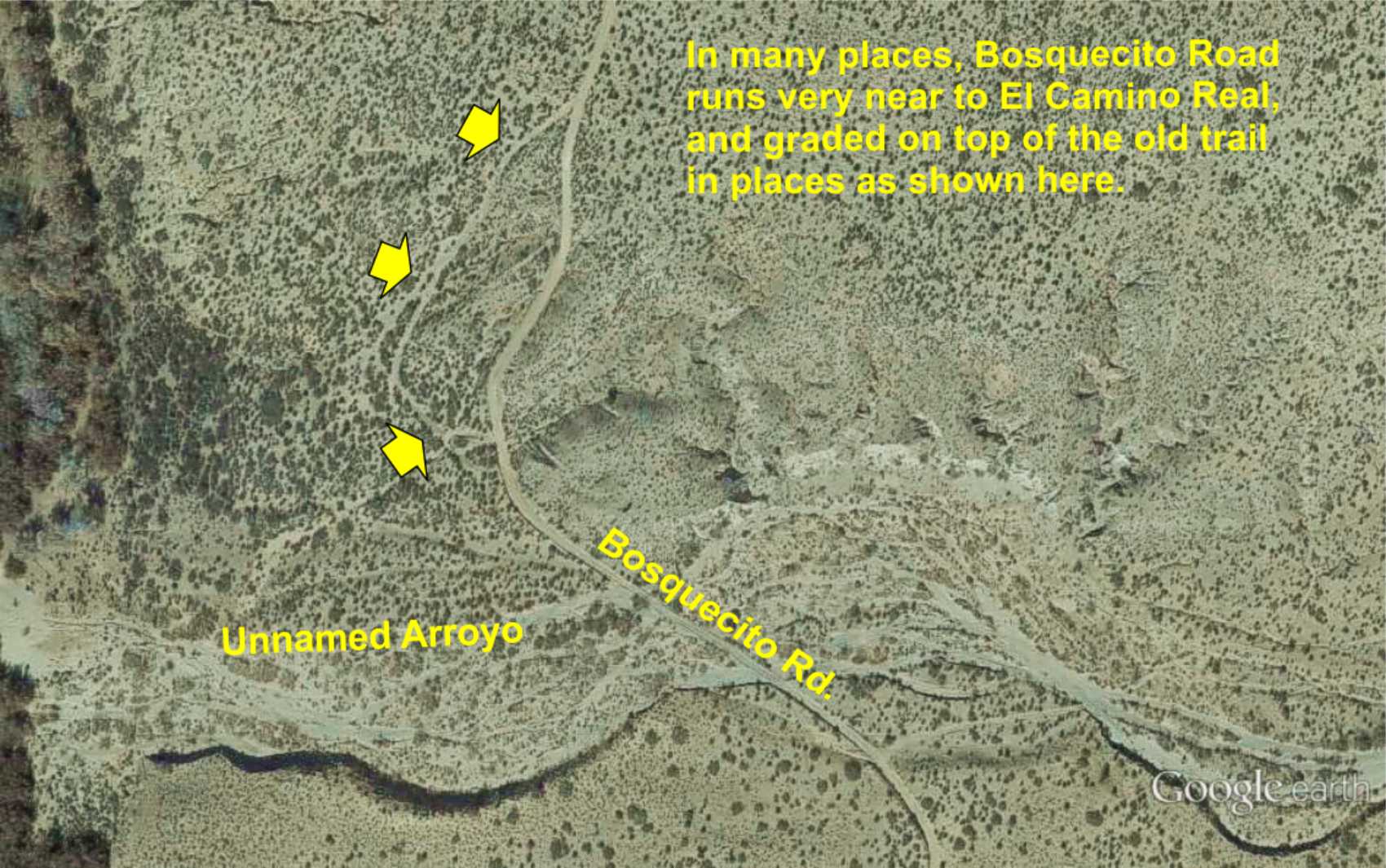
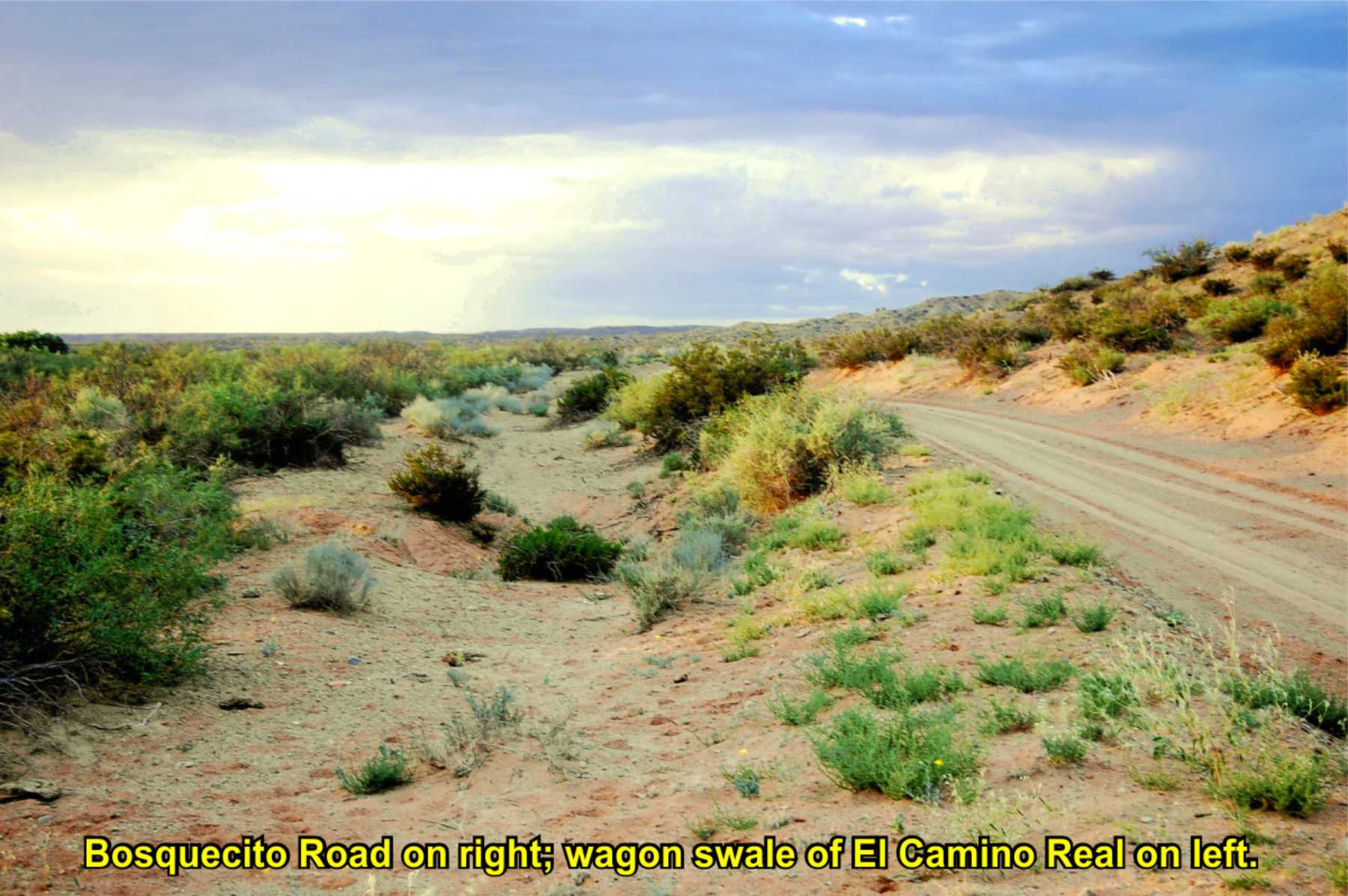
An example that shows the trail leaving the Bosquecito Road, then rejoining it, indicating Bosquecito Road was bladed on top of the trail in places.
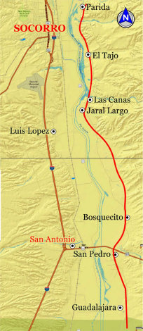
Soc-S

TRAIL SEGMENT ON THIS PAGE:
Las Cañas arroyo north
to Tio Bartolo arroyo and paraje

Website courtesy of the Socorro County Historical Society (SCHS), P.O. Box 921, Socorro, New Mexico 87801 [
SCHS home page]
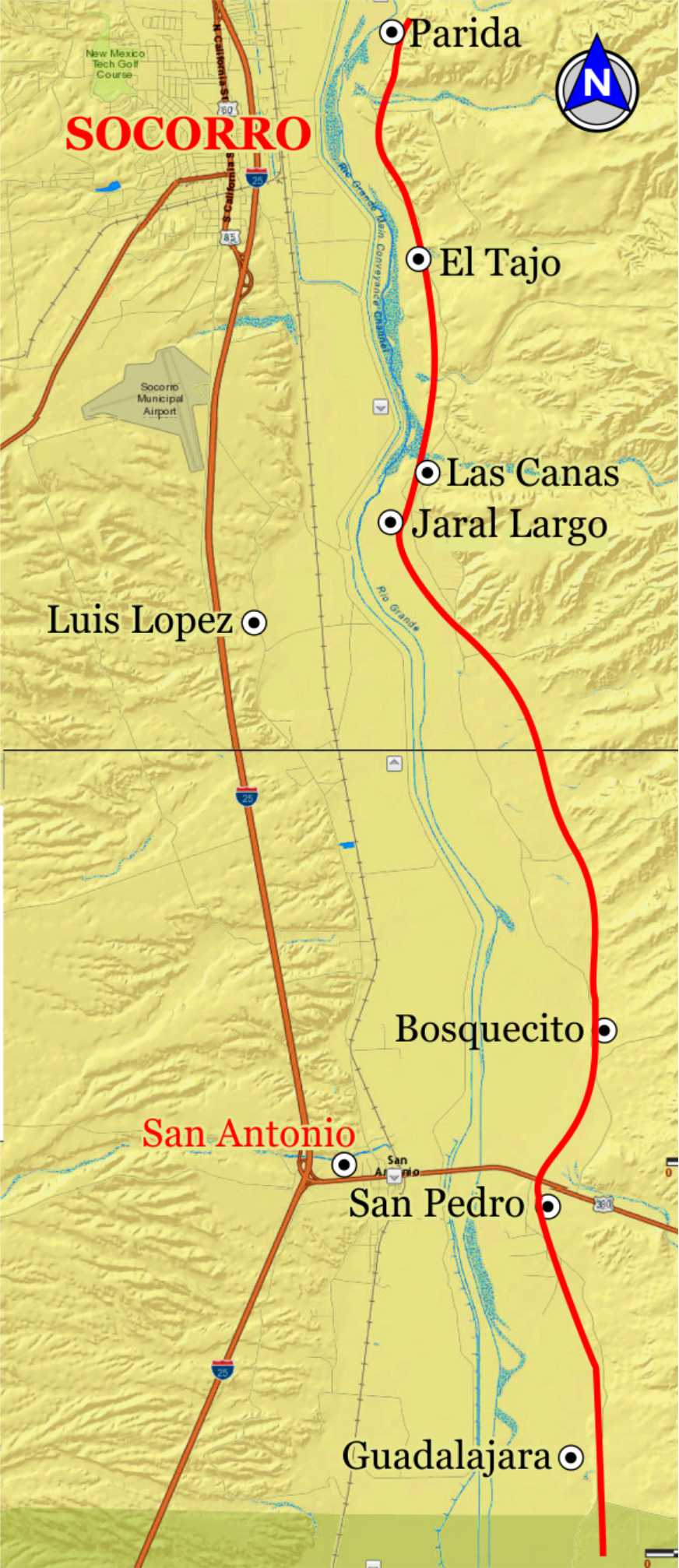
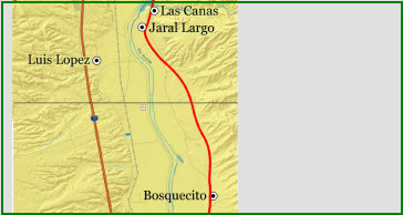
Las Canas & Jaral Largo


Excerpts from: "Rio Abajo: History and Prehistory of a Rio Grande Province"
by Michael Marshall and Henry Walt, 1984 Rio Abajo Survey
Las
Cañas and Jaral Largo
"Las Cañas and Jaral Largo were both small settlements on the east bank of the Rio Grande, to the south
of Arroyo de las Cañas. . . . The settlement of Las Scans mentioned by Lt. Abert in November 1846 and is located on the
Emory, Abert, and Peck map of 18461847, where it appears south of Parida and north of Bosquecito. 'After passing through the little
town of Las Cañas, we encountered another hill of sand."
The location of Jaral Largo appears on the 1906 U.S.G.S. Socorro 15'
quadrangle ... near the location of the earlier Las Cañas. ... The settlement name was known to José Olguin [area pioneer].
Jaral Largo was the location of a river ford in 1906, and is used today when the river is dry. A historic road swale [El Camino
Real] enters from the north and is visible as far as the Las Cañas arroyo area."
[See Las Cañas north and south on above map
for photos].
Small farming villages on El Camino Real from about the 1840s. Little remains today, though the trail is visible from the townsites running across the arroyo.
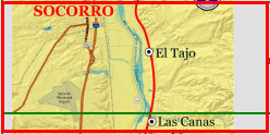
Bishop Tamaron's 1760 trip to New Mexico
Excerpts from Tamaron's journal:
"On the sixteenth [of May 1760] there was also
a short days journey as far as the site called Luis López because he had an hacienda there before the revolt.
"On the seventeenth
we went over a road full of ravines and in one of them the volante in which I and the Father Custos were riding suffered a severe
upset. [this would be the rough trail called "Vueltas de Socorro" through the deep arroyos of Las Cañas to Tio Bartolo]. The
Father Custos fell from the side and received a blow which hurt him. I escaped injury, because I fell on him. Therefore I took a horse
and continued my journey on it.
"On this day the remains of the pueblo of Socorro were seen on the other side of the river.
The walls of the church are standing, and there are peach trees. And they say that an arroyo which rises in the sierra comes down
on that side. This pueblo was also lost with the kingdom." [meaning lost during the 1680 Pueblo Revolt].
The ridge just north
of the Tio Bartolo arroyo offers an elevated view of Socorro from the trail, and likely where Bishop Tamaron viewed Socorro and likely
camped for the night. Socorro is visible from here, but to see the walls of the Socorro mission, Tamaron must have used field
glasses or a small telescope.
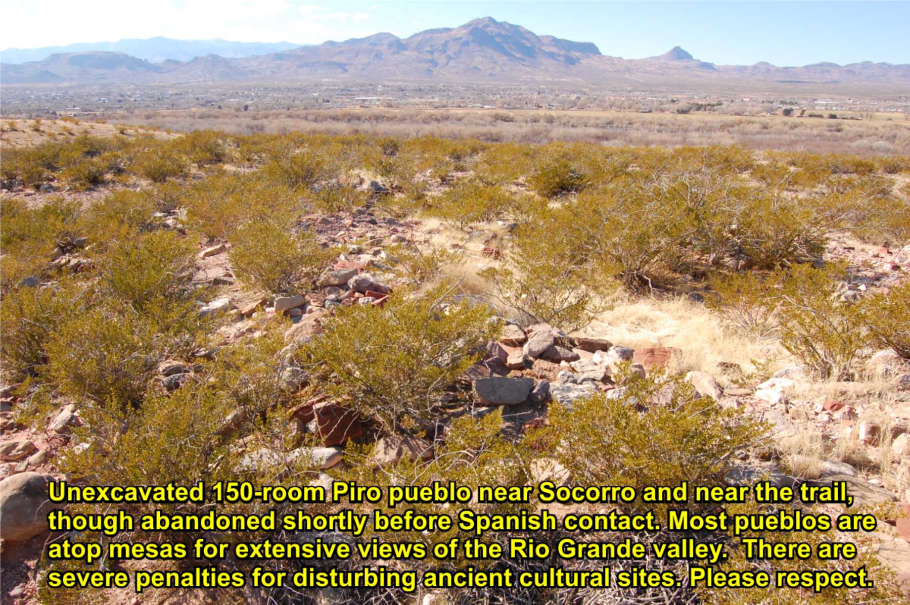
PUEBLO DE LA PRESCILLA
El Camino Real runs very near this 100+ room unexcavated Ancestral Piro pueblo. Occupation was from circa.
1300s through early Spanish contact. Onate's journals do not mention it, suggesting abandonment after 1540 and before 1598.
It is a large masonry complex about 200 ft. square with roomblocks built around a plaza and a single kiva.


LAS CAÑAS PUEBLO
El Camino Real runs very near this 200+ room unexcavated Piro pueblo. Ceramics found during a limited archaeological
survey suggests the pueblo may have been occupied during the very early 1600s Colonial era. The site is mostly destroyed
from river floods, arroyo erosion, and extensive looting.

3
Bishop
Tamaron
account
Historic
description
The Camino Real Mapping Project
on these web pages
is the exclusive work of the
members of the Socorro County
Historical Society and other
volunteers dedicated to
documenting, mapping, presenting,
and preserving the historic trail.
GoogleEarth
image
Drone
aerial photo
Trail photo
Notes or
documentation
LEGEND
Aerial photos with DJI Phantom 3 quadcopter camera


34°04.40'N 106°51.80'W
Elev. 4670'


34°00.97'N 106°51.53'W
Elev. 4610'