Sponsored by Socorro County Historical Society
El Camino Real de Tierra Adentro
Maps, photos, and aerial photography of the trail
Primarily in Sierra & Socorro counties
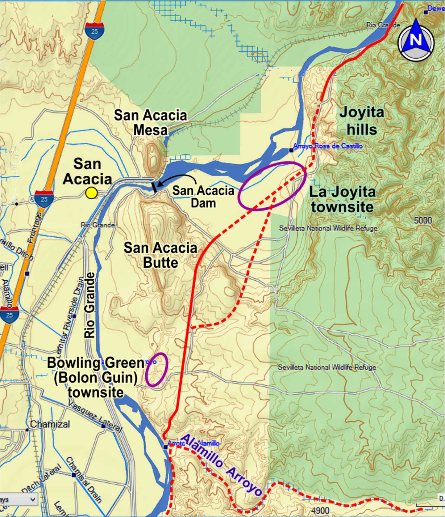
TRAIL SEGMENT ON THIS PAGE:
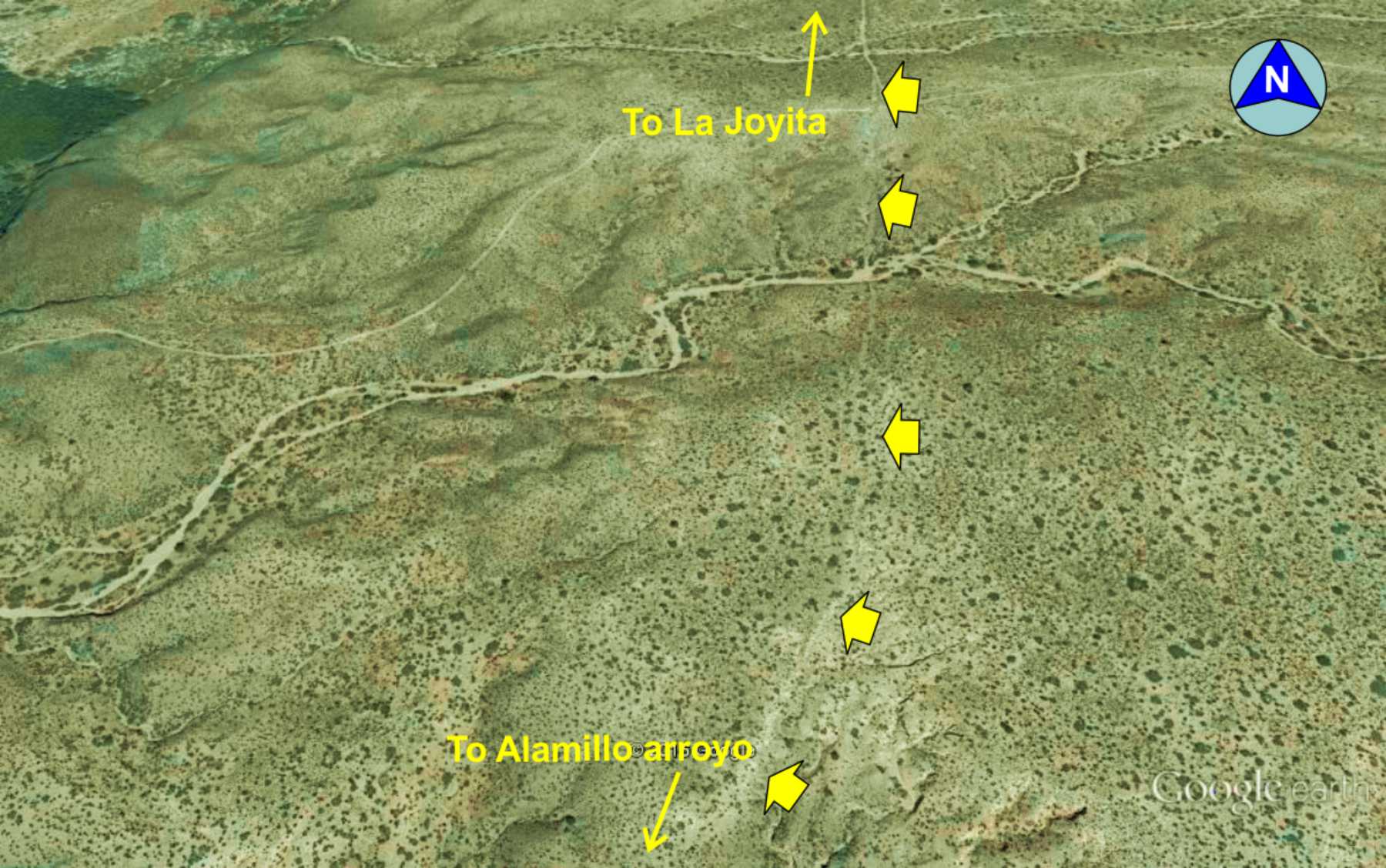
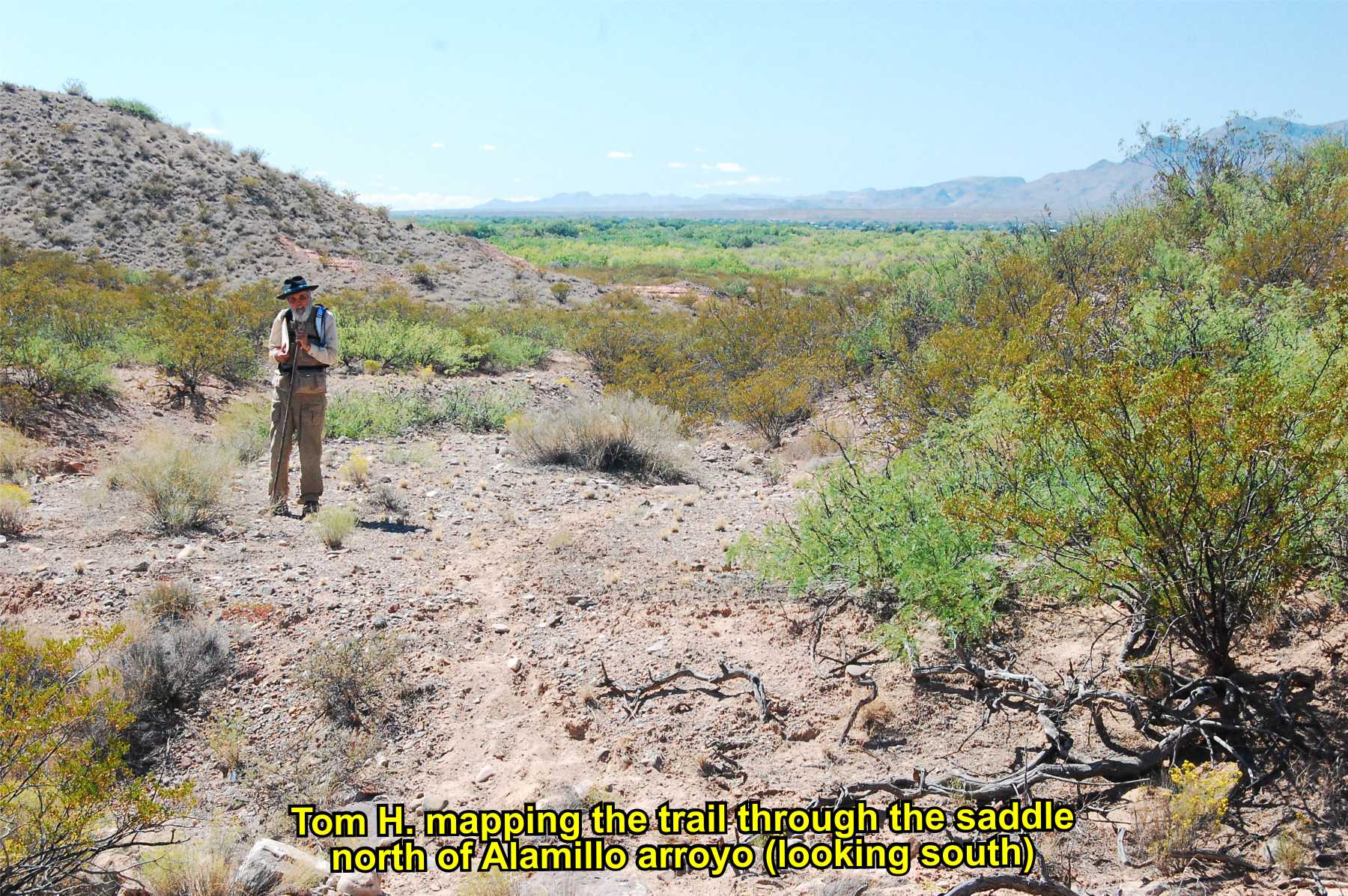
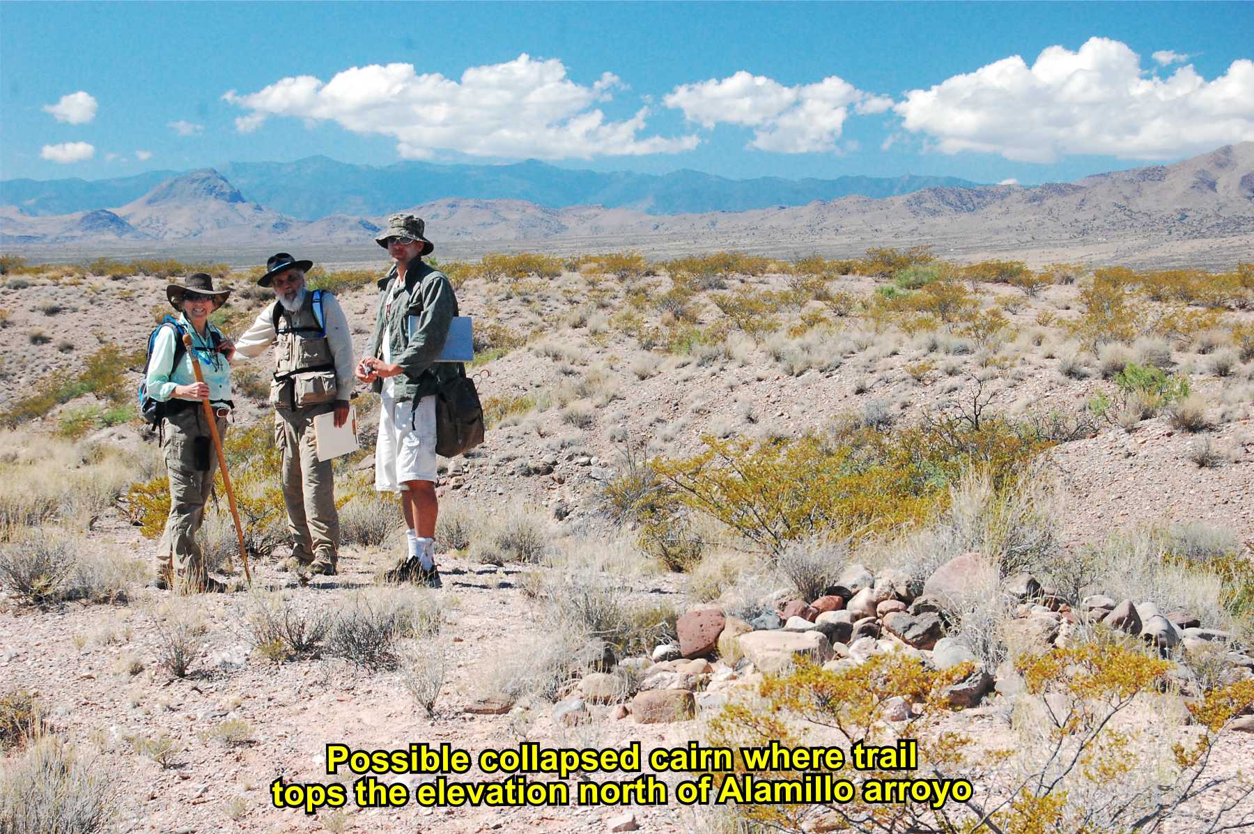
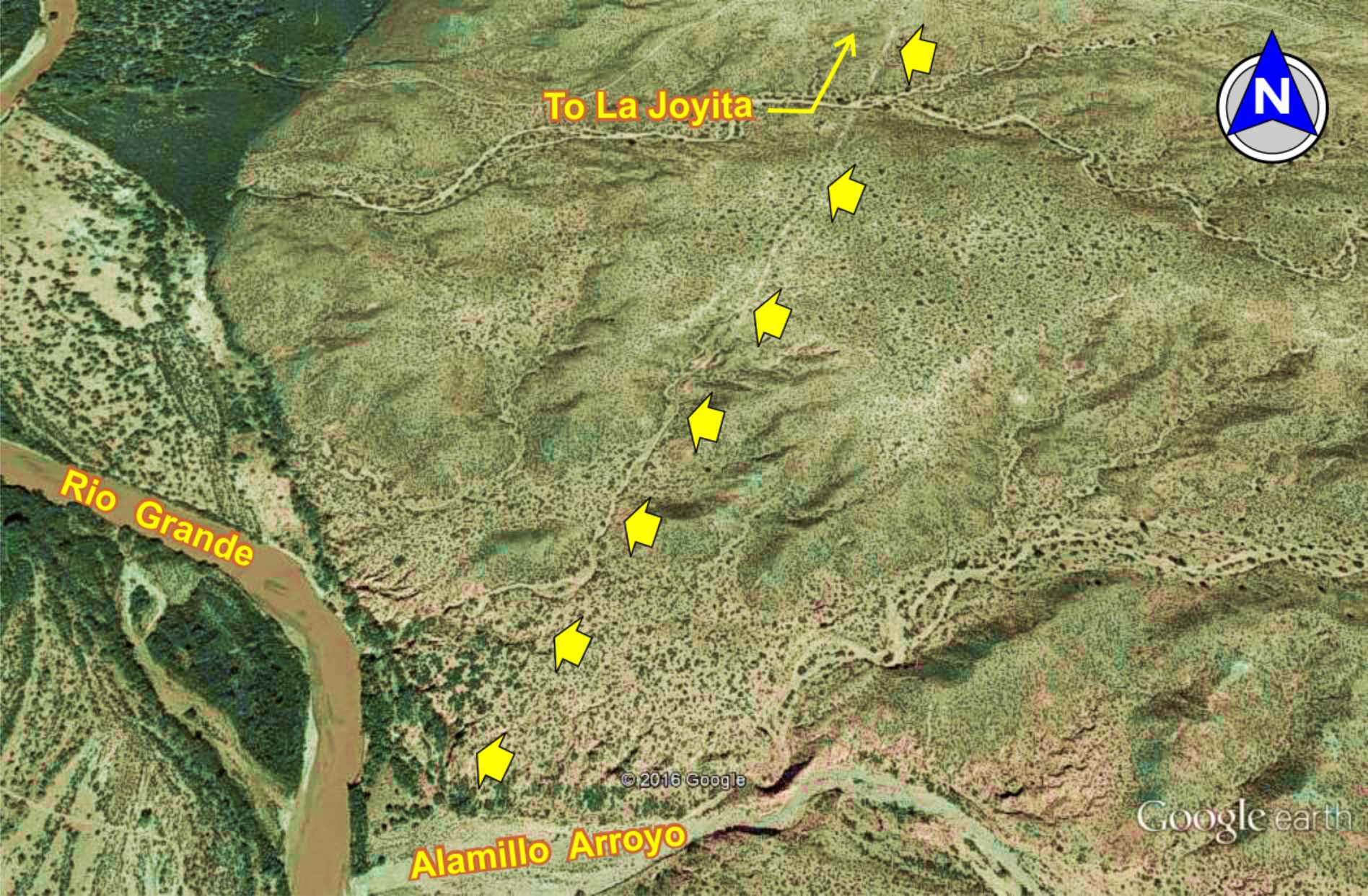
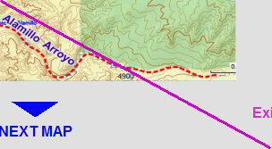
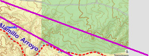
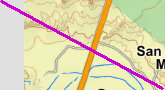
Alamillo Arroyo north to
La Joyita townsite
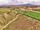
Exiting Alamillo arroyo
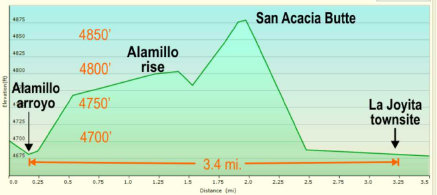
Elevation plot, Alamillo arroyo to La Joyita townsite


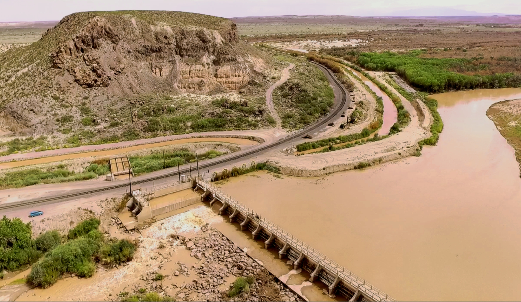
NOTE: This segment of the trail has not been well explored or mapped due to inaccessibility. Much of it passes through the Sevilleta
National Wildlife Refuge, for which no public entry is allowed except by permit. The San Acacia dam and roadway is now
locked by the Middle Rio Grande Conservency District which denies access to the east side of the river (Camino Real
side).


Near Bolon Guin (Bowling Green)
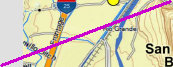
La Joyita townsite
La Joyita was established on El Camino Real in the late Mexican period. First mention is by surveyor Lt. Abert in 1846. It is a documented stop on the trail. La Joyita was destroyed in the 1884 flood. Subsequent floods and building the San Acacia dam has inundated the townsite.
Bolon Guin was a short lived village of 145 residents destroyed by flood in 1886. Residents resettled across the river at Chamizal.
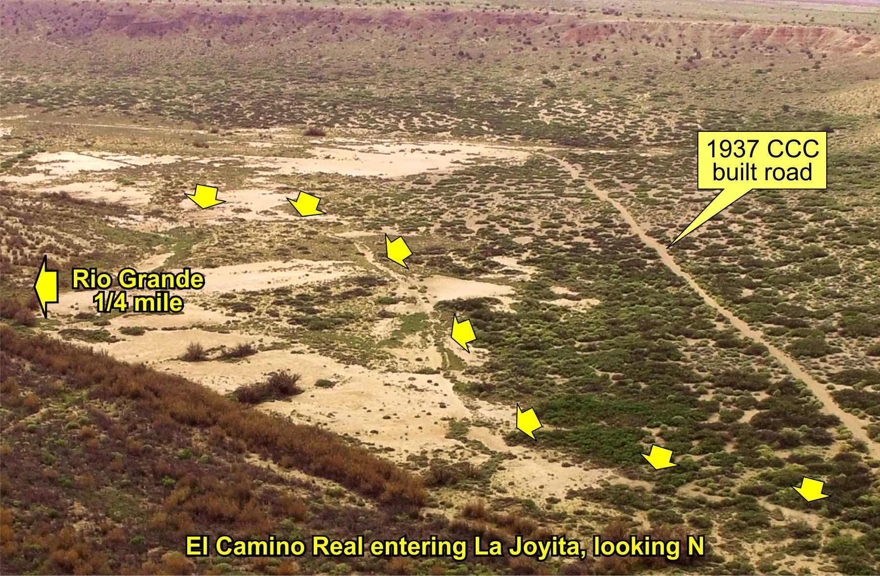
El Camino Real remains visible where it departs the Alamillo Arroyo and climbs the elevation northward towards Bolon Guin. Further north, an old ranch road to La Joyita appears to parallel or bladed on top of the trail in places.

3D
View

Stone
cairn
From Lt. Abert's journal, Nov. 8, 1846:
"The course of the river to-day was tortuous [sic]; high sand banks closed in on each
side, almost obliterating the valley, except at Joya and Joyeta, where there are fields sufficiently broad for raising corn enough
to supply the wants of the people, and to afford grazing grounds for their cattle."
This description of broad fields and grazing
near the river afforded a good camp (paraje) at both La Joya and La Joyita for travelers along the trail.
From Dr. Wislizenus journal, July 1846:
"We passed in the afternoon Joyita a small town ... Near Joyita, mountainous bluffs
reached for the first time the Rio del Norte; they consist of black amygdaloidal basalt."
Dr. Wislizenus is describing the San
Acacia Mesa (a.k.a. Indian Mesa) and San Acacia Butte, both of black basalt/lava. The Rio Grande passes through the narrow passage
between these two geologic features. See above map. The narrow basaltic river passage was unsuitable for wagons along
the trail, forcing the route over San Acacia Butte to Alamillo arroyo.

Website courtesy of the Socorro County Historical Society (SCHS), P.O. Box 921, Socorro, New Mexico 87801 [
SCHS home page]
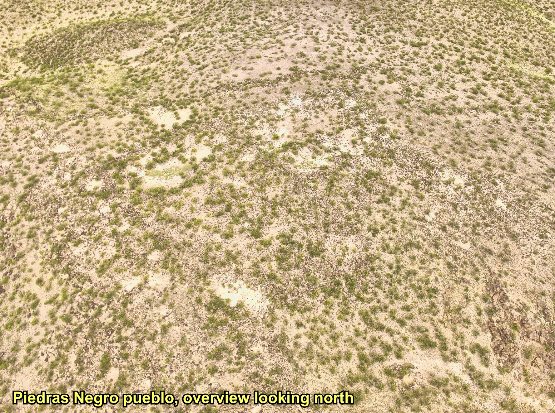
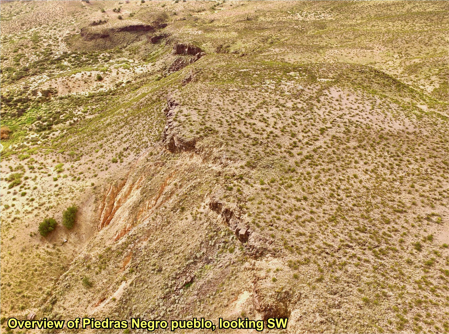
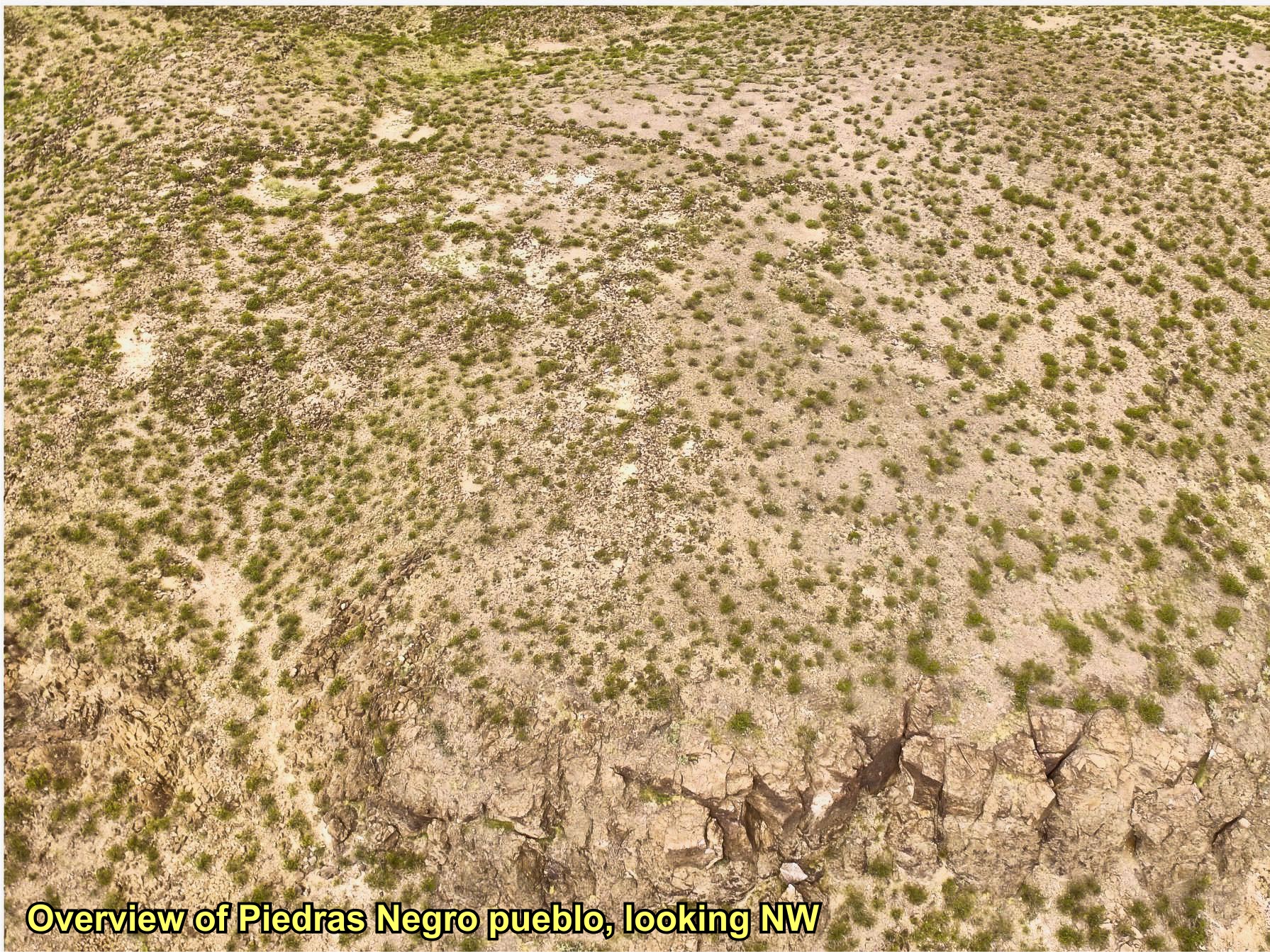
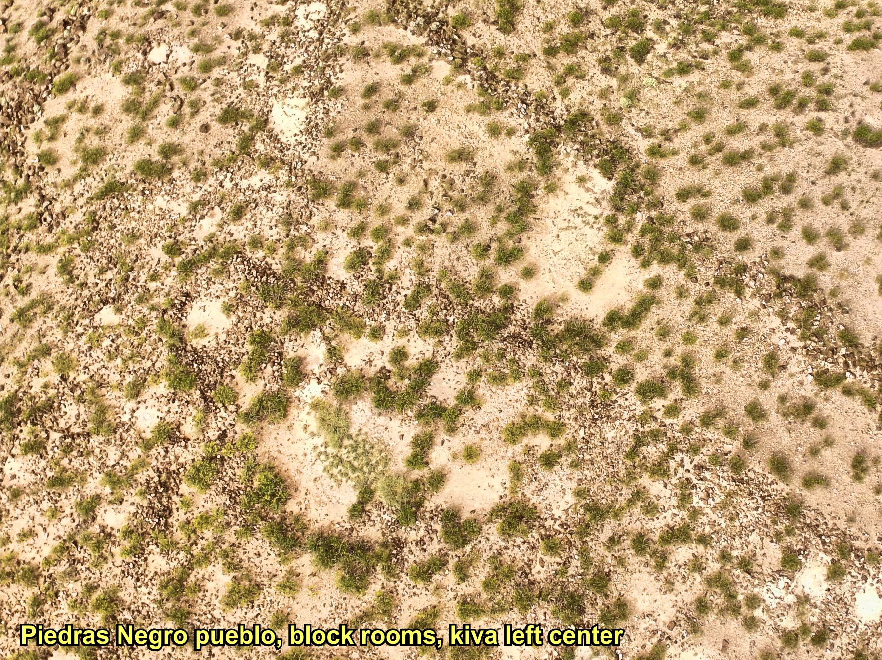
Piedras Negras Pueblo
is near the trail where it crosses the San Acacia Butte. It is an ancestral Piro pueblo built late 1300s
with some evidence of
pre-Revolt Colonial occupation.

Overview of pueblo
click map to enlarge
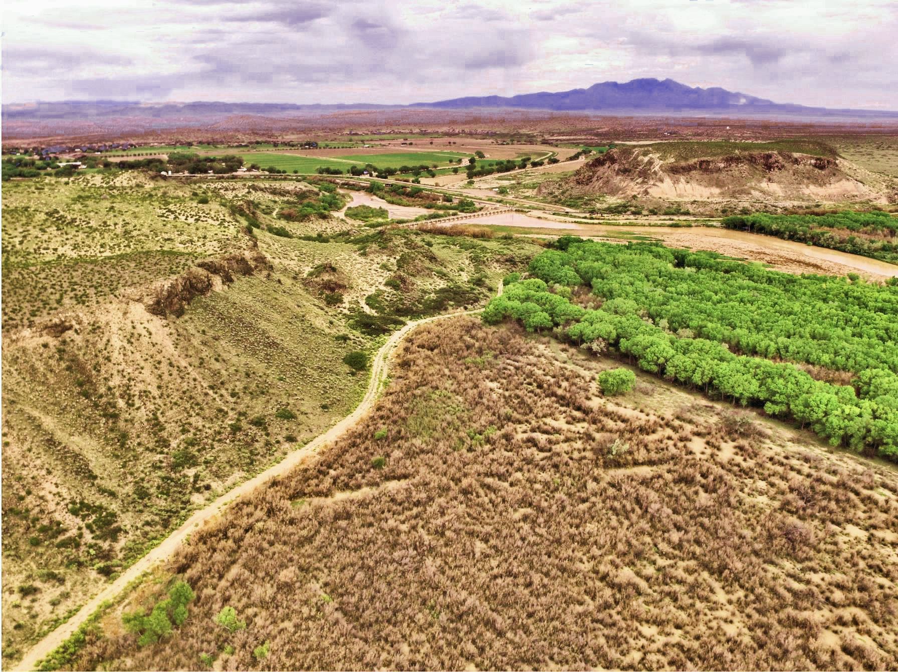
San Acacia, dam, and
La Joyita area
click photo to enlarge
San Acacia
Butte
& Cerro Indio
pueblo

Trail entering La Joyita area
NOTE: Drone photos and access to the dam, La Joyita and Piedras Negras pueblo by permission of Middle Rio Grande Conservancy District
(MRGCD)

4
soc-N4
The Camino Real Mapping Project
on these web pages
is the exclusive work of the
members of the Socorro County
Historical Society and other
volunteers dedicated to
documenting, mapping, presenting,
and preserving the historic trail.
GoogleEarth
image
Drone
aerial photo
Trail photo
Notes or
documentation
LEGEND
Aerial photos with DJI Phantom 3 quadcopter camera


Alamillo
trail north
"Alamillo
cliffs"

34°12.98'N 106°53.10'W
Elev. 4700'

34°13.45'N 106°52.92'W
Elev. 4760'

34°16.31'N 106°51.18'W
Elev. 4740'

.mp4
2:37min
38 meg
.mp4
2:30min
36 meg
.mp4
1:10min
21 meg
.mp4
1:23min
25 meg
0627/19