Sponsored by Socorro County Historical Society


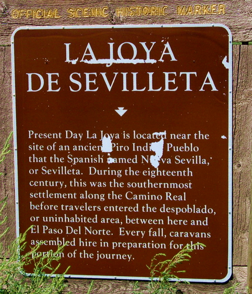
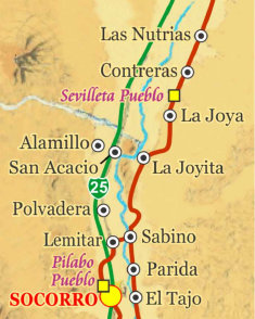
La Joya
(La Joya de Sevilleta)


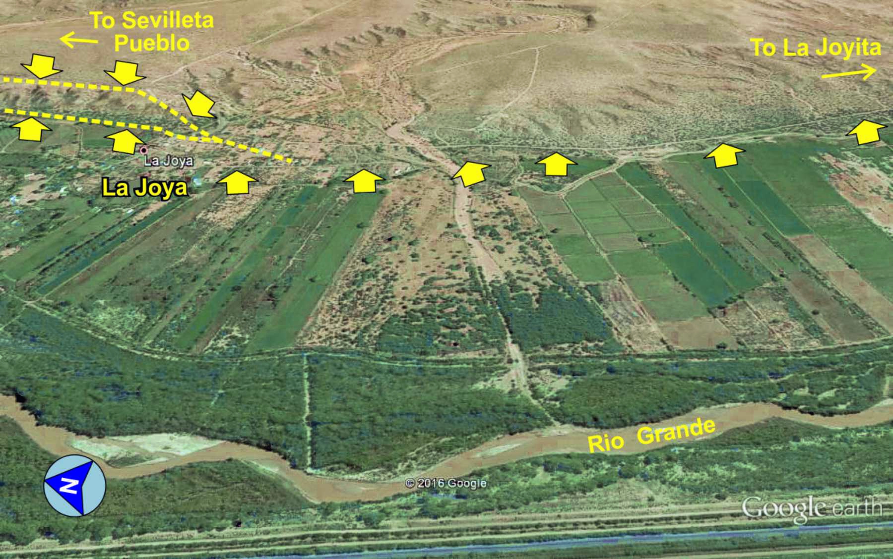
The present day village of La Joya, due to its close proximity to the Piro pueblo of Sevilleta (Tzelaqui), has been known throughout
history as Jolla de Sevilleta, Plaza Sevilleta, Ceboleta, Pueblo de la Joya, among others. The area has been a trail landmark since
the earliest days of the trail. La Joya is a well documented village and stop on El Camino Real. Travelers who kept journals describe
how they camped the night at La Joya or nearby pueblo, often with descriptions. It served as a staging area for assembling southbound
caravans, and a welcomed rest stop for northbound travelers.
About the La Joya land grant
here.
El Camino Real de Tierra Adentro
Maps, photos, and aerial photography of the trail
Primarily in Sierra & Socorro counties
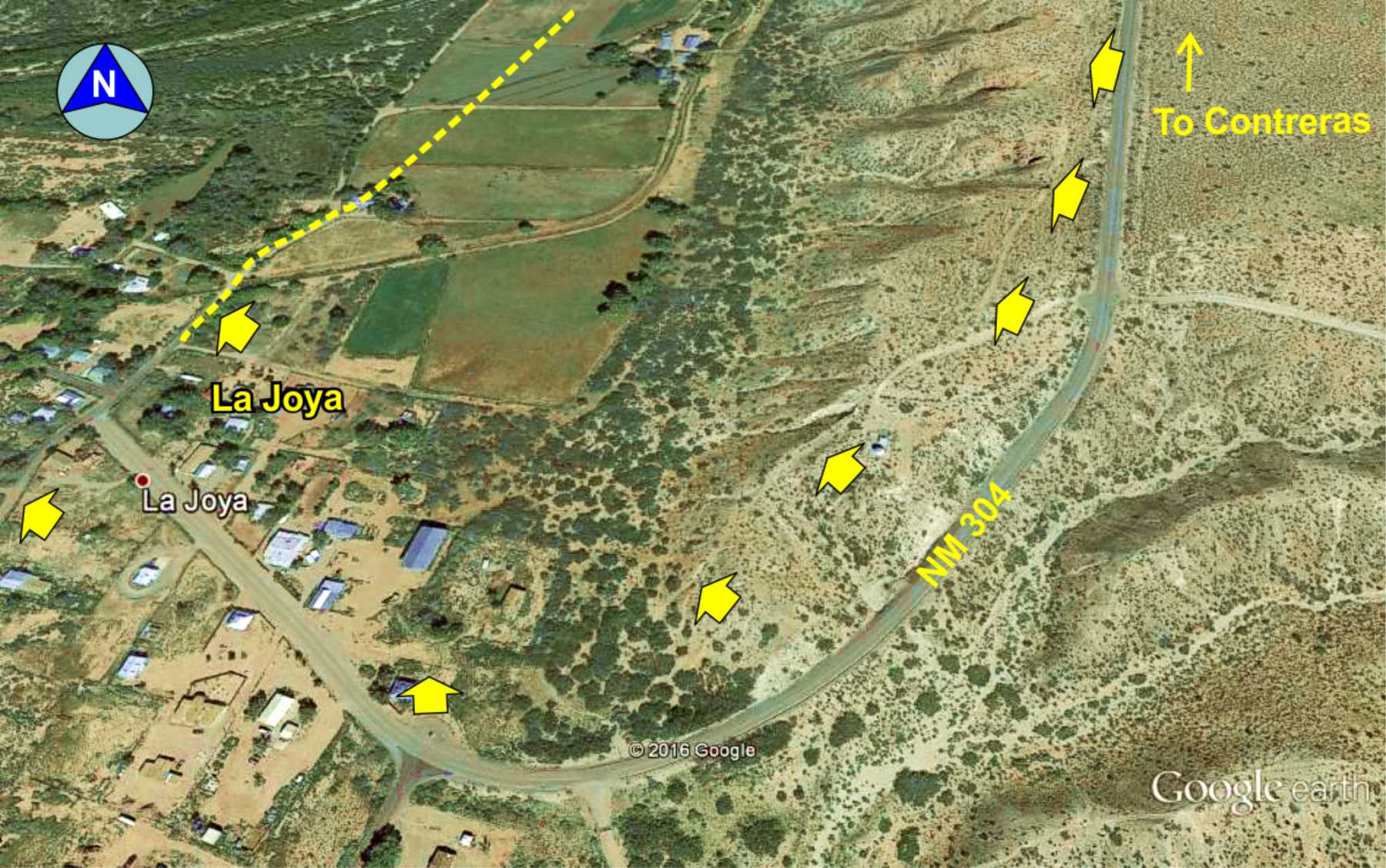
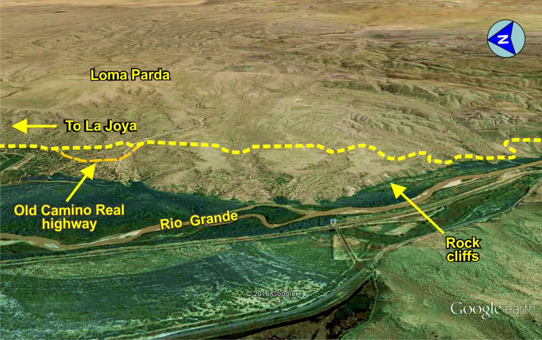
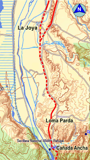
TRAIL SEGMENT ON THIS PAGE:
Loma Parda north to
La Joya village
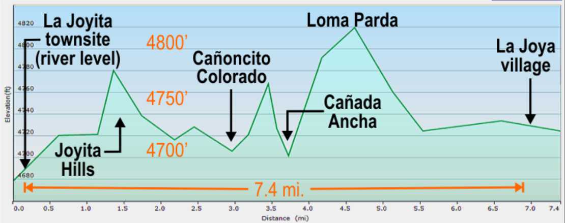
2
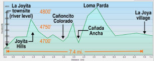
Elevation plot, La Joyita to La Joya
joya
The Sevilleta de La Joya land grant
The La Joya land grant is a long and convoluted story, cited here as concise as possible (and omitting
many details).
Sixty seven individuals of La Joya were awarded a "community" type
Spanish land grant in 1819, partially
for the defense given to travelers along El Camino Real. This was converted to a Mexican land grant in 1821. In 1848, the grant was
recognized by the U.S. government under the terms of the Treaty of Higaldo (which stated Mexican land grants must be respected). However,
when surveyed by the U.S., it was discovered the northern boundary of the La Joya land grant was also part of the Belen land grant,
triggering years of legal disputes. In 1891, the courts finally ruled the boundaries of the two land grants were in error and
11,000 acres were transferred from La Joya to the Belen land grant and the patents finally issued. This left the La Joya land grant
with about 216,000 acres.
Shortly thereafter, some of the original grant descendants, believing they had a private land grant,
began selling parcels of their land for farm and ranch land. This was determined to be in violation of the Treaty of Higaldo,
which states a community land grant can not be broken up or sold off without loosing the land grant status. At the time of 1912
statehood, and loosing their land grant status, residents were required to pay taxes on their large land holdings. Most were
unable to pay the taxes and the land reverted to ownership by the County of Socorro.
The courts ordered Socorro County to sell
the land for the back taxes owed, about $75,000. In 1936, Gen. Thomas Campbell purchased the land for $76,750 as the only bidder.
He ranched and farmed the land for the next 30 years. Before his death, he created a foundation to restore his ranch to the
natural environment and wildlife. The Foundation gave the land to the Nature Conservancy in 1973, who in turn donated it to
the U.S. Fish and Wildlife Service. Thus, much of the original La Joya land grant is now the Sevilleta National Wildlife Refuge
comprising 230,000 acres, some of which is through other land acquisitions.
Though no longer a land grant, La Joya remains a
viable community with many residents descendants of the original grant owners. In 1936, Socorro County allowed the square mile
of the town to remain as an unincorporated village.
The "Low Lands"

Trail over Loma Parda
Meaning "Gray Hill" in Spanish, this was a 100+ foot climb on the trail, though smooth and flat along the top terrace for the wagons before the descent back to the Rio Grande valley to La Joya through the Low Lands.
NOTE: This segment of the trail has not been well explored or mapped due to inaccessibility. The San Acacia dam and roadway is
now locked by the Middle Rio Grande Conservancy District which prevents access to the east side of the river (Camino Real
side). The trail south of La Joya runs through locked private ranch land and Sevilleta NWR for which access is seldom granted.
Historic
Marker
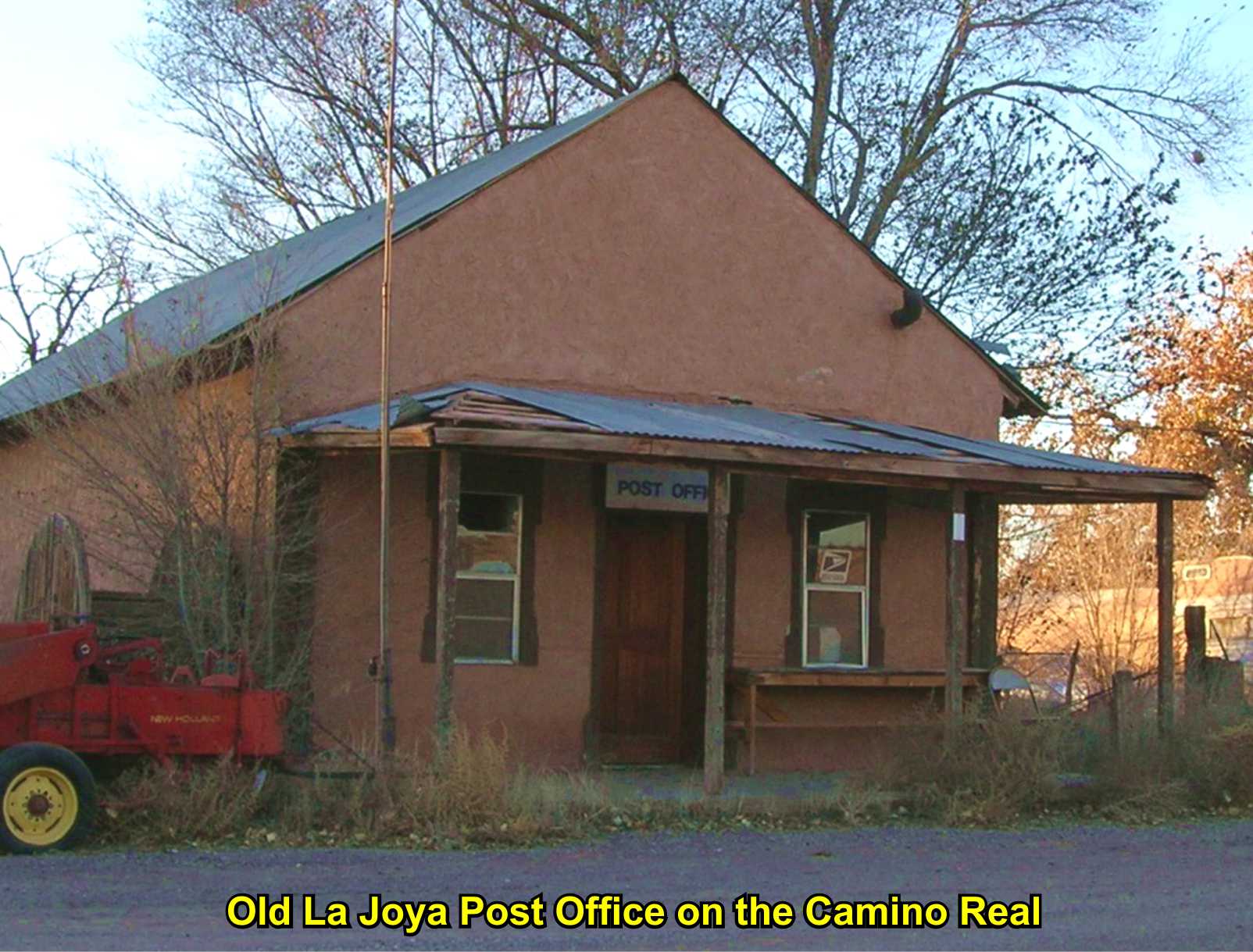
Old
P.O.

Annotated
History
Website courtesy of the Socorro County Historical Society (SCHS), P.O. Box 921, Socorro, New Mexico 87801 [
SCHS home page]


GoogleEarth
image
Drone
aerial photo
Trail photo
Notes or
documentation
LEGEND
Aerial photos with DJI Phantom 3 quadcopter camera


The Camino Real Mapping Project
on these web pages
is the exclusive work of the
members of the Socorro County
Historical Society and other
volunteers dedicated to
documenting, mapping, presenting,
and preserving the historic trail.

34°20.97'N 106°50.32'W
Elev. 4850'