El Camino Real de Tierra Adentro
Sponsored by Socorro County Historical Society
Maps, photos, and aerial photography of the trail
Primarily in Sierra & Socorro counties
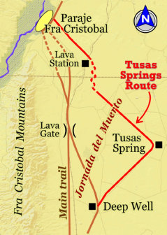
Paraje
6
TRAIL SEGMENT ON THIS PAGE:
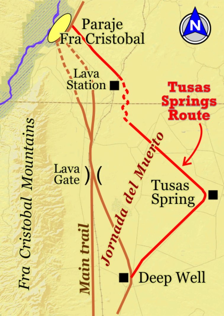
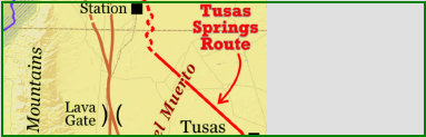
Tusas Springs Route
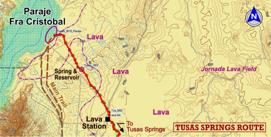
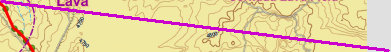
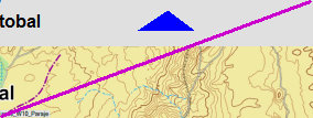
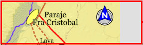
Lava Station to Paraje Fra Cristobal
Website courtesy of the Socorro County Historical Society (SCHS), P.O. Box 921, Socorro, New Mexico 87801 [
SCHS home page]

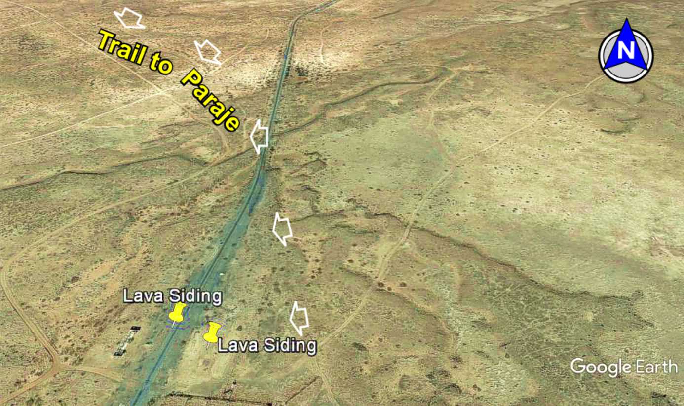
33°32.30N
107°03.84'W
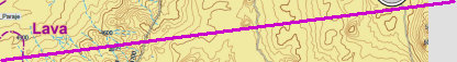

Lava Station
& Siding


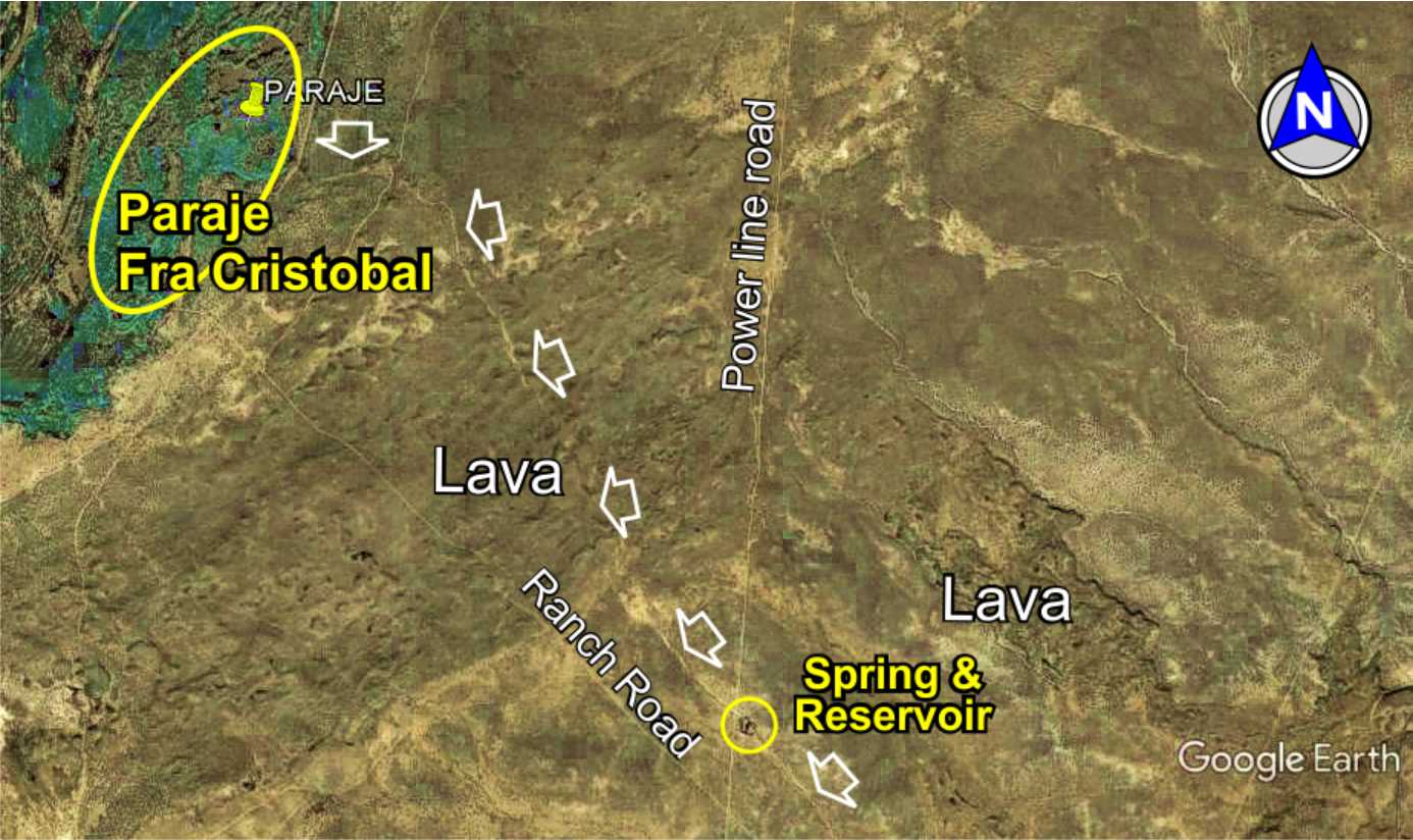
33°30.84'N
107°02.37'W

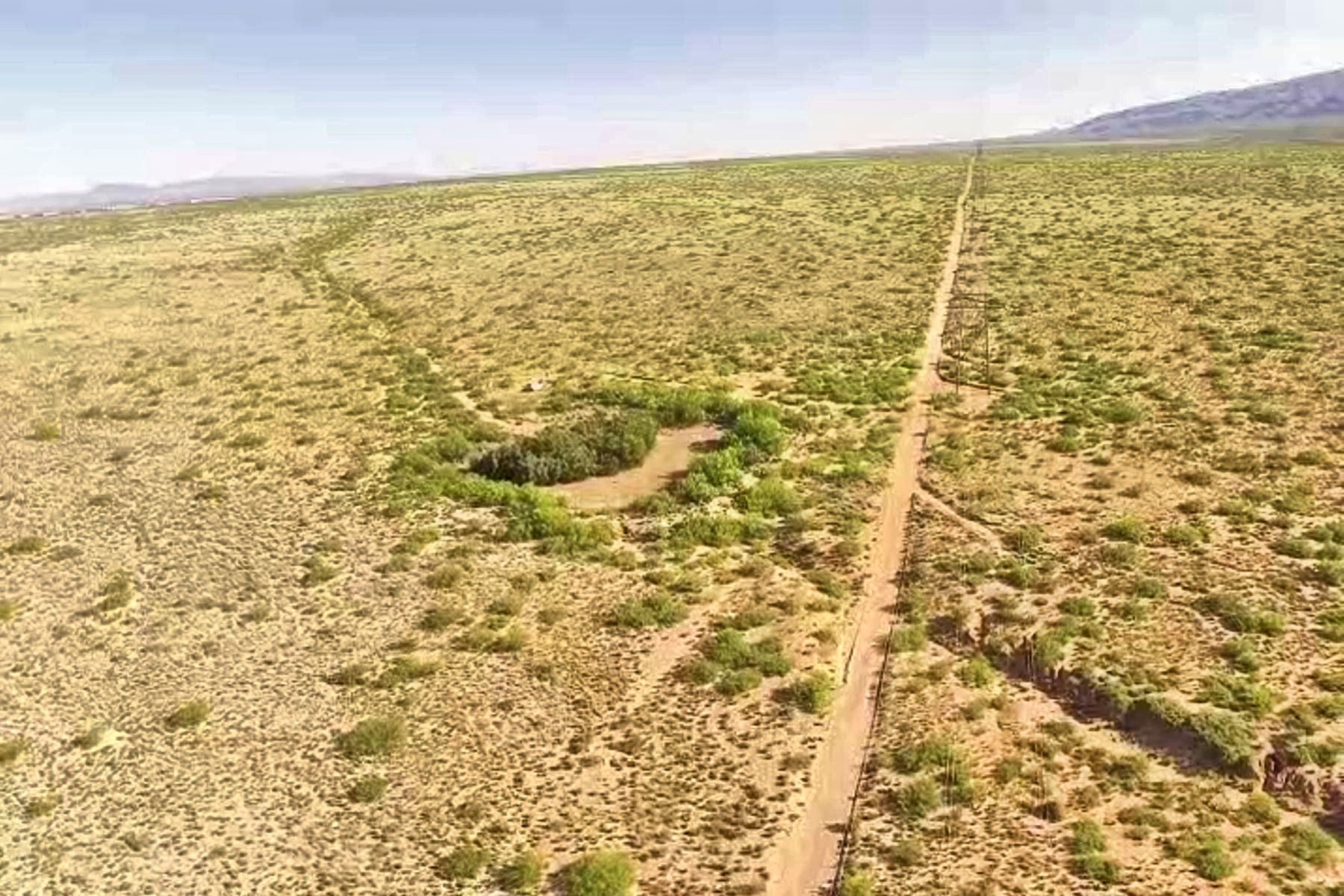
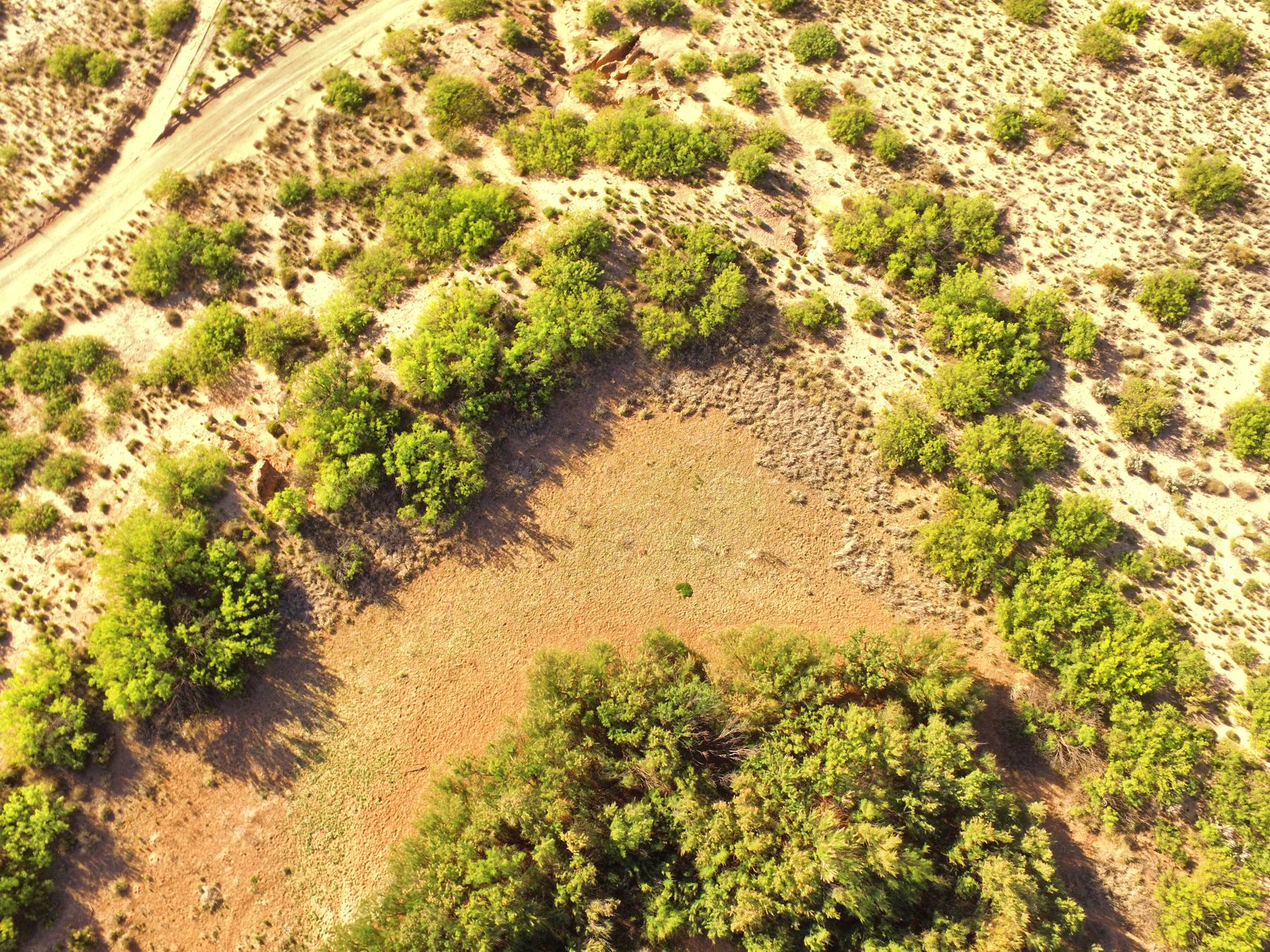
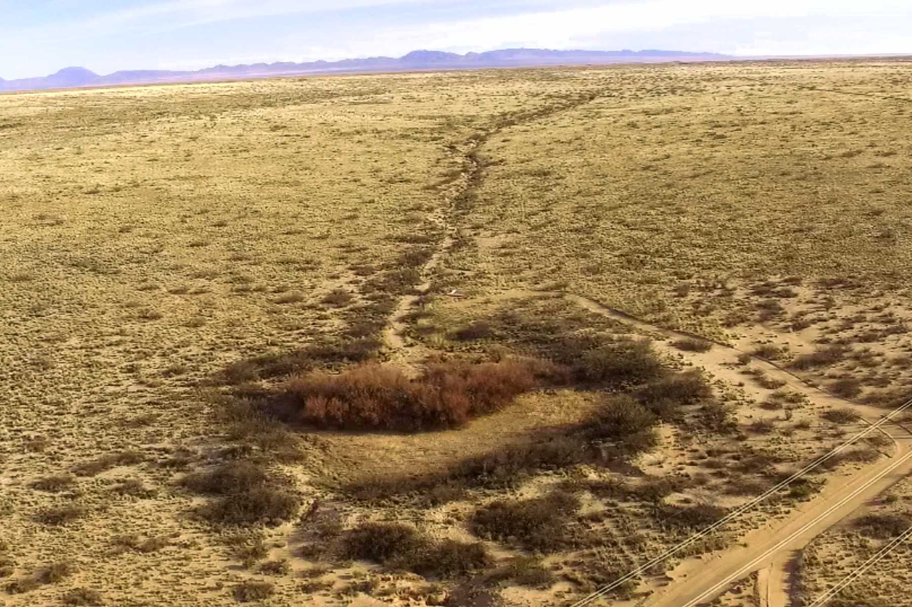
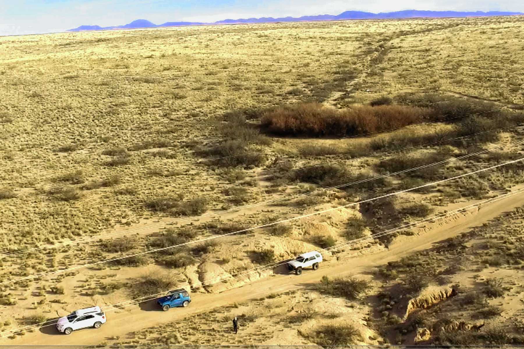
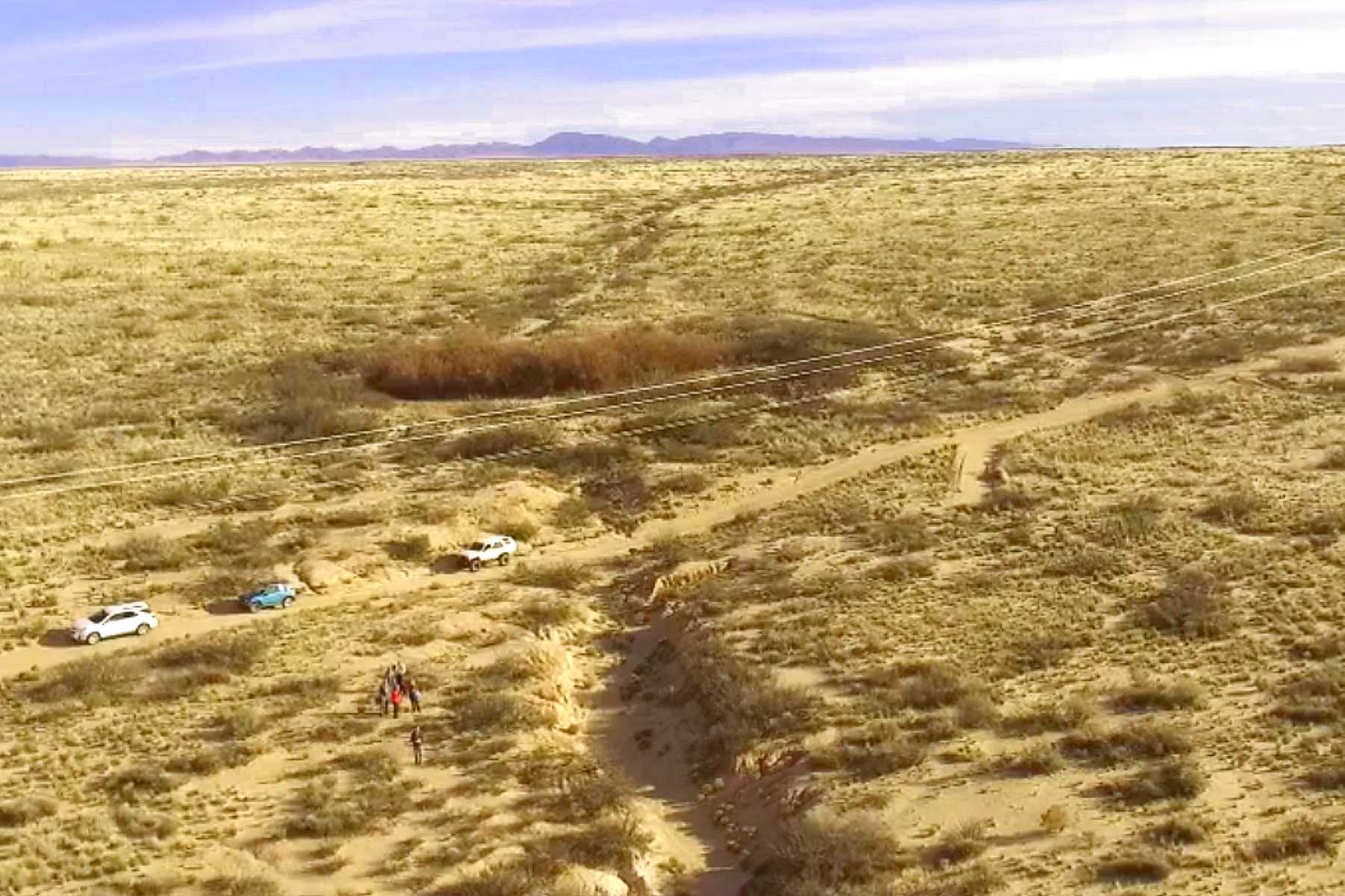
Trail reservoir
Reservoir
in winter

Tusas route west
.mp4
3:47min
70 meg
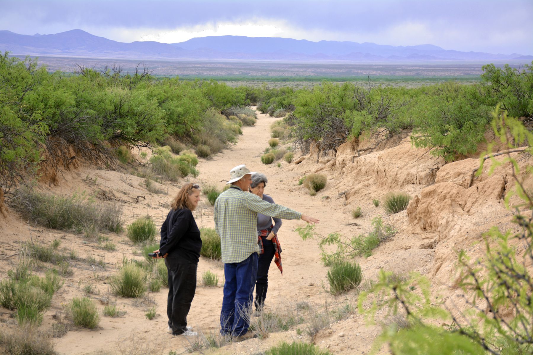
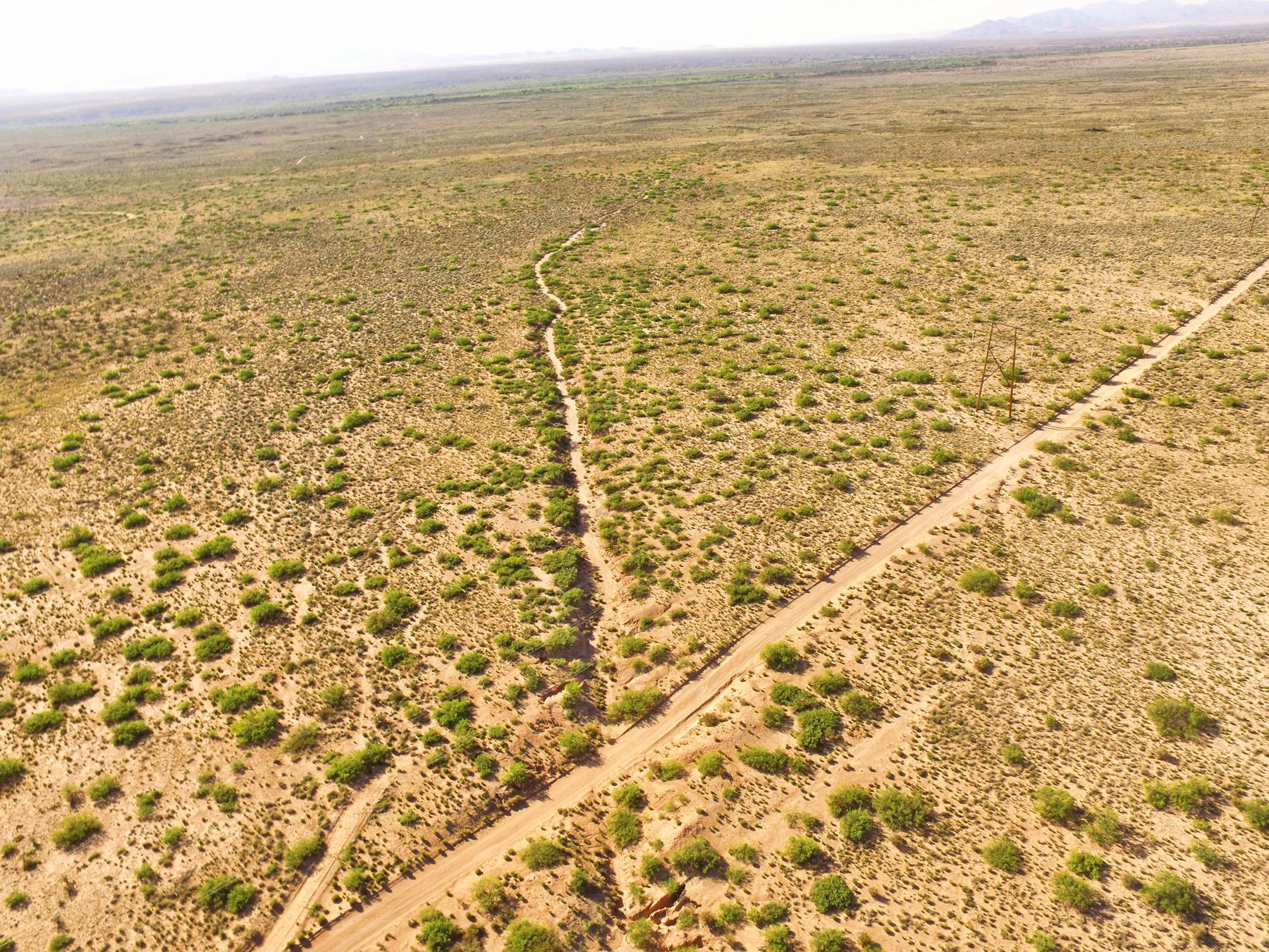
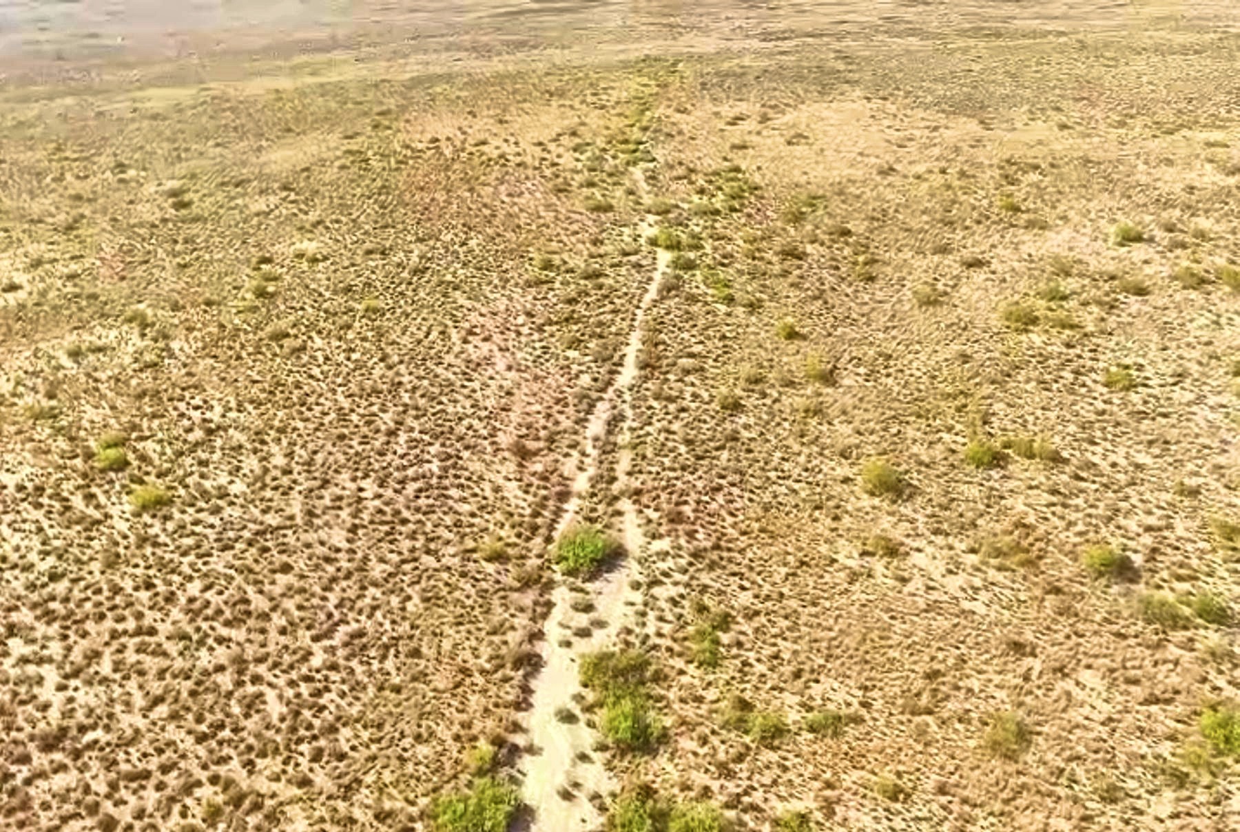
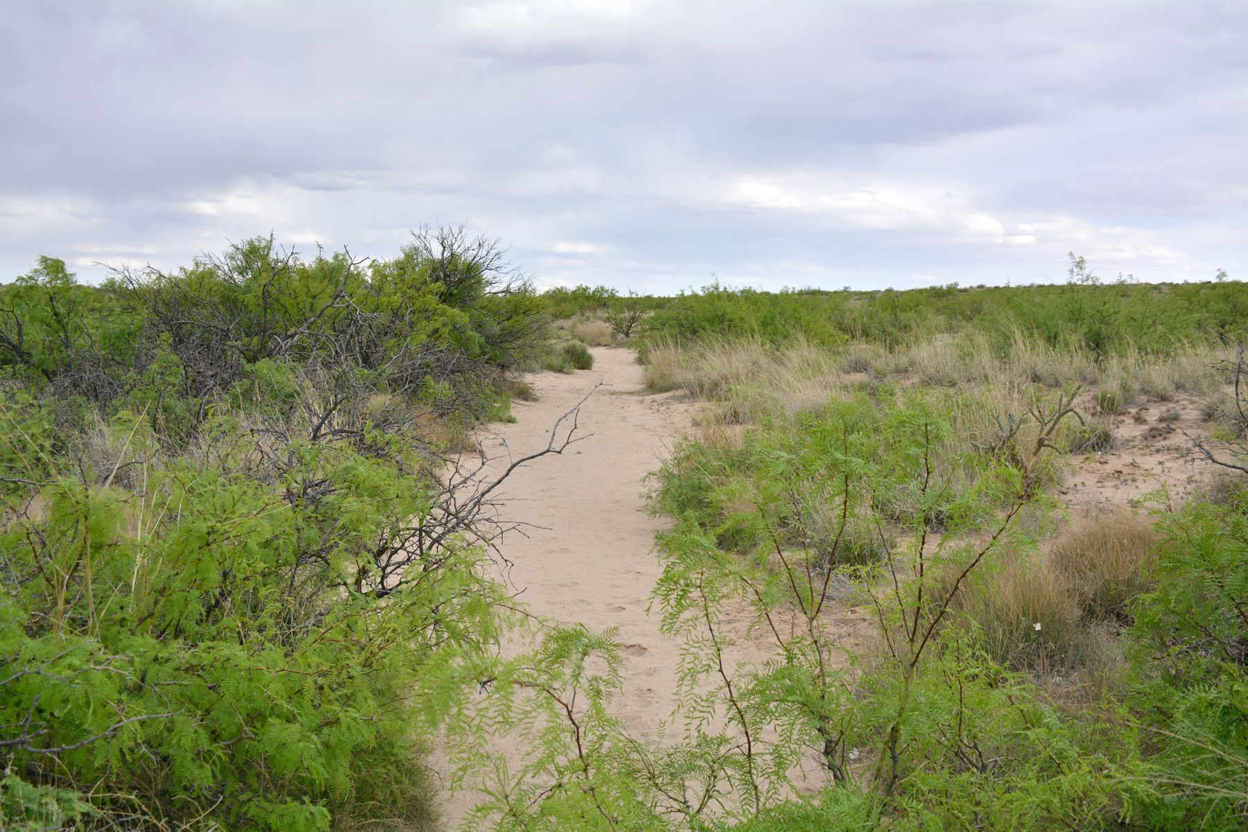
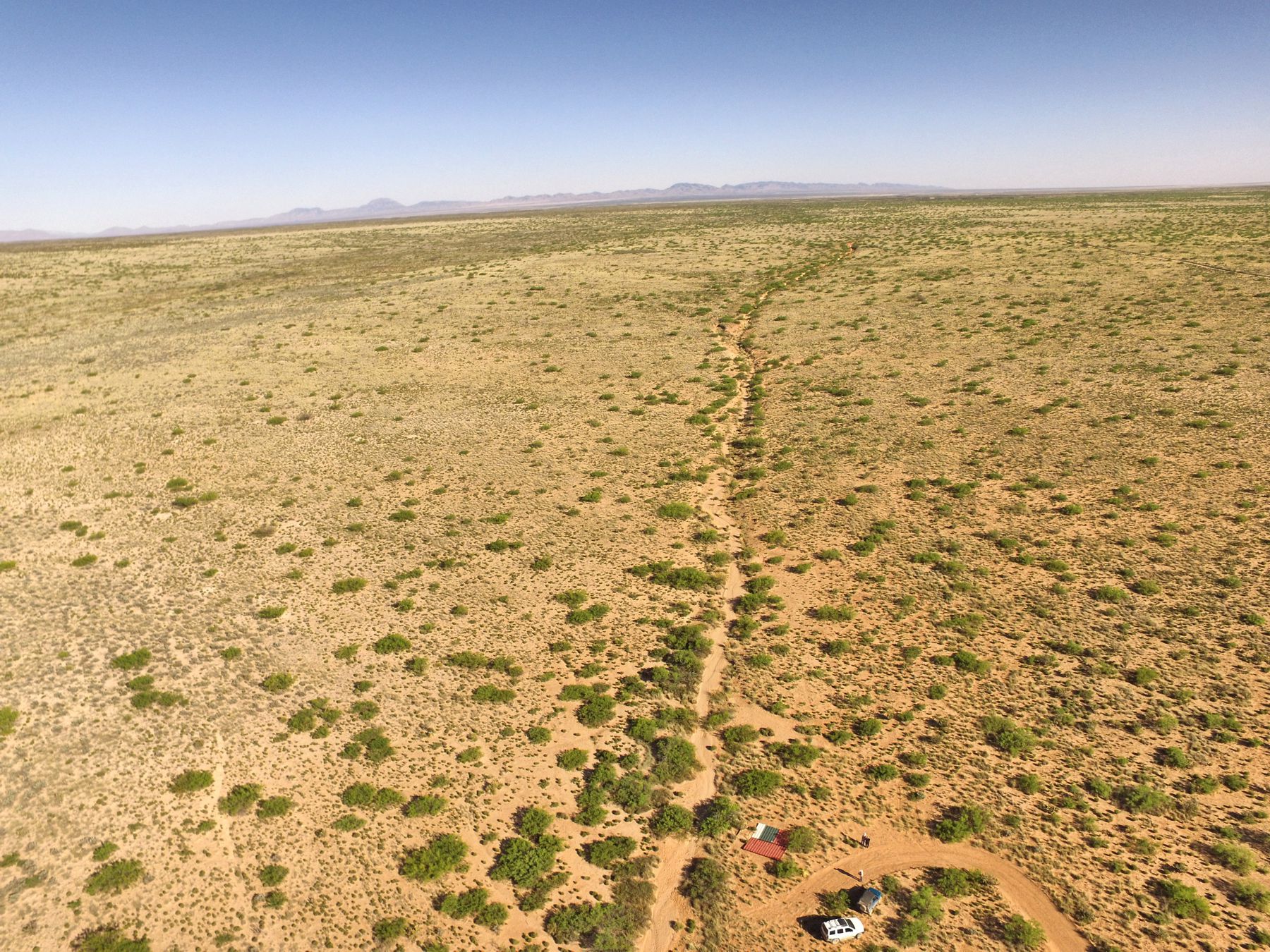
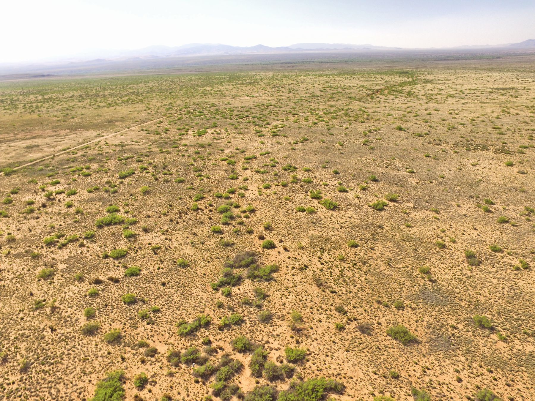
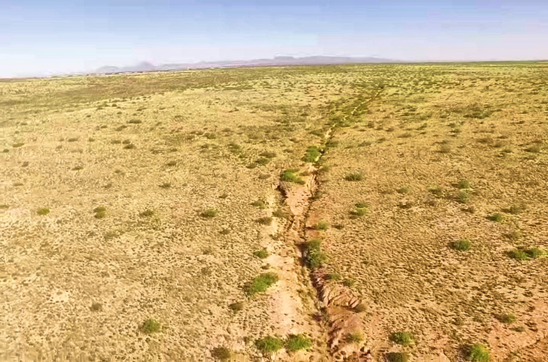
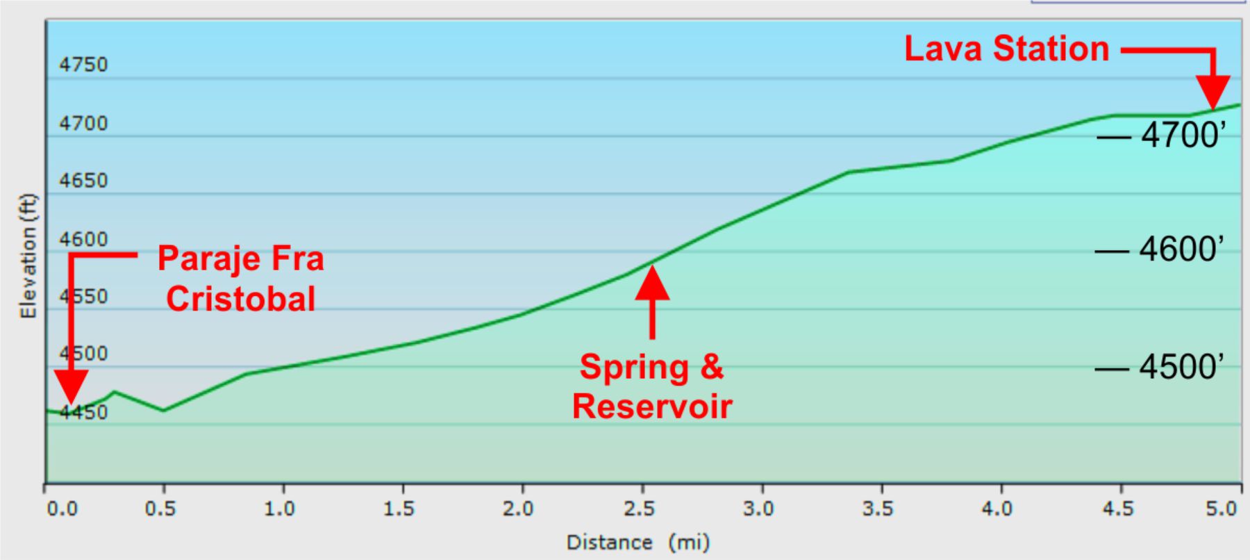
Reservoir west trail from the spring & reservoir continues wearing a path through the sandstone traveling west, then climbs
and winds over a lava ridge, then the slight descent to the river bank at trail landmark Paraje Fra Cristobal.
Spring & reservoir is a trail feature of unknown affinity, or whether the small reservoir was man-made or natural. It is used
as a reference point for the Tusas Route mapping project and access to the trail.

Trail east of the reservoir
Tusas route east
.mp4
4:04min
74 meg
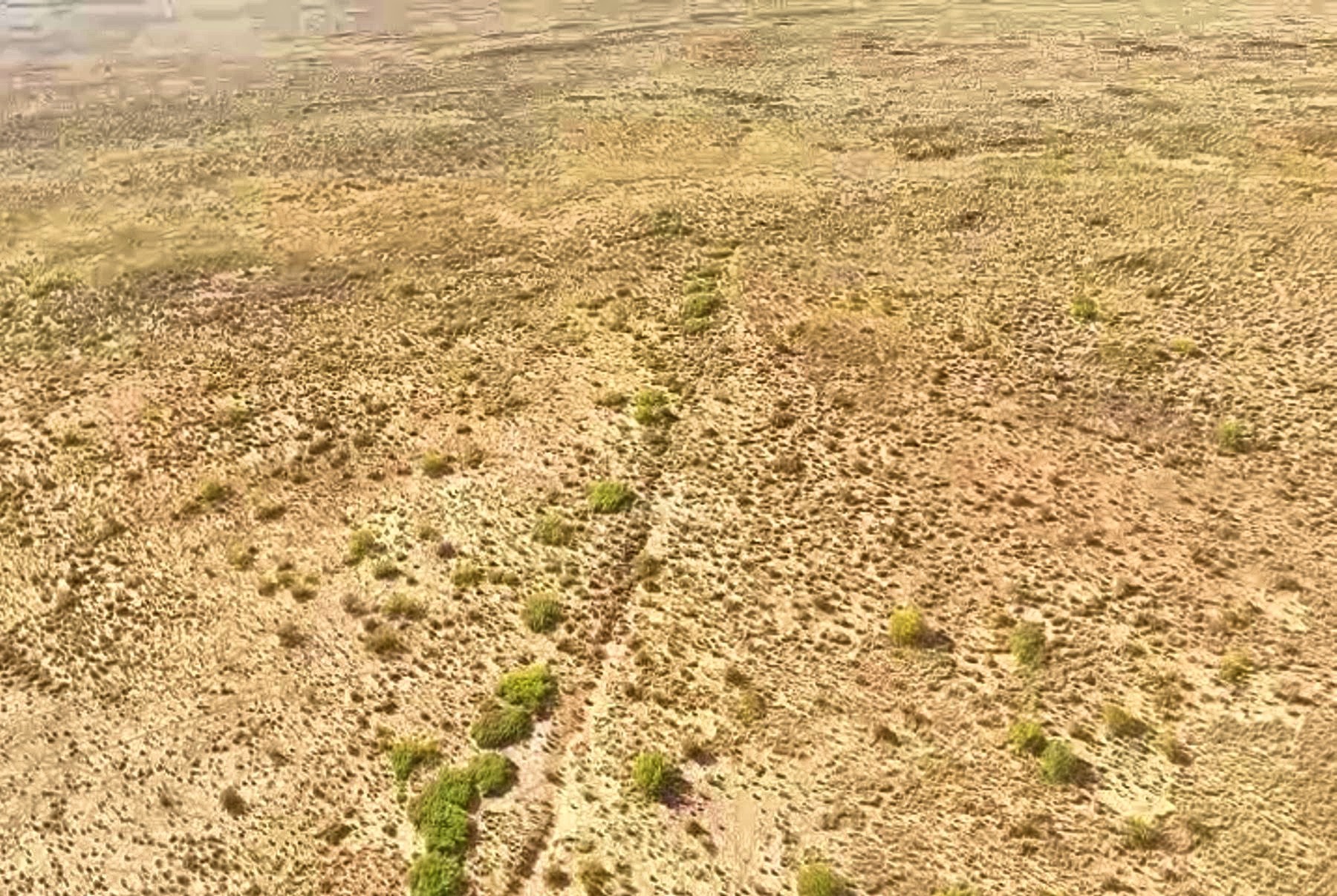
Reservoir east trail from Lava Station railroad siding continues as a mesquite lined trail across compact ground, then develops
into a well-worn trail through the softer sandstone to, and through, the spring & reservoir on the trail. This is one of
the most pristine sections of El Camino Real visible through the Jornada del Muerto.
Drone aerial photographs
Drone aerial photographs
Lava Station to
Paraje Fra Cristobal
Trail from the ground
Old railroad
section house
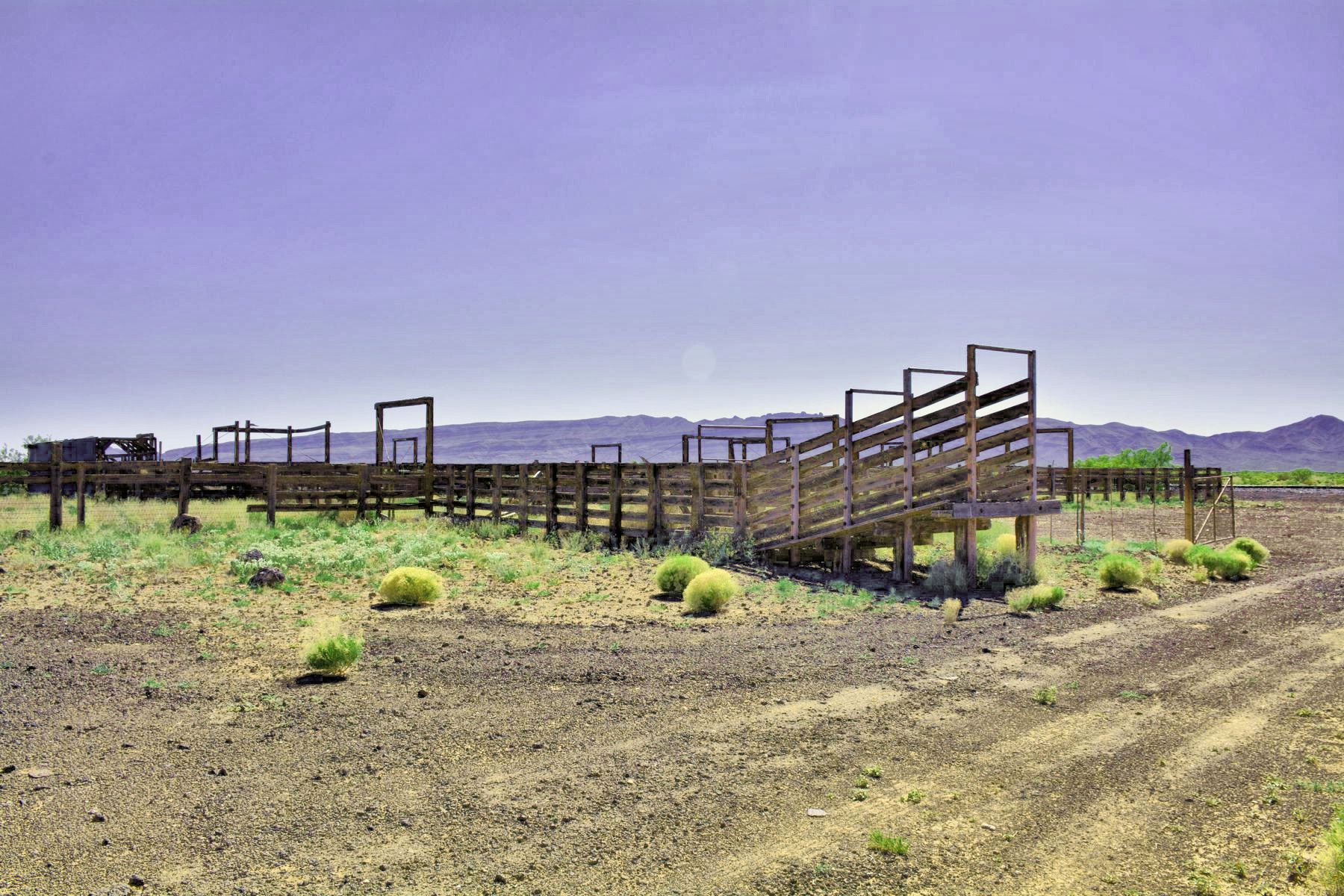
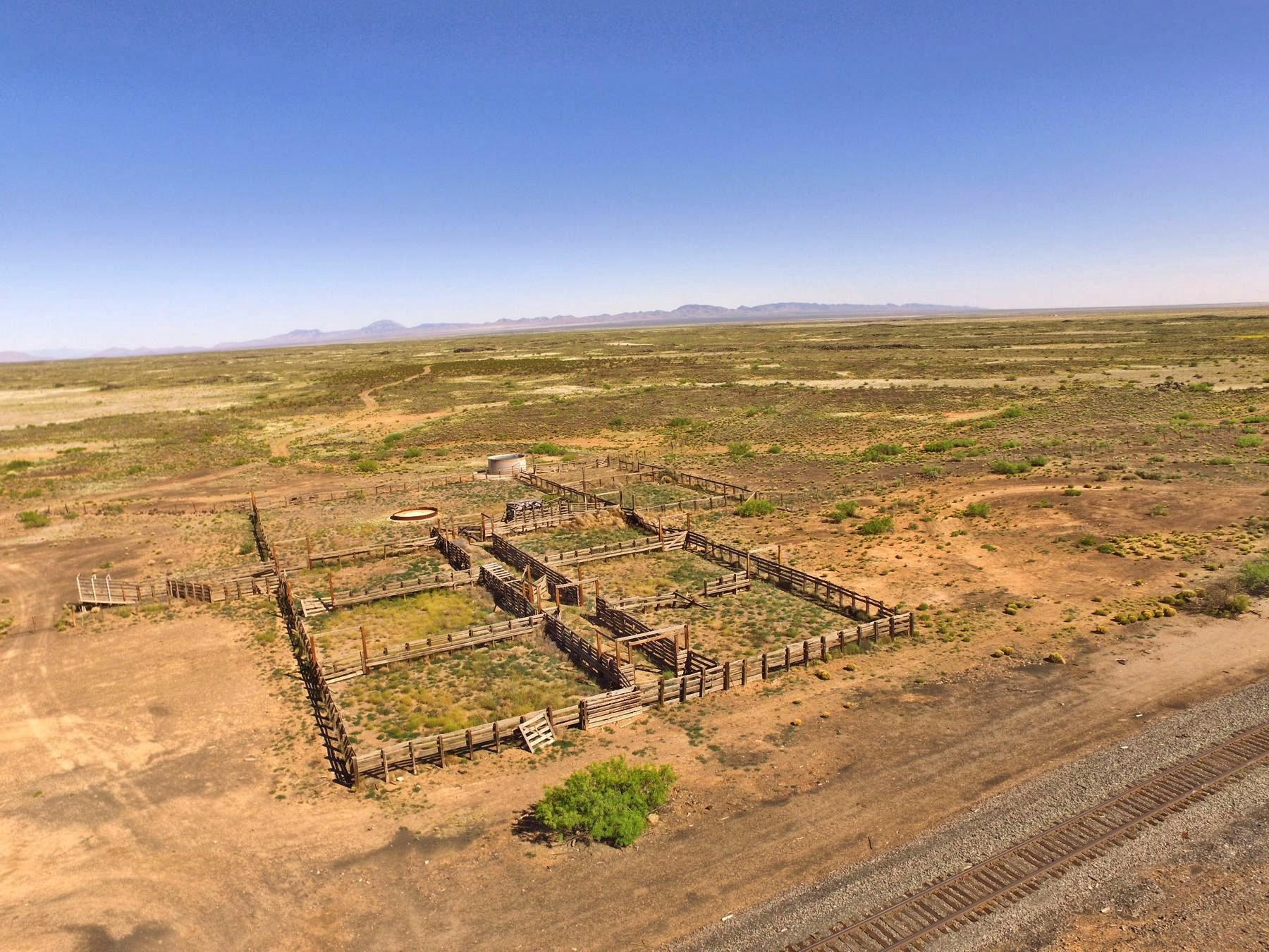
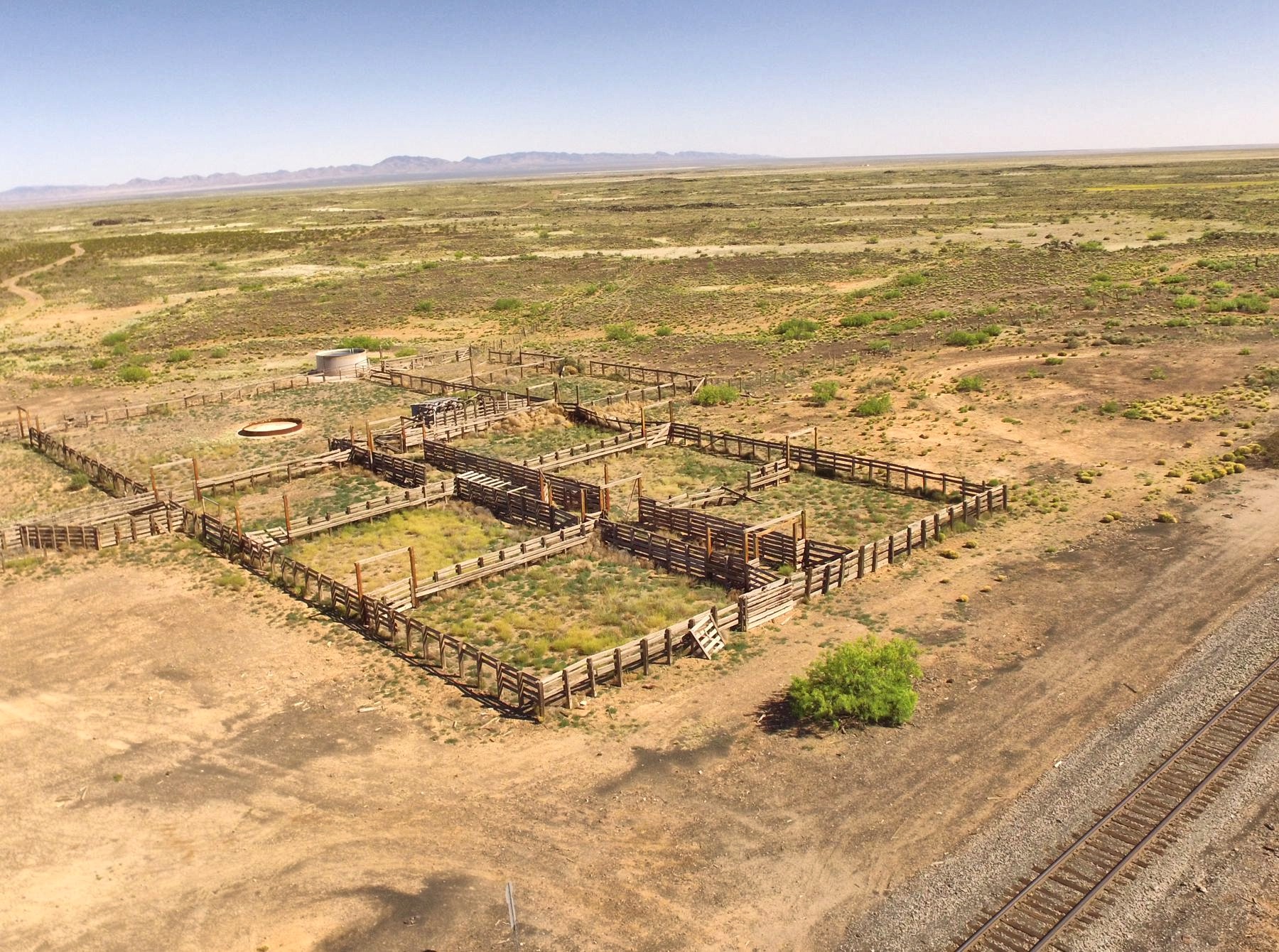
Old Diamond A
ranch corrals
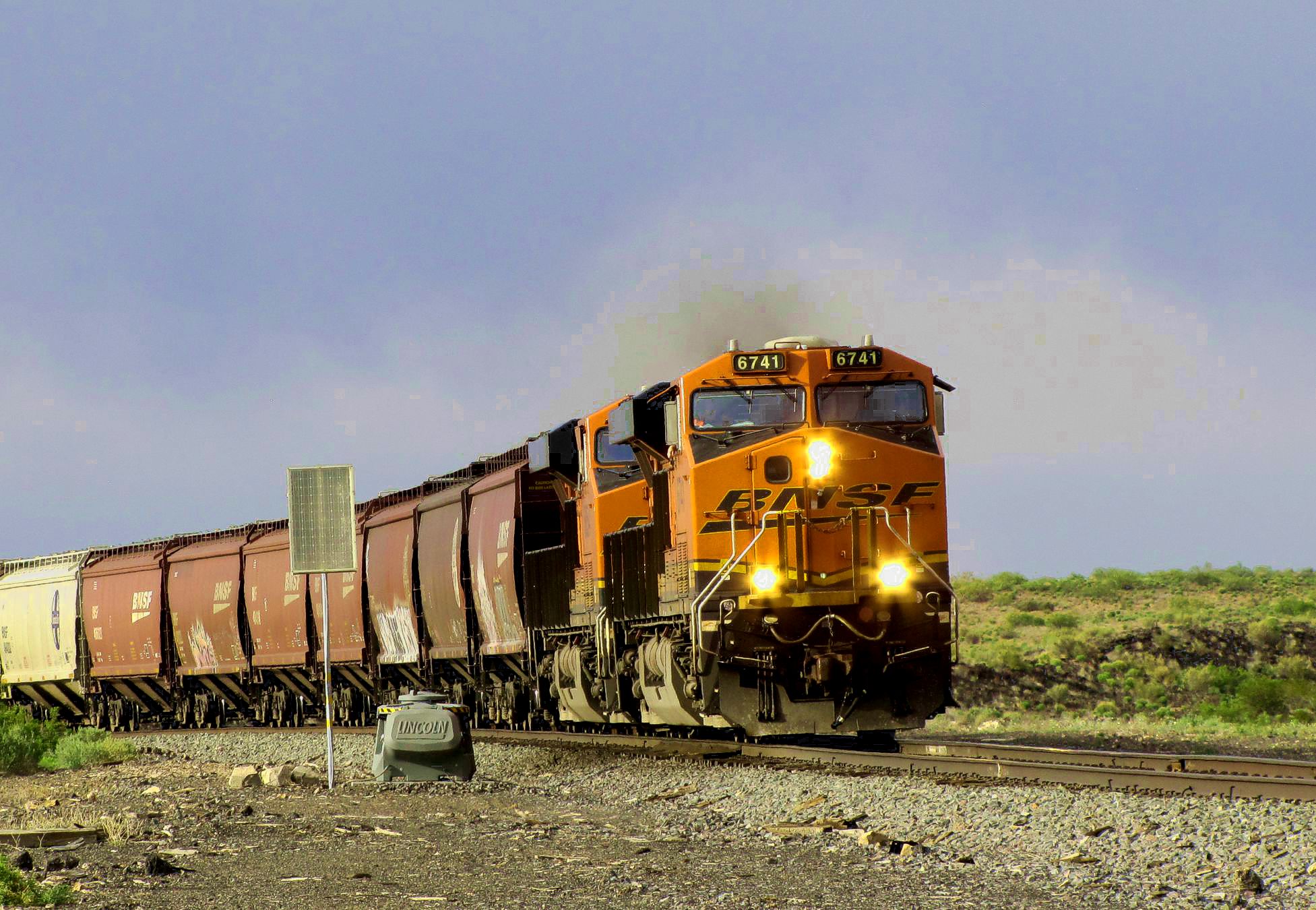
Train
at
Lava
Lava Station was a water stop built 18801881 with the arrival of the Santa Fe Railroad (now BNSF). In the 1890s, corrals
and a siding were built for shipping cattle from the Diamond A Ranch and guano from the Jornada bat caves. Later, a Section House
was built for the crews rebuilding the line. Lava Station was abandoned in the 1950s when diesel engines replaced the steam locomotives.
The telegraph and station building were razed and the water tank dismantled, leaving only the remnants of the section house and corrals.
El Camino Real from Tusas Springs came through the site.
NOTE: The trail in this area is part of the Armendaris Ranch for which no public
access is allowed without ranch permission. Trespassers are prosecuted.

TUSAS SPRINGS SEGMENTS
Lava Station to Paraje Fra Cristobal (this page)
Distances
14 mi. Tusas Springs to Paraje*
From Laguna del Muerto
26 mi. to Paraje* via main trail
29 mi. to Paraje* via Tusas Springs
*
Paraje Fra Cristobal

Trail elevation plot - Paraje Fra Cristobal to Lava Station

TUSAS SPRINGS ROUTE TO PARAJE
TUS_N
TUS_M
TUS_S
The Camino Real Mapping Project
on these web pages
is the exclusive work of the
members of the Socorro County
Historical Society and other
volunteers dedicated to
documenting, mapping, presenting,
and preserving the historic trail.
GoogleEarth
image
Drone
aerial photo
Trail photo
Notes or
documentation
LEGEND
Aerial photos with DJI Phantom 3 quadcopter camera