Socorro County Historical Society
Socorro, New Mexico, USA
On this page:
Socorro County mines are fun and interesting to explore
for their history and intrigue -- but should never be entered!
Have photos? If you have photos of the Kelly mining district or of family that worked the mines you'd like to share, please
let us know here and we'll add them to these pages.
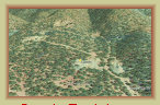
The Kelly Mine & Traylor Shaft
The
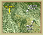
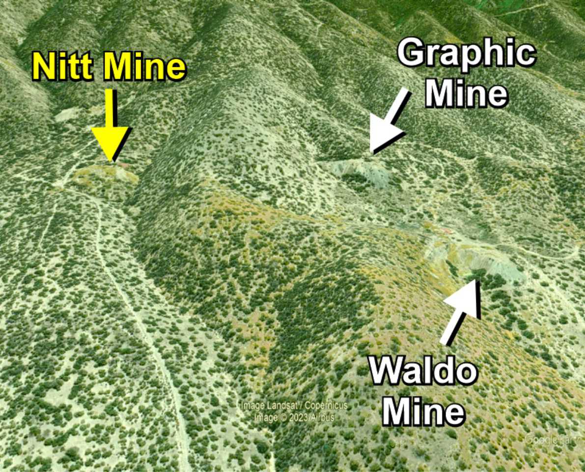
Nitt mine is a lead, zinc and copper mine, part of the Graphic-Waldo-Nitt mine complex, along with the nearby
Kelly mine, all working the same ore body. The Nitt mine is within 1,000 feet of the
Graphic and Waldo mines,
the shaft collar at 7450 feet elevation. It was owned by the
Tri-Bullion Smelting & Mining Co. and comprised several claims on
115 acres beginning in 1906. This included the Silver Bell claim that produced profitable silver ore, though quickly depleted. The
Nitt mine holdings were leased to the
Ozark Smelting & Mining Co., owners of the Graphic-Waldo mine, from 1914-1923. Shortly
after the Ozark Smelter
(Graphic mill) closed in 1921, the mine was operated 1923-1930 by
J. A. Macdonald of Kelly, who shipped
ore to outside smelters rated at about 20% zinc, 2% copper and 2 ounces of silver to the ton.
In 1930, William
R. Dobson became the owner operator of the Nitt mine, and later son William L. Dobson. The mine operated through WW2 and intermittently
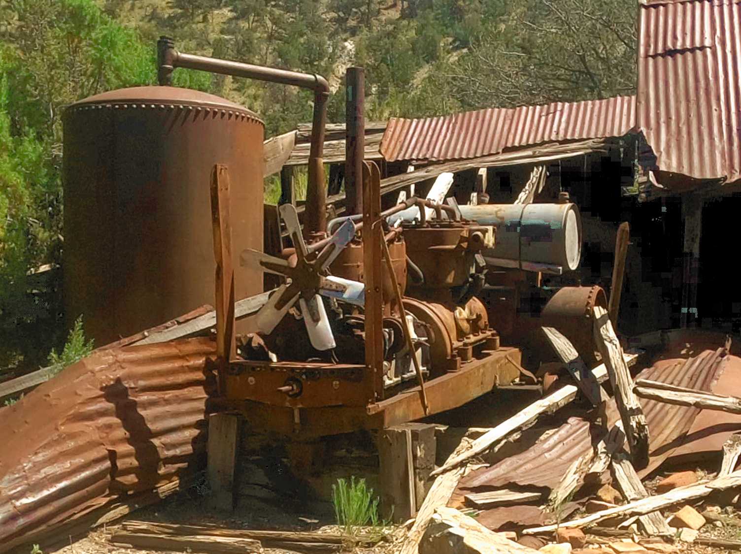
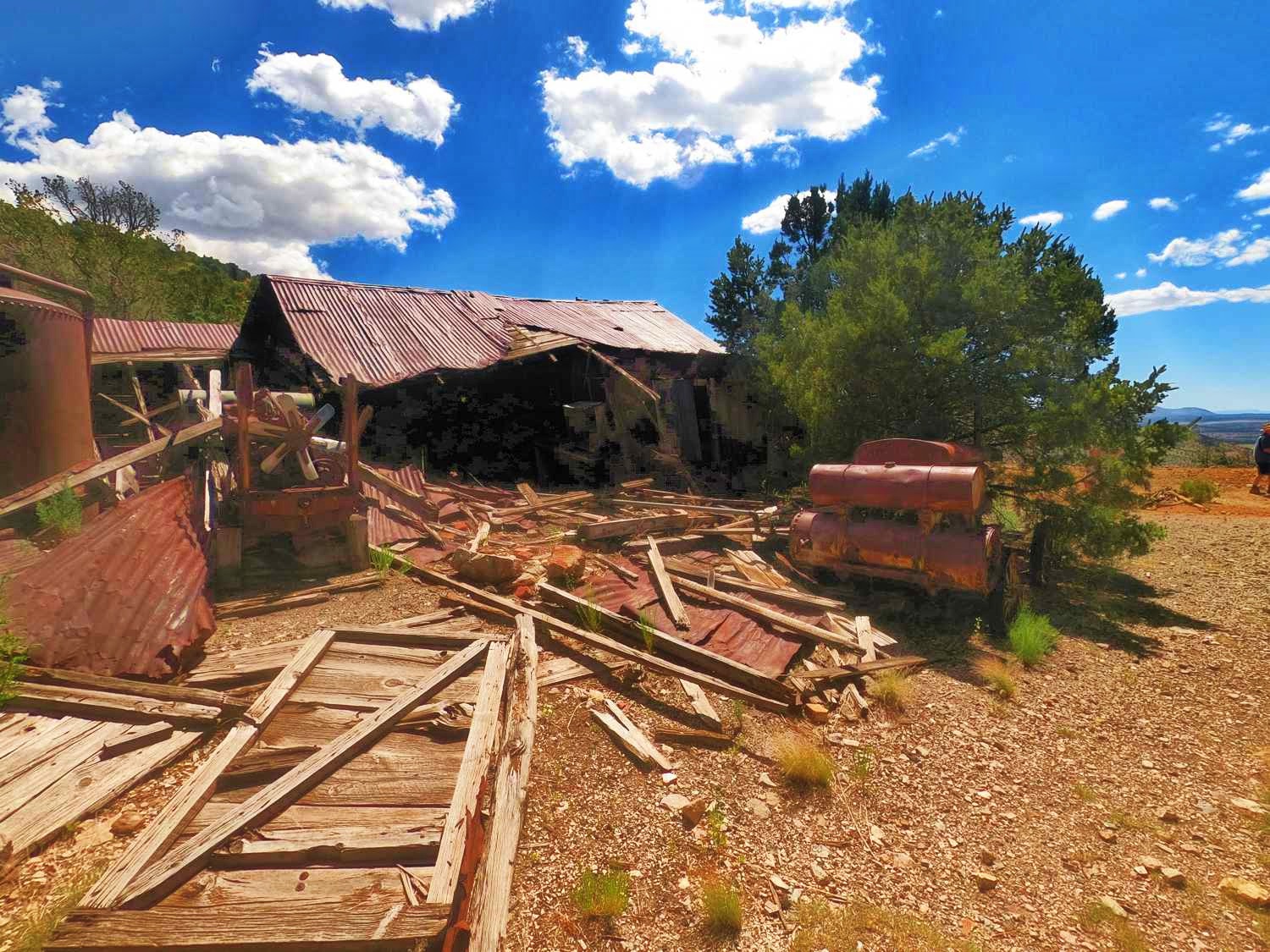
into the 1960s. The Dobsons made many improvements to the mine, replacing a boiler that powered the old equipment with more modern
diesel engines for the shaft hoist and other machinery. This included 100-125 psi high pressure air compressors and water
systems for powering and cooling the hard rock pneumatic drills.
Now in its 3rd generation of ownership by
the Dobson family, the Nitt mine has the distinction of being the only mine left in the Kelly mining district to be locally owned.
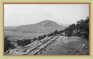
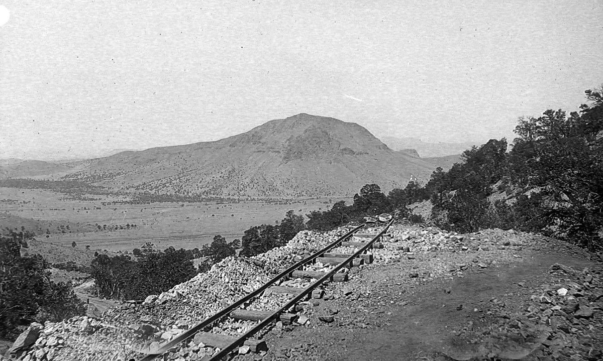
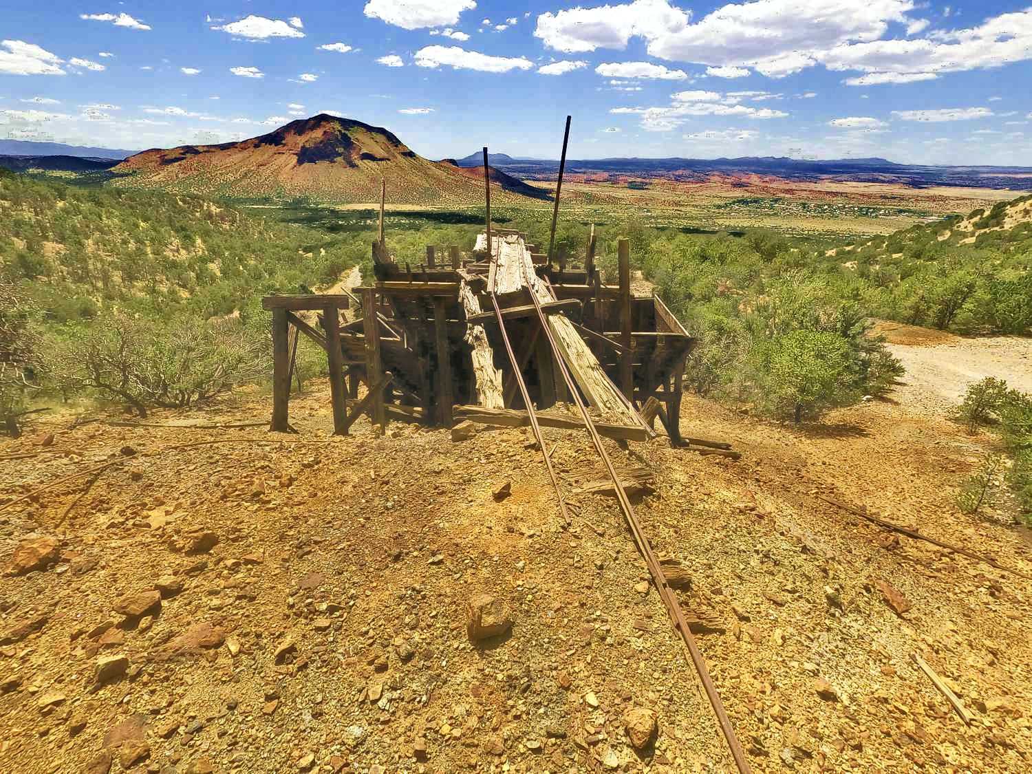
Track to ore bin
circa. 1916
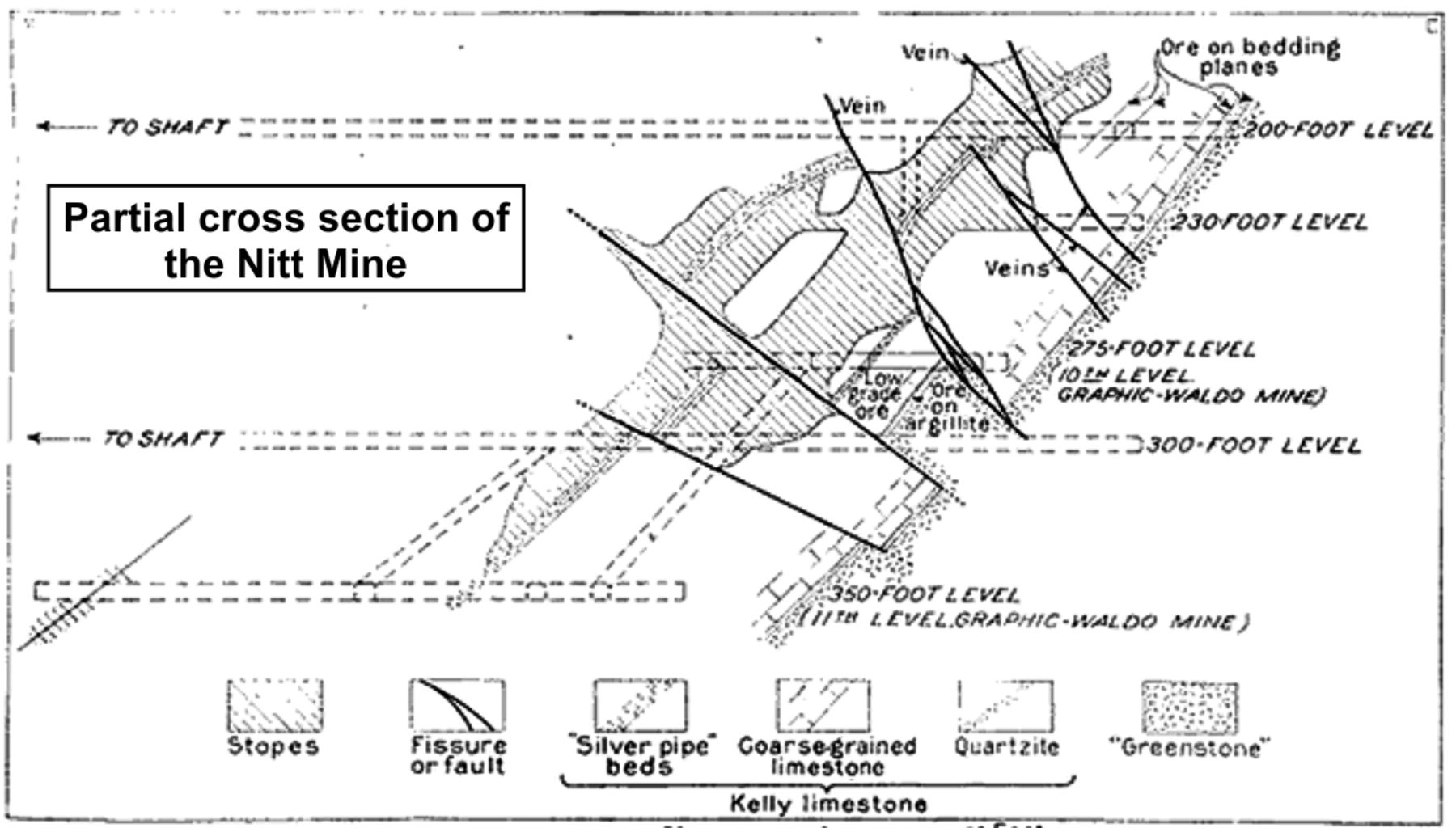
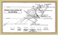
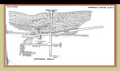
Partial cross-section
of Nitt mine
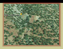
View of Nitt mine
GoogleEarth image
The Juanita mine was the first claim of "Old Hutch" Hutchison in 1866, and thus the oldest claim in the Kelly region. It
was purchased by attorney and former Senator T. B. Catron in 1915 upon settling the estate when Old Hutch died in 1914.
Catron, in turn, leased it to Mines & Metal Co. of Kelly 1915-1928. Others worked the mine until closed in 1937.
The Juanita was an active mine throughout Kelly's mining days. In spite of rather extensive underground workings, it was not an especially
profitable mine with modest output of lead and zinc, though did produce 23,352 ounces of silver 1905-1937.
Photos courtesy mindat.com
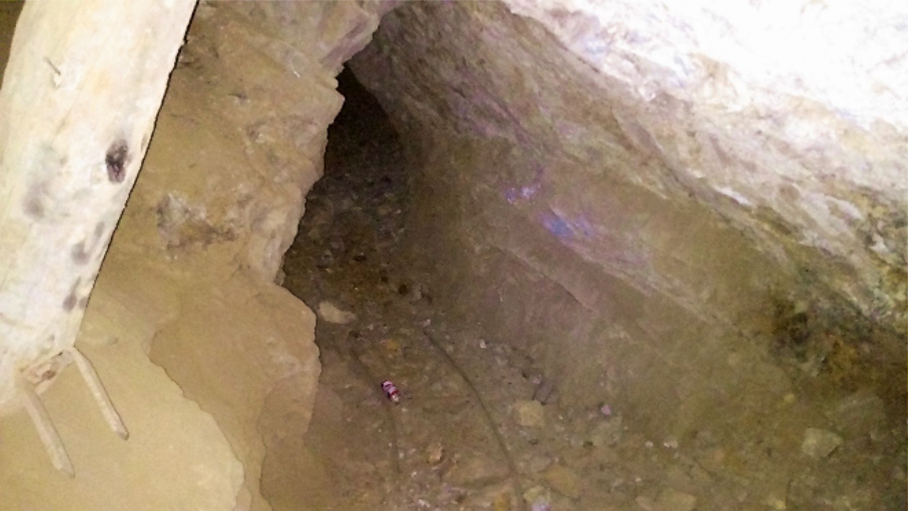
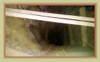
An inclined shaft at
the Juanita mine
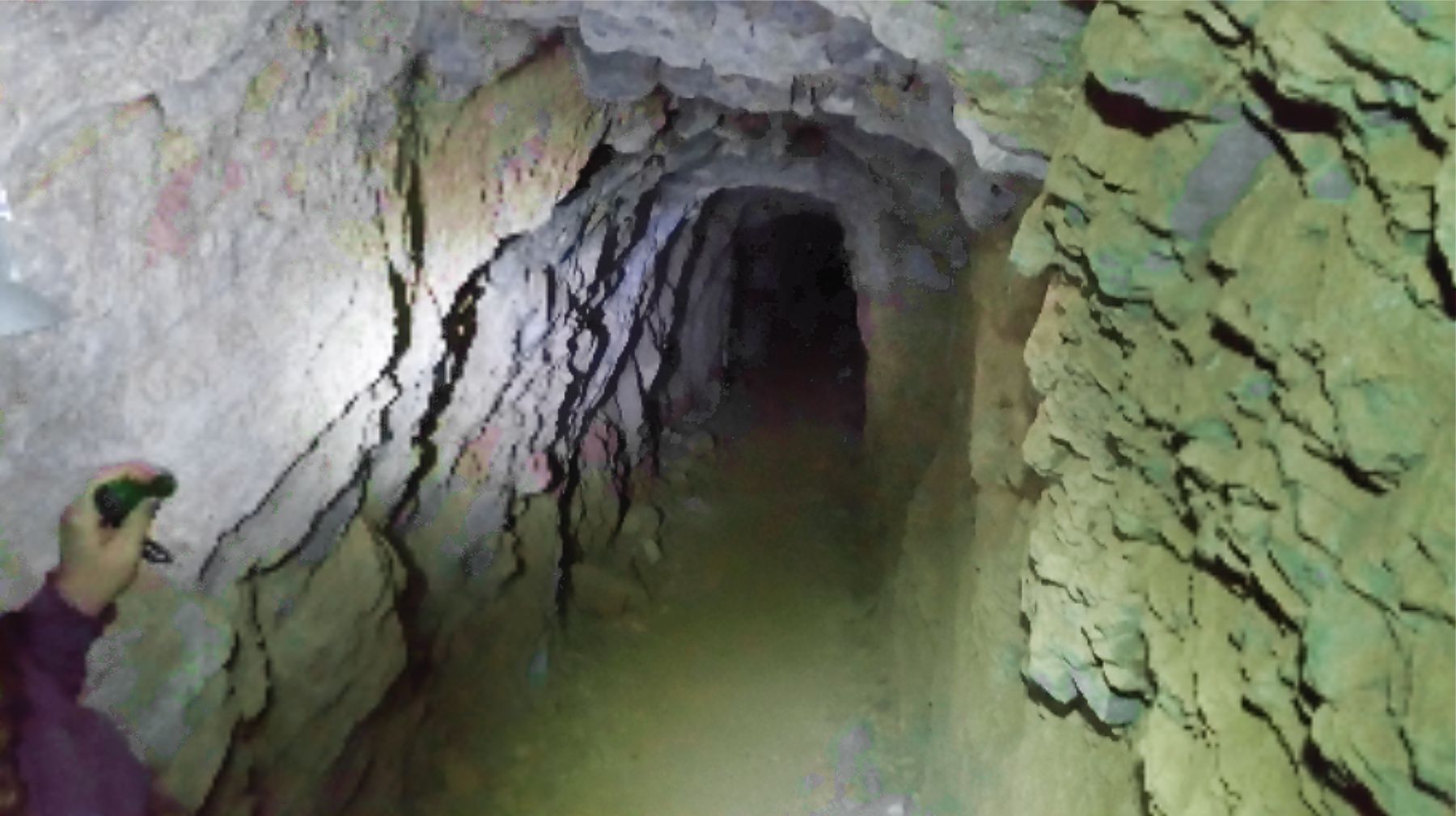
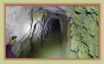
Main drift (tunnel) for
hauling ore
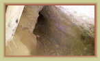
Mine rail leading into
one of the stopes
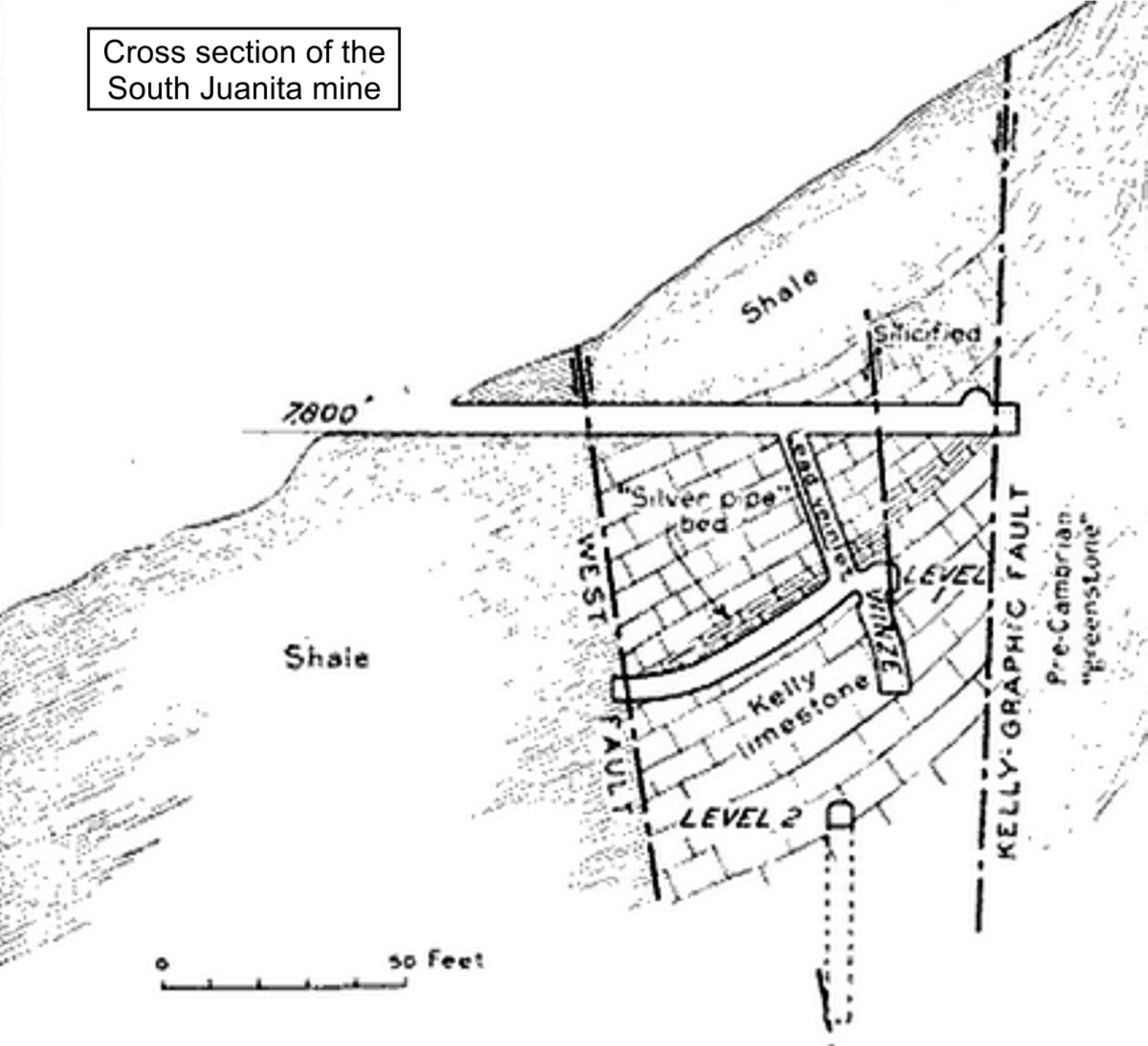
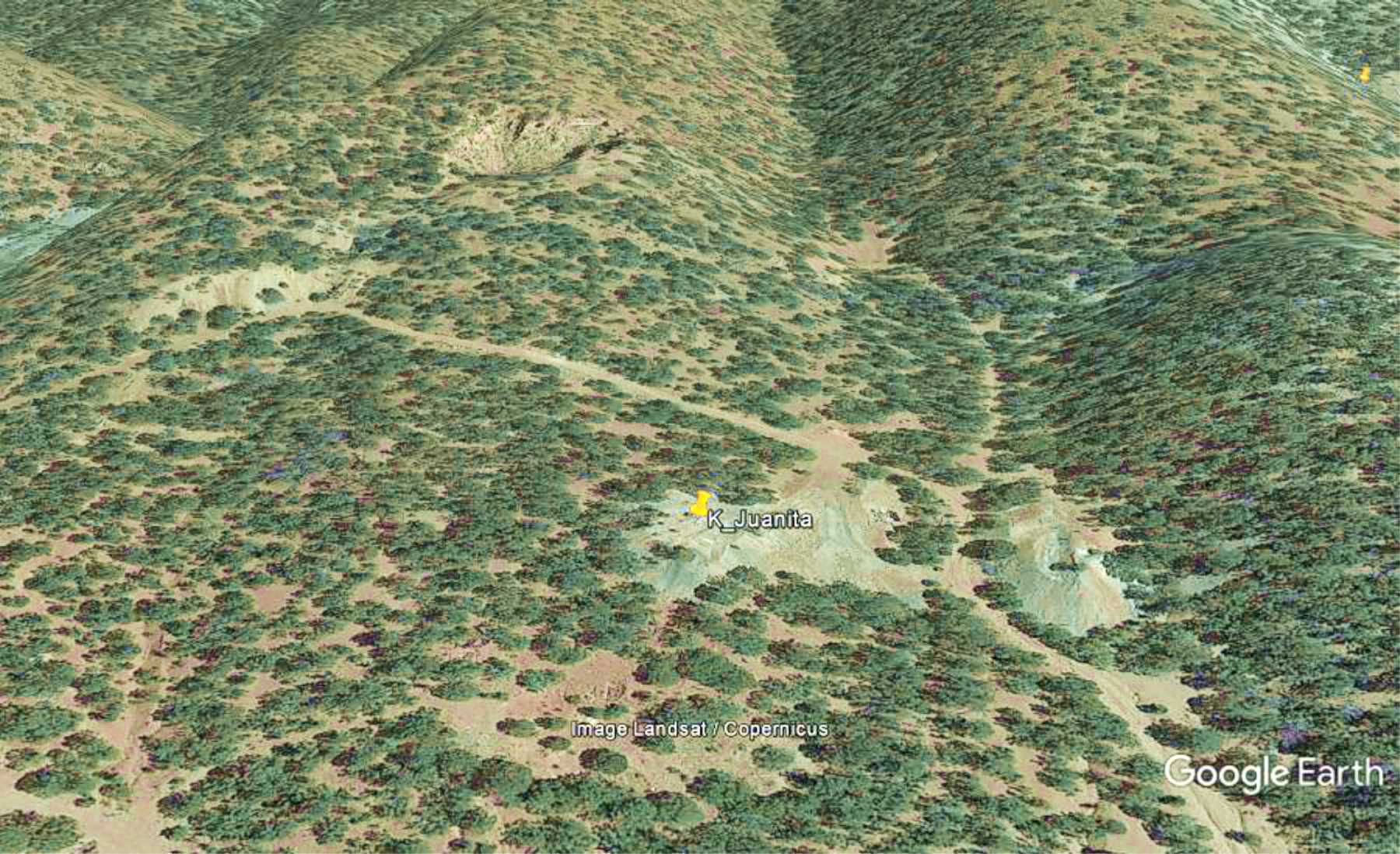
The
South Juanita mine, also known as the "Juanita Extention," is located about ¼-mile south of the
Juanita mine. Production
was reported in 1907, 1912, 1918-1919, and 1928-1929 producing lead, zinc and some silver. The mine sat idle in the other
years with some sporadic operation 1930-1939.
The mine consists of a 200 ft. vertical shaft that accessed three
levels. Most of the ore came from a stope about 100 by 270 feet along level 1, and a few small pockets of ore on level 2.
The dominant ore mined was lead carbonate with minor quantities of zinc carbonate. The adit entry to the mine has collapsed, burying
the portal. The main shaft is still open.
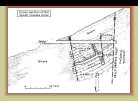
Cross-sections of South Juanita mine
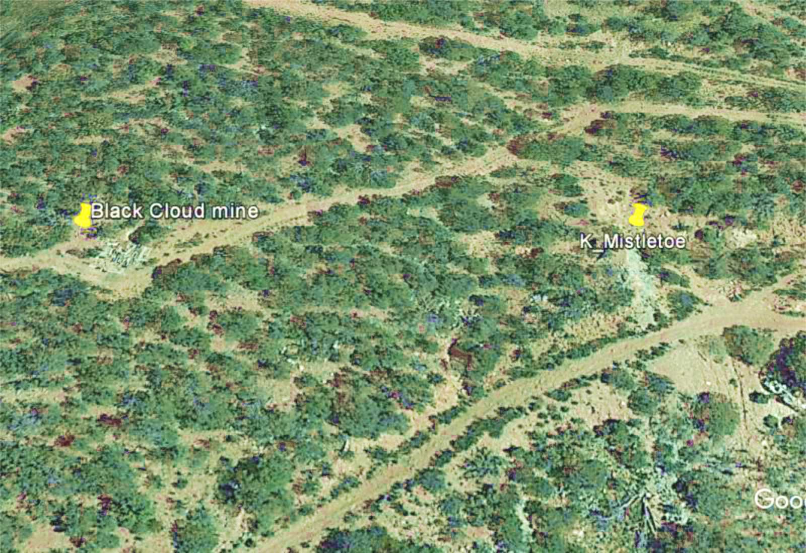
The Mistletoe mine started in 1906 by the Mistletoe & Magdalena Tunnel Co. A mill to process the ore was built
in 1908. The Mistletoe tunnel reached 1,050 feet in length when it struck water and flooded in 1915. Another mine was immediately started
nearby called the Black Cloud mine. In 1926, the mines were reorganized as the Black Cloud Mining & Milling Co. consisting about
400 acres. The consolidated properties were often called the Helen Cross group of claims.
The Mistletoe mine was
connected through an aerial tramway to their mill at the mouth of the tunnel. The mill was overhauled by the new owners in 1927
in response to the closure of the
Graphic Mill that same year, leaving the Black Cloud the only mill left in the Kelly region. Many
mines in the region closed in 1928-1929 era due to the higher grade ores being exhausted, forcing the Black Cloud mill to close
in late 1928 for lack of sufficient business to operate the mill -- the last mill in the area to close.
The Mistletoe
mine was closed in 1929 when the lower levels and the stope being worked again flooded. The Black Cloud continued to operate
until 1938 producing lead, copper, and only 214 ounces of silver.
In spite of the extent of the two mines and their own
mill, mining problems and several episodes of flooding prevented the mines from being a large producer of lead, zinc or silver the
owners had hoped.
Google Earth image
Google Earth image
View of the Black Cloud
and Mistletoe mines
Google Earth image
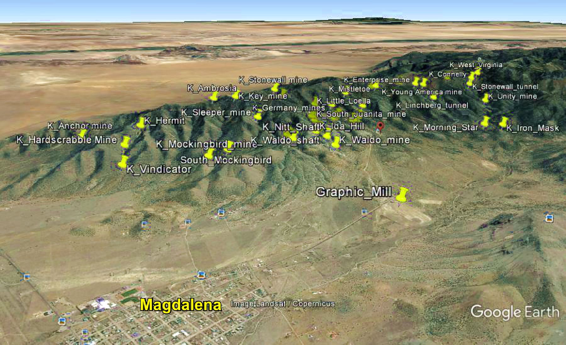
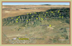
The map to the right shows the locations and names of the dominant area mines. Clicking on a mine name with a link takes you
to a thumbnail history of the mine and photographs or other information where available.
Information on these pages are to document
and archive the history of Kelly and her mines and is not meant as a geology or rock hounding guide. Additional information
and photos will be added as they become available.
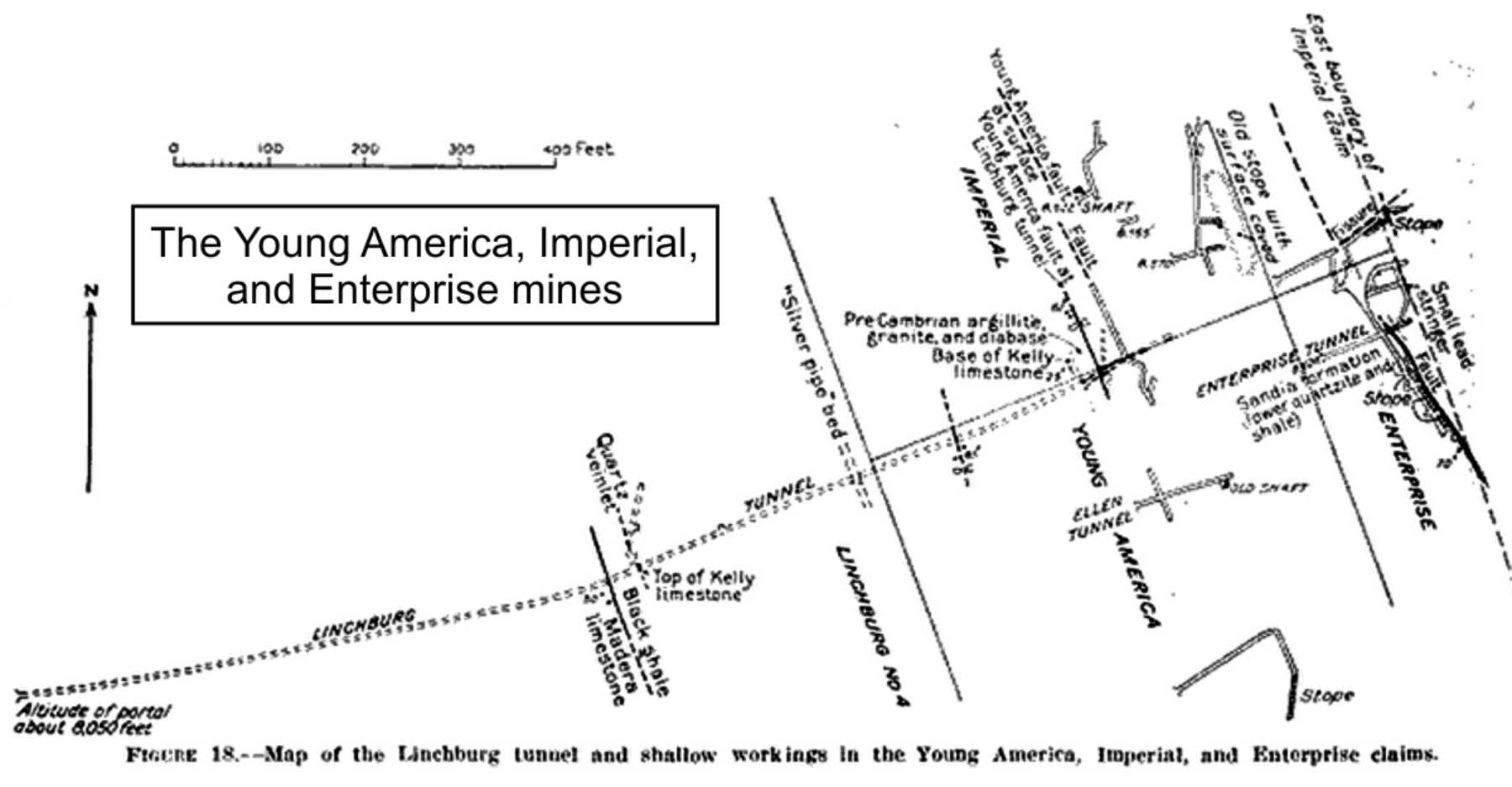
H. W. Russell & Co. developed the
Young America claim in 1907, located east and higher up on the mountain from
the
Linchberg mine and tunnel. In 1909, 22 tons of crude ore was shipped of which 22,520 pounds of lead and 220
ounces of silver were recovered. Ownership passed to C. T. Brown in 1911 and to the Empire Zinc Co. in 1915.
TheYoung America and Imperial mine workings consisted of several small tunnels running east, at 8,570 feet elevation, to connect
to north running drifts to lead and copper carbonate ores, and south running drifts that accessed two ore bodies of high
grade zinc.
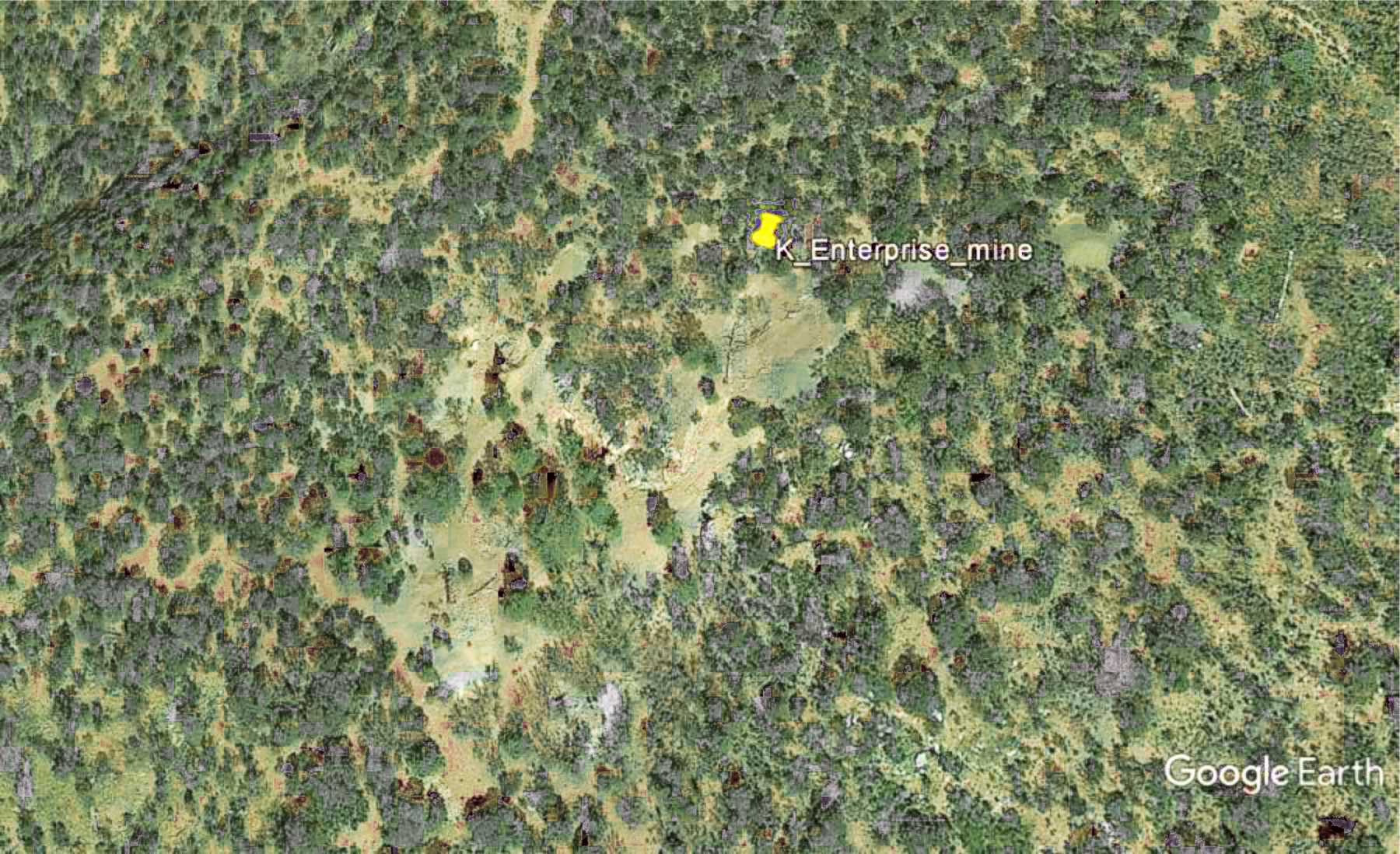
The Enterprise mine is located a few hundred yards south of the Young America and Imperial claims. The
northeast running Enterprise tunnel connected to south running drifts that followed a streak of lead carbonate. The north drift struck
a mass of high grade galena that contained an unusually high content of silver, though quickly mined out.
The Enterprise
and Young America were well worked mines, but their ore bodies proved to be limited. It appears none of the mines
were worked after about 1920.
The Enterprise tunnel has been sealed at the portal and no longer accessible.
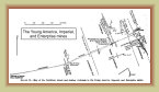
Google Earth image
Enterprise, Imperial, and
Young America map
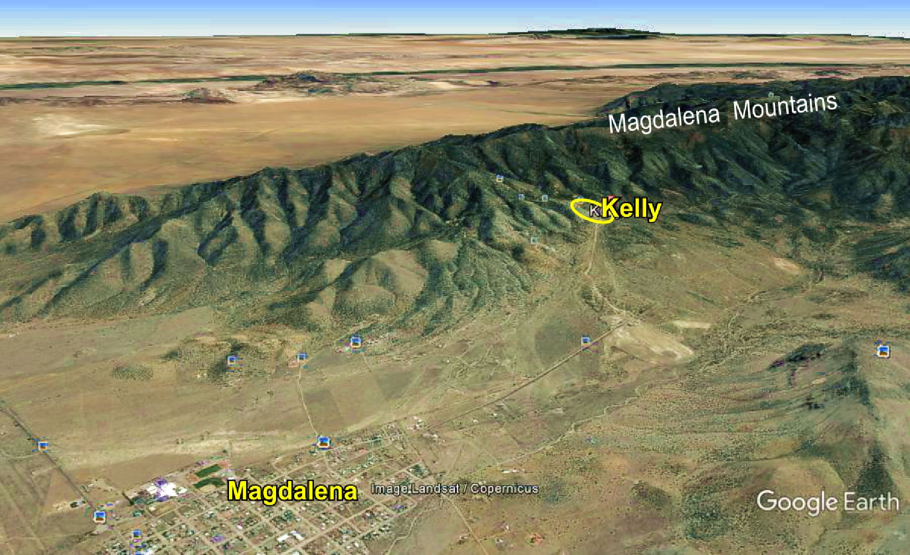
Kelly, NM is one of New Mexico best ghost towns and was once the leading producer of lead and zinc in the state, and a major
mining district in the Southwest. The region remains well known today due to the landmark remains of the Kelly
Mine and the Tri-Bullion smelter. However, the Kelly Mine was not the only mine in the area as these webpages show ... the Kelly
region is peppered with several dozen other mines, some of which were also major mining operations and mills, while others were smaller
yet profitable producers -- and some just hopeful prospects.
QUICK LINKS TO KELLY MINES

Ida Hill
Cimmaron
Paschal
Click on mine name with a blue link for more information, photos
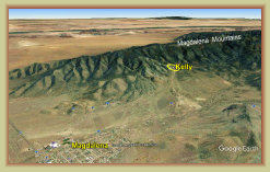
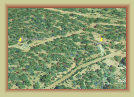
Magdalena-Kelly region
overview
Magdalena-Kelly region
overview showing mine locations
MINE SAFETY: Do not enter mine shafts or tunnels -- most are extremely fragile and hazardous due to to flooding, hidden shafts,
cave-ins,
dangerous gases & lack of oxygen.
Many mines listed here are on PRIVATE PROPERTY -- explore with respect.
History
Articles
Mines2
1
0723d
PRIVATE PROPERTY. Locked gates. For access or gem and mineral collecting, contact Grace at Bill's Rock Shop
in Magdalena
at 575-854-2236.
Please respect this local privately owned and historic mine.
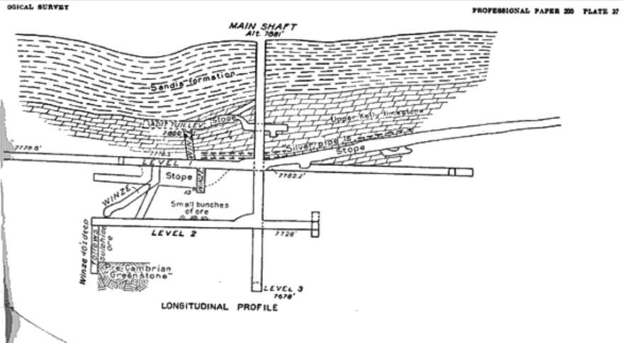
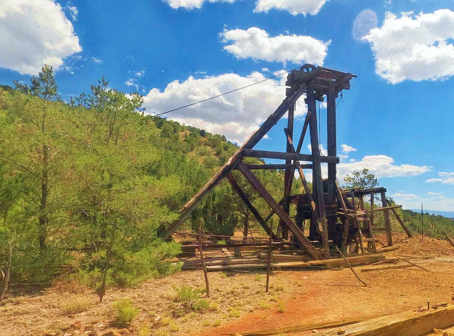
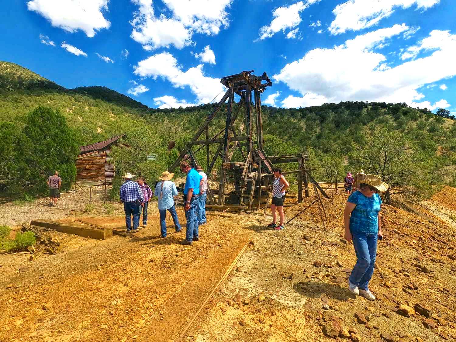
The mine consists of a shaft 300 feet deep with headframe, 4,000 feet of drifts and crosscuts over several levels between 200 and 300 feet, and an inclined winze to the 350 foot level following the ore. The 275 and 300 foot levels of the Nitt mine intersect with levels 10 and 11 of the Waldo mine. While the ore body has been largely exhausted by the extensive Kelly mine, the ore in the Graphic, Waldo and Nitt mines is not depleted.
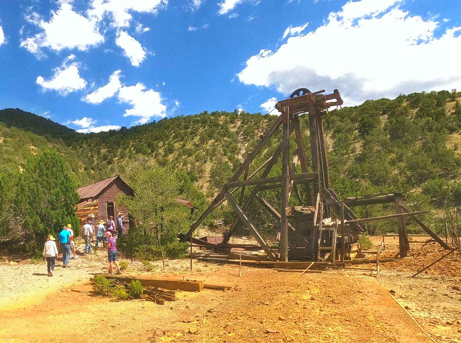
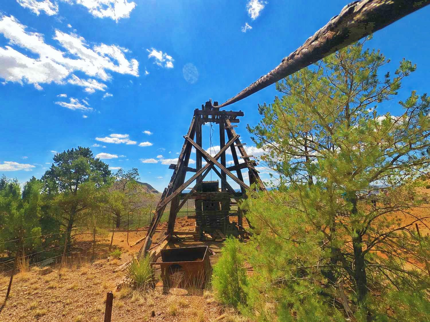
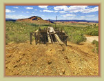
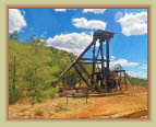
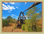
Nitt mine headframe
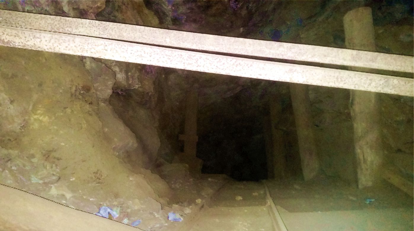
Track to ore bin
today
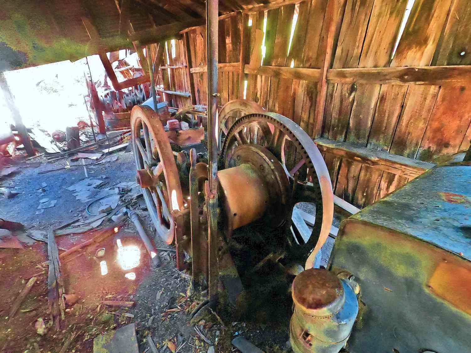
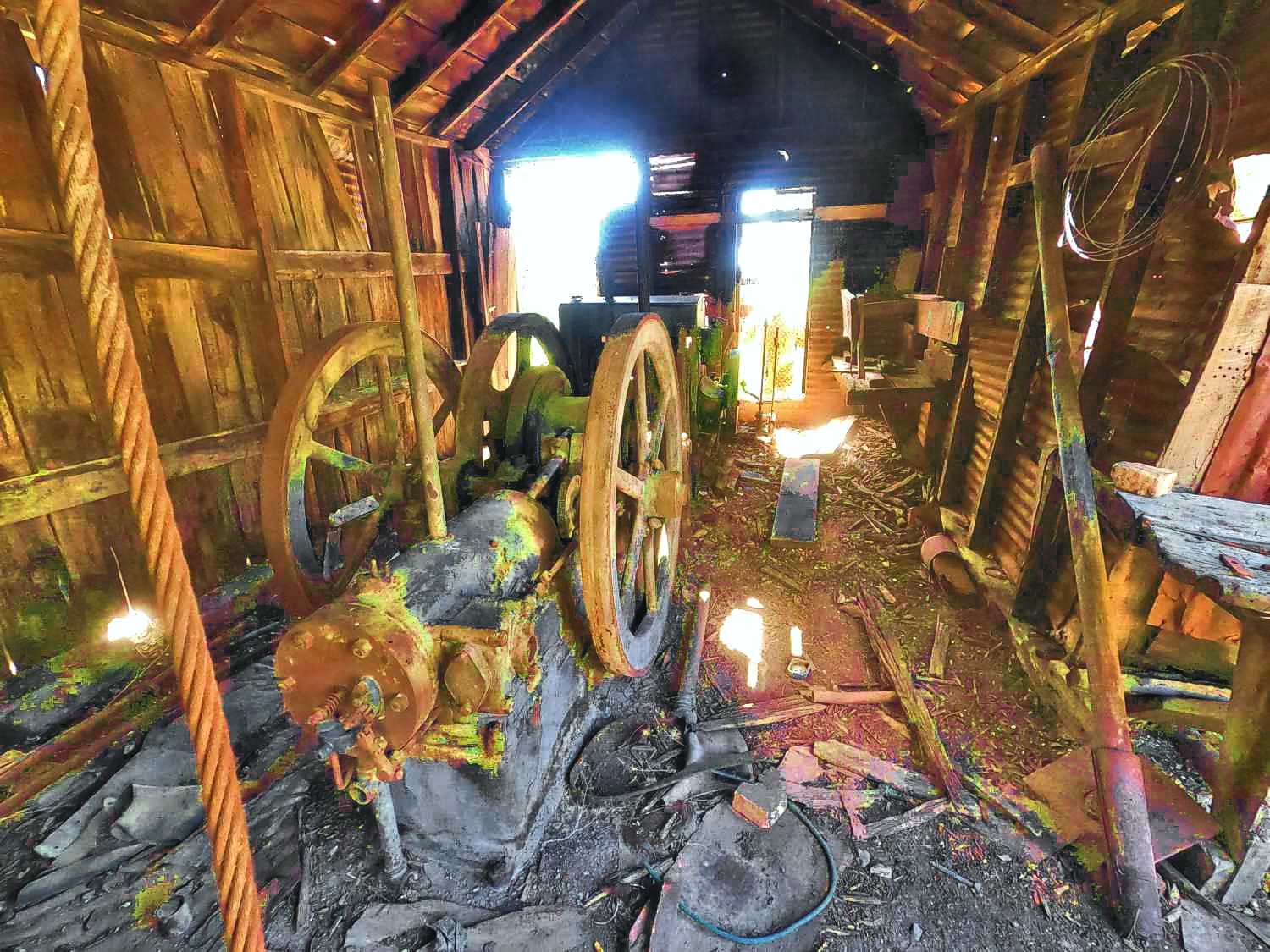
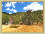
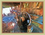
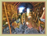
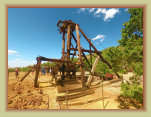
Hoist shack machinery
Head frame with hoist
cable still attached
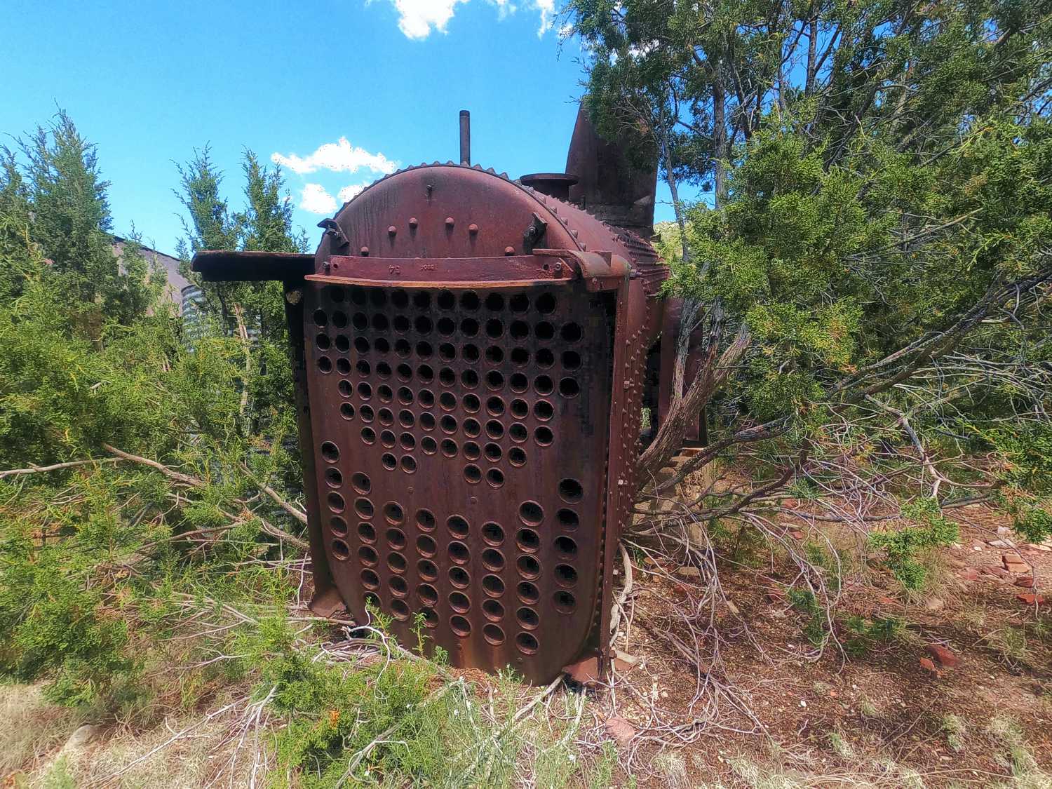
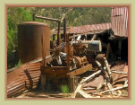
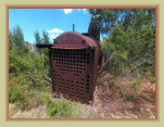
Original boiler.
Replaced by diesel engines for power 1930s
One (of 2) 125 psi
air compressor and
pressure tank
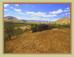
View of Magdalena
from the Nitt mine
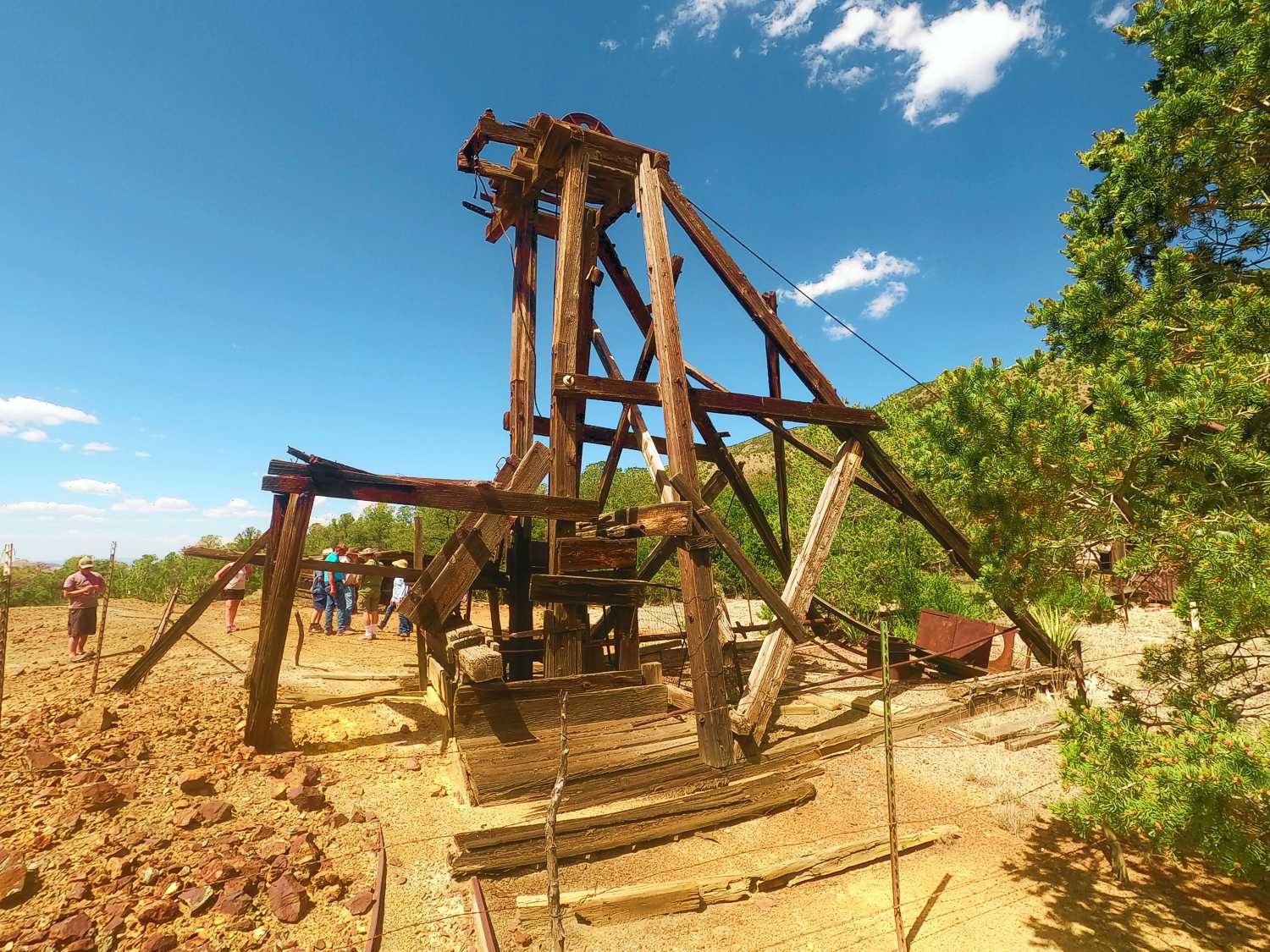
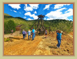
Auto tour, led by the owner, to the Nitt mine
during Magdalena Frontier Days 2023.