Socorro County Historical Society
Socorro, New Mexico, USA
History
Articles
On this page:
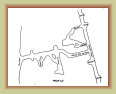
The Kelly Mine & Traylor Shaft
Mines2
3
The
Ambrosia mine was owned by famed attorney and former Senator
Tom B. Catron who leased the property to
Mines & Metals Co.,
C. T. Brown, manager. The main years of operation were 1914-1920. It is located on the crest of the Magdalena range about 1,500
feet north of the
Key mine tunnel.
There were two tunnels, the main Ambrosia tunnel and a lower tunnel about
500 feet southwest along the mining trail. Two short drifts were extended to the north without finding any profitable ore.
Around 1916, two additional tunnels were opened about 800 feet north of the Ambrosia shaft and west of the crest called North
Ambrosia or the Ambrosia Extension that recovered a small amount of zinc carbonate ore.
In 1941-42, most all the
Kelly mines were inspected to determine the potential for mining the "war metals" needed for WWII. The inspection found
all of tunnels of the Ambrosia mines caved in denying access, though unknown if natural or intentional tunnel collapses. The
Ambrosia mines were only a modest producer of pay ore with no indication of the mine operating after 1920.

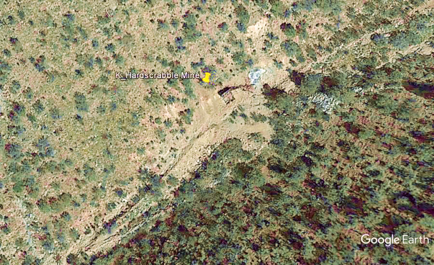
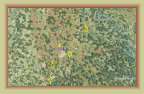
Google Earth image
The
Sleeper mine is located about midway betwen the
Key mine and the
Graphic mine. The tunnel is
950 feet in length with the portal about 7,970 feet in elevation.
The mine was not a big producer -- indeed, a "sleeper."
It did, however, strike a body of galena that was followed by a vertical rise inside the mine that also discovered a limited body
of high grade zinc. Additional ore was recovered by a zigzag of drifts towards the end of the Sleeper tunnel including calcite
and some Smithsonite.
Records could not be found to indicate period of activity, mine output, or ownership.

Google Earth image
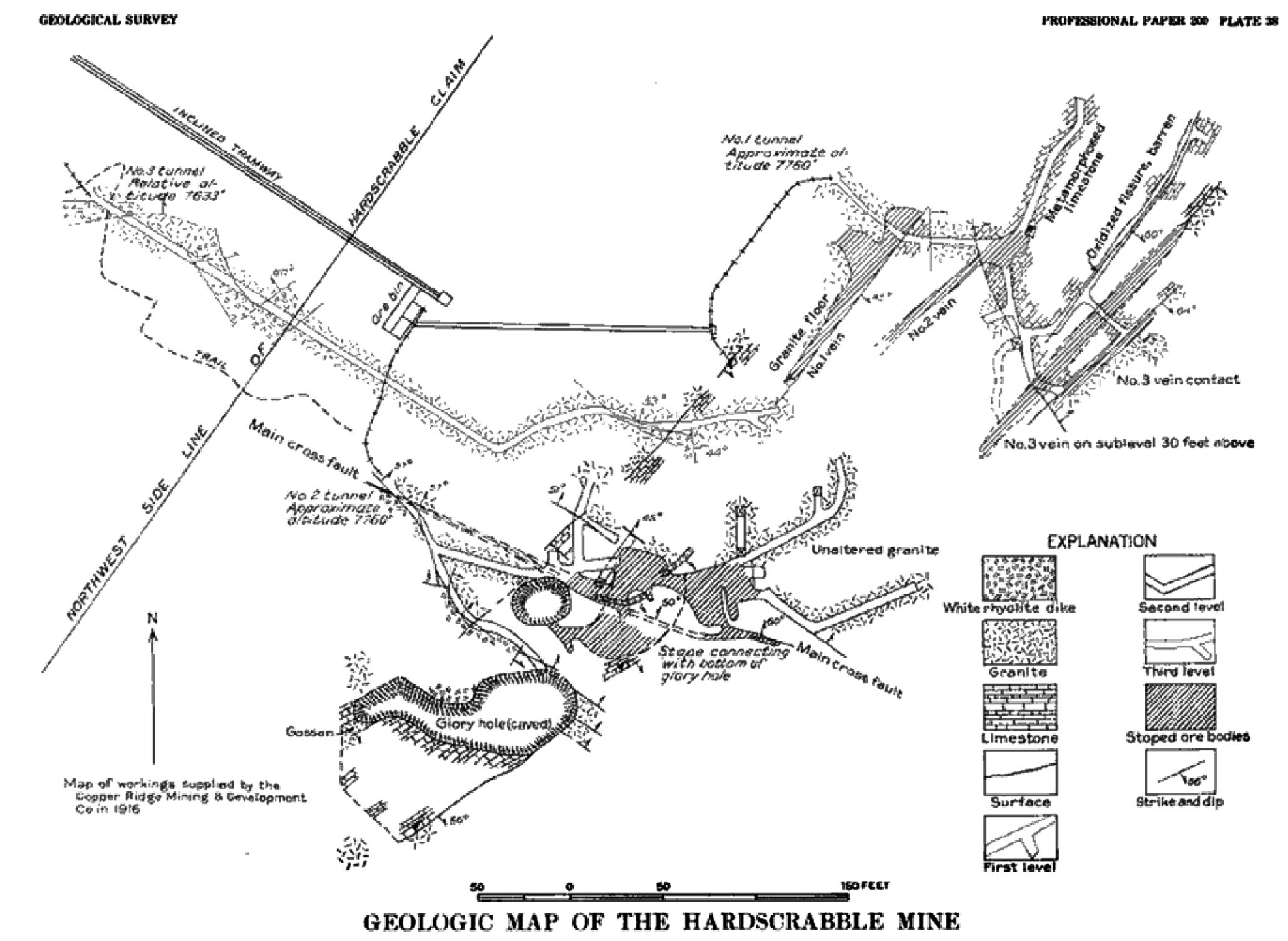
Mine map
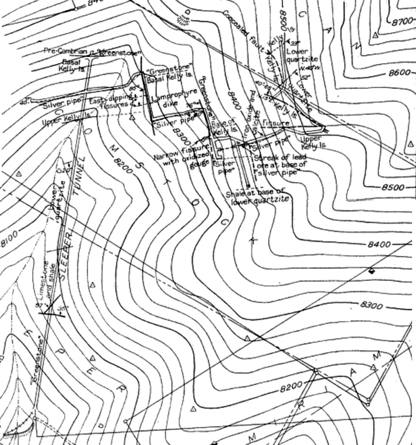
The Hardscrabble mine has an interesting and long history, though ownership at any given time is a bit confusing.
The Hardscrabble claim was first filed by a man name Baker in 1868, located on the upper west slope of the Magdalena range.
He later sold it for $25 to an unknown party. It appears the mine sat idle during the 1870s. By 1883, the mine was owned
by attorneys Thomas Catron and his brother-in-law Stephen Elkins who placed the mine into operation. They also purchased
some other claims in the Kelly area they called the Mary Group claims, supposedly after Mary Magdalen's image on the mountain.
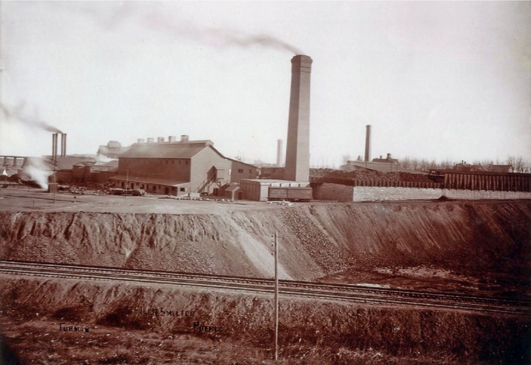
When the AT&SF railroad arrived in Magdalena in 1885, the Hardscrabble mine began shipping it's ore, up to 100 tons per day, to theColorado Smelter in Pueblo, CO, which recovered 25% lead per ton on average and some silver. Two years later, the Socorro
Chieftain reported 12 to 15 men employed at the mine.
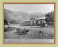
The mine consisted of two glory holes and three tunnels, the
upper two connected with an inclined tramway to near the Hardscrabble Camp, located at the foot of the mountain. This was a
small village of sorts to house the miners and company officials. From near the camp, the ore was transferred to wagons for
the one-mile trip to the railroad for shipping to the Pueblo, CO smelter. The ore mined was mostly oxidized and rich in
lead and silver, with some oxidized zinc.
In 1897, the Mary Mining & Smelter Co. built a smelter for the mines in
Cerrillos, NM by Catron and Elkins, also owners of the Hardscrabble mine, and named after their Mary Group holdings in Magdalena.
As soon as the Mary smelter was completed, Catron and Elkins sent portions of their Hardscrabble ores to their Cerrillos smelter,
in addition to the ASARCO smelter in El Paso. In 1902, the Mary smelter and the Magdalena holdings, presumably including the
Hardscrabble mine, were sold to the Consolidated Mining and Milling Co. which operated the mining and milling enterprise until 1910. Over
the next four years, ownership of the mine changed two more times. It was purchased by the Copper Ridge Mining & Development
Co. in 1915, who apparently continued shipping the ores to El Paso for smelting.
Ore from the Cerrillos area mines were quickly diminishing such that the smelter was forced to closed in
1918 and they sold their mining holdings. In 1919, the Hardscrabble mine was sold to Ian Mactavish, son of Magdalena
merchant John Sinclair Mactavish, co-owner of the Becker-Mactavish Mercantile in Magdalena.
The Hardscrabble mine was
a highly productive and profitable mine over many years of operation, though records are scarce and there are no precise output
or shipment figures prior to 1909. The July 14, 1900 Socorro Chieftain reported, for example, "Report says that the
Hardscrabble mine, Kelly district, is yielding about a carload of ore a day ... They are shipping a carload a day to El
Paso smelters, and the mine is one of the big dividend payers of the camp." A 1905 mining report stated, "The Hardscrabble
is among the most noted properties in the district; it is credited with a production of $325,000 up to January 1, 1904" (abouit $8
million today). Records do exist for 1916-1920 that shows the Hardscrabble mine recovered 65,181 pounds of copper, 70,111 pounds
of lead, 190,567 pounds of zinc, and 8,911 ounces of silver in those four years. Not bad for a mine that has been operating
for about 40 years.
It is not known when the Hardscrabble mine ceased operations, but it appears it was producing intermittently
under the Mactavish ownership in the early 1920's and idle by 1928-1930. Unlike other Kelly area mines, it does not appear
it was reactivated during WWII.
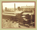
Mary Smelter
Cerrillos, NM
Colorado Smelter
Pueblo, CO
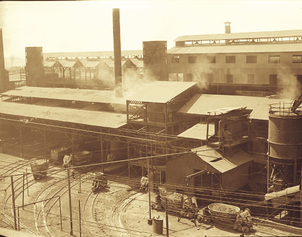
ASARCO smelter
El Paso, TX
Cerrillos Historical Society
Pueblo County Hist. Society
ASARCO Archives
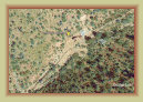
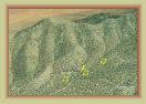
Google Earth image
Google Earth
image
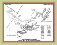
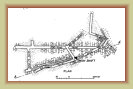
Hardscrabble
mine map
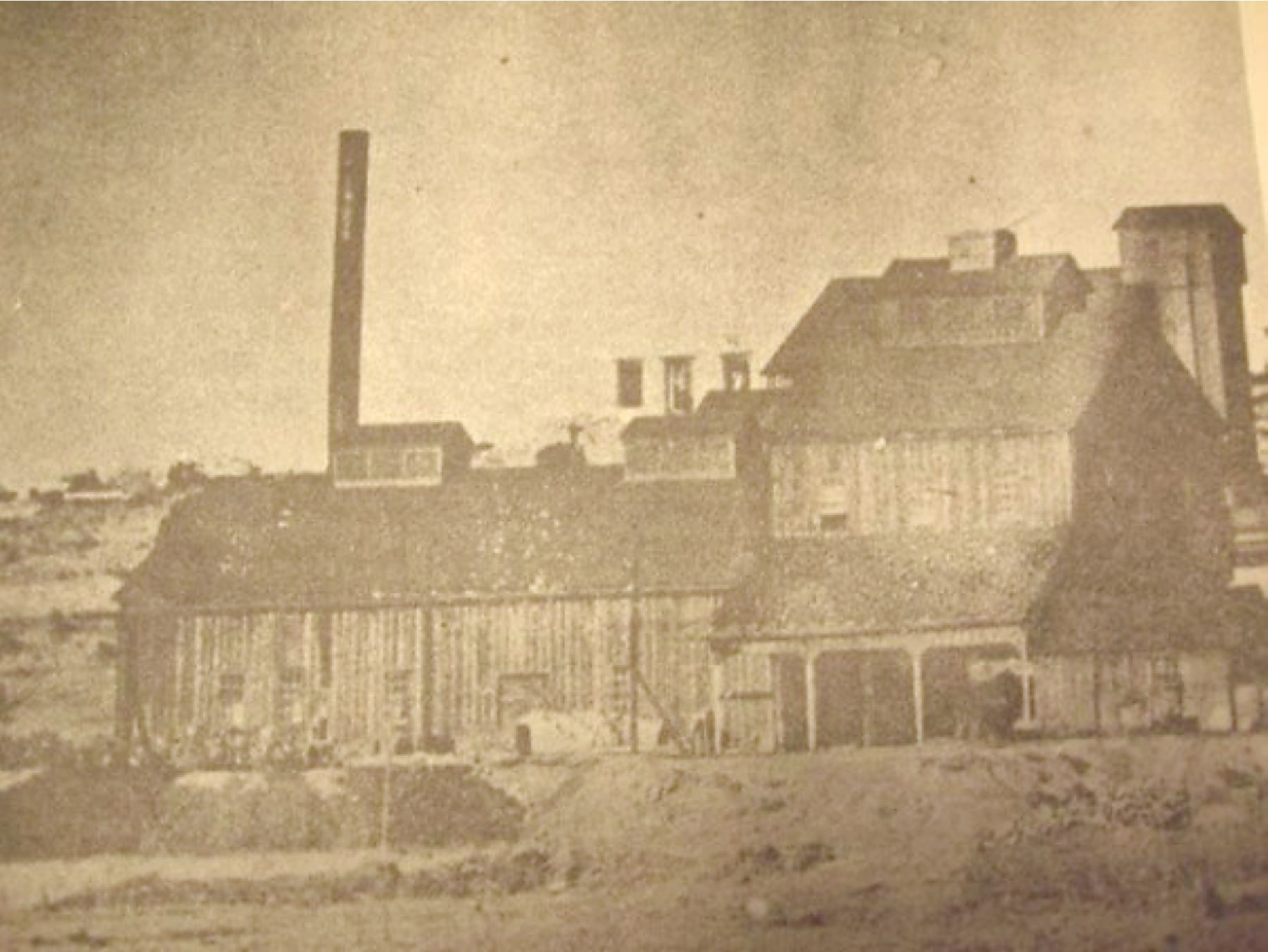
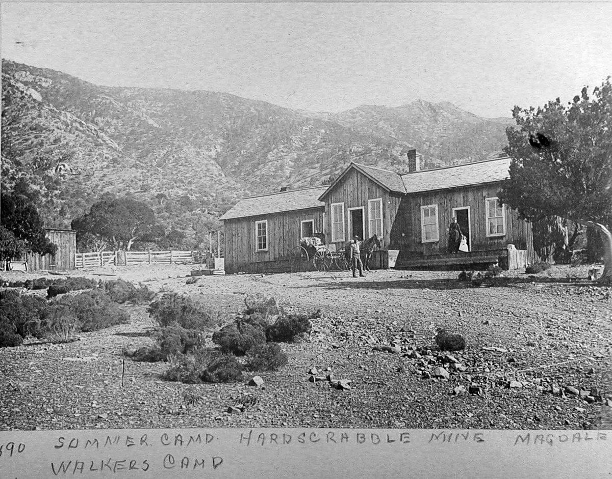
House at
Hardscrabble Camp
The
Stonewall mine is located 640 feet east from the portal of the
Tip Top mine.
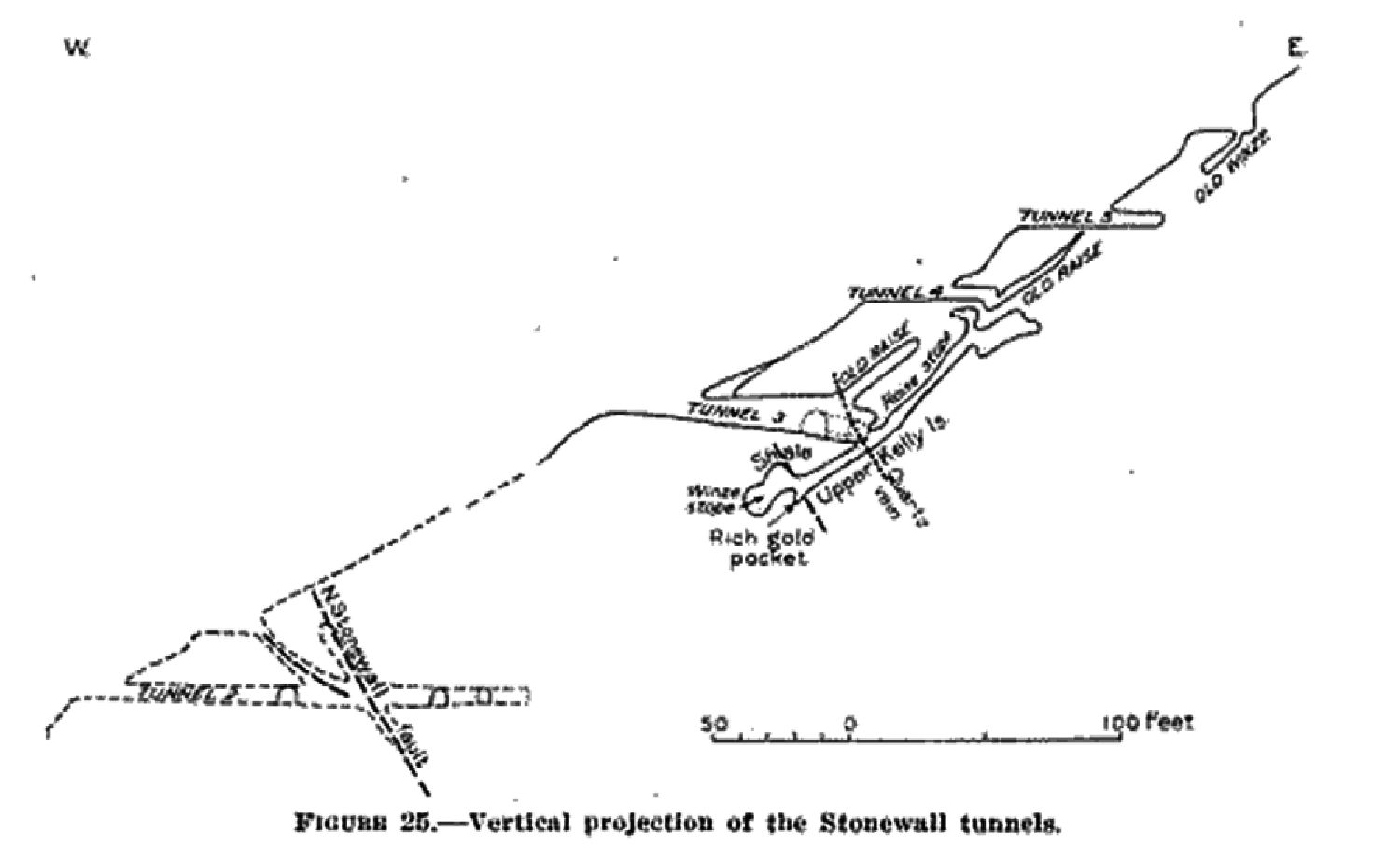
The Stonewall mine consists of five short tunnels bore into the steep side of the mountain ridge to access the ores.
Tunnel 1, at an elevation about 8,800 feet, goes through pre-Cambrian granite to reach the vein. Tunnel 2 is 200 feet north
of tunnel 2 going east then southward. A short distance south of tunnel 1 is a sloping inclined shaft to access the vein.
Tunnel 3 is about 250 feet east-northeast of tunnel 1. A quartz-galena vein was encountered 55 feet from the portal. The
vein was followed for 90 feet to recover carbonate lead and zinc, the resulting stope being worked 40 feet below the tunnel level
and 190 feet above it.
Of interest was a small lode of gold found near the bottom of the stope that yielded as much as
17 ounces to the ton - a high percentage while it lasted for the Kelly area. The Stonewall mine was bought by the Germany
Mine Co. in 1914 with little indication the mine operated past 1918.
Access to the mine was the road to the Tip Top mine.
The road no longer continues to the Stonewall tunnels, leaving the mine rather isolated. The last owner of the Stonewall mine
was the Germany
Google Earth
image
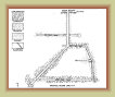
Stonewall
mine map
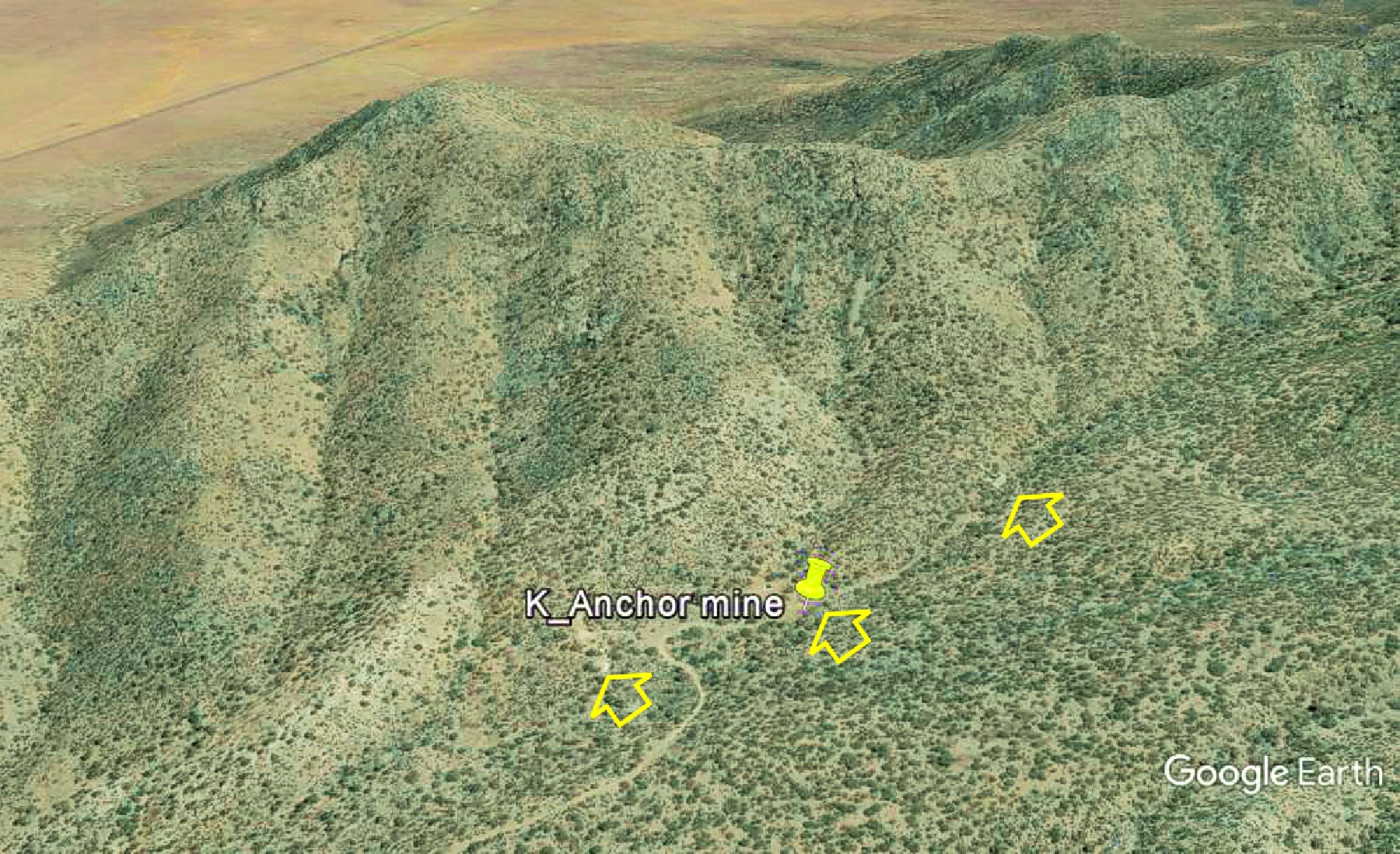
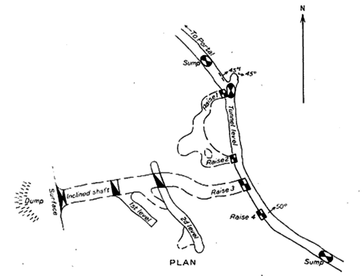
The
Anchor mine is located at the end of the road in Anchor Canyon and about 1¼ miles east-northeast
of the
Hardscrabble Camp. It was opened about 1885 and is said to have produced rich ore with a total value of about $60,000.
The mine consisted of seven claims over 125 acres. The mine was abandoned in 1893 when the price of silver was devaluated,
forcing most silver mines to close.
The Anchor mine was reopened in 1924 by the C. and M. Ores Co., owned by Ian
Mactavish of Magdalena, that operated the mine intermittently. They built a small gravitational concentration and flotation
mill to treat the ore. One report indicates 20 tons of lead-silver concentrates were shipped to the ASARCO mill in El Paso which
yielded 12.5 ounces of silver per ton but only .02 ounce of gold per ton. Mining was abandoned in 1926.
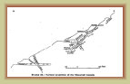
The workings consisted of an inclined shaft from which two levels were driven, and a tunnel 900 feet long. The tunnel and
lower portion of the shaft were flooded in a 1929 inspection.
Google Earth
image
Anchor mine
plan map
Anchor mine
profile map
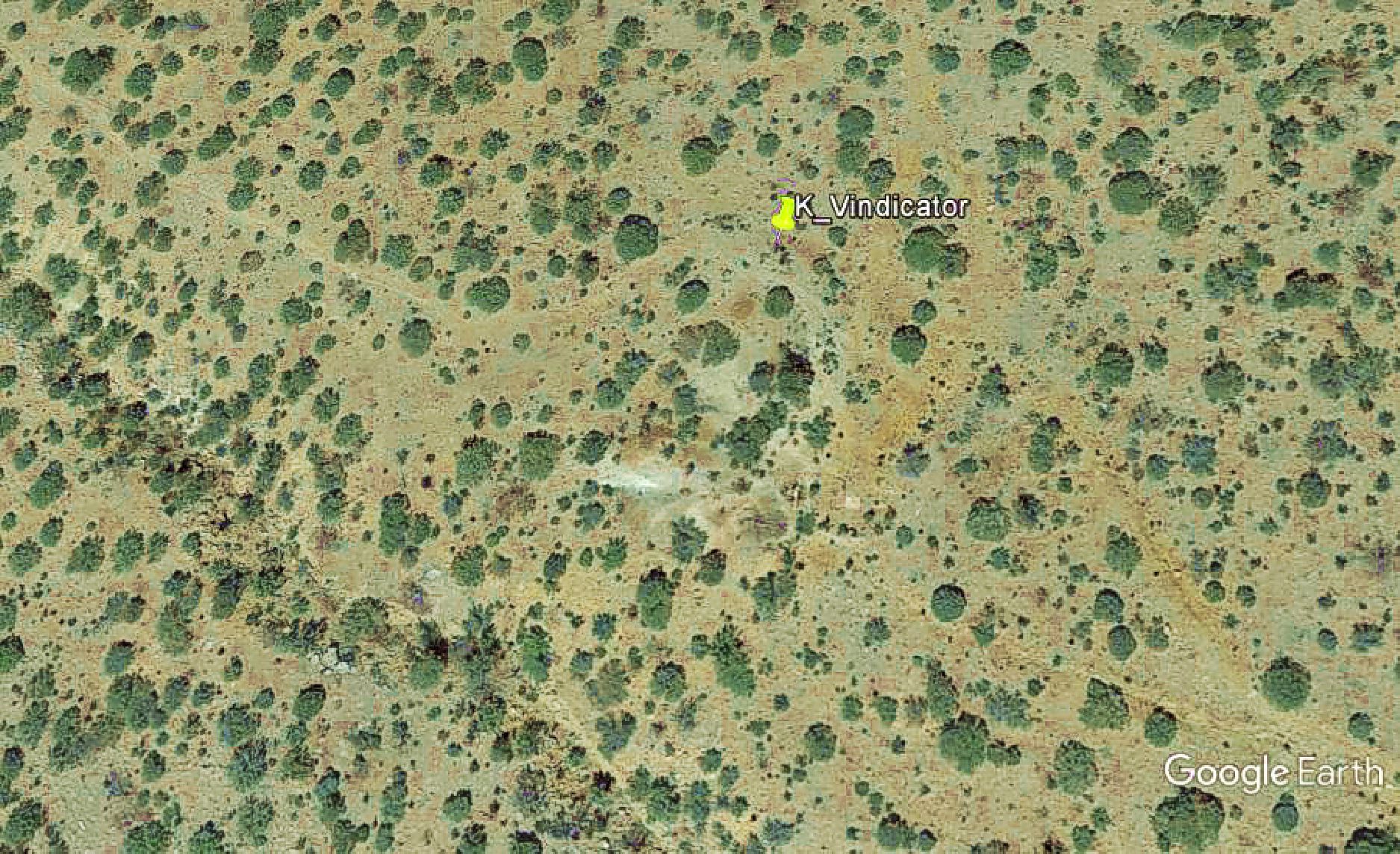
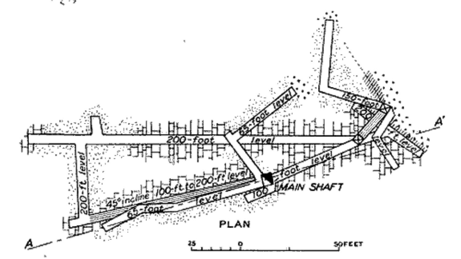
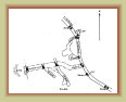
The
Vindicator mine is on the east side of the Hardscrabble Valley and northeast of the
Hardscrabble mine.
It consists of nine claims over about 150 acres. They were early claims in the Kelly region, originally called the
Jupiter claims,
owned by the
Jupiter Mining Co. In spite of several prospecting holes showing evidence of lead ore, the company did little to
develop or mine the property except the minimum to keep the claims active.
A Jupiter Mining Co. also held claims
near Lake Tahoe, NV and Bodie, CA, though seemed to spend more time in court for claim jumping than mining. It is not known
for certain if the same company.
The claims were purchased by the Grubnau Chemical Co. in 1924, renaming the
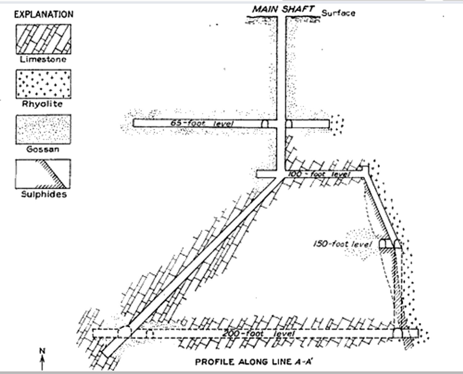
claims to Vindicator and began to develop the property. The new owners sunk a shaft 100 ft. deep, then an incline for another
100 feet, boring drifts to form levels at depths of 65, 100, 150 and 200 feet. The 150 ft. level was driven by a winze,
an internal vertical shaft, connected the 100 and 200 foot levels. All levels extend to the east with the 65 and 200 foot levels
extending an appreciable distance to the west.
One assay report in 1929 from 76 tons of ore sent to the ASARCO smelter
in El Paso, TX shows they recovered from 7-11% lead to the ton, 14-19% zinc to the ton, and 3 ounces of silver to the ton.
Unlike other nearby mines, the Vindicator was a dry mine, not hitting
water at the lower depths. Following the veins, it was
believed there remained good ore had the main shaft been extended, but it was also felt they would strike water around 350 feet to
flood the new workings. This
was never done and the mine was closed at the end of 1929.
Google Earth
image
Vindicator mine
plan map
Vindicator mine
profile map
0723d