Socorro County Historical Society
Socorro, New Mexico, USA
History
Articles
On this page:
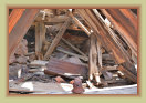
The Kelly Mine & Traylor Shaft
Mines2
2
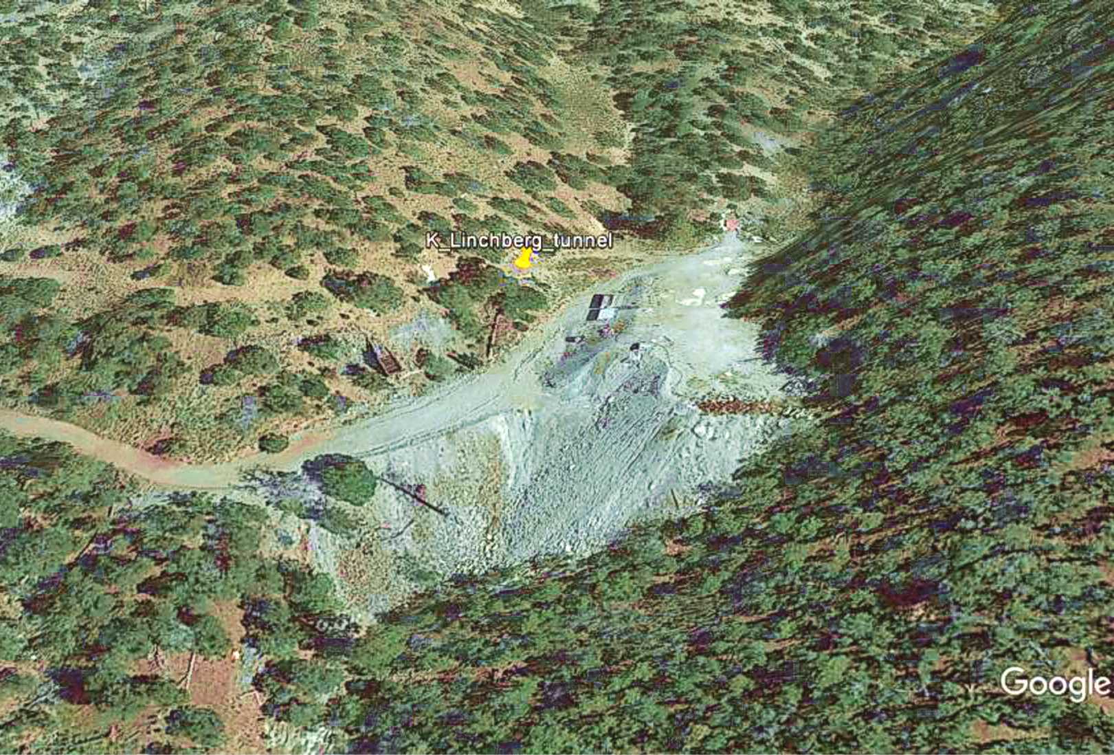
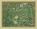
The Lynchburg mine and tunnel (also spelled Linchburg and Lynchberg in the documentation) is about a mile south of Kelly.
It was begun by the American, Zinc, Lead & Smelting Co. in 1910. The workings were purchased by C. T. Brown in 1912, who in turn
sold it to the Empire Zinc Co. in 1915 or 1916.
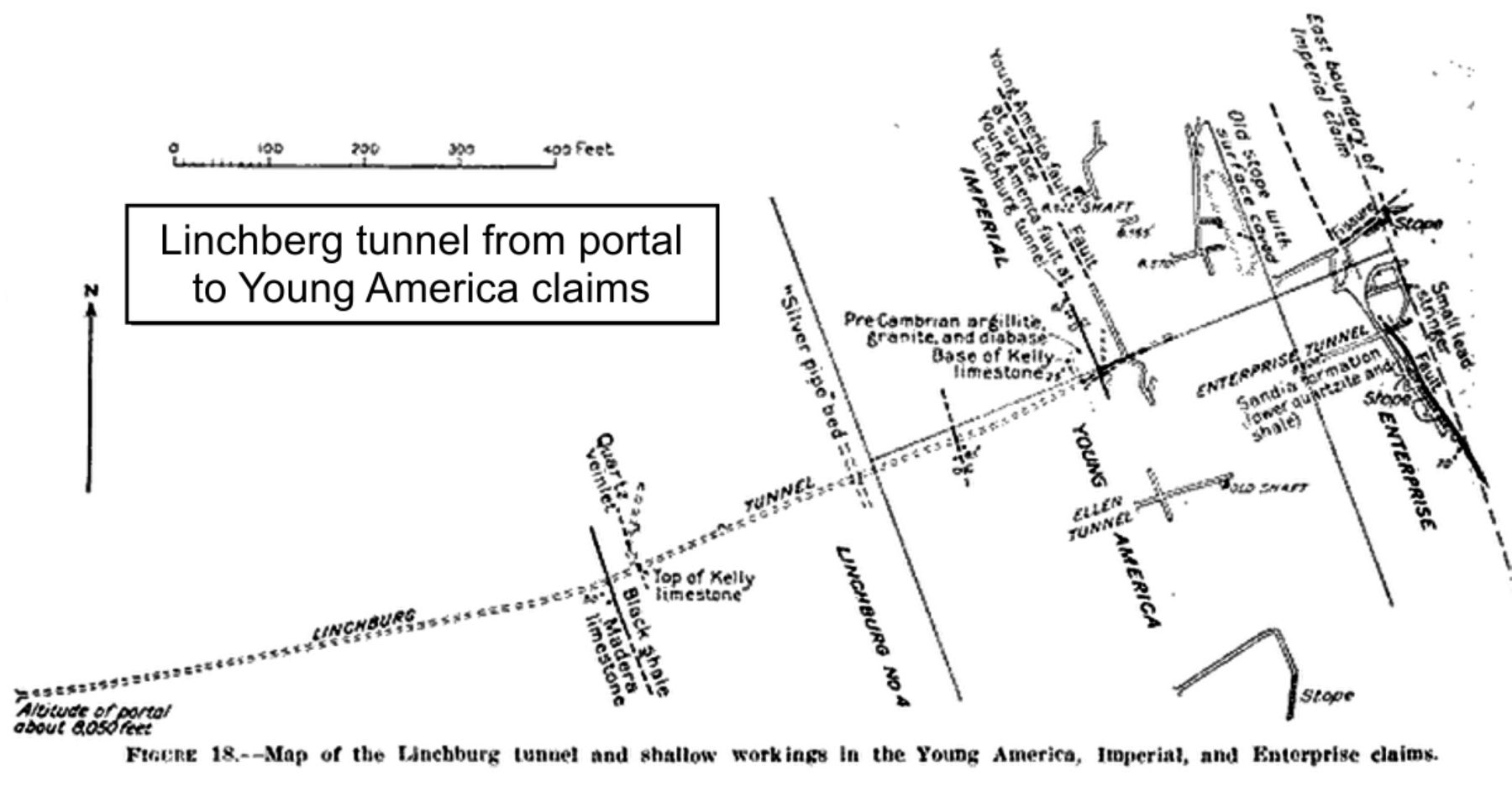
The Lynchburg tunnel was a substantial undertaking, boring 1,150
feet northeastward towards the
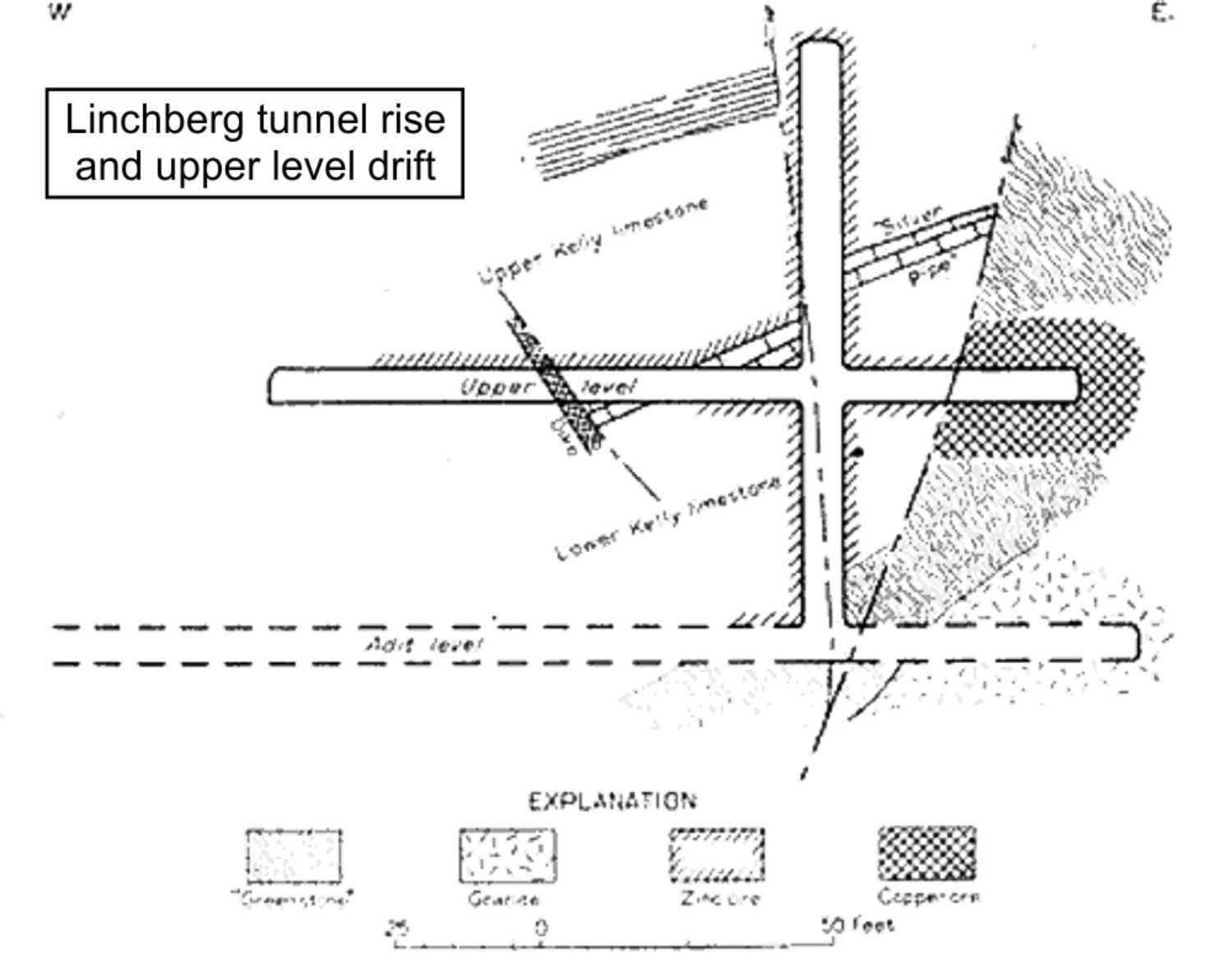
Young American and Enterprise claims with the portal elevation at 8,050 feet. A vertical raise
was built in 1916 to reach suspected ores, however, it filled with gas and was quickly closed. Instead, drifts were extended both
north and south from the tunnel level. In spite of these efforts, little pay ore was recovered and the mine sat idle 1921-1941.
The mine was reopened in 1942 for the war effort. This attempt was quite successful in producing high grade zinc ore, and
some copper, which added substantially to the zinc output of the Kelly region during WWII. The mine was closed following the war.
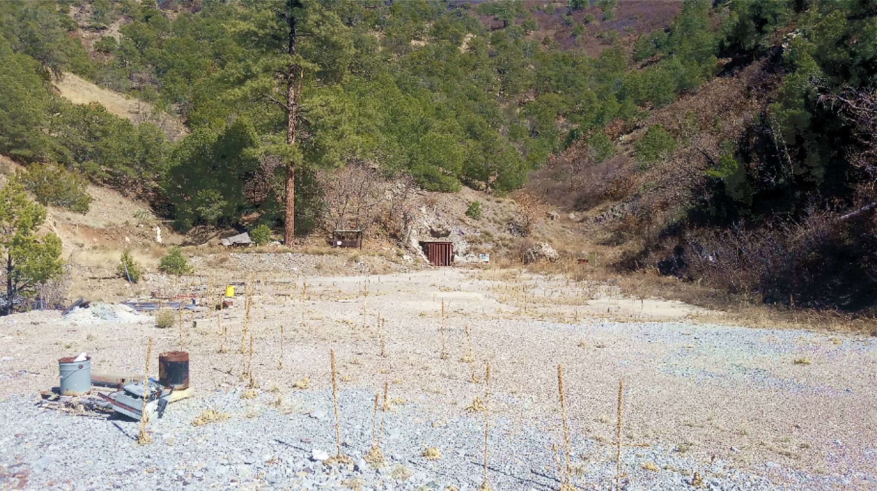
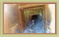
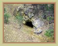
No attempt should be made to enter this mine. In 1993, the hard rock Lynchburg tunnel was one of the mines the government selected
for the storage of unstable explosives and other toxic materials. A substantial metal gate was installed at the portal and two
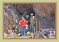
metal locked gates built on the road to the mine to protect the site. Mining engineers visiting the tunnel in 2016 revealed
mold at the entrance and substantial amounts of gas escaping the portal that caused prolonged eye irritation. If you visit the
mine, avoid the air and gasses escaping the tunnel portal. Rest of the site is relatively safe to explore. The Lynchburg mine remains
privately owned and repurposed as a hazardous materials storage facility, and appears to be owned and operated by Hydro Resolutions
LLC and/or United Nuclear Corp.
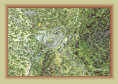
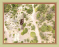
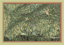
Google Earth image
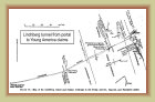
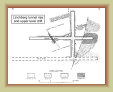
Plan of Lynchburg mine
Upper level & rise
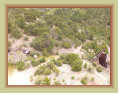
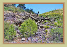
Photos from Mindat.com
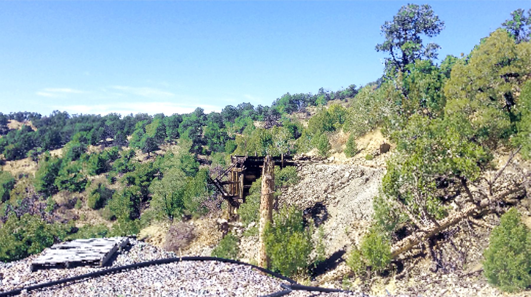
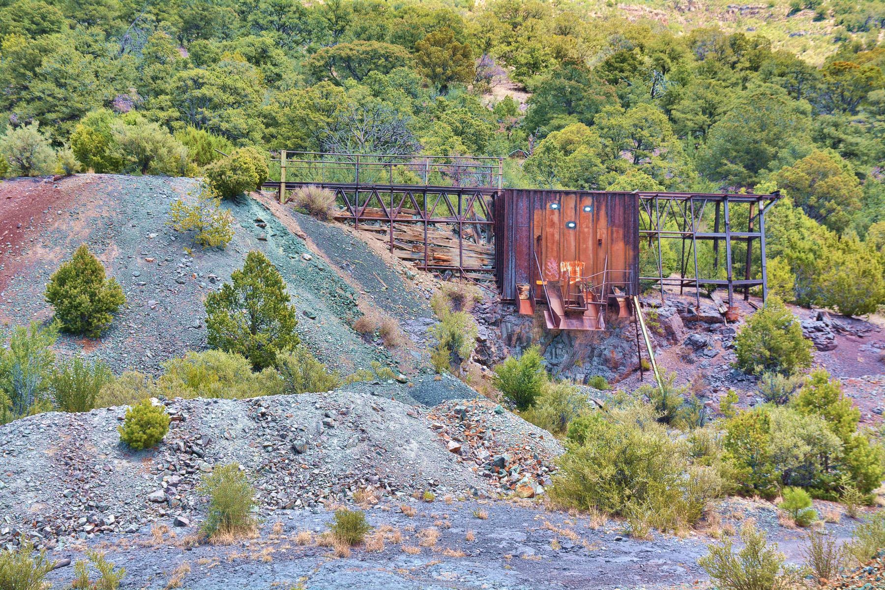
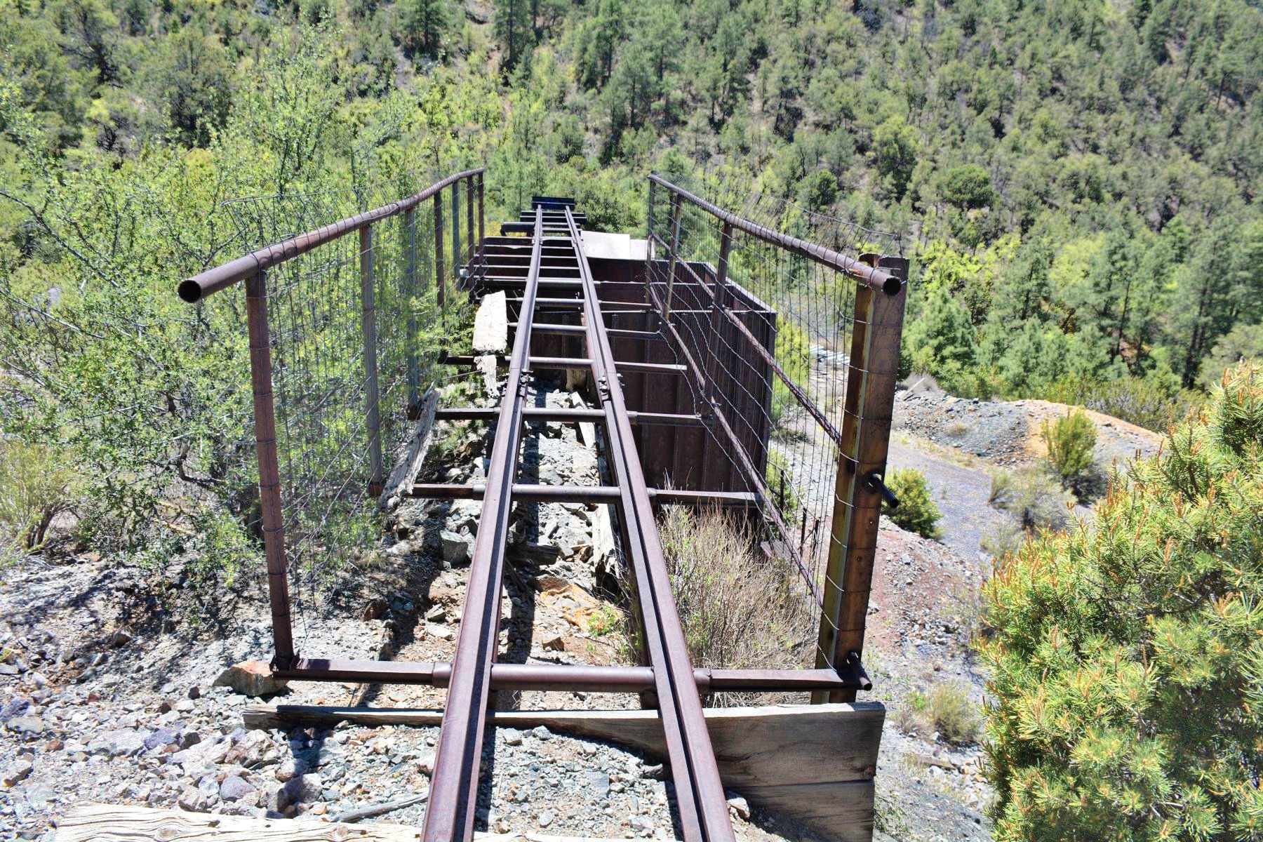
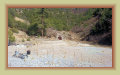
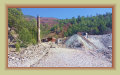
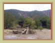
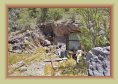
Lynchburg tunnel portal and entrance
Narrow guage tracks
leading to ore bin
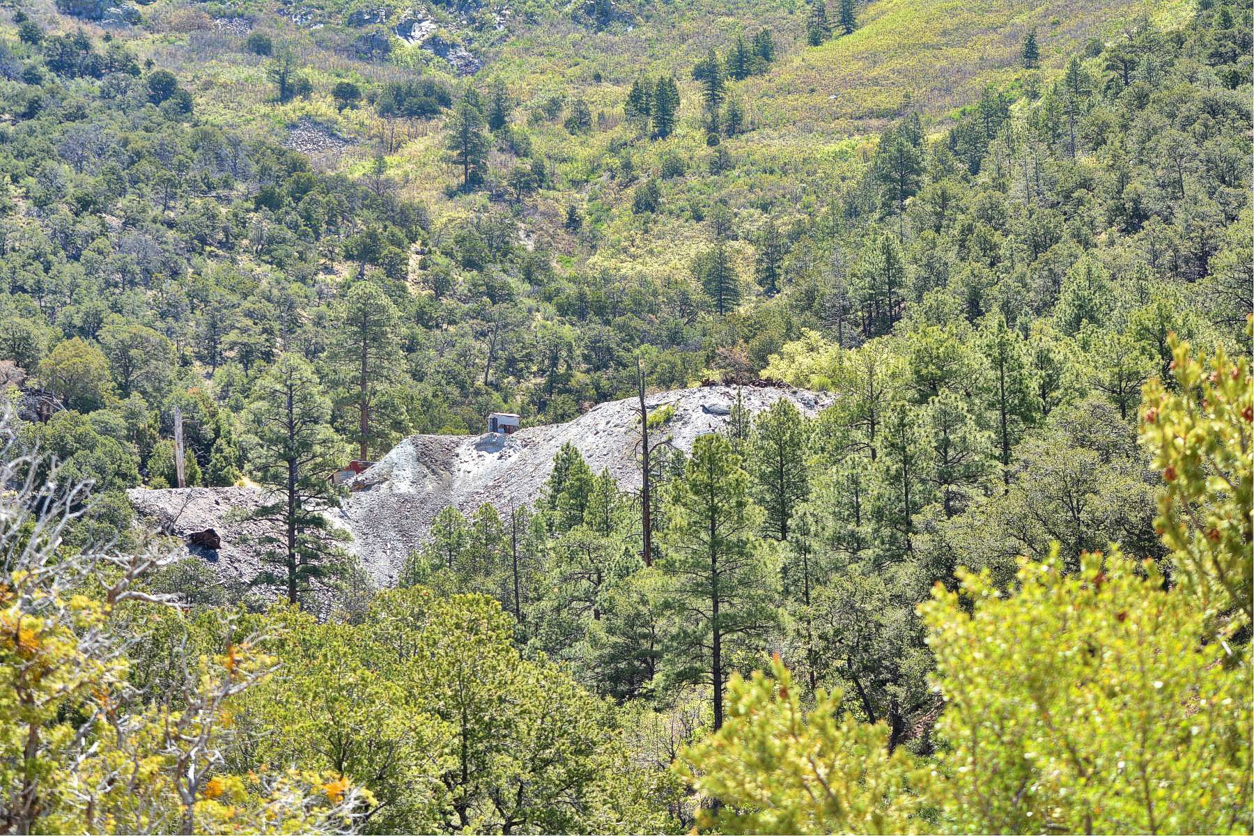
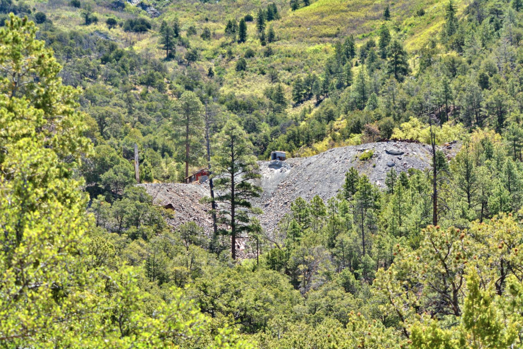
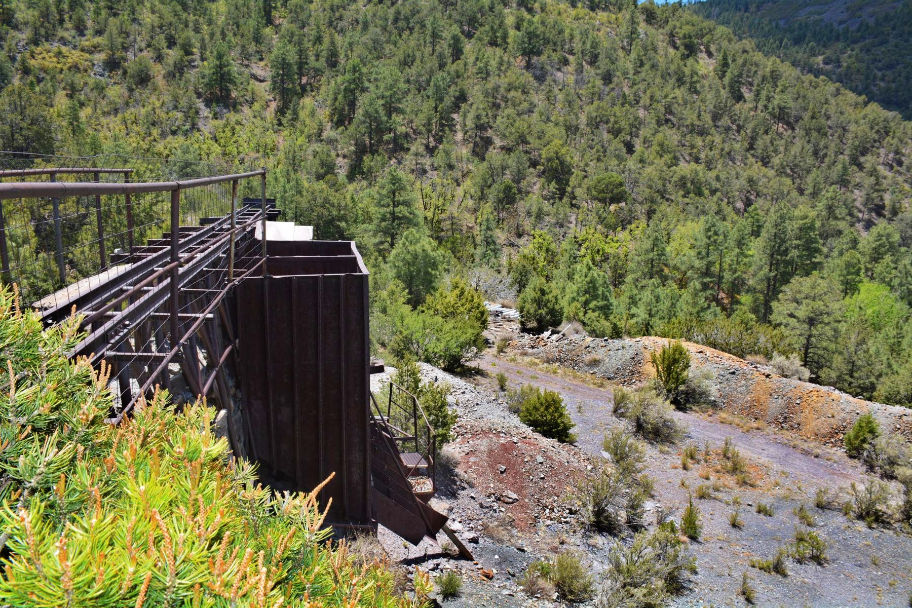
Waste rock pile
and buildings
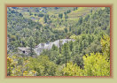
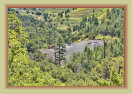

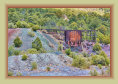
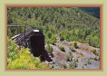
Lynchburg tunnel, mine, and waste rock dump
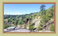
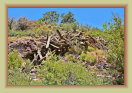
Hiking the steep mine
road to the Lynchburg
Photos by Paul Harden
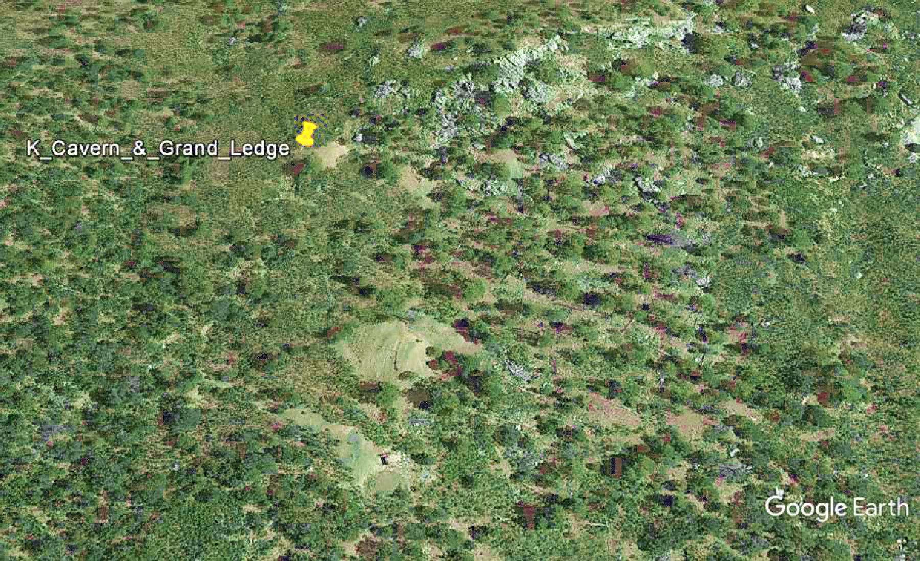
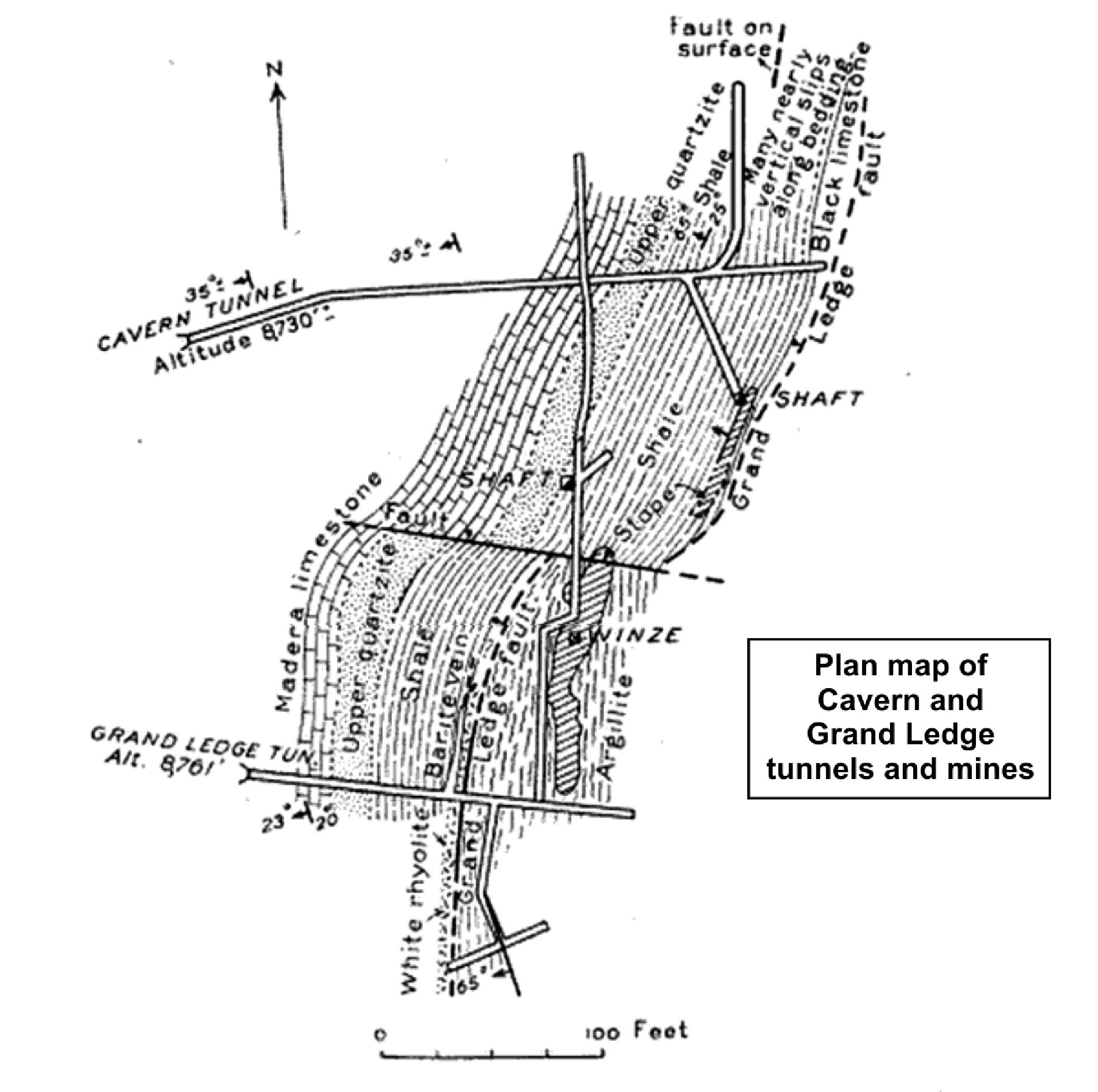
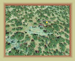
The Cavern and Grand Ledge mines are two tunnels about 200 feet
apart in the middle branch of Patterson
canyon and south of the
Young America claims. They were old and short-lived mines, established in 1885 by the
Cavern
Gold Mining Co. and mined until 1897 on the Grand Ledge mine with the Cavern mine operating until 1904.
TheGrand Ledge tunnel is the first level of the workings, at an elevation of 8,761 feet, bore into a granite ledge outcropping,
and hence its name. A south drift follows a barite vein of zinc and copper to a stope 100 feet long and extends upwards to nearly
the surface. The north drift extends about 200 feet to a shaft.
The Cavern tunnel is about 200 feet north of the
Grand Ledge tunnel at an elevation about 8,730 feet. A south drift connects to the Grande Ledge tunnel with an incline (winze)
to the stope. A shorter drift further back in the tunnel connects to a shaft to the surface and access to a small upward trending stope.
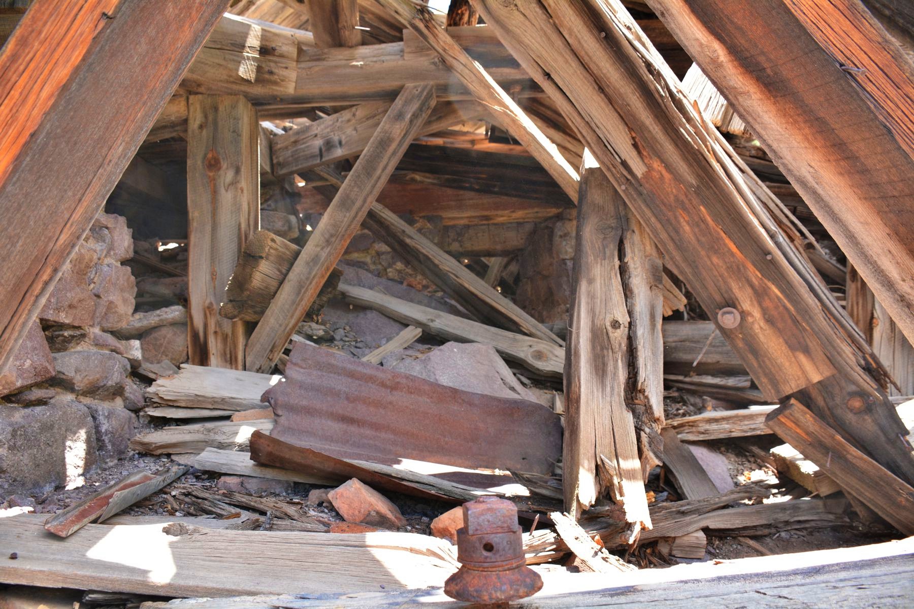
The two tunnels were connected by an inclined tram road to a small mill, that concentrated 50 tons of ore per day. Only
scarce remnants of the mill remains. The ore output or distribution of ores of these two mines are not available
as production figures were not kept until 1905. However, articles in 1890s period newspapers report the Grande Ledge as
"an active producing mine shipping high grade ore."

Google Earth image
Plan map of Cavern
& Grand Ledge
The Grand Tower mine is northeast from the Kelly mine's Paschal shaft about 700 feet up the mountain at 8,230 feet elevation.
Documentation on this mine is scarce, believed to have begun operation around 1890 with no reports of production after 1904. The mine
consists of several shallow shafts and prospects of both the Grand Tower and Legal Tender claims. Two of the shafts and one short
tunnel access the ore bodies. The largest ore body is reached by the Grand Tower shaft, about 190 feet deep, but water filled the
shaft to the 130 foot level making the lower levels inaccessible. Between 10,000 and 15,000 tons or ore are said to have been milled
and shipped prior to 1904. A 1916 inspection of the mines could not account for the tonnage of ore reported to have been mined, suggesting
the ore came from a stope at the lower level of the shaft now submerged under water, and perhaps the demise of the mine.
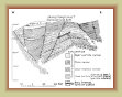
Google Earth
image
Cross section
map
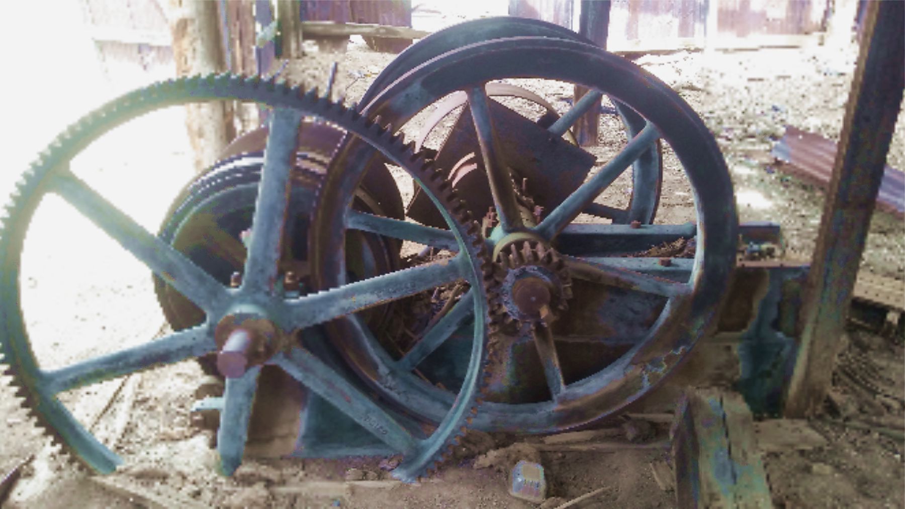
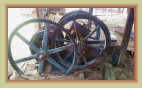
Legal Tender
mine hoist
Grand Tower
shaft
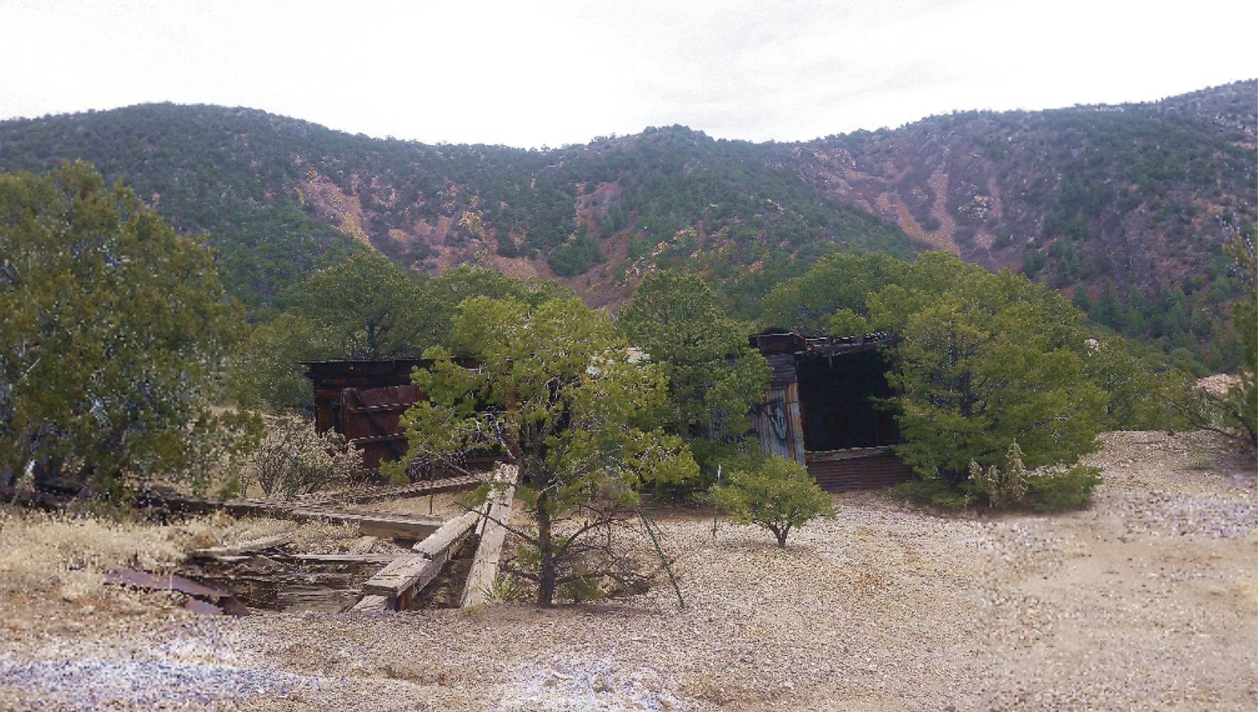
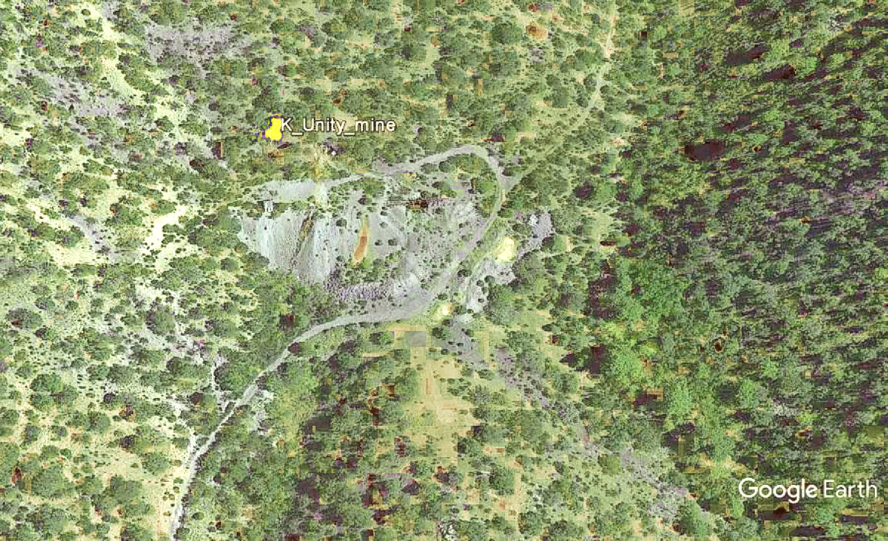
The
Unity mine is about 2 miles south of Kelly and about 0.8 mi. south of the
Linchberg mine. The mine is well
known locally for the fairly extensive workings right on the road, as a hiking destination, and widely known by the name
"Unity mine." It is shown on some mining maps as "Unity mine" or "Unity tunnel." However, no information on this
mine by that name or location can be found in the documentation on the Kelly or Magdaena mining districts. Research on this
mine is ongoing.
Regardless, the main Unity mine consists of fairly large tailings, an exposed (though blocked) tunnel
and portal, a substantial steel ore bin, several small buildings, and ore tracks from the tunnel leading to the ore dump and the ore
bins. About 600 feet further southeast is the remnants of another mine, herein called Unity 2, with what appears to be a
collapsed headframe, and perhaps an ore bin, over a shaft.
Unity mine is an easily accessible, reasonably
safe, and interesting mine to explore, providing you don't enter the tunnel -- which is largely blocked with large rocks and
timbers. Water issues from the portal, indicating the tunnel may be flooded.
Photos from Mindat.com
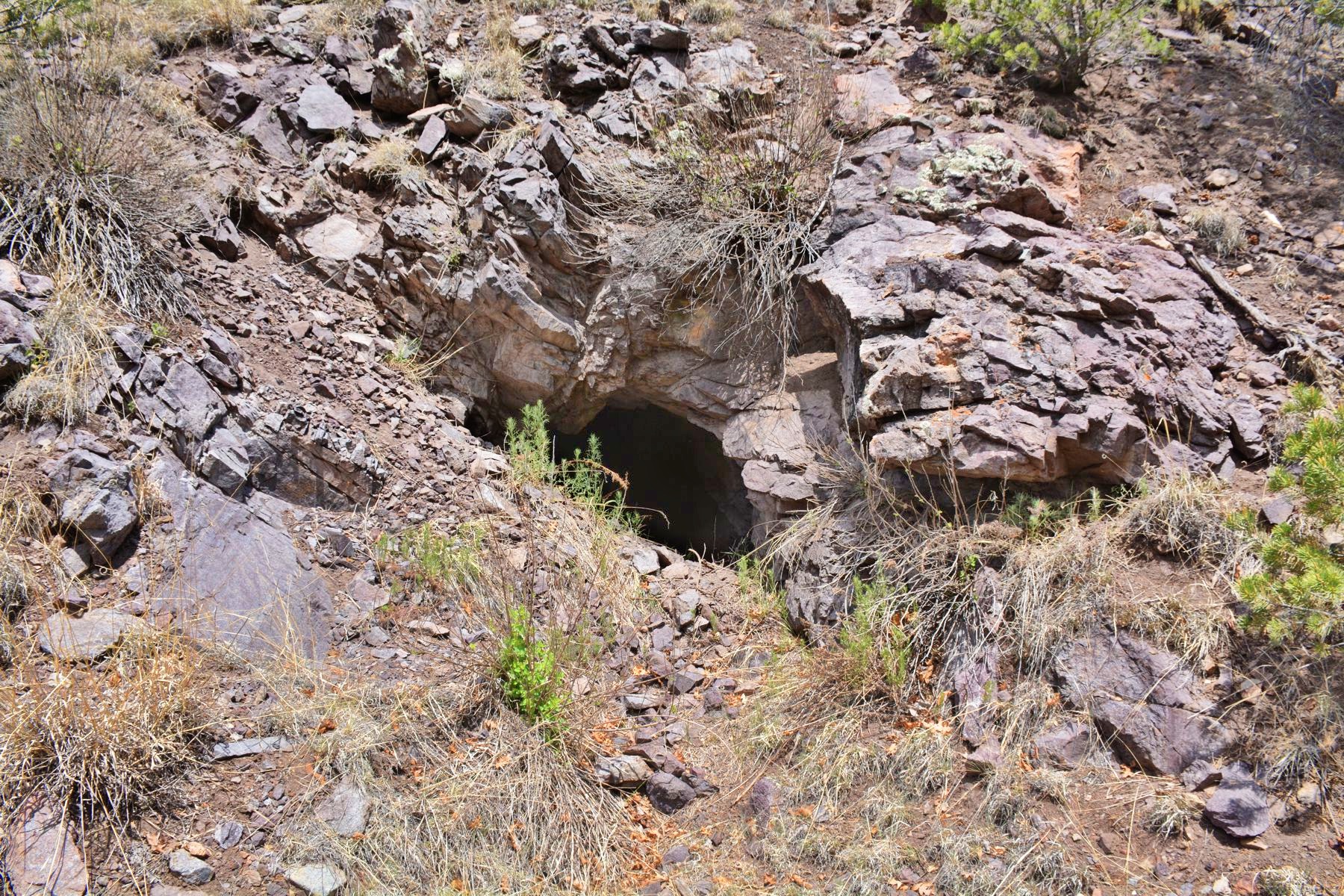
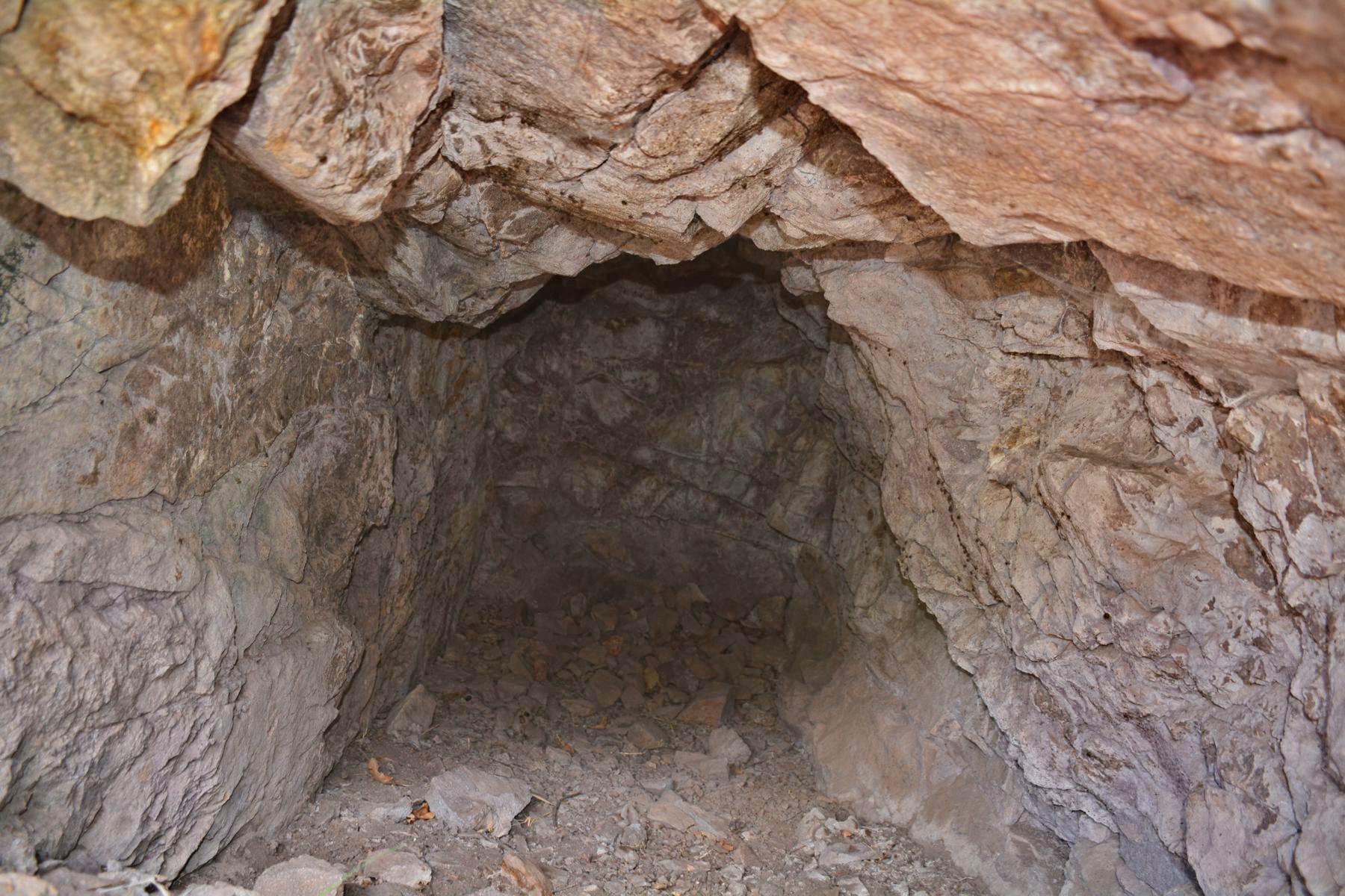
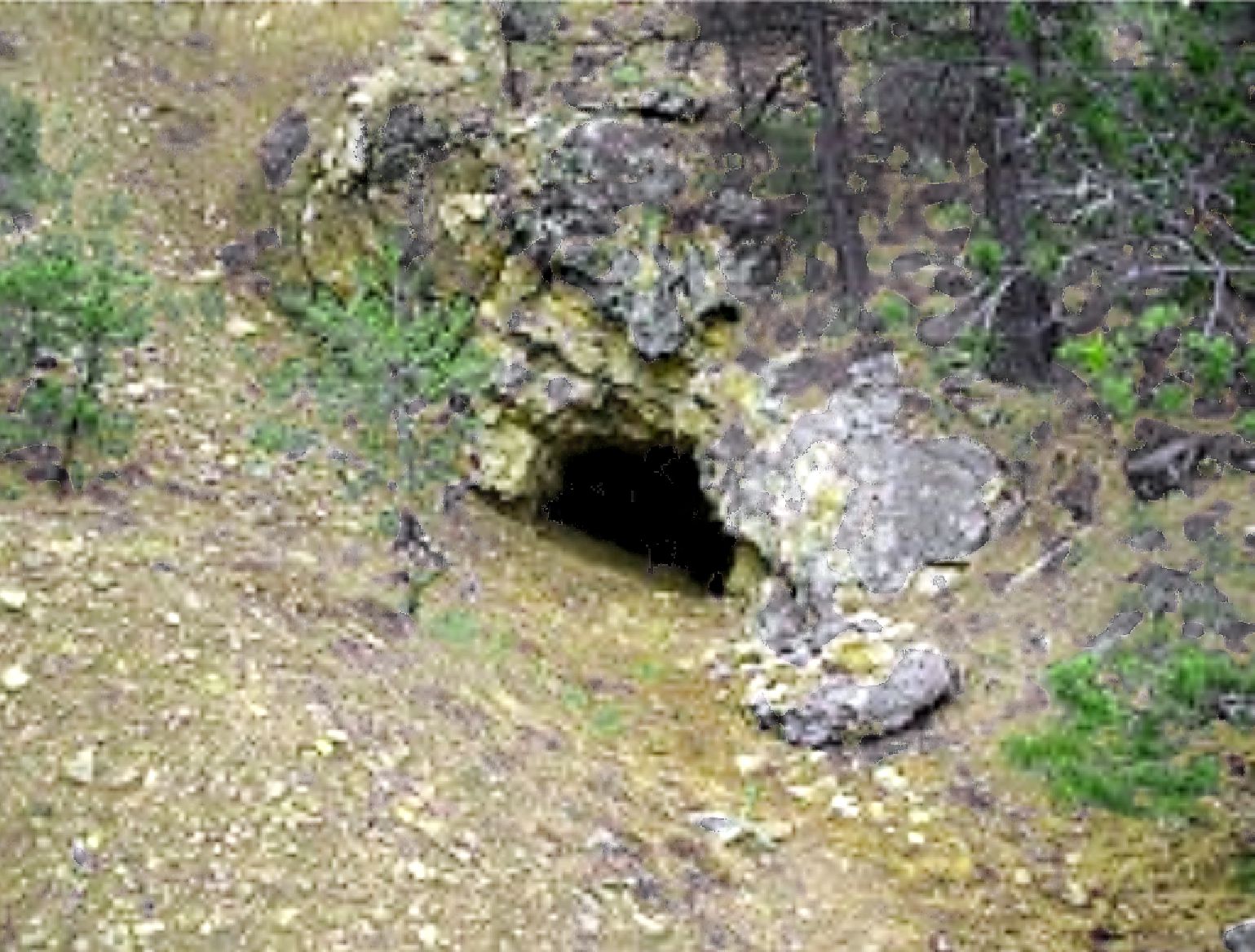
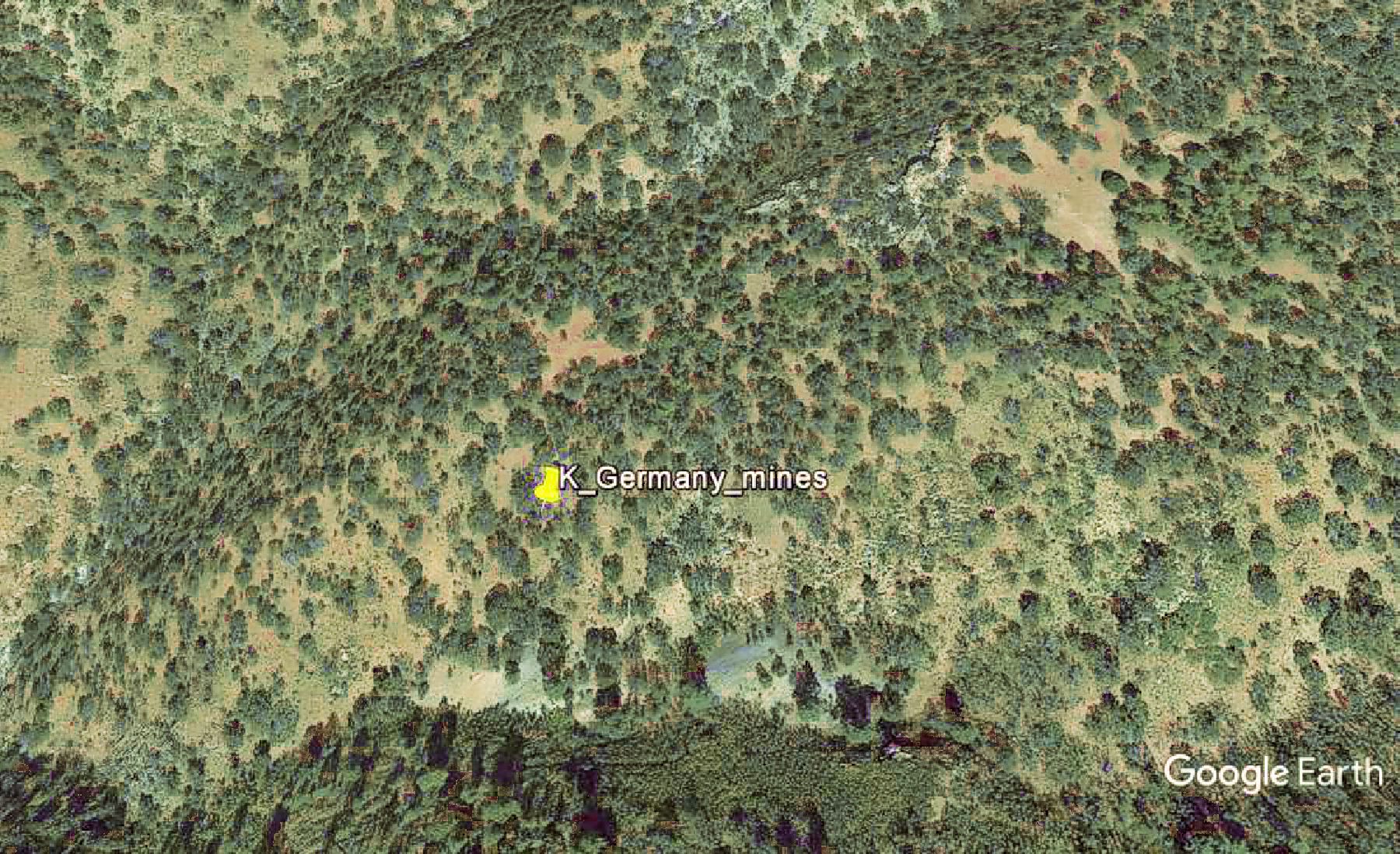
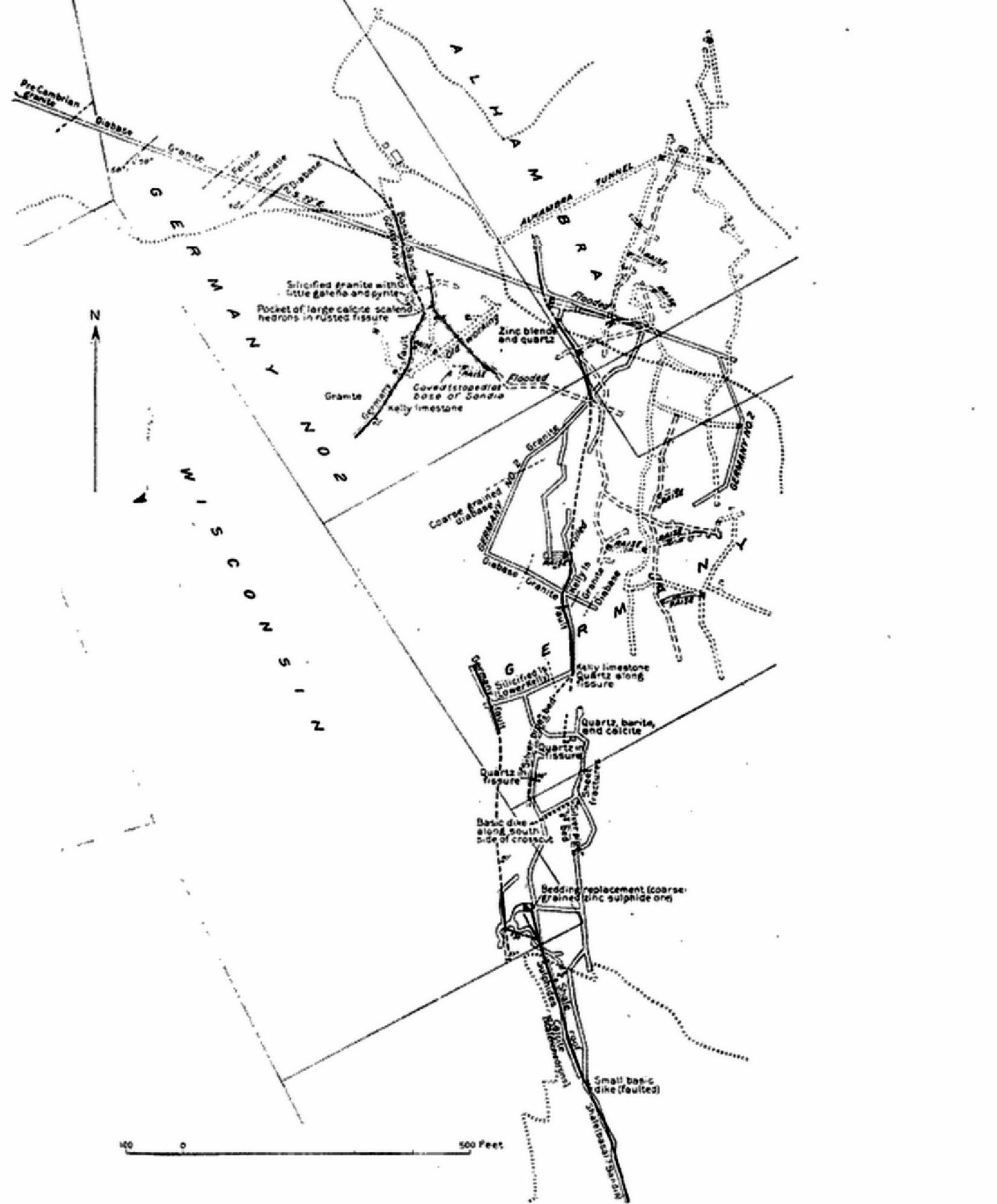
The
Germany mines were begun in 1906 by the
Germany Mining & Milling Co. eventually to include 9 claims over 108
acres. The property is located east of the
Juanita mine. It was a fairly extensive mine that from 1906-1929
produced 1.1 million pounds of lead, 199,000 pounds of zinc, 75,000 pounds of copper, and 32,596 ounces of silver. In spite
of these numbers, the mine was not highly profitable due to ores mined of a lower grade than surrounding mines (except
the silver ore).
The main tunnel accesses the lower levels of the mine with the portal at 7,840 feet elevation.
A second tunnel on Germany #2 claim, is located 700 feet further east and about 200 feet higher in elevation at 8,020 feet.
A third tunnel, the Alhambra tunnel, is located at 8,060 feet. During 1915-1916, the Alhambra tunnel and portions of the
main Germany tunnel flooded, making large portions of the mine inaccessible followed by a significant drop in production.
New drifts to access the ore increased production in 1917, but diminished again in later years due to the low grade ores encountered.
The mine was closed 1923-1928. The mine was purchased by
C. T. Brown , who reopened the mine in 1929. However, Brown
was only able to recover 14,000 pounds of lead, 279 pounds of copper, and 104 ounces of silver that year. The lack of good
pay ore forced Brown to close the Germany mines in late 1929, and has been closed since. The main adit to the mine remains
flooded to this day.
Google Earth image
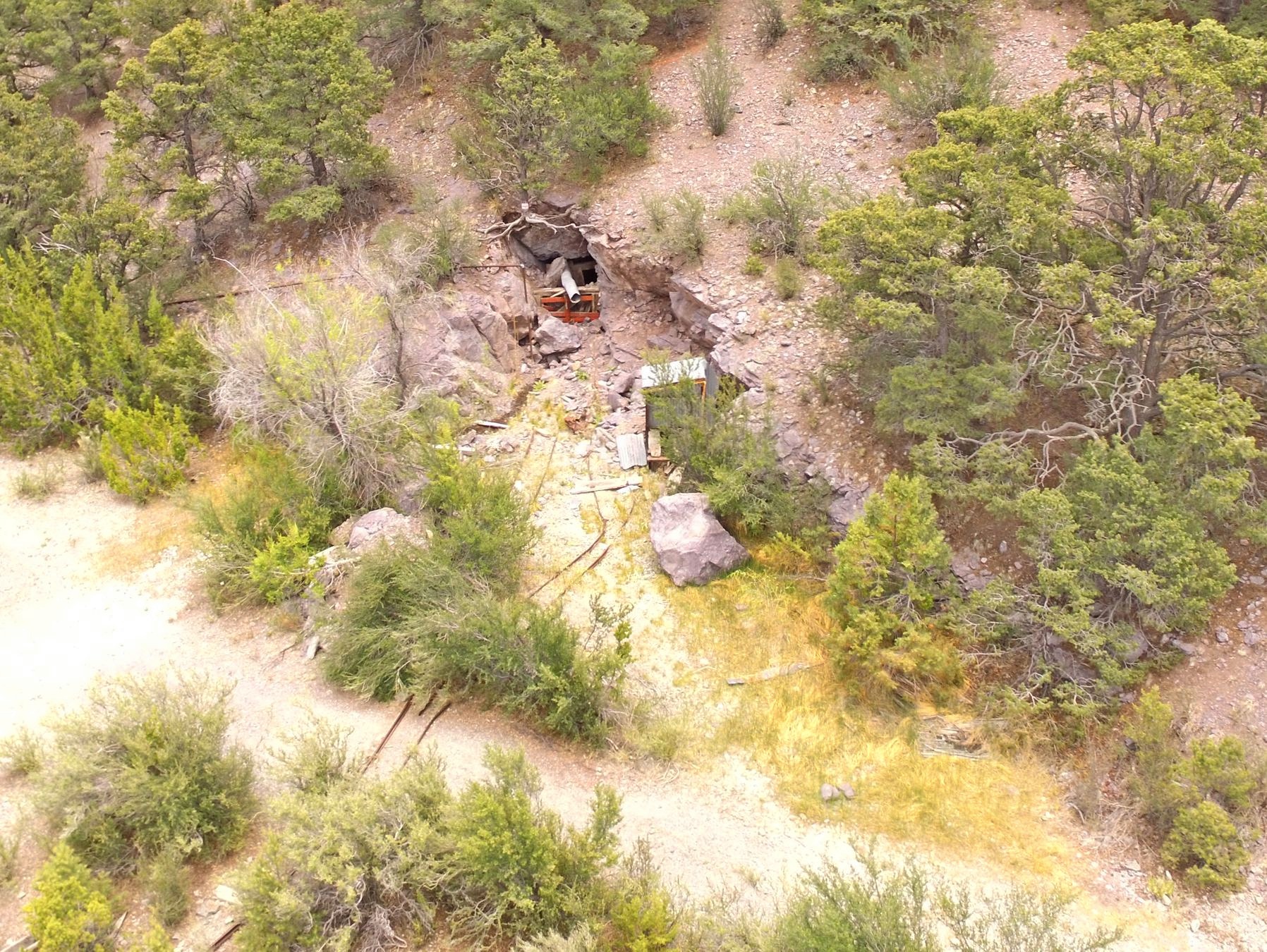
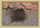
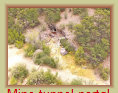
Entrance to the Unity mine tunnel

Mine overview
Ore bins
Ore tracks
Mine tunnel portal
Drone photos by Paul Harden
The ore bins and ore shoots at the Unity mine
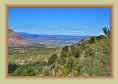
View towards
Magdalena from mine
Photos by Paul Harden and Peggy Hardman
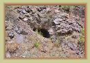
Unity 2 mine (Actual name of mine unknown)
Collapsed headframe over the shaft at Unity 2 mine
Nearby tunnel is just a short prospect dig
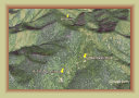
Google Earth image
Mine entrance

Plan map
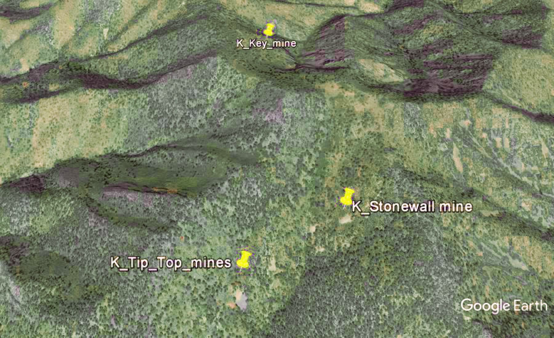
The Tip Top mine is located near the summit of Tip Top mountain, the peak to the northeast from Kelly.
It is one of the mines in the Key group of claims, which included the Key and Stonewall mines, worked by the Mine Development
Co. from 1900-1909. During those years, the Tip Top mine shipped 337,071 pounds of lead ore with concentrations of 15 to
21% lead to the ton, and 2,159 ounces of silver.
The mines were sold to the Germany Mining & Development Co. in 1910
due to the low price of lead, which did not improve until about 1916 due to WWI. There are no output figures for the mine after
1909 as it was likely included with the output of the Germany mines.
The Tip Top mine portal is at 8,520 feet elevation
and on the south slope of Tip Top mountain at the end of an ore road built to the mine. It is connected by a short horizontal
track to an ore bin just beyond the dump.
The Key mine portal is on the north slope of the mountain about 2,000 feet north
of the Tip Top portal at an elevation of 8,540 feet.
The Tip Top and Key tunnels are connected by a zigzag set of drifts.
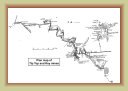
Google Earth
image
Plan map of
Tip Top & Key mines
WARNING: DO NOT ENTER THIS MINE !!!
The Lynchburg tunnel has been repurposed as a government storage facility for toxic waste
and unstable explosives the reason for the substantial metal gates on the access road and the mine portal. Toxic gasses
and unstable explosives in tunnel.
0723d