On this page:
The Rosedale mining district is located on the northeast portion of the San Mateo mountains, near Big Rosa Canyon in
Socorro County. The Rosedale mine was the leading gold mine in the region, with the town of Rosedale, about a mile
east of the mine, to support the area mines, the miners, and their families. The town had a population ranging from 100 to nearly
400 during its history, approximately 18861937.
Like all mining operations, a small town developed nearby tents at first to house the miners until more substantial homes were built.
A small business district soon consisted of a boarding house, a saloon, and two stores. In 1899, the school house was built and the
Post Office established, receiving mail from San Marcial three times weekly. The May 12, 1899 Santa Fe New Mexican offered a
thumbnail description of the area:
"There are 26 buildings in the
Rosedale mining camp,
and 16
children of school age. A teacher
for them has been secured and is
being paid by subscription. The
sheepherders around Rosedale have
been responsible
for destroying by
fire a large acreage of pasture."
The 1900 census shows Rosedale
with about 200 persons living in the small mining town with up to 300 residents at times of heavy mining activity. Some
of Socorro County's familiar families settled in or around Rosedale, such as Wesley and Martha Burris, Edna Fite (mother
to Dean Fite), and the Bruton's, McKee's, Harris and Brunton, all well known local ranching families. Some of these families
formed ranches near Rosedale, mostly to the south around North and Turkey canyons.
The oral histories of a few of the Rosedale
citizens all reveal how much they enjoyed living in the forested mountain mining camp. There was plenty of water and plenty
of local lumber for building homes and businesses.
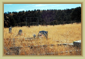
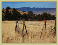
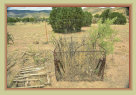
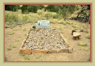
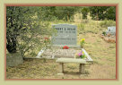
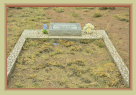
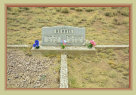
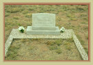
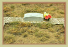
The Rosedale cemetery is located just north of FR-330 before entering the old townsite. There are a fair number of graves a few
of those growing up in Rosedale who died many years after the town was gone, and others whose ancestors once lived in Rosedale
a testiment to the connection and pride the residents and descendants held for their former town.
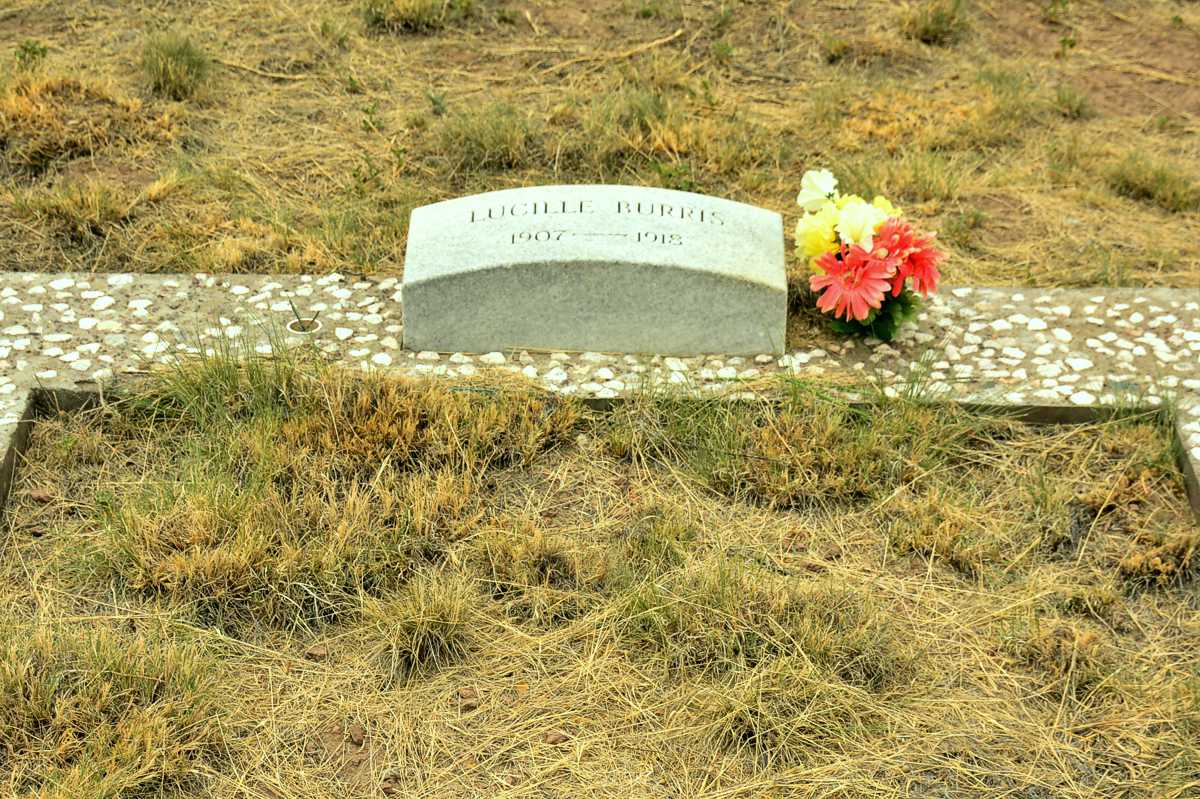
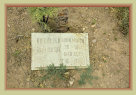
Several generations of
the Burris family are buried at Rosedale, as are the founders of the gold strike, Jack and Lydia Rose Richardson, and a soldier from
Fort Craig.
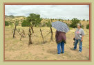
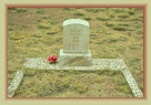
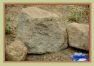
The small old wood fence marks the grave of the soldier killed by an Apache raid in 1883. Unfortunately, his name has been lost to time. He was buried near where he was killed and the fence erected by soldiers from Fort Craig. His solitary grave became the site of the town cemetery and the town's people of Rosedale always ensured it was well maintained.
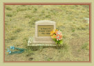
A portion of the Rosedale cemetery
The Burris family was one of the first to live in Rosedale, and one of the last to leave.
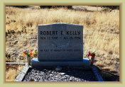
Robert Kelly (Burris family) was a forest fire slurry pilot killed fighting a Montana forest fire in 1994.
Have photos? Rosedale photos are scarce! If you have photos of the Rosedale mining district, the town, or of
family that worked the mines or lived in the area you'd like to share, please let us know here and we'll add them
to these pages with proper credit.
Socorro County Historical Society
Socorro, New Mexico, USA
History
Articles
Rosedale and the Rosedale Mines
Mines3
1
Location
In late1882, gold was discovered in some rhyolite outcroppings south of Big Rosa Canyon by prospector Jack Richardson and wife Lydia
"Rose," and hence the genesis of the name "Rosedale." In 1883, as the strike was being developed, Apache Indians threatened
the miners and later killed two soldiers from Ft. Craig on patrol near the claim. One was returned to family for burial, the
other slain soldier remains buried at the small
Rosedale cemetery today. Fear of further Apache raids prevented the prospect from
being worked until 1886 when the last of the Apache warriors surrendered, including Geronimo, Nana, Naiche, and Lozen, ending the
so-called "Indian Wars."
Profitable gold was being mined by the late 1880s. The
Rosedale mine and stamp mill produced
an astounding amount of gold ore for a relatively small operation over its short lifetime, estimated at around 24,000 troy
ounces of gold bullion with a value of over $500,000 over $15 million today. They were able to pay dividends to their
stockholders for 15 consecutive years making them quite popular with their investors. Including the other nearby mines, total
gold produced in the Rosedale Mining District is estimated at $600,000$650,000 through the 1920s.
Gold Rush. Similar to
most mining districts, once the Rosedale mine struck good gold, it attracted many prospectors and investors to the area hoping
to get lucky as well. Only the
Golden Bell mine and
Whitecap mine produced some profitable gold. Other prospects
and mines with lesser success included the
Ninety-Nine,
Baking Powder, and
Noonday mines, and some others. Some
prospects only accomplished digging a few holes in the ground until investor money ran out.
With Rosedale located about midway
between Magdalena and San Marcial, it had two commerce centers about 30 miles away, both with stores, banks, and the railroad. For
whatever reason, it seems most residents of Rosedale preferred San Marcial as the place to go for shopping, banking, and entertainment.
New
Mexico Gold. A 1910 ming report cites Socorro County produced 46% of the $298 million in gold production in New Mexico
in 1909, mostly from the Rosedale and Mogollon mines and mills. (Mogollon and Catron county were part of Socorro County
at this time). Thus, Rosedale was more than a flash in the pan, but a major gold producing district in the state in the early
20th century. The processed ores were shipped by wagons to San Marcial and sent to the Asarco smelter in El Paso, TX by railroad.
After about 1914, ores were shipped to San Marcial by motor trucks.
Rosedale was a small, peaceful and scenic mountain town. Everybody knew everybody and when something needed
to be done, even building a house, it was a town effort. The only complaint was the occasional harsh winters. A deep
snow virtually isolated the town from the outside world on several occasions. The Socorro Chieftain reported one such storm
in March 1909:
"An unusually heavy snowstorm struck the Rosedale area
with very
deep snows and frigid temperatures. The area
mines were closed for over a week due to the heavysnows
denying access to the mines. Quite a number of cattle and
sheep
perished in the storm. Two sheepherders are missing
and feared had frozen to death along with their
flocks.
Snow depths of 30-36 inches have been reported in the
mountains
in and around Rosedale.
After 1920, the mines operated periodically, at times with only a skeleton crew. The town of Rosedale began
its decline as miners moved elsewhere to seek employment. The Post Office was closed in 1928. A few hearty souls hung
in there during the 1930s Great Depression. The last families left Rosedale in 1937, abandoning the town.
Today, there are only
a few scant reminders that a town once existed in the region. Some of the smaller wood frame houses were moved to
Magdalena where they still stand and in use. Others were razed and salvaged for the wood until almost nothing was left.
Links:
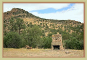
About 1/2-mile west from the cemetery is a lone standing stone fireplace and chimney one of the few remnants of the town. This
was part of the Rosedale Lodge, built ca. 1932 and operated by area rancher Paul Woofter.
Preserving and archiving Socorro County history
Rosedale is located about 25 miles from Magdalena (33 miles by road) and 25 miles from San Marcial, about equidistant between the two. Today, it is located south on NM-107 from Magdalena then west into the San Mateo mountains on FR-330, the Forest Service road to Grassy Lookout.
Remember, when visiting Rosedale or any mining areas ... ** Take only photos -- leave only footprints. **
to preserve our living
history for future generations.
** Do not enter mine shafts, portals, or tunnels for your safety **
The Rosedale mine has lethal
levels of CO2 and bad air in places
Kiss of Death. The Rosedale mine was on a good run of profitability until a fire in 1916 burned the stamp mill, headframe, and winch
house to the ground and set the shoring and timbers in the main shaft and drifts ablaze. The underground fire
smoldered for weeks and evacuated the mine of oxygen and filled the passages with toxic CO2 and deadly gasses a situation
that remains to this day.
This fire was the kiss of death for the Rosedale mine. The gold ore in the mine was not "played out."
The profitable vein down 500-735 feet is still there, but no longer accessible. Engineering plans and attempts to reopen the mine
with its dangers were unsuccessful. Subsequent activities worked the reserve ore already mined and reprocessed the tailings
from the mill and cyanide plant for limited continuing gold recovery. This work continued sporadically and on a small scale
until 1941.
Most other mines and prospects in the region were abandoned by the 1920s. Only low-grade gold ore
was found in the other mines, if at all, not nearly as lucky as the rich ore from the Rosedale mine and mill. The town
of Rosedale and the mining district was dying by the 1930s and virtually abandoned by 1937.
Today, some of the mill ruins
of the Rosedale mine, a few scant remains of the town and the cemetery is about all the remains to see of the once bustling area.
Mines3
0510/20d
Photo: SCHS Comstock collection
The Comstock family building their retreat home at Rosedale in 1911. Right photo shows finished
cabin and garden.
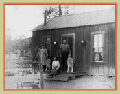
Photos: SCHS Correa/McInnis collection
Photo: SCHS Correa/McInnis collection
The McInnis family home
in Rosedale, ca, 1910-1916
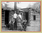
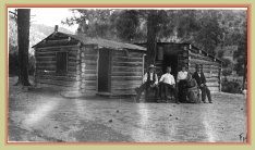
Photos: SCHS Correa/McInnis collection
"Grandpa McInnis' " log cabin in Rosedale
Photo: SCHS Correa/McInnis collection
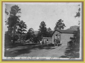
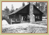
The popular Rosedale Lodge, mid-1930s
Photos: Paul Harden / SCHS
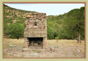
Fireplace and chimney the only remnants of the Rosedale Lodge after the 1943 fire.
Photo: SCHS Comstock collection
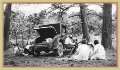
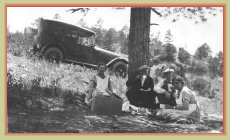
Rosedale became a popular weekend camping and picnic location for families in Socorro,
Magdalena and San Marcial for the mountains, trees, cooler summer temps and hunting. Here the Comstock family, from San
Marcial, are enjoying a day in Rosedale.
Photo: SCHS Correa/McInnis collection
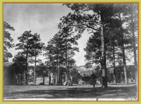
Rosedale camp, circa. 1915
SCHS Correa/McInnis collection
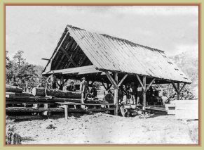
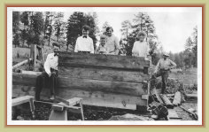
Rosedale even had their own sawmill, operated by the mine, to provide cut lumber
References:
COMSTOCK COLLECTION: Photos taken by Esther Comstock early 1900s and prior to the 1929 San Marcial floods. Photos contributed by Dennis Gabaldon.
Esther lived in San Marcial with her family, her father an engineer on the Santa Fe Railroad; they also built a "weekend home" in Rosedale. After the 1929
San Marcial floods, the family moved to Albuquerque where many of the railroad employees were transferred.
McINNIS COLLECTION: Photos taken by Hattie McInnis, whose family lived in Rosedale. Her photos of Rosedale and the mine are among the only known
photos of the area. After the 1916 Rosedale mine fire, they moved to San Marcial. The family lost their home in the 1929 floods and moved to La Joya.
Photos contributed by John Correa.
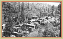
These two views of Rosedale are the only known photos of the town. They were taken by Hattie McInnis around 1910 and graciously donated by the Correa and McInnis families.
Links:
Click photos to enlarge

The elder McInnis family, "grandpa' and "grandma Hattie," built a cabin and small ranch in Rosedale. Their adult son worked at the Rosedale mine. When the mine closed, they established a new ranch near La Joya, New Mexico, and later, the son became an engineer on the AT&SF railroad running freight locomotives over Raton Pass.
The Comstock family lived in San Marcial with the elder Comstock a locomotive engineer for the AT&SF railroad. Daughter Esther was born in San Marcial 1901. As a young child, the family built a cabin home in Rosedale for the cooler summer days and rented it out during the winters. Esther became interested in photography in her teens, the source of many valuable photos of Rosedale and San Marcial. The family moved to Albuquerque in 1929 following the San Marcial flood.
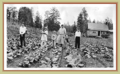
The Burris family is the most dominant in Rosedale with three generations involved with the town. Wesley Burris (1874-1940) moved
to Rosedale 1900; wife Martha (1871-1956), with a college degree, taught at the Rosedale School ; son Edward was born there 1901.
The family also started a ranch south of town at Turkey Springs, which they operated until the 1930s. As a young man, Edward worked
in the Rosedale Mine, and later at the ranch with wife Julia (1909-2005) and their son, Wesley (named after their grandfather) and
other siblings. The Burris' were the last family to move from Rosedale when the ores at the mine were exhausted. They started and
operated the Ft. Craig Service Station from 1937 until 1964, when bypassed by the new I-25. It was located where the rest area at
Exit 115 is located today. Descendents of the Burris family still live in the region; three generations are buried in the Rosedale
cemetery.
Oral history by Edward Burris
here
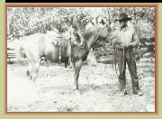
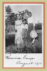
Edward Burris, ca. 1920s on their Turkey Springs Ranch.
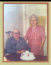
Edward and Julia Burris
in 1982.
Photos courtesy
Lucille Burris Hadden
The popular lodge served as a hunting camp and homebase for hunters visiting the popular San Mateo mountains known at the time for good hunting. The lodge burned in 1943, after Rosedale was abandoned, and never rebuilt.